

Photo: Shah Tahsin Anwar, with thanks · CC BY-SA 4.0 · via Wikimedia Commons · temporary stand-in photo

Chitral
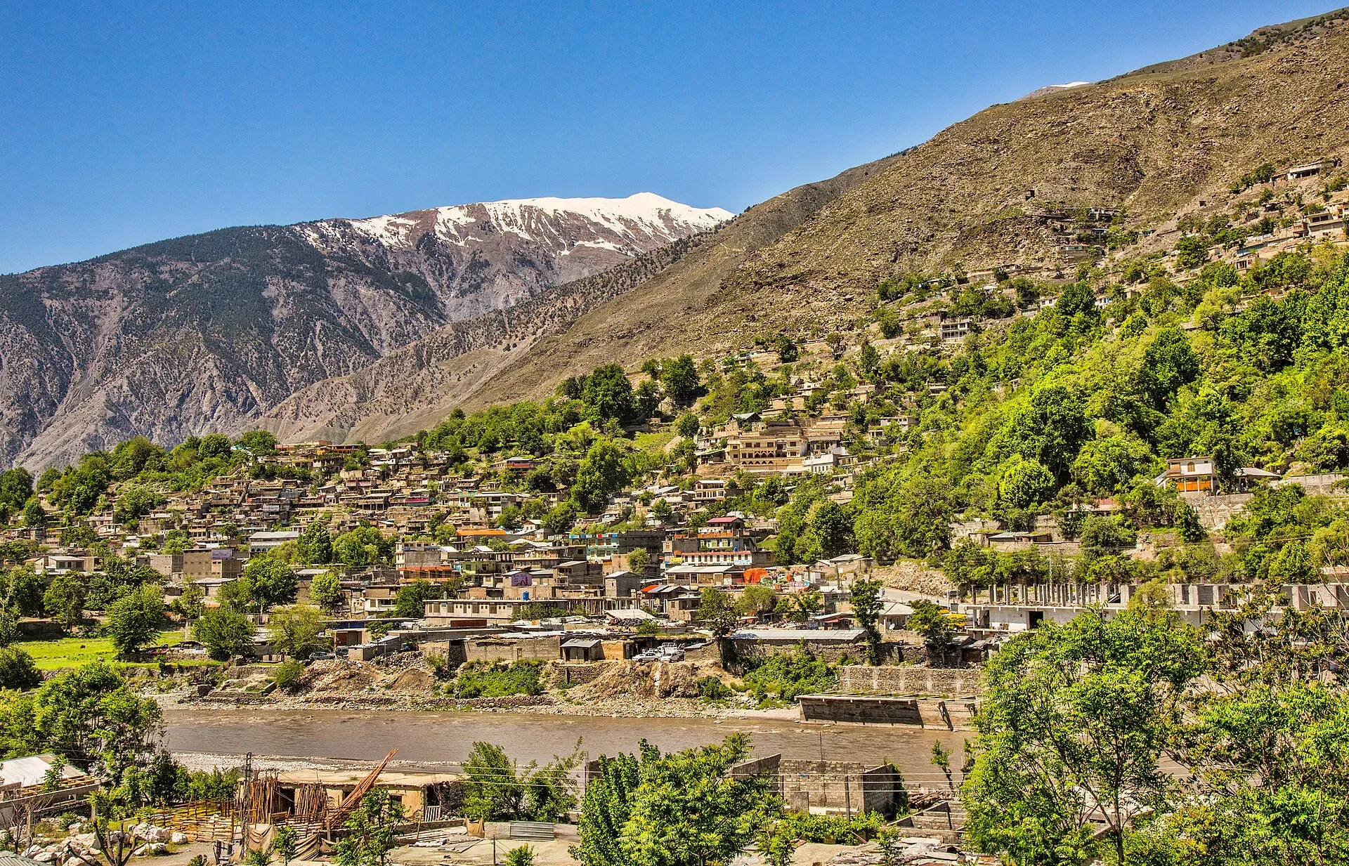
The main town of Lower Chitral District, at about 1,500 m on the Chitral River, with a historic fort, a royal mosque and views of Tirich Mir. The base for the Kalash valleys.
Overview
Chitral is the capital of Lower Chitral District and was the capital of the princely state of Chitral until 1969-72 (Wikipedia). The town stands at about 1,500 m on the Chitral River. According to Wikipedia, citing the 2023 census, Chitral has 57,157 people. The name comes from the Khowar word for field, and Khowar is the main language (98% of speakers in the 1981 census, per Wikipedia).
Plan your visit
- Getting there
Road: from Dir about 99 km (OSRM about 1 h 10 min, optimistic) via the Lowari Tunnel on the N-45; from Peshawar about 342 km (OSRM about 4 h 15 min, allow a day). More
Best months
May – Oct
- Chitral
- Related places nearby: Chitral Valley, Kalash Valleys (Bumburet, Rumbur, Birir), Chitral Gol National Park, Drosh, Booni, Bumburet Valley
What to see and do
- Chitral Fort, thought to date from 1774, beside the river, still the home of the ceremonial ruler. Ask about visiting.
- Shahi Mosque, built next to the fort in 1924.
- The bazaar, for Chitrali caps, wool and dried fruit.
- Chitral Gol National Park, just outside town.
- The Kalash valleys of Bumburet, Rumbur and Birir, about 30 km south (OSRM about 40 minutes).
See the Chitral valley page for villages up the Mastuj valley and the Shandur Pass.
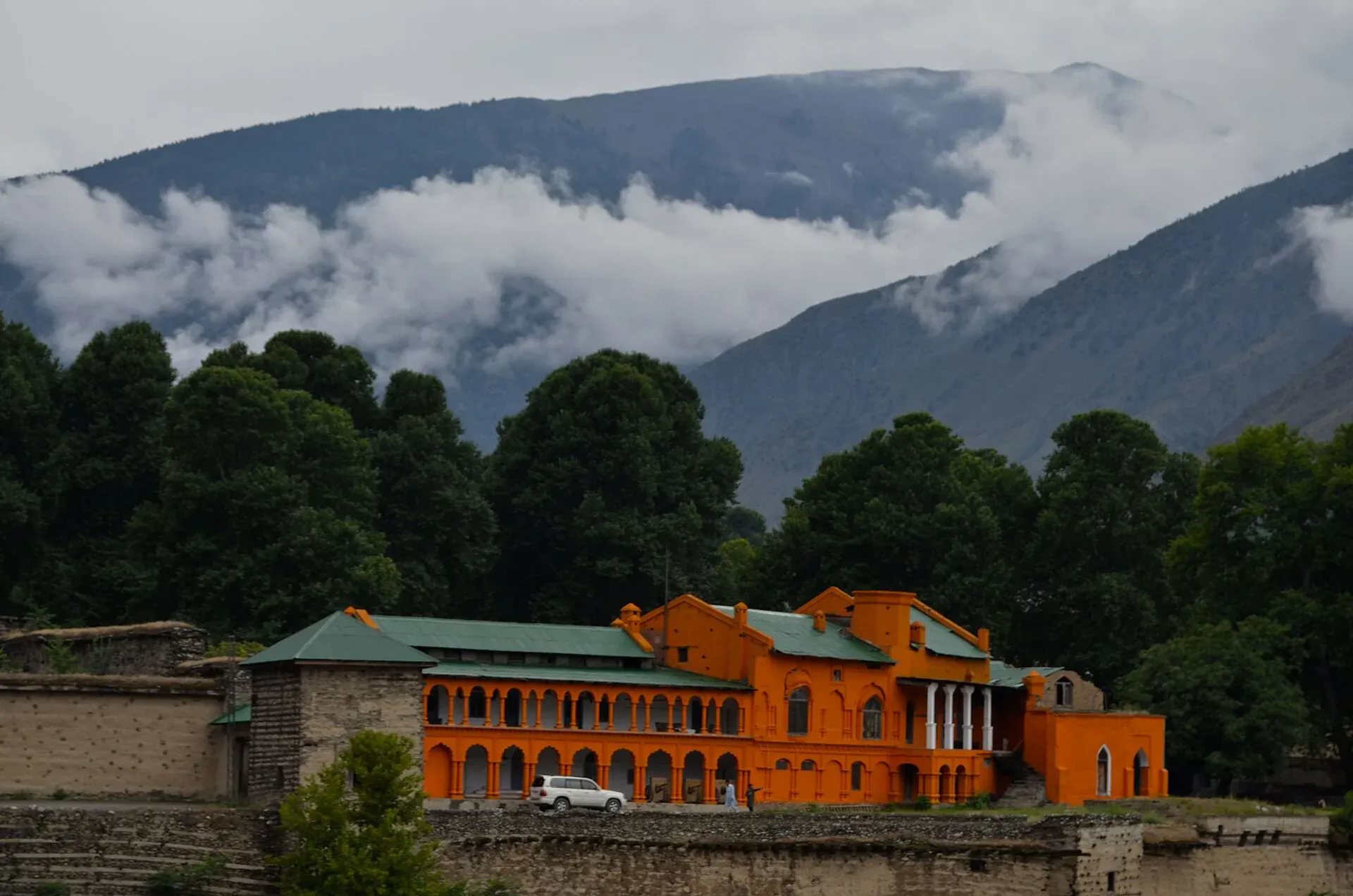
Photo: Kamran Adil, with thanks · CC BY-SA 4.0 · via Wikimedia Commons · temporary stand-in photo

History in brief
Gandharan Grave Culture sites in the valleys point to early settlement, and in the 2nd century CE the area was part of the Kushan Empire, which left Buddhist stupas, monasteries and images. From 1571 Chitral was the capital of a kingdom ruled by the Katur dynasty, whose rulers were called mehtars. In 1895 Chitralis besieged the British garrison in Chitral Fort during the Chitral Expedition, after which the British installed the young Shuja ul-Mulk as mehtar; he ruled for 41 years. Chitral chose at first to remain independent in 1947 and then acceded to Pakistan, and it was fully integrated as a district between 1969 and 1972 (Wikipedia).
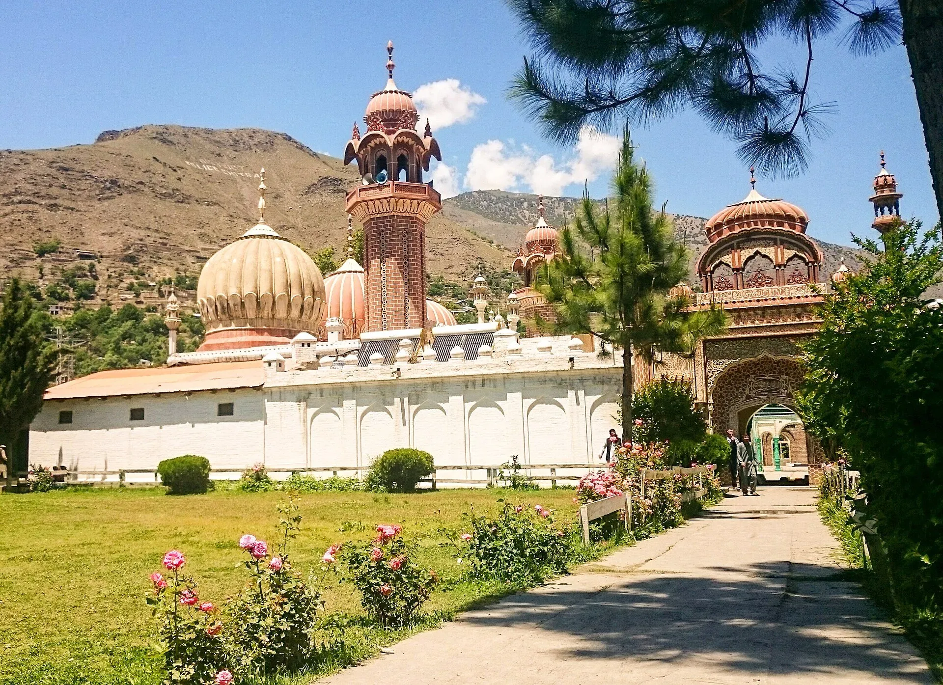
Photo: Fassifarooq, with thanks · CC BY-SA 4.0 · via Wikimedia Commons · temporary stand-in photo

Kalash festivals
Wikivoyage lists three festivals of the Kalash community: Joshi (14 to 15 May, welcoming spring), Uchau (19 to 20 August, the grape and fruit harvest) and Choimus (7 to 22 December, the winter new year). Dates can shift, so confirm them locally. Visitors are guests at community events; follow the guidance of your host and ask before photographing people.
A day in Chitral
An outline built from the sights above. Walk to Chitral Fort and the Shahi Mosque in the morning, then spend the middle of the day in the bazaar for caps, wool and dried fruit. In the afternoon drive out to Chitral Gol National Park, or use the day for a trip to the Kalash valleys instead, which needs most of a day.
Getting there
- By road: from Dir about 99 km, OSRM about 1 hour 10 minutes (optimistic), over the Lowari Tunnel on the N-45. The tunnel (about 10.4 km in two parts, opened 2017) makes the road usable in winter, when the Lowari Pass itself is closed; Wikipedia says it was open at least ten hours a day by late 2018, and there are no known current hours. From Peshawar the OSRM figure is about 342 km and 4 hours 15 minutes; allow a long day.
- By air: the domestic airport is served only by PIA from Islamabad. Dawn reported in March 2025 that PIA would restart the route from 5 April 2025, initially once a week. On 8 April 2025 Dawn reported that the flight had not resumed because of poor ticket sales. No later report of a regular service has been found, so do not count on one; check with the airline. Flights are often cancelled in bad weather. Check with the airline.
- From Gilgit: over the Shandur Pass in summer only. Wikivoyage describes the jeep journey as about 14 hours if connections are coordinated.
- From Islamabad by road: Wikivoyage gives about 8 to 10 hours by car. Check road conditions first.
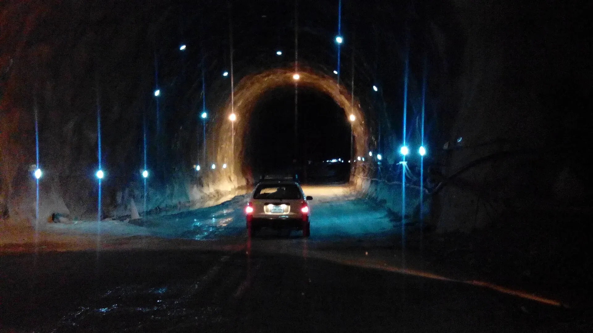
Photo: Ihsan Farid, with thanks · CC BY-SA 4.0 · via Wikimedia Commons · temporary stand-in photo

When to visit
Summers are very hot and dry, with almost no summer rain; most rain falls in spring thunderstorms. Winter nights can fall to -10 C and snowfall of up to 60 cm is common in town (Wikipedia, NOAA 1971-1990 averages). May to October is the easiest time for visitors.
Where to stay and eat
Hotels and guesthouses are along the river and in the bazaar. Restaurants serve Chitrali dishes, kebabs and tea. Book ahead around the Kalash festivals and the Shandur polo festival.
Basic services
The town is the main service centre for the district. Hospitals, pharmacies, fuel stations and ATMs are normal in a district headquarters, but none is confirmed for this town from an official source. Ask at your hotel, and use the business listings on this site.
Safety and good to know
Ask the district administration or local police about current conditions before you go. For foreign visitors: the UK FCDO (updated 27 October 2026, checked 17 November 2026) advises against all travel on the N-45 up to the edge of Chitral city, including the Kalash valleys, and against all travel to Upper and Lower Dir, which the road crosses. The page does not name Chitral city itself. This is government advice, not a closure. Read it in full and check the road with local police, your hotel and your driver.
Highlights
- Chitral Fort and Shahi Mosque
- Base for the Kalash valleys
- Views of Tirich Mir and the Hindu Kush
Hotels, food, fuel and services in Chitral
Places to stay
- Tirch Mir View Hotel ChitralCall Tirch Mir View Hotel ChitralMap of Tirch Mir View Hotel Chitral in Google Maps
- Hindukush HeightsCall Hindukush HeightsMap of Hindukush Heights in Google Maps
- Tower Hotel ChitralCall Tower Hotel ChitralMap of Tower Hotel Chitral in Google Maps
- Legendary Hotel ChitralCall Legendary Hotel ChitralMap of Legendary Hotel Chitral in Google Maps
- Hindukush Sarai ChitralCall Hindukush Sarai ChitralMap of Hindukush Sarai Chitral in Google Maps
- BnB Chitral TownCall BnB Chitral TownMap of BnB Chitral Town in Google Maps
Places to eat
- Diwan Hotel & RestaurantCall Diwan Hotel & RestaurantMap of Diwan Hotel & Restaurant in Google Maps
- Kashmir Bakers and Sweet HouseCall Kashmir Bakers and Sweet HouseMap of Kashmir Bakers and Sweet House in Google Maps
- Chitral Guest House and Zowalo RestaurantCall Chitral Guest House and Zowalo RestaurantMap of Chitral Guest House and Zowalo Restaurant in Google Maps
Essential services fuel stations, mechanics, ATMs, pharmacies and hospitals and clinics
Fuel
- PSO Filling StationMap of PSO Filling Station in Google Maps
- PSO oil fill Station Danin ChitralMap of PSO oil fill Station Danin Chitral in Google Maps
- By Pass Petrol PumpCall By Pass Petrol PumpMap of By Pass Petrol Pump in Google Maps
- Rehman Filling Station Bakrabad ChitralMap of Rehman Filling Station Bakrabad Chitral in Google Maps
- Filling Station BakrabadCall Filling Station BakrabadMap of Filling Station Bakrabad in Google Maps
- Chumurkone Petrol PumpMap of Chumurkone Petrol Pump in Google Maps
Mechanics and tyre shops
- Car Repairing Near Al Khidmat FoundationMap of Car Repairing Near Al Khidmat Foundation in Google Maps
ATMs
- Bank AlfalahMap of Bank Alfalah in Google Maps
- NBP AitemaadCall NBP AitemaadMap of NBP Aitemaad in Google Maps
- Summit BankMap of Summit Bank in Google Maps
- Soneri Bank LtdMap of Soneri Bank Ltd in Google Maps
- JS bankMap of JS bank in Google Maps
Pharmacies
- Alim MedicosCall Alim MedicosMap of Alim Medicos in Google Maps
- Alam MedicoseCall Alam MedicoseMap of Alam Medicose in Google Maps
- Miftah Medicose Ataliq BazarMap of Miftah Medicose Ataliq Bazar in Google Maps
- Rastan PharmacyMap of Rastan Pharmacy in Google Maps
Hospitals and clinics
- District Headquarter HospitalMap of District Headquarter Hospital in Google Maps
- CHILDREN HOSPITALMap of CHILDREN HOSPITAL in Google Maps
- Aga Khan Diagnostic Center, ChitralCall Aga Khan Diagnostic Center, ChitralMap of Aga Khan Diagnostic Center, Chitral in Google Maps
- Chitral Scout HospitalCall Chitral Scout HospitalMap of Chitral Scout Hospital in Google Maps
- Dr.Jan, Endovascular Neurosurgeon, Neurovascular SpecialistMap of Dr.Jan, Endovascular Neurosurgeon, Neurovascular Specialist in Google Maps
- Alkhidmat Diagnostic CenterCall Alkhidmat Diagnostic CenterMap of Alkhidmat Diagnostic Center in Google Maps
Listings come from Google Maps data and are unverified: phone numbers, opening months and prices may have changed. Report a problem · Own one of these? Claim it
Tips
- Read the FCDO advice for the N-45 and the Kalash valleys.
- Book the Islamabad flight flexibly; cancellations are common.
- Allow a full day by road from Peshawar or Islamabad.
- Ask permission before photographing people in the bazaar.
Photos we still need: Chitral bazaar and polo ground (openly licensed). Send us yours
Sources and last checked
Last checked Confidence medium10 sources4 still to check
- Last checked
- Method
- Desk research from published sources
- Confidence
- medium
- Checked by
- trek.pk research team
Researched from published sources; not yet checked on the ground by our team. Spot something out of date? Report a mistake.
Sources
- Chitral · Wikipedia · checked
- Lower Chitral District · Wikipedia · checked
- Chitral awaits tourists · Dawn · checked
- Pakistan travel advice (updated 27 October 2026) · UK Foreign, Commonwealth & Development Office · checked
- OSRM driving route service: distances and times measured 16 November 2026 (times are optimistic, without stops) · OSRM / OpenStreetMap · checked
- Chitral Airport · Wikipedia · checked
- Lowari Tunnel · Wikipedia · checked
- Chitral (travel guide) · Wikivoyage · checked
- PIA to resume flights to Chitral after three years (19 March 2025) · Dawn · checked
- PIA yet to resume weekly Islamabad-Chitral flight (8 April 2025) · Dawn · checked
Still to be checked on the ground (4)
- Current flight schedule (planned weekly service had not started on 8 April 2025; no later report found)
- Lowari Tunnel opening hours (only a late-2018 figure of at least ten hours a day found)
- Hotel availability in festival weeks
- Kalash festival dates (Wikivoyage only; confirm with the Chitral tourism office)
Nearby and related

Chitral Valley
The long Chitral River valley at the foot of the Hindu Kush, with Chitral town's fort and Shahi Mosque, the Lowari Tunnel route, Tirich Mir views and side valleys leading to Kalash and Shandur.

Kalash Valleys (Bumburet, Rumbur, Birir)
Three side valleys of the Chitral River, home to the Kalasha people, who keep their own religion, language and festivals. Visit with respect and check security advice first.

Chitral Gol National Park
A mountain park beside Chitral town, set up in 1984 to protect the markhor. About 78 square kilometres rising from 1,450 m to 5,000 m, with snow leopard and ibex.

Khyber Pakhtunkhwa
Mountains, Buddhist ruins and old bazaars in north-west Pakistan: Swat, Kaghan, Chitral, the Kalash valleys, the Khyber Pass and Peshawar.

Drosh
A river town at about 1,359 m in Lower Chitral, on the N-45 road south of Chitral city. It is the largest town in Lower Chitral after Chitral itself and a common stop on the way to the Kalash valleys.

Booni
Headquarters of Upper Chitral District at about 2,085 m, near the foothills of Buni Zom and the Qaqlasht meadows. It is a base for local walks and a stop on the road to Mastuj and Shandur.

Mastuj
The main settlement of Mastuj valley in Upper Chitral, at about 2,359 m. It has an old fort ruin, big mountain views, and is the last major stop on the road to Shandur Pass and Gilgit.

Bumburet Valley
The largest of the three Kalash valleys, about 20 km south of Chitral town. Home to Kalasha villages, the Kalasha Dur museum, walnut and apricot orchards and the spring festival.

Chitral and Kalash
A 6-7 day road trip from Islamabad to Chitral through Dir and the Lowari Tunnel, with the Kalash valleys of Bumburet, Rumbur and Birir, Chitral Fort and Tirich Mir views.