

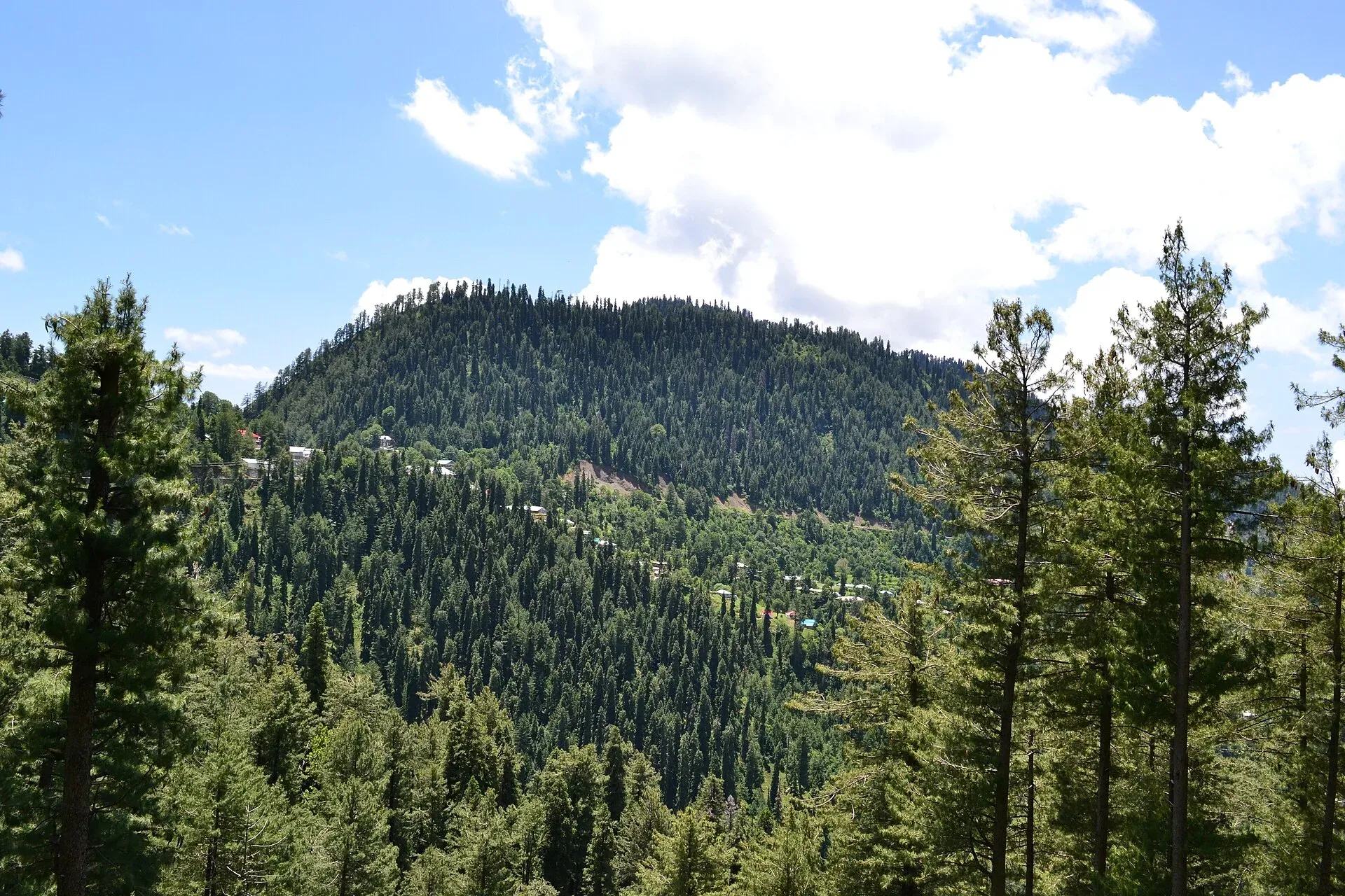
Photo: Khalid Mahmood, with thanks · CC BY-SA 3.0 · via Wikimedia Commons · temporary stand-in photo

Dunga Gali
A small Galyat hill town at about 2,500 m, 3 km from Nathia Gali, once a British sanatorium. It is the headquarters of Ayubia National Park and a base for walks to Mukeshpuri and Miranjani.
Overview
Dunga Gali is a small town on the Galyat ridge, about 3 km from Nathia Gali and 34 km from Abbottabad, at around 2,500 m (Wikipedia). It lies in the Nathia Gali union council of Abbottabad district. In British times it was a sanatorium for soldiers and had a hotel, a church and a post office; Europeans built houses on the southern slopes below Mukeshpuri. The ridge marked Abbottabad's eastern boundary with the princely state of Kashmir. The Haro River rises on the southern slopes of the range.
The Galyat is the string of hill stations along this ridge, including Nathia Gali and Ayubia.
Plan your visit
- Nearest town
- Nathia Gali
- Getting there
About 84 km from Islamabad via Murree, roughly 1 hour 15 minutes by OSRM without traffic (checked 16 November 2026); allow more at weekends. It is 34 km from Abbottabad (Wikipedia) and 3 km from Nathia Gali. More
Best months
May – Jun, Sep – Oct
- Dunga Gali
- Related places nearby: Nathia Gali, Ayubia National Park, Mushkpuri, Miranjani, Murree, Abbottabad
What to see and do
- Walks on Mukeshpuri and Miranjani. Both peaks rise from the Dunga Gali and Nathia Gali ridge. Mushkpuri (about 2,800 m) is a 4 km climb from Nathia Gali through deodar forest, and Miranjani (2,992 m) is the highest peak in the Galyat, a half-day forest hike. Thousands of visitors hike here each year (Wikipedia).
- Tilla Donga. A hill of more than 8,000 feet beside the town, photographed from the north on Wikimedia Commons.
- Ayubia National Park. See the section below.
- Pipeline Track. A walking track of about 4 km between Ayubia and Nathia Gali, a short drive from the town.
- Colonial remains. Look for the old church and houses from the sanatorium days, but check access locally.
Ayubia National Park
The park headquarters is at Dunga Gali, about 50 km from Abbottabad and 25 km from Murree. Wikipedia gives the park about 3,312 hectares, declared a national park in 1984 and expanded in 1998, at an average height of about 2,400 m. It is managed by the Khyber Pakhtunkhwa Wildlife Department. See the Ayubia National Park page.
The forest is temperate conifer and mixed broadleaf, with deodar, blue pine, yew, silver fir, horse chestnut and oak among 104 plant species recorded. Wikipedia lists 23 mammal species, including the Indian leopard, leopard cat and rhesus macaque, and 203 bird species, including kalij and koklass pheasants and the golden eagle. Rainfall is about 1,644 mm a year. Visitor numbers are given as over 100,000 a year in the article's tourism section, so weekends and holidays can be busy. Wikipedia also notes that a proposal to de-notify the park in September 2023 was contested by officials, environmentalists and legal experts.
When to visit
Late spring to early autumn is the pleasant season. May and June are mildly hot by hill standards. The monsoon brings rain and fog from late July through August. Winter is cold with snow, mostly January and February, and the Galyat roads can close.
Winter roads and safety
In February 2026 the district administration banned tourist entry to the Galyat after landslides on Murree Road; The News reported one to 1.5 feet of snow in nearby Nathia Gali and Thandiani. On 31 December 2025 the Murree Expressway was closed to general traffic in heavy snow. Because the main approach from Islamabad passes through Murree, remember the January 2022 snowstorm there, when at least 22 people died in stranded vehicles, most from exhaust fumes. Carry chains, fuel, food and blankets, keep windows slightly open if you ever must idle, and obey road closures.
For foreign visitors: the UK FCDO (checked 16 November 2026) does not name Abbottabad, Murree or the Galyat in its advice against travel, but notes emergency measures in Khyber Pakhtunkhwa.
Where to stay and eat
Most visitors stay in Nathia Gali or Ayubia, a few minutes away. Small hotels and tea stalls serve the town.
Good to know
Phone coverage is weak in the forest. Fees for the national park are not confirmed; current fees will be added soon.
Highlights
- Former British sanatorium town
- Headquarters of Ayubia National Park
- Base for Mukeshpuri and Miranjani walks
- 3 km from Nathia Gali
Getting there
About 84 km from Islamabad via Murree, roughly 1 hour 15 minutes by OSRM without traffic (checked 16 November 2026); allow more at weekends. It is 34 km from Abbottabad (Wikipedia) and 3 km from Nathia Gali.
Stay, eat and essentials near Dunga Gali
Within 8 km of Dunga Gali, nearest first.
Places to stay
- The Mountain Lounge & RestaurantCall The Mountain Lounge & RestaurantMap of The Mountain Lounge & Restaurant in Google Maps
- DoubleTree by Hilton NathiagaliCall DoubleTree by Hilton NathiagaliMap of DoubleTree by Hilton Nathiagali in Google Maps
- The Cloud XpressCall The Cloud XpressMap of The Cloud Xpress in Google Maps
- Zesora Nathia GaliCall Zesora Nathia GaliMap of Zesora Nathia Gali in Google Maps
- Raees Khana Hotel Nathia galiCall Raees Khana Hotel Nathia galiMap of Raees Khana Hotel Nathia gali in Google Maps
- Richmond Boutique Hotel Nathia GaliCall Richmond Boutique Hotel Nathia GaliMap of Richmond Boutique Hotel Nathia Gali in Google Maps
Places to eat
- Kaldis Cafe & GrillCall Kaldis Cafe & GrillMap of Kaldis Cafe & Grill in Google Maps
- Desi Butt Karahi nathiagali abbotabad road kpkCall Desi Butt Karahi nathiagali abbotabad road kpkMap of Desi Butt Karahi nathiagali abbotabad road kpk in Google Maps
- D.Dream grill cafe & Pizza houseCall D.Dream grill cafe & Pizza houseMap of D.Dream grill cafe & Pizza house in Google Maps
- The GreyCall The GreyMap of The Grey in Google Maps
- Cafe FoodsterCall Cafe FoodsterMap of Cafe Foodster in Google Maps
- Soy Pan AsianMap of Soy Pan Asian in Google Maps
Essential services fuel stations, ATMs, pharmacies and hospitals and clinics
Fuel
- Phalwan Petrol PumpCall Phalwan Petrol PumpMap of Phalwan Petrol Pump in Google Maps
ATMs
- MCB BANKMap of MCB BANK in Google Maps
Pharmacies
- Kashif Medical Store, Nathia GhaliMap of Kashif Medical Store, Nathia Ghali in Google Maps
Hospitals and clinics
- Shaheen Women and children hospital kalabagh Nathiagali Abbottabad- Paediatric Medical SevicesCall Shaheen Women and children hospital kalabagh Nathiagali Abbottabad- Paediatric Medical SevicesMap of Shaheen Women and children hospital kalabagh Nathiagali Abbottabad- Paediatric Medical Sevices in Google Maps
- BHU Nagri BalaCall BHU Nagri BalaMap of BHU Nagri Bala in Google Maps
Listings come from Google Maps data and are unverified: phone numbers, opening months and prices may have changed. Report a problem · Own one of these? Claim it
Tips
- Stay in Nathia Gali or Ayubia and visit Dunga Gali on a day walk.
- Check winter road notices before you travel.
- Start walks early; clouds often cover the peaks by afternoon.
Photos we still need: the Pipeline Track and the forest around Dunga Gali; Ayubia National Park headquarters or entrance; the Galyat ridge in snow. Send us yours
Sources and last checked
Last checked Confidence medium9 sources3 still to check
- Last checked
- Method
- Desk research from published sources
- Confidence
- medium
- Checked by
- trek.pk research team
Researched from published sources; not yet checked on the ground by our team. Spot something out of date? Report a mistake.
Sources
- Dunga Gali (Wikipedia) · Wikipedia · checked
- Ayubia National Park (Wikipedia) · Wikipedia · checked
- Heavy snowfall disrupts life in Galiyat and Thandiani · The News (11 February 2026) · checked
- Entry of tourists banned after landslides (10 February 2026) · ProPakistani · checked
- Murree Expressway closed for traffic after heavy snowfall (1 January 2026) · ProPakistani · checked
- Tragedy befalls Murree as 22 die trapped in snowfall (9 January 2022) · Dawn · checked
- Pakistan travel advice (updated 27 October 2026) · UK Foreign, Commonwealth & Development Office · checked
- OSRM driving routes (distances and modelled times) · OSRM / OpenStreetMap · checked
- Ayubia National Park (area, wildlife, Pipeline Track) · Wikipedia · checked
Still to be checked on the ground (3)
- Which colonial buildings can be visited (Wikipedia only says a hotel, church and post office existed)
- Park fees and permits
- Current hotels
Nearby and related

Nathia Gali
A pine-forest hill station at about 2,410 m in the Galyat hills, with a wooden colonial church, walks to Miranjani and Mukeshpuri, and snow from December to February. Roads often close in heavy snow.

Ayubia
A forest hill station in the Galyat inside Ayubia National Park, at about 2,400 m, known for the Pipeline Track to Nathia Gali. Its historic chairlift has been closed since October 2021; no reopening date is confirmed.

Ayubia National Park
A cool pine and fir forest park in the Galyat hills above Abbottabad, with the Pipeline Track, a chairlift, leopards and many birds. Established 1984, about 33 square kilometres.

Mushkpuri
Mushkpuri Top (about 2,800 m) is the second highest peak of the Galyat, above Dunga Gali in Ayubia National Park. A 4 km climb from Nathia Gali leads through deodar forest.

Miranjani
Miranjani (2,992 m) is the highest peak in the Galyat hills, in Ayubia National Park above Nathia Gali. It is a half-day forest hike with views on clear days.

Murree
Hill resort and district capital at about 2,300 m in the Galyat hills above Islamabad. Mall Road, viewpoints, cool summers and winter snow; busy at weekends.

Abbottabad
A cool, green cantonment city at about 1,256 m in Hazara, the military academy town and the main gateway to Nathia Gali, Thandiani, Ayubia National Park and the Kaghan Valley.