

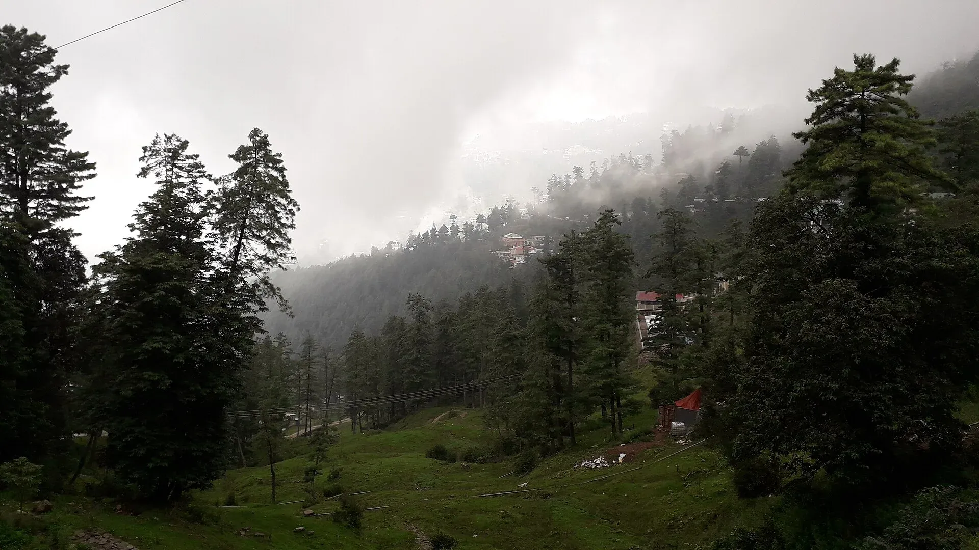
Photo: King Eliot, with thanks · CC BY-SA 4.0 · via Wikimedia Commons · temporary stand-in photo

Nathia Gali
A pine-forest hill station at about 2,410 m in the Galyat hills, with a wooden colonial church, walks to Miranjani and Mukeshpuri, and snow from December to February. Roads often close in heavy snow.
Overview
Nathia Gali is a small hill station in the Galyat, the forested ridge between Murree and Abbottabad. Wikipedia gives its height as 2,410 m and its distance as about 32 km from both towns. Pine, cedar, oak and walnut cover the slopes around it. The main tribe of the area is the Karlal, with a minority of Dhund-Abbasis, and the local language is Hindko.
Under British rule it was part of Abbottabad tehsil and served as a summer seat of the Chief Commissioner of the Peshawar division. With neighbouring Dunga Gali it was a notified area under the Punjab Municipalities Act of 1891. Today it is a summer retreat for families from Islamabad, Rawalpindi and Peshawar. It is cooler than the rest of the Galyat because of its height, and quieter than Murree, which has more to do but more traffic.
Plan your visit
- Nearest town
- Abbottabad
- Getting there
From Islamabad: about 87 km via Murree; OSRM models roughly 1 hour 15 minutes without traffic (checked 16 November 2026). Weekends and snow days take much longer. From Abbottabad: about 33 km, around 40 minutes by OSRM. More
Best months
Feb, May – Jun, Sep – Oct
- Nathia Gali
- Related places nearby: Murree, Ayubia National Park, Miranjani, Mushkpuri, Abbottabad, Dunga Gali, Thandiani, Changla Gali
What to see and do
The town is one main road with a small bazaar and viewpoints along the ridge.
- St Matthew's Church. A wooden church from the British period, built at the edge of the mountain with a wide view towards Kashmir. It is a landmark rather than a large building; look at it from the road and the slope below.
- The bazaar. Small and compact. It sells shawls, scarves, embroidered cloth, woodwork and handmade jewellery.
- Viewpoints. On a clear day the ridge gives long views over the forest. Wikipedia says Nanga Parbat can be seen in the far distance, but marks the claim as needing a citation, so do not plan around it.
- Miranjani and Mukeshpuri. The two high peaks of the area. Miranjani, the higher, is seen from the town (see Miranjani and Mushkpuri).
Walks and the Pipeline Track
The best-known short walk is the Pipeline Track, about 4 km between Nathia Gali and Ayubia. It is a forest path inside Ayubia National Park and is mostly level and easy. Arrange a vehicle for the way back if you do not want to return on foot.
From Ayubia a chairlift runs to the Mukeshpuri summit for views over the forest; see Ayubia chairlift. Longer walks lead to Miranjani and Mukeshpuri from the Nathia Gali and Dunga Gali side. A longer trek to Thandiani via Dagri Naka is mentioned by Wikipedia; ask locally about the route and its condition before setting out.
Forest and wildlife
Nathia Gali sits beside Ayubia National Park, which Wikipedia describes as surrounded by seven villages and three small towns: Thandiani, Nathia Gali and Khanspur. Wikipedia describes a park of about 3,312 hectares at an average height of about 2,400 m, established in 1984 and expanded in 1998, with its headquarters at Dunga Gali.
- Trees. About 104 plant species are recorded. The main trees are deodar (a Himalayan cedar), blue pine, yew, silver fir, horse chestnut and oak.
- Animals. The park lists 23 mammal species, including the Indian leopard, leopard cat and rhesus macaque, and 203 bird species, including the kalij pheasant, koklass pheasant and golden eagle. Rhesus macaques are frequently sighted; leopards are rarely seen.
- Museum. A small wildlife museum at Dunga Gali holds a leopard shot in 2006.
Do not feed the monkeys, and keep food out of sight in cars and bags.
TDAP's 2021 tourism guide lists Nathia Gali among Pakistan's skiing areas, but there is no known source for a lift, groomed slope or operating ski resort here. Treat it as a snow-viewing and sledging place, not a ski resort.
When to visit
May to September is mild: Wikipedia gives daytime highs of about 22 to 25 degrees Celsius and nights of 13 to 16. Summer is often foggy. The monsoon (roughly 1 July to mid-September) brings rain almost every day. Winter days reach only about 6 to 9 degrees, with nights from about minus 4 to 0. Snow now falls mostly in February, though it was once more usual from late December to January. Annual rainfall is about 1,650 to 1,850 mm.
Winter roads and safety
Heavy snow can close the roads. On 10 February 2026 the district administration banned tourist entry to the Galyat after landslides on Murree Road. The same week The News reported one to 1.5 feet of snow, with the Abbottabad to Nathia Gali to Murree road closed to tourists. On 28 January 2026 Murree began allowing tourists in only with a confirmed hotel booking, and the Murree Expressway was shut to general traffic on 31 December 2025.
The approach from Islamabad runs through Murree, where in January 2022 at least 22 people died in their cars during a snowstorm, mostly from exhaust fumes. An official inquiry blamed failures of planning and snow clearing. Never sit in a stopped car with the engine running and windows closed, fit chains, carry a full tank, warm clothes and food, and turn back if officials say the road is closed.
For foreign visitors: the UK FCDO (checked 16 November 2026) does not name Abbottabad, Murree or the Galyat in its advice against travel, but it does note emergency measures in Khyber Pakhtunkhwa. Check the page before you go.
Where to stay and eat
Guesthouses, hotels and small restaurants line the main road; book ahead for summer weekends and snow days. The area suits a night or two. A simple plan: arrive by midday, walk the Pipeline Track in the afternoon, and spend the next morning at the church, bazaar and a ridge viewpoint before the drive back.
Good to know
Buses and vans run daily from Abbottabad and Rawalpindi. Mobile signal is patchy in the forest.
Highlights
- Wooden St Matthew's Church from the British period
- Pipeline Track to Ayubia, about 4 km
- Walks to Miranjani and Mukeshpuri
- Snow in winter, mostly February
Getting there
From Islamabad: about 87 km via Murree; OSRM models roughly 1 hour 15 minutes without traffic (checked 16 November 2026). Weekends and snow days take much longer. From Abbottabad: about 33 km, around 40 minutes by OSRM. Public transport runs daily from Abbottabad and Rawalpindi (Wikipedia).
Hotels, food, fuel and services in Nathia Gali
Places to stay
- Hotel Elites NathiaGaliCall Hotel Elites NathiaGaliMap of Hotel Elites NathiaGali in Google Maps
- DoubleTree by Hilton NathiagaliCall DoubleTree by Hilton NathiagaliMap of DoubleTree by Hilton Nathiagali in Google Maps
- Hotel Summer Retreat NathiagaliCall Hotel Summer Retreat NathiagaliMap of Hotel Summer Retreat Nathiagali in Google Maps
- The Cloud XpressCall The Cloud XpressMap of The Cloud Xpress in Google Maps
- Raees Khana Hotel Nathia galiCall Raees Khana Hotel Nathia galiMap of Raees Khana Hotel Nathia gali in Google Maps
- Gali's End by RoomyCall Gali's End by RoomyMap of Gali's End by Roomy in Google Maps
Places to eat
- The GreyCall The GreyMap of The Grey in Google Maps
- Cafe FoodsterCall Cafe FoodsterMap of Cafe Foodster in Google Maps
- Desi Butt Karahi nathiagali abbotabad road kpkCall Desi Butt Karahi nathiagali abbotabad road kpkMap of Desi Butt Karahi nathiagali abbotabad road kpk in Google Maps
- Soy Pan AsianMap of Soy Pan Asian in Google Maps
- D.Dream grill cafe & Pizza houseCall D.Dream grill cafe & Pizza houseMap of D.Dream grill cafe & Pizza house in Google Maps
- Kaldis Cafe & GrillCall Kaldis Cafe & GrillMap of Kaldis Cafe & Grill in Google Maps
Essential services ATMs, pharmacies and hospitals and clinics
ATMs
- MCB BANKMap of MCB BANK in Google Maps
Pharmacies
- Kashif Medical Store, Nathia GhaliMap of Kashif Medical Store, Nathia Ghali in Google Maps
Hospitals and clinics
- Shaheen Women and children hospital kalabagh Nathiagali Abbottabad- Paediatric Medical SevicesCall Shaheen Women and children hospital kalabagh Nathiagali Abbottabad- Paediatric Medical SevicesMap of Shaheen Women and children hospital kalabagh Nathiagali Abbottabad- Paediatric Medical Sevices in Google Maps
- BHU Nagri BalaCall BHU Nagri BalaMap of BHU Nagri Bala in Google Maps
Listings come from Google Maps data and are unverified: phone numbers, opening months and prices may have changed. Report a problem · Own one of these? Claim it
Tips
- Check road and tourist-entry notices before any winter trip; the Galyat has been closed to tourists after snow.
- Carry chains, a full tank and warm clothes from December to February.
- Never run a car engine with windows shut if you are stuck in snow.
- Book ahead for summer weekends.
Photos we still need: the Pipeline Track and a winter road scene at Nathia Gali. Send us yours
Sources and last checked
Last checked Confidence medium12 sources5 still to check
- Last checked
- Method
- Desk research from published sources
- Confidence
- medium
- Checked by
- trek.pk research team
Researched from published sources; not yet checked on the ground by our team. Spot something out of date? Report a mistake.
Sources
- Nathia Gali (Wikipedia) · Wikipedia · checked
- Pakistan Tourism Guide 2021 · TDAP Pakistan · checked
- Heavy snowfall disrupts life in Galiyat and Thandiani · The News (11 February 2026) · checked
- Entry of tourists banned after landslides (10 February 2026) · ProPakistani · checked
- Murree to ban tourists without hotel reservations (28 January 2026) · ProPakistani · checked
- Murree Expressway closed for traffic after heavy snowfall (1 January 2026) · ProPakistani · checked
- Tragedy befalls Murree as 22 die trapped in snowfall (9 January 2022) · Dawn · checked
- Government failures led to Pakistan tourist snowstorm deaths, report says (21 January 2022) · Reuters via Arab News · checked
- Pakistan travel advice (updated 27 October 2026) · UK Foreign, Commonwealth & Development Office · checked
- OSRM driving routes (distances and modelled times) · OSRM / OpenStreetMap · checked
- Ayubia National Park (Wikipedia) · Wikipedia · checked
- Ayubia National Park (Wikipedia) · Wikipedia · checked
Still to be checked on the ground (5)
- Current road and tourist-entry status after snow (changes daily; Wikipedia: heavy snow in December and January can sometimes block the road)
- Whether the Thandiani trek via Dagri Naka is still walked (Wikipedia mentions it; no trail detail in Wikipedia's Thandiani article or The Friday Times)
- Hotel names and bus operators (Wikipedia: daily public transport from Abbottabad and Rawalpindi; no operators named)
- Pipeline Track: current condition and how long the walk takes (no source gives a time)
- Entry rules and any fee for Ayubia National Park (Wikipedia gives none)
Nearby and related

Murree
Hill resort and district capital at about 2,300 m in the Galyat hills above Islamabad. Mall Road, viewpoints, cool summers and winter snow; busy at weekends.

Ayubia National Park
A cool pine and fir forest park in the Galyat hills above Abbottabad, with the Pipeline Track, a chairlift, leopards and many birds. Established 1984, about 33 square kilometres.

Miranjani
Miranjani (2,992 m) is the highest peak in the Galyat hills, in Ayubia National Park above Nathia Gali. It is a half-day forest hike with views on clear days.

Mushkpuri
Mushkpuri Top (about 2,800 m) is the second highest peak of the Galyat, above Dunga Gali in Ayubia National Park. A 4 km climb from Nathia Gali leads through deodar forest.

Abbottabad
A cool, green cantonment city at about 1,256 m in Hazara, the military academy town and the main gateway to Nathia Gali, Thandiani, Ayubia National Park and the Kaghan Valley.

Dunga Gali
A small Galyat hill town at about 2,500 m, 3 km from Nathia Gali, once a British sanatorium. It is the headquarters of Ayubia National Park and a base for walks to Mukeshpuri and Miranjani.

Ayubia
A forest hill station in the Galyat inside Ayubia National Park, at about 2,400 m, known for the Pipeline Track to Nathia Gali. Its historic chairlift has been closed since October 2021; no reopening date is confirmed.

Thandiani
A thickly forested hill station at about 2,750 m above Abbottabad, started by British missionaries and a sanatorium. Snow can close the road for days, so check conditions in winter.
Changla Gali
A Galyat hill resort town in Abbottabad district, about 16 km north of Murree, between Murree and Nathia Gali. Wikipedia gives its height as about 2,800 m.