

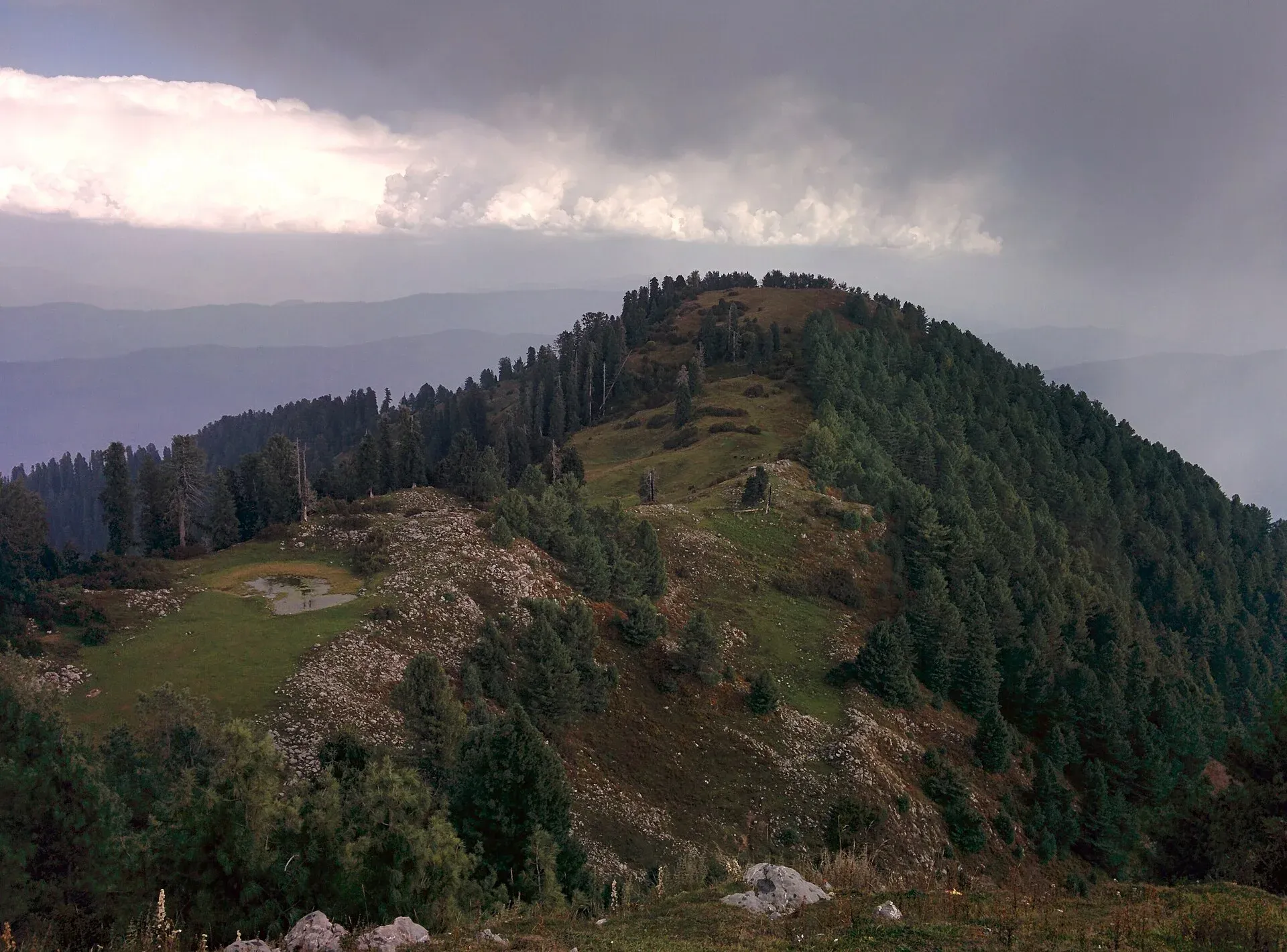
Photo: Hidden ragnar, with thanks · CC BY-SA 4.0 · via Wikimedia Commons · temporary stand-in photo

Ayubia National Park
A cool pine and fir forest park in the Galyat hills above Abbottabad, with the Pipeline Track, a chairlift, leopards and many birds. Established 1984, about 33 square kilometres.
Overview
Ayubia National Park protects temperate forest in the Galyat hills of Abbottabad District. It was declared a national park in 1984 to protect the temperate forests and was enlarged in 1998, from about 1,684 hectares to 3,312 hectares (about 33 square kilometres). It is an IUCN Category V protected area. Its average elevation is around 2,400 m. The park is named after Ayub Khan, the second president of Pakistan, and is managed by the Khyber Pakhtunkhwa Wildlife and Parks Department. Its headquarters are at Dunga Gali. The headquarters at Dunga Gali is about 50 km from Abbottabad and about 25 km from Murree. The park forms a resort cluster around Khaira Gali, Changla Gali, Khanspur and Ghora Dhaka, and sits close to Nathiagali and Thandiani.
Wikipedia gives the park's rainfall as about 1,644 mm a year and its temperature range as 3 to 11 degrees C, with cool summers, monsoon rain in late July and early August, and snow in winter. It records about 104 plant species. The forest is mostly deodar cedar, blue pine, silver fir, yew, horse chestnut and oak. Records list about 23 mammals, 203 bird species and 13 reptiles and amphibians. Wikipedia names the Indian leopard, leopard cat, golden jackal, red fox, yellow-throated marten, Asian palm civet, rhesus macaque, Kashmir flying squirrel and red giant flying squirrel among the mammals. Birds named include the kalij pheasant, koklass pheasant, golden eagle, crested serpent-eagle, wedge-tailed green pigeon and Kashmir nuthatch.
Plan your visit
- Nearest town
- Nathiagali
- Getting there
From Islamabad take the Murree Expressway or the Murree road towards Murree, then follow signs to the Galyat and Nathiagali. The drive is about 90 km and a routing estimate gives roughly 1.5 hours without traffic; More
Best months
Apr – Jun, Sep – Oct
- Ayubia National Park
- Related places nearby: Khanspur, Changla Gali, Abbottabad, Nathia Gali, Murree, Dunga Gali, Mushkpuri, Miranjani, Thandiani
What to see and do
- The Pipeline Track. A gentle path along a water pipeline through the forest between Ayubia and Nathiagali. Wikipedia gives its length as about 4 km. It is mostly level and suitable for most walkers and families.
- Chairlift and cable car. The chairlift at Ayubia runs to the summit of Mukeshpuri and is described by Wikipedia as the first of its kind in Pakistan. A chair-cable also operates, and both are popular family outings. Check running times locally, as they depend on weather and maintenance.
- Birdwatching. Early morning walks on the tracks around Khaira Gali and Changla Gali are good for pheasants, woodpeckers and flycatchers.
- Hikes nearby. Mushkpuri Top and Miranjani are the best known peaks above the Galyat. They are day hikes from Nathiagali. Ask a local guide for the path and check conditions before climbing.
Conservation
The park is managed by the Khyber Pakhtunkhwa Wildlife Department under the 1975 Khyber Pakhtunkhwa Wildlife Act. Wikipedia reports a proposal in September 2023 to de-notify part of the park, which wildlife officials and legal experts contested. Check current news before relying on park boundaries. Wikipedia reports between 100,000 and 250,000 visitors a year, which explains the crowds on summer weekends and snow days.
When to visit
April to June and September to October are pleasant. July and August bring monsoon cloud, rain and mist. December to February can be cold, with snow on the tracks and sometimes road closures. Snow brings many day visitors at weekends.
Where to stay and eat
There are hotels, guest houses and PTDC and provincial rest houses around Nathiagali, Khanspur and Ayubia; Wikipedia lists a PTDC motel at Ayubia. Food stalls and small restaurants line the main stops. Book ahead for summer weekends and snowfall days.
Good to know
- A fee may apply. Current fees will be added soon; check with the park office or the provincial wildlife department before you go.
- Follow the standard park rules: take your litter out with you, do not light fires outside marked sites, do not pick plants or disturb animals, and do not hunt. Hunting and trapping inside a national park are offences. Ask the park office before flying a drone; many parks need written permission and drones are banned near borders and sensitive sites.
- Weekends and public holidays are very busy and the roads can jam; weekdays are far quieter.
- Leopards do live here. Keep to marked paths, avoid walking alone at dusk and keep children close.
- Temperatures drop quickly; carry a warm layer even in summer.
Highlights
- Pipeline Track forest walk
- Chairlift over the Galyat forest
- Leopard, flying squirrel and kalij pheasant habitat
- Close to Nathiagali and the Mushkpuri and Miranjani hikes
Getting there
From Islamabad take the Murree Expressway or the Murree road towards Murree, then follow signs to the Galyat and Nathiagali. The drive is about 90 km and a routing estimate gives roughly 1.5 hours without traffic; allow more at weekends and in snow. From Abbottabad Nathiagali is about 35 km by road, roughly 45 minutes to an hour. Local jeeps and wagons run between Murree, Ayubia and Nathiagali. Check roads in winter.
Tips
- Visit on weekdays to avoid crowds
- Carry a jacket even in summer
- Check snow and road reports in winter
- Hire a local guide for Mushkpuri or Miranjani
Wildlife
Facilities
- Pipeline Track
- Chairlift and cable car
- Hotels and rest houses nearby in Nathiagali and Khanspur
- Food stalls
Photos we still need: the Ayubia chairlift. Send us yours
Sources and last checked
Last checked Confidence medium4 sources6 still to check
- Last checked
- Method
- Desk research from published sources
- Confidence
- medium
- Checked by
- trek.pk research team
Researched from published sources; not yet checked on the ground by our team. Spot something out of date? Report a mistake.
Sources
- Ayubia National Park (Wikipedia) · Wikipedia · checked
- Pakistan Tourism Guide 2021 · TDAP Pakistan · checked
- Nathia Gali (Wikipedia) · Wikipedia · checked
- Murree (Wikipedia) · Wikipedia · checked
Still to be checked on the ground (6)
- Chairlift status, operator and timings
- Entry or parking fees
- Current road conditions and snow closures (Wikipedia says the Nathia Gali road can be blocked by heavy snow, mostly in February now; no current notice found)
- Exact boundary of the park near Nathiagali (not described in any source opened; Wikipedia only says villages and small towns surround the park)
- Park area: Wikipedia gives 3,312 ha in most places but different figures in its history section; confirm with the KP Wildlife Department
- Status of the 2023 de-notification proposal
Nearby and related

Khanspur
A small Galyat hill resort at about 2,250 m in the Ayubia area of Abbottabad district, next to Ayubia National Park. Cool summers and heavy winter snow.
Changla Gali
A Galyat hill resort town in Abbottabad district, about 16 km north of Murree, between Murree and Nathia Gali. Wikipedia gives its height as about 2,800 m.

Abbottabad
A cool, green cantonment city at about 1,256 m in Hazara, the military academy town and the main gateway to Nathia Gali, Thandiani, Ayubia National Park and the Kaghan Valley.

Nathia Gali
A pine-forest hill station at about 2,410 m in the Galyat hills, with a wooden colonial church, walks to Miranjani and Mukeshpuri, and snow from December to February. Roads often close in heavy snow.

Murree
Hill resort and district capital at about 2,300 m in the Galyat hills above Islamabad. Mall Road, viewpoints, cool summers and winter snow; busy at weekends.

Dunga Gali
A small Galyat hill town at about 2,500 m, 3 km from Nathia Gali, once a British sanatorium. It is the headquarters of Ayubia National Park and a base for walks to Mukeshpuri and Miranjani.

Mushkpuri
Mushkpuri Top (about 2,800 m) is the second highest peak of the Galyat, above Dunga Gali in Ayubia National Park. A 4 km climb from Nathia Gali leads through deodar forest.

Miranjani
Miranjani (2,992 m) is the highest peak in the Galyat hills, in Ayubia National Park above Nathia Gali. It is a half-day forest hike with views on clear days.
Galyat Pine Forests
The conifer and mixed forests of the Galyat hills between Murree and Abbottabad: pine, fir and oak at 2,000 to 2,400 m, with Ayubia National Park and a UNESCO biosphere reserve.

Thandiani
A thickly forested hill station at about 2,750 m above Abbottabad, started by British missionaries and a sanatorium. Snow can close the road for days, so check conditions in winter.