

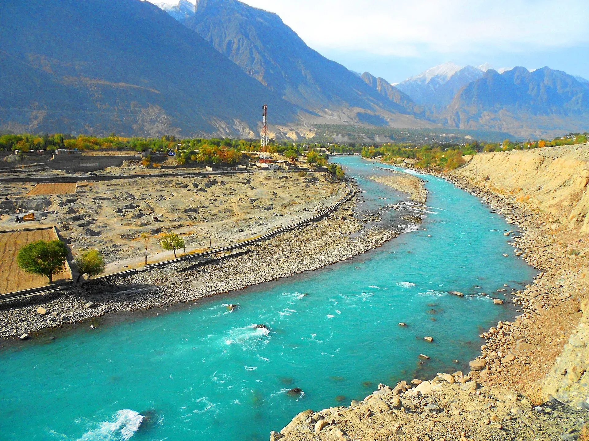
Photo: Ahmed Zohair, with thanks · CC BY-SA 3.0 · via Wikimedia Commons · temporary stand-in photo

Gilgit Bazaar
The busy main market of Gilgit, the gateway town of Gilgit-Baltistan, for dried apricots, crafts, woollens, tea and onward transport. No official opening hours found.
Overview
Gilgit lies at about 1,500 m in the Gilgit Valley, where the Gilgit, Hunza and Indus rivers meet. It is the transport hub for the Karakoram Highway (KKH) and the Hunza, Skardu, Ghizer and Astore routes, and about 10 km from the highway itself. Its main bazaar is the working centre of the town (Wikivoyage names the NLI market and Saddar Bazaar, and puts the Gilgit Bridge at the end of the traditional bazaar), crowded with small shops, banks, hotels, tea houses and van stops. The town is busy rather than pretty, but it has the most services in the region.
Plan your visit
- Nearest town
- Gilgit
- Getting there
The bazaar is in central Gilgit. Gilgit is about 183 km from Sost, about 102 km from Karimabad and about 211 km from Skardu by road (OSRM). More
Best months
Apr – Oct
- Gilgit Bazaar
- Related places nearby: Gilgit, Kargah Buddha, Gilgit River, Danyore Suspension Bridge, Hunza Valley
Why visit
The bazaar is useful: you can buy supplies, change money, arrange transport and find local products before heading to the valleys. It also shows ordinary life in Gilgit, with shoppers from many valleys. Shina and Urdu are the official languages of the region.
What to see and do
- Look for dried apricots, walnuts, local crafts and woollens. Wikivoyage also lists gemstones, antiques and Chinese goods, from silk to electronics, and says some shops accept foreign currency.
- NLI Market, on NLI Road, is described as closed to motor traffic on certain days. A local SIM card needs a copy of your passport and visa.
- Stop for tea or a simple meal at a small restaurant. Local food described by Wikivoyage includes baked breads, handmade-noodle soups, salted and roasted meats, and a breakfast of salted tea with bread. The food is not spicy, and apples, cherries, apricots, almonds, chestnuts and walnuts are the local produce.
- Ask about vans or hired cars to Hunza, Naltar or Skardu, or into Ghizer. Within the city, taxis and minivans are the usual transport; wave a minivan down and knock on the driver's cabin to get off.
- Walk to the Gilgit River and the long wooden suspension bridge.
- Few banks and ATMs accept foreign cards, so bring enough cash.
History
The name appears as Giligitta in a 7th-century rock inscription at Hatun. Gilgit was a Buddhist centre and a Silk Road stop, and Chinese pilgrims Faxian and Xuanzang passed through. The Buddha figure carved on rock at Kargah, outside the town, dates from about 700 CE.
The Trakhan dynasty ruled until about 1810. The British established the Gilgit Agency in 1877, and in 1935 leased the Gilgit area from Jammu and Kashmir for 60 years. The Gilgit Scouts, led by Major William Brown, took over on 1 November 1947, after which the area joined Pakistan. The bazaar grew up around the old centre.
When to visit
April to October is the main season. Winter is cold, with a January mean minimum of about -2.7 C, and the climate is dry (roughly 110 to 240 mm of rain a year, depending on the source). The bazaar stays open for local trade in winter.
Good to know
- Ask the district administration or local police about current conditions before you go. Travel advice. For foreign visitors: the UK FCDO (updated 27 October 2026, checked 17 November 2026) does not advise against Gilgit-Baltistan generally, but it does advise against all travel on the Karakoram Highway between Mansehra and Chilas, which many road routes from Islamabad use. Read the current page before making any plans.
- Getting there. Gilgit Airport has direct flights to Islamabad, with PIA the only airline. There is no railway. Check the current flight and KKH situation before planning.
- Opening hours. None found from an official source.
- Etiquette. Gilgit is conservative. Dress modestly, and ask before photographing people.
- Safety. Keep valuables close in crowded streets. Check the local situation if tensions or protests are reported.
- Nearby. Gilgit town, Kargah Buddha, Danyore Suspension Bridge and Gilgit River.
Highlights
- Main market of Gilgit-Baltistan's gateway town
- Dried apricots, crafts and woollens
- Van and car hire to Hunza, Skardu and Naltar
- Short walk to Gilgit River
Getting there
The bazaar is in central Gilgit. Gilgit is about 183 km from Sost, about 102 km from Karimabad and about 211 km from Skardu by road (OSRM). Wikivoyage says PIA flies from Islamabad in about 45 minutes, with frequent delays and cancellations in bad weather. Karakoram Highway buses also run to Gilgit; check current schedules and FCDO advice. The map point is the town centre, not a surveyed bazaar centre.
Tips
- Stock up here before Hunza, Naltar or treks.
- Agree fares before taking a hired car.
- Dress modestly.
- Keep valuables out of sight.
Photos we still need: the bazaar streets and shops (section: What to see and do); dried apricots and walnuts on sale (section: What to see and do). Send us yours
Sources and last checked
Last checked Confidence low5 sources3 still to check
- Last checked
- Method
- Desk research from published sources
- Confidence
- low
- Checked by
- trek.pk research team
Researched from published sources; not yet checked on the ground by our team. Spot something out of date? Report a mistake.
Sources
- Gilgit · Wikipedia · checked
- Pakistan travel advice: warnings and insurance (updated 27 October 2026) · UK FCDO · checked
- OSRM driving route service: distances and times measured 16 November 2026 (times are optimistic, without stops) · OSRM · checked
- Pakistan Tourism Guide 2021 · TDAP Pakistan · checked
- Gilgit · Wikivoyage · checked
Still to be checked on the ground (3)
- Exact bazaar coordinates (Wikipedia gives only the town centre, 35.9208 N 74.3083 E; OpenStreetMap place search found no bazaar)
- Shop hours (none in Wikivoyage or Wikipedia)
- Current KKH and flight situation (Wikivoyage: PIA only, delays common; no dated schedule found)
Nearby and related

Gilgit
Gateway to Gilgit-Baltistan on the Karakoram Highway: a busy mountain town with the Kargah Buddha and the base for Hunza, Naltar and Skardu.

Kargah Buddha
A standing Buddha about 15 m tall, carved into a cliff in Kargah Nala west of Gilgit, probably from the 7th century.

Gilgit River
A glacier-fed river of about 240 km that rises at Shandur and runs through Ghizer to Gilgit, picks up the Hunza, and meets the Indus near Jaglot where the Karakoram, Hindu Kush and Himalaya join.

Danyore Suspension Bridge
A long single-lane suspension bridge over the Hunza River at Danyor near Gilgit, built in the mid-1960s and now used mainly by pedestrians and motorcyclists. Wooden deck and swaying walkway.

Naltar Valley
A forested valley north of Gilgit with Naltar Paain and Naltar Bala villages, a wildlife sanctuary, the colourful Satrangi and Blue lakes and the PAF-run ski resort.

Hunza Valley
A long Karakoram valley on the Karakoram Highway, with Karimabad, Baltit and Altit forts, Ganish village and Attabad Lake, below Rakaposhi and Ultar Sar. About 100 km from Gilgit.