

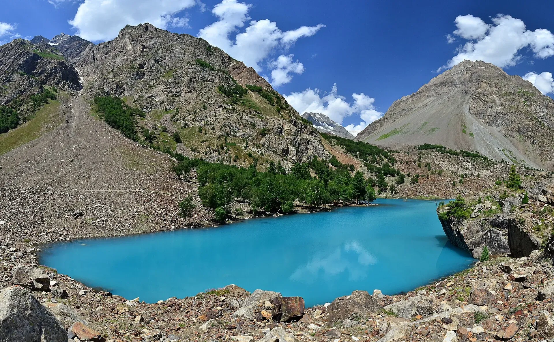
Photo: Thealimir, with thanks · CC BY-SA 3.0 · via Wikimedia Commons · temporary stand-in photo

Naltar Valley
A forested valley north of Gilgit with Naltar Paain and Naltar Bala villages, a wildlife sanctuary, the colourful Satrangi and Blue lakes and the PAF-run ski resort.
Overview
Naltar is a forested side valley north of Gilgit, known for its alpine lakes, its pine woods and what is described as the oldest ski resort in Pakistan. A wildlife sanctuary protects much of the valley. Naltar has two main settlements, Naltar Paain (lower) and Naltar Bala (upper), strung along the Naltar stream, and a jeep road continues to the lakes higher up. It is a popular day trip or overnight stay from Gilgit, and the start of the Daintar and Pakora pass treks.
Plan your visit
- Nearest town
- Nomal
- Getting there
From Gilgit, drive about 26 km on the Karakoram Highway to Nomal, then up the Naltar road. Naltar Bala is about 34 km from Gilgit by Wikipedia, 54 km by the official tourism sheet (about 1 hour by jeep). More
Best months
Jun – Oct
Getting there
Naltar leaves the Karakoram Highway at Nomal, about 26 km from Gilgit by OSRM. Distances to Naltar vary by source: Wikipedia gives about 34 km to Naltar Bala and 40 km to Naltar Paain, the tourism sheet for Gilgit district gives 54 km (about 1 hour, jeep), the wildlife sanctuary article says about 45 km, and Daily Times says about 40 km. An OSRM route to a point near Naltar Bala (approximate end point) gave about 44 km and 1 hour 40 minutes. The final stretch is a rough, narrow road beside the stream, and a 4x4 with an experienced driver is recommended. Road works have improved parts of it, but landslides and snow can block it.
What to see and do
- Naltar Lakes. About 13 km beyond Naltar Bala are the Satrangi (Bashkiri), Blue and Bodlok lakes, among others, known for their colours. The road is unpaved and narrow. Higher lakes stay snow-covered for much of the year.
- Naltar Wildlife Sanctuary. Established on 22 November 1975 and covering about 27,000 hectares, it protects Astor markhor, Alpine ibex, snow leopard, brown bear and grey wolf. Around 35 bird species have been recorded, including Brooks's leaf warbler. You are unlikely to see large mammals from the road.
- Forest walks and meadows. Spruce, juniper and mixed woods, grazing meadows and yaks, with several rest houses and camping places.
- Skiing. See Naltar Ski Resort. The Pakistan Air Force runs the ski resort, and the winter sports season usually opens around late December. Check dates, as the season is announced each year.
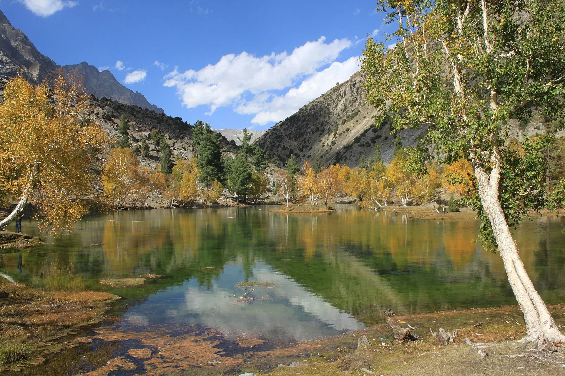
Photo: Tipuabdul, with thanks · CC BY-SA 3.0 · via Wikimedia Commons · temporary stand-in photo

Treks from the valley
- Daintar Pass (technical) links Upper Naltar with the Hunza side.
- Pakora Pass (moderate) links Upper Naltar with Pakora in Ishkoman.
- Short walks to Satrangi and the other lakes are possible for fit visitors.
When to go
June to September for the lakes and high meadows; October for autumn colour. In winter the valley is deep in snow, with 10 to 15 feet reported on the lake road, and it is accessible mainly for skiing. Check road and weather reports before travelling at any time of year.
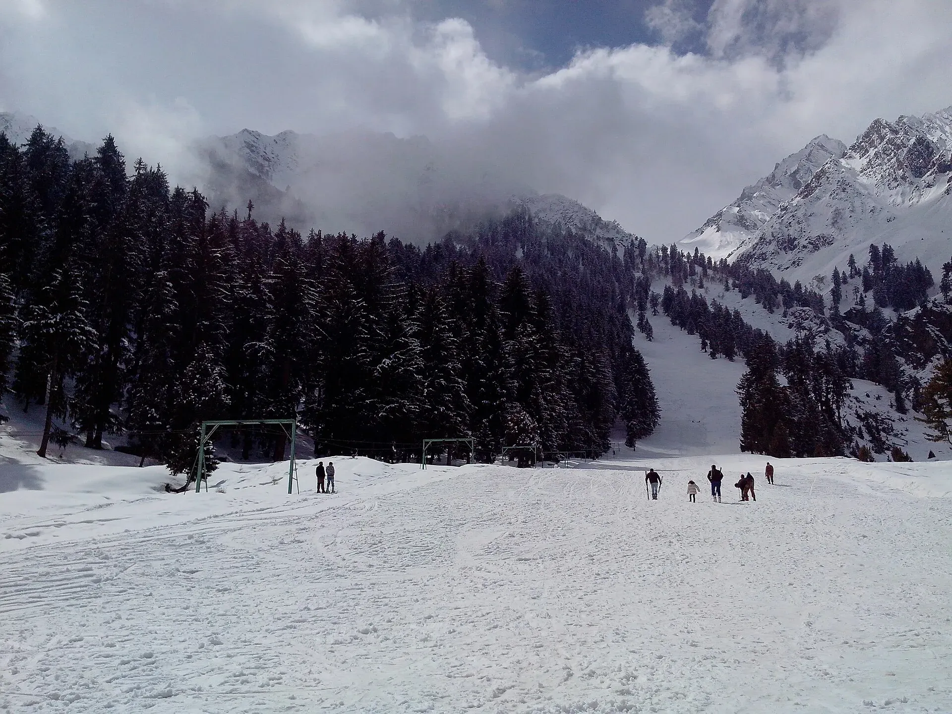
Photo: Mr Haseeb Ahmed, with thanks · CC BY-SA 3.0 · via Wikimedia Commons · temporary stand-in photo

Where to stay and eat
Naltar has government rest houses (the oldest is the GBPWD rest house), as well as rest houses run by the Pakistan Air Force and other organisations, and private hotels and guest houses. Book ahead in summer and in the ski season, and bring food supplies for trips to the lakes.
Culture and languages
Shina is the local language of the Gilgit district, with Urdu and English widely understood. Local people farm, graze yaks and work in tourism and the hydropower stations in the valley. Dress modestly in the villages.
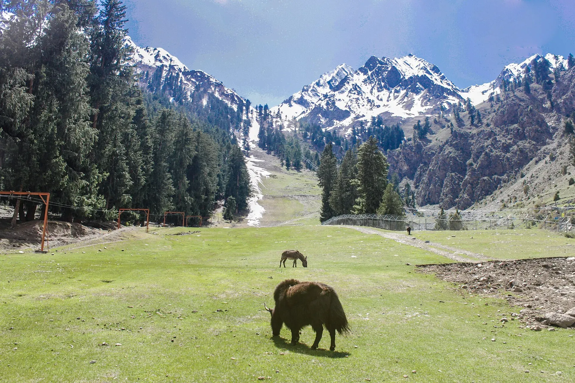
Photo: Irfansheen, with thanks · CC BY-SA 4.0 · via Wikimedia Commons · temporary stand-in photo

Safety and practical points
- The road to the lakes is steep, narrow and prone to washouts; do not drive it in poor weather or at night.
- Altitude: the lakes are at about 3,050 to 3,150 m.
- Wildlife: keep your distance from animals and do not feed them.
- Trekking over Daintar and Pakora passes needs a guide and current advice on glaciers and weather.
- The GB Tourist Police helpline is 1422.
Highlights
- Satrangi, Blue and other Naltar Lakes
- Naltar Wildlife Sanctuary with Astor markhor and snow leopard
- A ski resort run by the Pakistan Air Force, described as Pakistan's oldest
- Pine woods and yak meadows close to Gilgit
- Starts of the Daintar Pass and Pakora Pass treks
Tips
- Use a 4x4 with an experienced driver; the lake road is rough.
- Book rest houses early for July, August and the ski season.
- Check weather and road conditions before leaving Nomal.
- Bring food and warm layers; evenings are cold.
Photos we still need: a trek route from Naltar over Daintar or Pakora pass; a rest house or camping place at Naltar. Send us yours
Sources and last checked
Last checked Confidence medium5 sources5 still to check
- Last checked
- Method
- Desk research from published sources
- Confidence
- medium
- Checked by
- trek.pk research team
Researched from published sources; not yet checked on the ground by our team. Spot something out of date? Report a mistake.
Sources
- Land of Diversity: District Gilgit tourist guide sheet · Tourism & Culture Department, Gilgit-Baltistan · checked
- Naltar Valley (Wikipedia) · Wikipedia · checked
- Naltar Wildlife Sanctuary (Wikipedia) · Wikipedia · checked
- Naltar: a winter sports paradise · Daily Times · checked
- OSRM driving routes (distances and modelled times between towns) · OSRM / OpenStreetMap · checked
Still to be checked on the ground (5)
- Distance from Gilgit to Naltar Bala (range of 34 to 54 km across Wikipedia, Daily Times, the sanctuary article and the tourism sheet; none official and dated)
- Altitude of the valley and ski resort (Wikipedia gives none; Daily Times gives an implausible 15,000 ft for the valley; the page's 3,050 to 3,150 m refers to the lakes)
- Ski season dates and current operator rules (Daily Times: run by the Pakistan Air Force with the Winter Sports Federation; no dates)
- Condition of the lake road (Wikipedia: unmetalled and narrow, snow-blocked in winter; no current report)
- Rest house booking arrangements
Nearby and related

Daintar Pass

Pakora Pass
Naltar Lakes
A group of three lakes at about 3,050 to 3,150 m above Naltar Valley near Gilgit. The Bashkiri lakes, including Satrangi and Blue Lake, are reached by a rough jeep road and are known for their colours.

Gilgit
Gateway to Gilgit-Baltistan on the Karakoram Highway: a busy mountain town with the Kargah Buddha and the base for Hunza, Naltar and Skardu.

Ishkoman Valley
A quiet glacier and trout valley north of Gahkuch in Ghizer, with Chatorkhand, Dain waterfall, Phakora and the road end at Imit, and treks towards Yasin, Naltar and Karambar Lake.

Hunza Valley
A long Karakoram valley on the Karakoram Highway, with Karimabad, Baltit and Altit forts, Ganish village and Attabad Lake, below Rakaposhi and Ultar Sar. About 100 km from Gilgit.
Nomal Valley
A green oasis on the Hunza River about 25 km north of Gilgit, and the turn-off for the Naltar road.
Chaprot Pass
A high pass of about 4,900 m linking the Chaprot valley in Nagar with the Naltar valley. Little documented.
Hayal Pass
A seldom-used pass of about 4,700 m north of Shani Peak, west of Naltar Pass. It is mentioned as a route from the Pakora Glacier to Chatorkhand.
Naltar Pass
A pass of about 4,600 m north of Shani Peak in the Naltar valley. Little documented; Pakora Pass is the better-known crossing from Naltar.
Shani Glacier (Naltar Valley)
A glacier in the Naltar Valley, north of Gilgit, below Shani Peak (5,887 m). Its meltwater feeds the Naltar River and the lakes.

Grand Northern Loop
A 12-14 day circuit of the north from Islamabad: Naran and Babusar, Hunza and Khunjerab, Skardu and Deosai, Gilgit, then Swat or the KKH back. Distances, passes and seasons.