

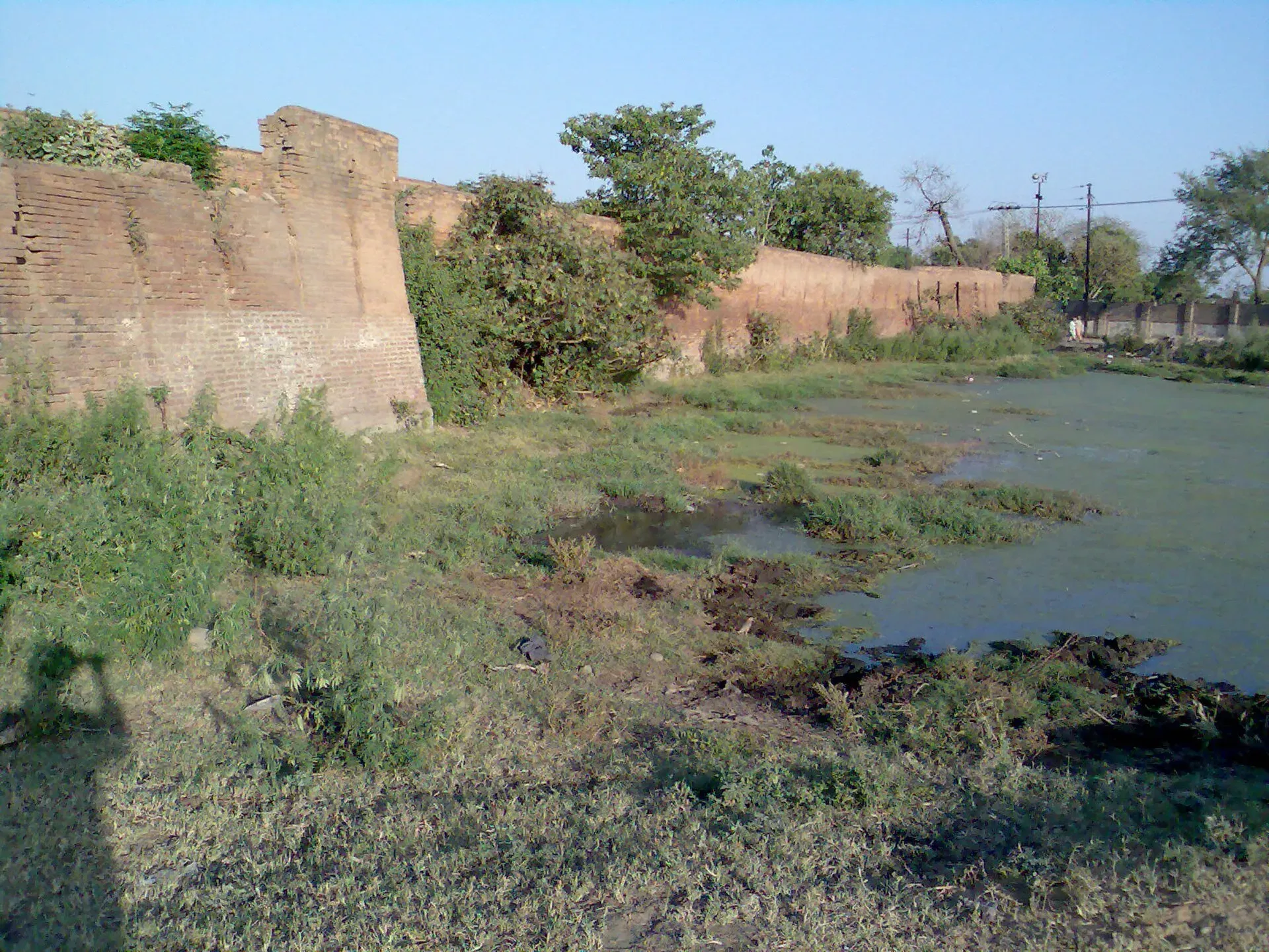
Photo: Talha, with thanks · CC BY-SA 3.0 · via Wikimedia Commons · temporary stand-in photo

Jhelum
Grand Trunk Road city on the Jhelum River, 23 km from Rohtas Fort (UNESCO), about 30 km from Mangla Dam and about 116 km from Islamabad.
Overview
Jhelum lies on the western bank of the Jhelum River in northern Punjab. It is the district capital and is nicknamed the City of Soldiers because so many local men served in the British Indian Army and later the Pakistan Armed Forces. Wikipedia says the area is several miles upstream from the site of the ancient Battle of the Hydaspes between Alexander the Great and Porus. A railway bridge across the river was built in 1873.
At the 2023 census the city, including the Jhelum cantonment, had about 312,426 people (Wikipedia). Punjabi is the main mother tongue. Literacy is among the highest in Pakistan.
Plan your visit
- Getting there
Road: Islamabad is about 116 km (roughly 1 hour 35 minutes) and Lahore about 173 km (roughly 2 hours 20 minutes) via the N-5 and motorway links (OSRM, checked 16 November 2026). More
Best months
Oct – Apr
- Jhelum
- Related places nearby: Rohtas Fort, Gujrat, Tilla Reserve National Park, Nandana Fort, Dina, Pind Dadan Khan, Gujar Khan, Kharian, Tilla Jogian (Jogi monastery and hill), Jhelum, Mangla Dam
History in brief
Alexander the Great fought Porus at the Battle of the Hydaspes several miles downstream of the modern city. Mahmud of Ghazni took the region after 1005, and the Delhi Sultanate and the Mughals followed. The Sikh Empire occupied Jhelum District in 1808. The British took it in 1849, and in the 1857 rising mutineers killed 35 soldiers of the 24th Regiment of Foot at the Battle of Jhelum. In the First World War the district ranked first in recruiting for the British effort. Wikipedia also records that Jhelum was a timber depot, with Kashmir timber floated down the river, and had a notable boat-building trade.
What to see and do
- Rohtas Fort: Sher Shah Suri's huge fort, about 18 km north-west of Jhelum by Wikipedia and 23 km by road (OSRM). It is a UNESCO World Heritage Site. See our Rohtas Fort page.
- Mangla Dam: on the Jhelum River about 30 km from the city, according to Wikipedia. Wikipedia lists it among Jhelum's tourist attractions and notes it lies partly in Mirpur District of Azad Kashmir, but it gives no public access rules, so check before you go. Wikipedia also names Lehri Nature Park and the Rasul Barrage picnic area, each about 30 km from the city; the barrage is downstream, and its lake is a picnic spot. Mangla Dam was built in 1967.
- A Sikh-era fort in the city: a photo on Wikipedia shows a fort in Jhelum built in the Sikh period. Opening details are not published.
- St John's Church and the railway bridge: the church was built in 1860 beside the river and reopened after renovation in 2007. The railway bridge across the river dates from 1873 and was built by William St. John Galwey.
- Tilla Jogian: an ancient complex of temples in the hills nearby.
- The riverfront and bazaars: a pleasant evening walk when the weather allows.
When to visit
October to April is best. Summers are extremely hot and humid. The highest recorded temperature is 49.2 C, and winter lows can touch about -0.6 C. Annual rainfall averages about 900 mm. Monsoon torrents can damage roads and bridges.
Where to stay and eat
Jhelum has a range of hotels and many roadside restaurants, as it sits on the main N-5 route. The N-5 links the city with Islamabad in about 1.5 hours and Lahore in about 3 hours, according to Wikipedia. Jhelum railway station, built in 1928, is on the main line, and Islamabad International Airport is about 110 km by road.
Good to know
Expect banks, pharmacies, fuel and several hospitals. Confirm on arrival. Check current advice before you travel. Ask the district administration or local police about current conditions before you go. For foreign visitors: the UK FCDO Pakistan page (updated 27 October 2026, checked 16 November 2026) advises against all travel to Balochistan and to a long list of Khyber Pakhtunkhwa districts, and against all but essential travel within 5 miles of the India border. Dera Ghazi Khan is the only Punjab district it lists. Jhelum is not named on that page.
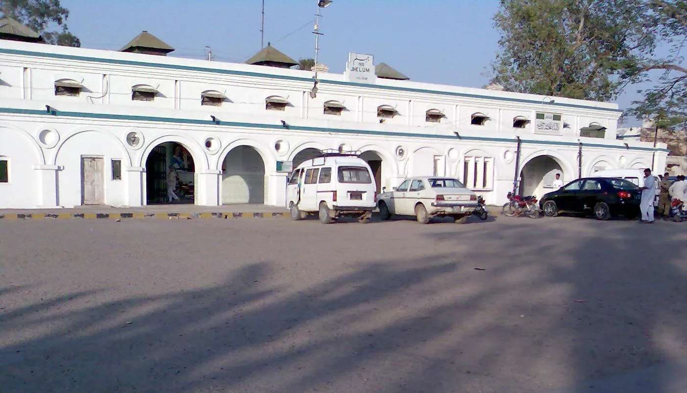
Photo: Talha, with thanks · CC BY-SA 3.0 · via Wikimedia Commons · temporary stand-in photo

Highlights
- Rohtas Fort (UNESCO) about 23 km away
- Mangla Dam about 30 km away
- Sikh-era fort in the city
- Strong military tradition: the City of Soldiers
Getting there
Road: Islamabad is about 116 km (roughly 1 hour 35 minutes) and Lahore about 173 km (roughly 2 hours 20 minutes) via the N-5 and motorway links (OSRM, checked 16 November 2026). Rail: Jhelum Railway Station is on the Pakistan Railways main line, opened in 1928. Air: Islamabad International is the nearest major airport.
Hotels, food, fuel and services in Jhelum
Places to eat
- Chaaye Khana JhelumCall Chaaye Khana JhelumMap of Chaaye Khana Jhelum in Google Maps
- 2nd Wife RestaurantCall 2nd Wife RestaurantMap of 2nd Wife Restaurant in Google Maps
- Pizzalicious Fast FoodCall Pizzalicious Fast FoodMap of Pizzalicious Fast Food in Google Maps
- Chicken Cottage JhelumCall Chicken Cottage JhelumMap of Chicken Cottage Jhelum in Google Maps
- Handi House Restaurant JhelumCall Handi House Restaurant JhelumMap of Handi House Restaurant Jhelum in Google Maps
- Habibi Restaurant JhelumCall Habibi Restaurant JhelumMap of Habibi Restaurant Jhelum in Google Maps
Essential services fuel stations, mechanics, ATMs, pharmacies, hospitals and clinics and Rescue 1122
Fuel
- Noor PSO Filling StationCall Noor PSO Filling StationMap of Noor PSO Filling Station in Google Maps
- Four Star Petroleum- Total Petrol StationCall Four Star Petroleum- Total Petrol StationMap of Four Star Petroleum- Total Petrol Station in Google Maps
- GO Petroleum & Heera CNG.Call GO Petroleum & Heera CNG.Map of GO Petroleum & Heera CNG. in Google Maps
- Admore Petrol PumpCall Admore Petrol PumpMap of Admore Petrol Pump in Google Maps
- Jhelum CNGMap of Jhelum CNG in Google Maps
- Al Rehman CNG StationMap of Al Rehman CNG Station in Google Maps
Mechanics and tyre shops
- Fazal Din & Sons Honda DealerCall Fazal Din & Sons Honda DealerMap of Fazal Din & Sons Honda Dealer in Google Maps
- Haji Pervez Autos & Battery StoreCall Haji Pervez Autos & Battery StoreMap of Haji Pervez Autos & Battery Store in Google Maps
- Al-Makkah Autos WorkshopCall Al-Makkah Autos WorkshopMap of Al-Makkah Autos Workshop in Google Maps
- Munir Autos Sara-e-AlamgirCall Munir Autos Sara-e-AlamgirMap of Munir Autos Sara-e-Alamgir in Google Maps
- Al-Haseeb Auto StoreCall Al-Haseeb Auto StoreMap of Al-Haseeb Auto Store in Google Maps
- Shehzad Auto Workshop & Spare PartsCall Shehzad Auto Workshop & Spare PartsMap of Shehzad Auto Workshop & Spare Parts in Google Maps
ATMs
- HBL Kharala Branch JhelumCall HBL Kharala Branch JhelumMap of HBL Kharala Branch Jhelum in Google Maps
- Faysal BankMap of Faysal Bank in Google Maps
- UBL ATMCall UBL ATMMap of UBL ATM in Google Maps
- ATM UBLMap of ATM UBL in Google Maps
Pharmacies
- Shifa PharmacyCall Shifa PharmacyMap of Shifa Pharmacy in Google Maps
- Tariq PharmacyCall Tariq PharmacyMap of Tariq Pharmacy in Google Maps
- MD Clinic and PharmacyMap of MD Clinic and Pharmacy in Google Maps
- Sunny Medical StoreCall Sunny Medical StoreMap of Sunny Medical Store in Google Maps
- Awan Medical StoreCall Awan Medical StoreMap of Awan Medical Store in Google Maps
- A.S Pharmacy (المدینہ میڈیکل سٹور)Call A.S Pharmacy (المدینہ میڈیکل سٹور)Map of A.S Pharmacy (المدینہ میڈیکل سٹور) in Google Maps
Hospitals and clinics
- Jhelum Doctors HospitalCall Jhelum Doctors HospitalMap of Jhelum Doctors Hospital in Google Maps
- Jhelum Poly ClinicCall Jhelum Poly ClinicMap of Jhelum Poly Clinic in Google Maps
- Jhelum Cardiac CentreCall Jhelum Cardiac CentreMap of Jhelum Cardiac Centre in Google Maps
- Hijama Center Hakeem Zubair Khan JhelumCall Hijama Center Hakeem Zubair Khan JhelumMap of Hijama Center Hakeem Zubair Khan Jhelum in Google Maps
- Dr Fozia Kazmi Clinic & Maternity HomeCall Dr Fozia Kazmi Clinic & Maternity HomeMap of Dr Fozia Kazmi Clinic & Maternity Home in Google Maps
- Mirza HospitalCall Mirza HospitalMap of Mirza Hospital in Google Maps
Rescue 1122
- Rescue 1122 Office Sarai AlamgirMap of Rescue 1122 Office Sarai Alamgir in Google Maps
- Rescue 1122 JhelumCall Rescue 1122 JhelumMap of Rescue 1122 Jhelum in Google Maps
Listings come from Google Maps data and are unverified: phone numbers, opening months and prices may have changed. Report a problem · Own one of these? Claim it
Tips
- Visit Rohtas Fort as a half-day trip.
- Go between October and April: Jhelum has recorded highs of 49.2 C.
- Stop on the way between Islamabad and Lahore.
- Check Rohtas opening hours before you go.
Photos we still need: Jhelum riverfront or bazaar (When to visit). Send us yours
Sources and last checked
Last checked Confidence medium5 sources4 still to check
- Last checked
- Method
- Desk research from published sources
- Confidence
- medium
- Checked by
- trek.pk research team
Researched from published sources; not yet checked on the ground by our team. Spot something out of date? Report a mistake.
Sources
- Jhelum · Wikipedia · checked
- Rohtas Fort · Wikipedia · checked
- OSRM driving routes (road distances and times, optimistic) · Project OSRM · checked
- Pakistan travel advice: warnings and insurance · UK FCDO (GOV.UK) · checked
- Mangla Dam · Wikipedia · checked
Still to be checked on the ground (4)
- Mangla Dam public access rules (no source says whether visitors can enter)
- Sikh-era fort in the city: name and access (Wikipedia names none)
- Hotels and services
- Whether Tilla Jogian is open to visitors and how to reach it from the city (Wikipedia names it as nearby only)
Nearby and related

Rohtas Fort
A huge 16th-century fort of Sher Shah Suri near Jhelum, with four kilometres of walls, monumental gates and a village still living inside. UNESCO inscribed it in 1997.

Islamabad
Pakistan's green, planned capital at the foot of the Margalla Hills: Faisal Mosque, hillside trails, cafes and the gateway to the north.

Rawalpindi
Islamabad's older twin city: a busy bazaar and cantonment, the north's main rail and bus hub, and an easy base for Taxila and Murree.

Lahore
Punjab's capital and Pakistan's cultural city: Mughal forts, mosques and gardens, a lively Walled City, and some of the best food in the country.

Gujrat
A Mughal-era city on the Chenab in Pakistan's Golden Triangle, with Akbar's fort, the Shah Daula shrine, old city gates and the setting of the Sohni Mahiwal love story.

Tilla Reserve National Park
A national park in the eastern Salt Range in Jhelum District, Punjab, notified in 2021. It takes in the Tilla Jogian ridge. Size figures differ between sources.
Nandana Fort
A ruined hilltop fort and temple on the eastern Salt Range near Baghanwala in Jhelum district, once a capital of the Odi Shahi dynasty.
Dina
Army-linked town on the Grand Trunk Road in Jhelum District, at the junctions for Rohtas Fort and Mangla Dam.
Pind Dadan Khan
Old river-port and grain-market town on the Jhelum, the nearest town to Khewra Salt Mine. Historically known for brass, pottery and boats.
Gujar Khan
Large Pothohar town of about 103,000 people on the N-5 between Islamabad and Jhelum, known for its army tradition and nearby oil and gas fields. Few visitor sights.
Kharian
Large garrison town on the Grand Trunk Road in Gujrat District. Known for its cantonment and its overseas community in Scandinavia; not set up for sightseeing.
Tilla Jogian (Jogi monastery and hill), Jhelum
The highest hill of the eastern Salt Range (about 975 m), crowned by an abandoned Hindu temple and Kanphata jogi monastery complex about 25 km west of Jhelum.

Mangla Dam
A large embankment dam on the Jhelum River, completed in 1967 and raised in 2009. The lake has a recreation side open to the public, but parts of the area are restricted.