

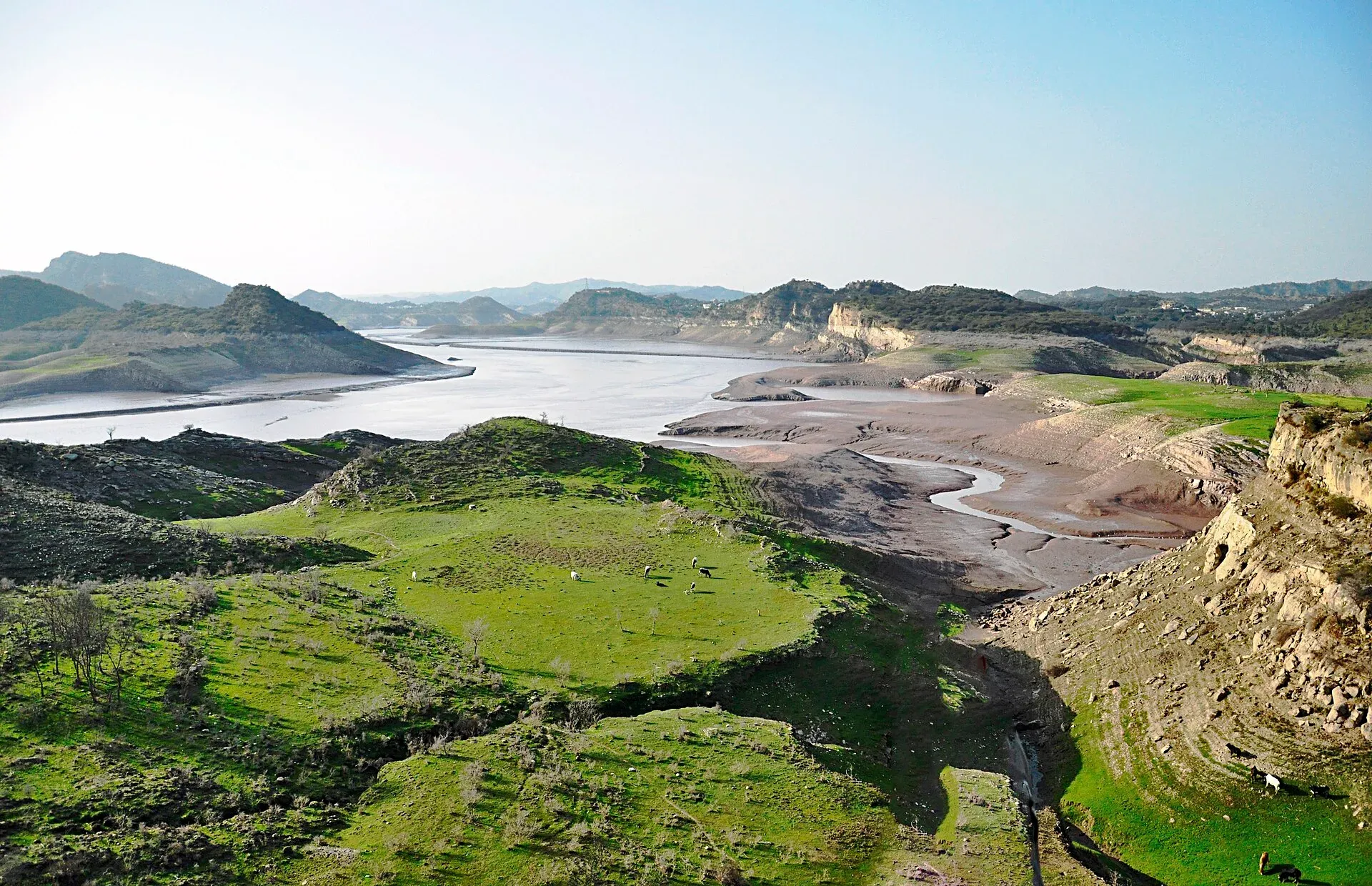
Photo: Nmansoor, with thanks · CC BY-SA 3.0 · via Wikimedia Commons · temporary stand-in photo

Mangla Dam
A large embankment dam on the Jhelum River, completed in 1967 and raised in 2009. The lake has a recreation side open to the public, but parts of the area are restricted.
Overview
Mangla Dam stands on the Jhelum River where Azad Kashmir meets Punjab, about 108 km south-east of Islamabad by Wikipedia's measure. It lies between Mirpur District in Azad Kashmir and Jhelum District in Punjab. It is 147 m high and 3,140 m long. Mangla Lake covers about 250 sq km. The fort of Mangla, at the mouth of the dam, gave it its name.
Why it was built
The Indus Waters Treaty of 1960 gave Pakistan the rights to the Jhelum, Chenab and Indus river basins. Until the late 1960s the country's irrigation system depended on unregulated river flows, with too little water in the growing season and a glut in the monsoon. Mangla was the first of two big dams built to store that surplus, the other being Tarbela on the Indus. Its main purpose is irrigation, with power generation second, and it also works as a flood control structure during the monsoon (Wikipedia).
British engineers Binnie & Partners designed and supervised the project, and a consortium of eight American firms, Mangla Dam Contractors, built it. Construction began in 1961 and the dam opened in 1967.
The dam and the power station
The dam is a group of structures: a main embankment, an intake embankment, a main spillway with nine radial gates, an emergency spillway, five tunnels and a power station. Wikipedia's construction section gives the main embankment as 2,600 m long and 138 m high above its core trench, so quoted heights and lengths vary with what is counted. A dyke called Sukian and a small dam called Jari Dam close gaps in the reservoir rim.
The power station has ten turbines. Its installed capacity is given as 1,000 MW, and the station generated about 4,800 million kWh in 2008 to 2009. WAPDA commissioned two refurbished units on 23 May 2022 (Wikipedia). The dam was bombed in an air raid in the 1971 war and was briefly out of service. On 1 September 2013 the lake reached a record level of 377.1 m, just under the maximum conservation level of 379 m.
The raising project
Sediment cut the reservoir's capacity from 7.25 billion cubic metres to 5.77 billion by 2005. A raising project, started in 2004 and finished in 2009, lifted the dam by 9.1 m and increased storage from 5.56 to 9.12 billion cubic metres. It affected more than 40,000 people living near the lake. The resettlement programme included New Mirpur City and four satellite towns (Wikipedia).
What to see and do
Most visitors come for the lake rather than the dam wall. Travel sites describe boat hire, fishing and picnics along a developed lakeshore, and a boat ride to the old Ramkot Fort on the lake. These are commercial or travel-guide descriptions, not official notices, so check what is running when you arrive.
Entry to the dam structure itself is not a normal visitor attraction. Guides report that parts of the Mangla area are restricted because of military and WAPDA establishments. There is no known official visitor scheme.
When to visit
Spring and autumn are best for lake views and boating. Summer is hot, and monsoon weather can make the water rough.
Photography and safety
No official photography rule was found. Treat the dam wall, spillways, powerhouse and any military or security area as no-photo zones unless a guard says otherwise. Use licensed boats with life jackets, avoid swimming in open water and stay away from the spillway areas.
Good to know
- Ask the district administration or local police about current conditions before you go. Travel advice. For foreign visitors: the UK FCDO (updated 27 October 2026, checked 16 November 2026) advises against all but essential travel to Azad Jammu and Kashmir, and against all travel within 10 miles of the Line of Control. Read the live page before you go.
- Fees. Boating and park charges are not confirmed from an official source; current fees will be added soon.
- Nearby. Jhelum and the Jhelum River.
Highlights
- 147 m high, 3,140 m long
- Opened 1967, raised in 2009
- Lake of about 250 sq km
- Boating on the lake; Ramkot Fort by boat
Getting there
From Islamabad it is about 119 km by road (OSRM, around 1 hour 40 minutes without traffic) towards Mangla. Roads and checkpoints change; confirm locally.
Tips
- Do not photograph the dam works or security areas.
- Use licensed boats and life jackets.
- Check the FCDO page for Azad Kashmir before you go.
- Avoid summer midday and the monsoon.
Sources and last checked
Last checked Confidence medium3 sources5 still to check
- Last checked
- Method
- Desk research from published sources
- Confidence
- medium
- Checked by
- trek.pk research team
Researched from published sources; not yet checked on the ground by our team. Spot something out of date? Report a mistake.
Sources
- Mangla Dam · Wikipedia · checked
- Mangla Dam tour · Apricot Tours (operator) · checked
- Foreign travel advice: Pakistan · UK FCDO · checked
Still to be checked on the ground (5)
- Which parts of the lake and dam area are open to the public (an operator mentions a boating area, viewpoint and visitor centre; no official list)
- Boating operators and current rules
- Whether any visitor museum or visitor centre is open at the dam (operator page mentions a visitor centre; unconfirmed)
- Dam dimensions: 147 m high and 3,140 m long here; Wikipedia's construction section gives the main embankment as 138 m high and 2,600 m long
- Construction dates: Wikipedia gives 1961 to 1965 in one place and an opening in 1967 elsewhere
Nearby and related

Jhelum
Grand Trunk Road city on the Jhelum River, 23 km from Rohtas Fort (UNESCO), about 30 km from Mangla Dam and about 116 km from Islamabad.

Jhelum River
A river of about 725 km that rises at Verinag in Kashmir, passes Srinagar and Muzaffarabad, fills Mangla Dam, crosses Punjab past Jhelum city and joins the Chenab at Trimmu.

Islamabad
Pakistan's green, planned capital at the foot of the Margalla Hills: Faisal Mosque, hillside trails, cafes and the gateway to the north.

Mirpur
District capital of Mirpur in Azad Kashmir, nicknamed Little England for its British Pakistani links, beside Mangla Dam.
Dina
Army-linked town on the Grand Trunk Road in Jhelum District, at the junctions for Rohtas Fort and Mangla Dam.