

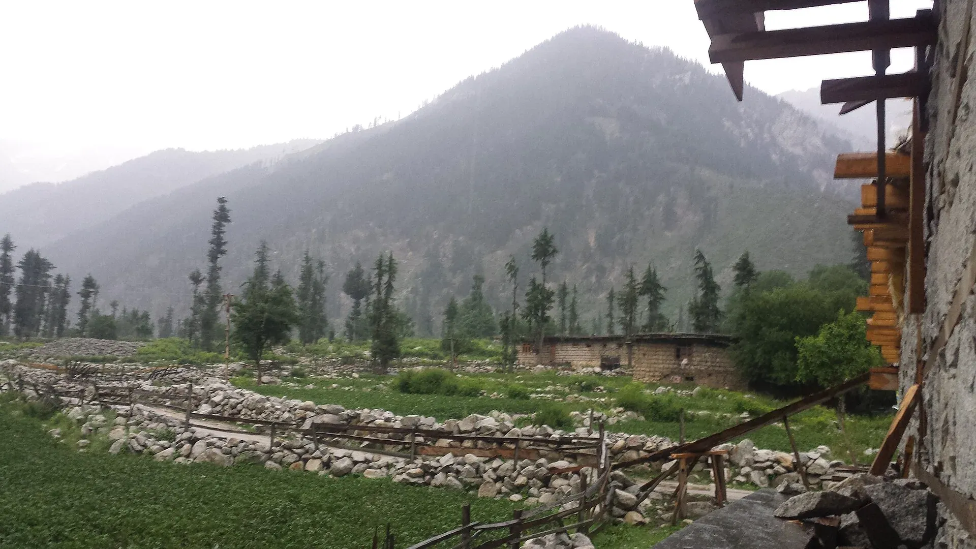
Photo: Umair khan, with thanks · CC BY-SA 4.0 · via Wikimedia Commons · temporary stand-in photo

Kumrat Deodar Forests
The dense deodar forests of Kumrat in the upper Panjkora valley, Upper Dir. Access was cut by floods and a collapsed bridge in 2025 and 2026, and the FCDO advises against travel to Upper Dir.
Overview
Kumrat lies in the upper Panjkora valley in Upper Dir District, in Sharingal tehsil, and covers about 346 square km. It is known for deodar forest, the Jahaz Banda meadow and Katora Lake. This page covers the forest side of the valley. The Kumrat Valley page has the general picture of the valley, its campsites and its access problems.
Plan your visit
- Nearest town
- Thal
- Getting there
From Thal it is about 84 km (OSRM, modelled 1.9 h), though the bridge collapse changed access. For foreign visitors: the UK FCDO advises against all travel to Upper Dir. More
Best months
Jun – Sep
- Kumrat Deodar Forests
- Related places nearby: Kumrat Valley, Jahaz Banda, Katora Lake
The forests
Pine forest covers the upper valley and oak forest the lower valley, while the tall deodar grows on the level ground beside the Panjkora river. Wikipedia lists blue pine, Indian horse-chestnut, deodar, West-Himalayan fir, holly oak, Himalayan birch, common walnut and Himalayan poplar among the main trees. The same page names the Asiatic black bear, grey wolf, red fox, yellow-throated marten, Kashmir musk deer and Astor markhor among the mammals of the valley.
The trees give shade and hold the steep soil; where they are cut, slopes become unstable and landslides follow. Wikipedia says the deodar forests are shrinking because residents burn the wood for heating and cooking in winter. No source opened gives a forest area or tree count, so none is given here. Local people use the forest for grazing and timber under village rules, so ask before you camp or collect wood.
What to see and do
The usual visit is a camp or a day trip at the forest edge, with short walks to waterfalls and the river, which splits into channels in places. Kala Chashma (Black Spring) is one of the valley's water features. A longer walk reaches Jahaz Banda meadow at about 3,100 m and Katora Lake. The valley is mainly home to Gawri-speaking people.
When to visit
June to September is the usual season. Snow limits access in winter; the Kalam to Utror road is closed about seven months a year by snow, according to the Express Tribune.
Getting there
Thal to Kumrat is about 84 km (modelled 1.9 hours by OSRM, an estimate). Wikipedia says only four-wheel vehicles can reach the valley because the road is unmetalled, and that around Eid al-Fitr about 2,000 vehicles enter daily. The Tribune reported in April 2026 that the Patrak to Kumrat road had been under construction for about 10 years and was unfinished, and that floods in 2010 and 2022 destroyed link roads that still need rebuilding.
Where to stay and eat
Most visitors stay in tents or simple huts run by local people, with simple camping spots along the river. Bring your own supplies. Tourism is the main livelihood in Kumrat, according to a local guide quoted by the Tribune, and hotel owners reported fewer visitors than expected at Eid in 2026.
Good to know
- Access: The Express Tribune (27 April 2026) reported that the Thal Bazaar to Kumrat link bridge collapsed under an overloaded vehicle and cut the valley off, and that it had not been rebuilt about four months later despite three official inauguration ceremonies. It also said roads to Kumrat and Jahaz Banda were badly damaged. An APP report on the collapse is dated 2 November, with no year printed on the page. Check road status with Upper Dir authorities.
- Travel advice. Ask the district administration or local police about current conditions before you go. For foreign visitors: the UK FCDO (updated 27 October 2026) advises against all travel to Upper and Lower Dir, and notes KP emergency measures and Governor's Rule since 11 October 2026. Read the live page first.
- Threats: Illegal cutting of deodar is a known problem across upper Swat and Dir. Local reports of the scale in Kumrat were not confirmed.
- Camping and entry charges, if any, are not confirmed; current fees will be added soon.
- Mobile signal is weak or absent in much of the valley, so tell someone your plan.
Highlights
- Deodar forests above the Panjkora river
- Jahaz Banda meadow and Katora Lake
- Access currently disrupted
Tips
- Confirm road and bridge status before travelling
- Read the FCDO advice
- Carry supplies; services are basic
Photos we still need: deodar forest beside the Panjkora river in Kumrat (current photo is a general forested-slope view). Send us yours
Sources and last checked
Last checked Confidence low5 sources3 still to check
- Last checked
- Method
- Desk research from published sources
- Confidence
- low
- Checked by
- trek.pk research team
Researched from published sources; not yet checked on the ground by our team. Spot something out of date? Report a mistake.
Sources
- Kumrat Valley (Wikipedia) · Wikipedia · checked
- Kumrat tourism hit as neglect persists (27 April 2026) · The Express Tribune · checked
- Historic bridge collapse cuts off Kumrat valley's access in Upper Dir · APP · checked
- Pakistan travel advice (updated 27 October 2026) · UK Foreign, Commonwealth & Development Office · checked
- OSRM driving routes (modelled distance and time) · OSRM project · checked
Still to be checked on the ground (3)
- Current road and bridge status (Tribune 27 Apr 2026: bridge not rebuilt; nothing newer opened)
- Forest area (no figure in any source opened)
- Camping rules and fees (no source covers them)
Nearby and related

Kumrat Valley
The upper Panjkora valley in Upper Dir, known for deodar forest, the Jahaz Banda meadow and Katora Lake. Access has been cut by floods and a collapsed bridge in 2025 and 2026.

Jahaz Banda
A large high meadow at about 3,100 m in the upper Kumrat Valley, Upper Dir, reached by a rough jeep road and a walk. UK travel advice is against all travel to Upper Dir.

Katora Lake
An alpine glacial lake at about 3,500 m above Jahaz Banda in the Kumrat valley, Upper Dir. A trek of several hours from the end of the jeep road.

Kumrat Waterfall
A waterfall in Kumrat Valley, Upper Dir, in the Panjkora river area. Sources are thin and sometimes confusing. For foreign visitors: the UK FCDO advises against all travel to Upper Dir.