

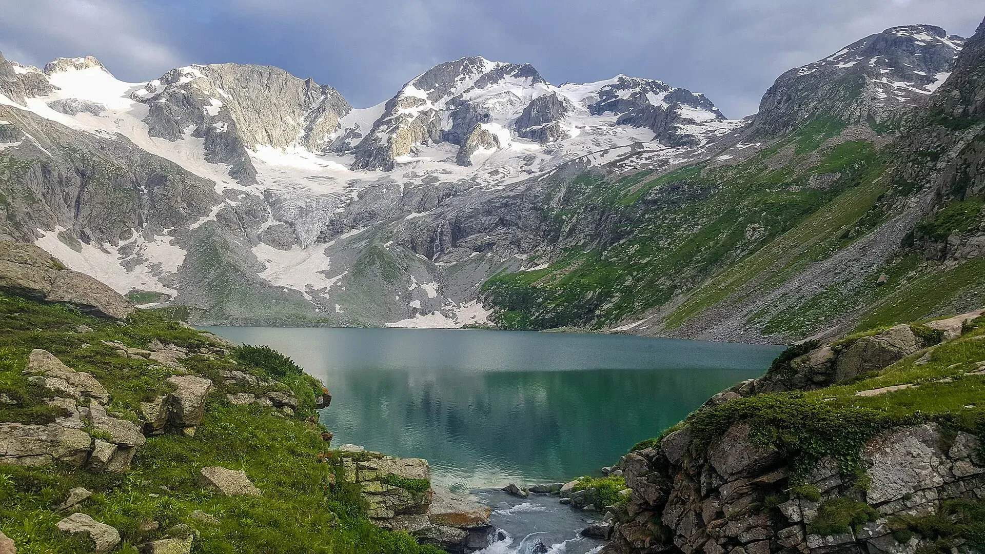
Photo: Jehan Sher, with thanks · CC BY-SA 4.0 · via Wikimedia Commons · temporary stand-in photo

Katora Lake
An alpine glacial lake at about 3,500 m above Jahaz Banda in the Kumrat valley, Upper Dir. A trek of several hours from the end of the jeep road.
Overview
Katora Lake is an alpine glacial lake at about 3,500 m (11,500 ft) in the upper reaches of Jahaz Banda, in the Kumrat valley of Upper Dir. "Katora" means "bowl" in Pashto and the lake is named for its shape. It is fed by snowmelt from the glaciers around it and lies close to the boundary with Swat.
It is usually visited as part of a three to five day trip combining Kumrat, the Jahaz Banda meadows and the lake. The scenery is open alpine meadow, with conifer forest lower down.
Plan your visit
- Nearest town
- Thal (Kumrat)
- Getting there
Drive from Islamabad to Dir (a long day, via the Lowari road or Chakdara), then on to Thal in the Kumrat valley. From Thal, hire a 4x4 jeep to Taki Top, a ride reported at two to three hours. More
Best months
Jul – Sep
- Katora Lake
- Related places nearby: Dir, Swat Valley
Kumrat valley
Kumrat is the upper part of the Panjkora valley in Upper Dir, about 346 square kilometres in Sharingal tehsil (Wikipedia). The Panjkora River splits into several channels, and deodar forest grows on the flat ground beside it, with pine higher up and oak lower down. Several waterfalls fall in the valley, and Kala Chashma (the "black spring") is a known stop. The valley is mainly home to Gawri-speaking people. The road in is unmetalled, so only four-wheel-drive vehicles reach it. See Kumrat Valley.
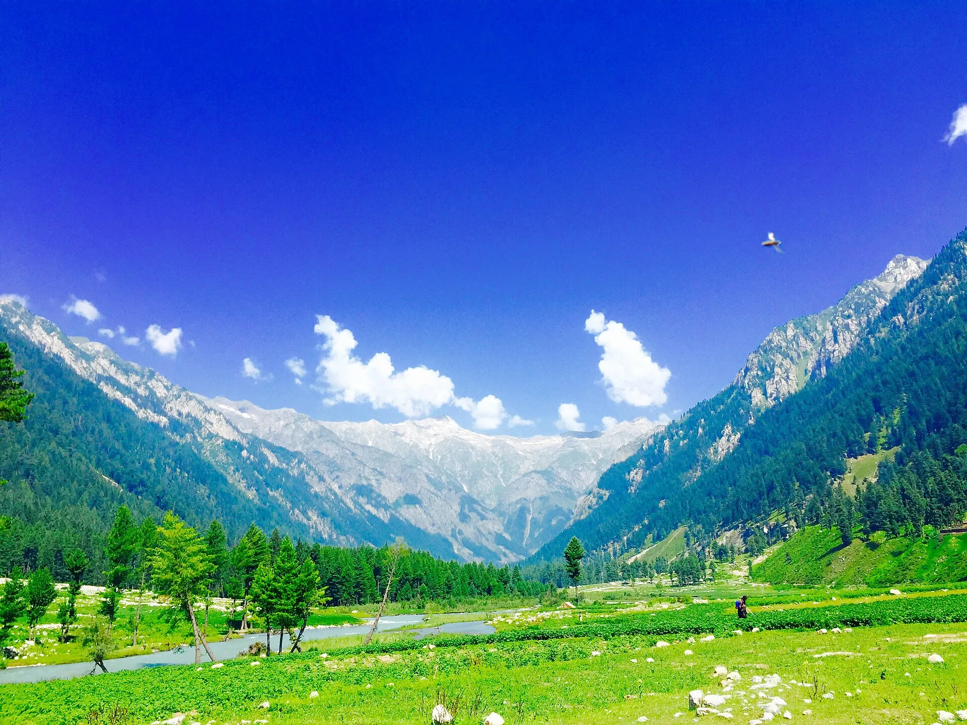
Photo: Haris akhon, with thanks · CC BY-SA 4.0 · via Wikimedia Commons · temporary stand-in photo

The route
One operator lists a four-day trip from Islamabad. Day one is a drive to Timergara, then jeeps from Thal to Kumrat. On day two a jeep climbs a winding road to Takai Banda, where the walking starts. The walk to Jahaz Banda takes about three hours through meadows, ending at a camp at about 3,100 m. On day three the climb to the lake takes about three to four hours through alpine meadow and steeper trail, reaching the lake around 11 am, and the group returns to Jahaz Banda to camp again. Day four goes back down to Takai Banda and by jeep to Thal. Other trekkers report anything from one and a half to four hours from Jahaz Banda to the lake, so the time depends on fitness and conditions.
The lake is about 4.5 km beyond Jahaz Banda. By the figures above (about 3,100 m at camp, about 3,500 m at the lake) the climb is roughly 400 m. The ground is grass and steep trail, and the final stretch is the steepest.
When to visit
July to September is the practical window. Snow can cover the upper trail and the lake into July. The jeep road may close in rain.
Where to stay and eat
There are guesthouses, huts and camps in Kumrat and Thal. On the trail you camp in tents at Jahaz Banda, usually with a local guide and porters providing food. There are no facilities at the lake.
Good to know
- Not for small children. Operators note the final stretch is steep.
- Altitude: The lake is over 3,500 m. Acclimatise at Jahaz Banda.
- Vehicle: Jeeps from Thal reach the end of the road at Taki (Takai) Top, a ride of roughly two to three hours.
- Guide: Go with a local guide; the trail is not signed.
- Fees: Any permit, camping or jeep charges are set locally. Current fees will be added soon; ask the Upper Dir tourism office or your guesthouse.
Travel advice
Ask the district administration or local police about current conditions before you go. For foreign visitors: the UK FCDO advises against all travel to Upper Dir (advice updated 27 October 2026, checked 16 November 2026). Read the live advice before you plan.
Highlights
- Bowl-shaped glacial lake at about 3,500 m
- Jahaz Banda alpine meadows on the way
- Combines well with a Kumrat valley stay
- Jeep from Thal to Taki Top, then a trek
Getting there
Drive from Islamabad to Dir (a long day, via the Lowari road or Chakdara), then on to Thal in the Kumrat valley. From Thal, hire a 4x4 jeep to Taki Top, a ride reported at two to three hours. Walk from there to Jahaz Banda (about two to three hours reported), then on to the lake (about 4.5 km). There is no public transport beyond Thal.
Tips
- Hire a local guide and jeep from Thal
- Camp at Jahaz Banda the night before to acclimatise
- Carry warm clothes; nights are cold in summer
- Check conditions in July when snow may remain
Photos we still need: the Jahaz Banda meadows and the trail to the lake. Send us yours
Sources and last checked
Last checked Confidence medium3 sources5 still to check
- Last checked
- Method
- Desk research from published sources
- Confidence
- medium
- Checked by
- trek.pk research team
Researched from published sources; not yet checked on the ground by our team. Spot something out of date? Report a mistake.
Sources
- Katora Lake · Wikipedia · checked
- Katora Lake trek · Apricot Tours (operator; supporting only) · checked
- Kumrat Valley · Wikipedia · checked
Still to be checked on the ground (5)
- Trek times (sources vary widely; the Tribune blog link redirects and could not be read)
- Exact coordinates: the page's 35.3667, 72.3464 comes from Wikipedia only and is approximate
- Where the jeep road currently ends
- Current permit or camping charges
- Height of Jahaz Banda (one operator gives about 3,100 m; no survey figure)
Nearby and related

Katora Lake Trek from Kumrat

Dir
The old capital of the princely state of Dir, on the Dir River at the foot of the Lowari Pass, with a palace on the hill above. A stop on the road between Peshawar and Chitral.

Swat Valley
A long green river valley in northern Khyber Pakhtunkhwa, with Gandhara Buddhist sites, orchards, hill towns and the road up to Kalam. Check the current security advice before you plan a trip.