

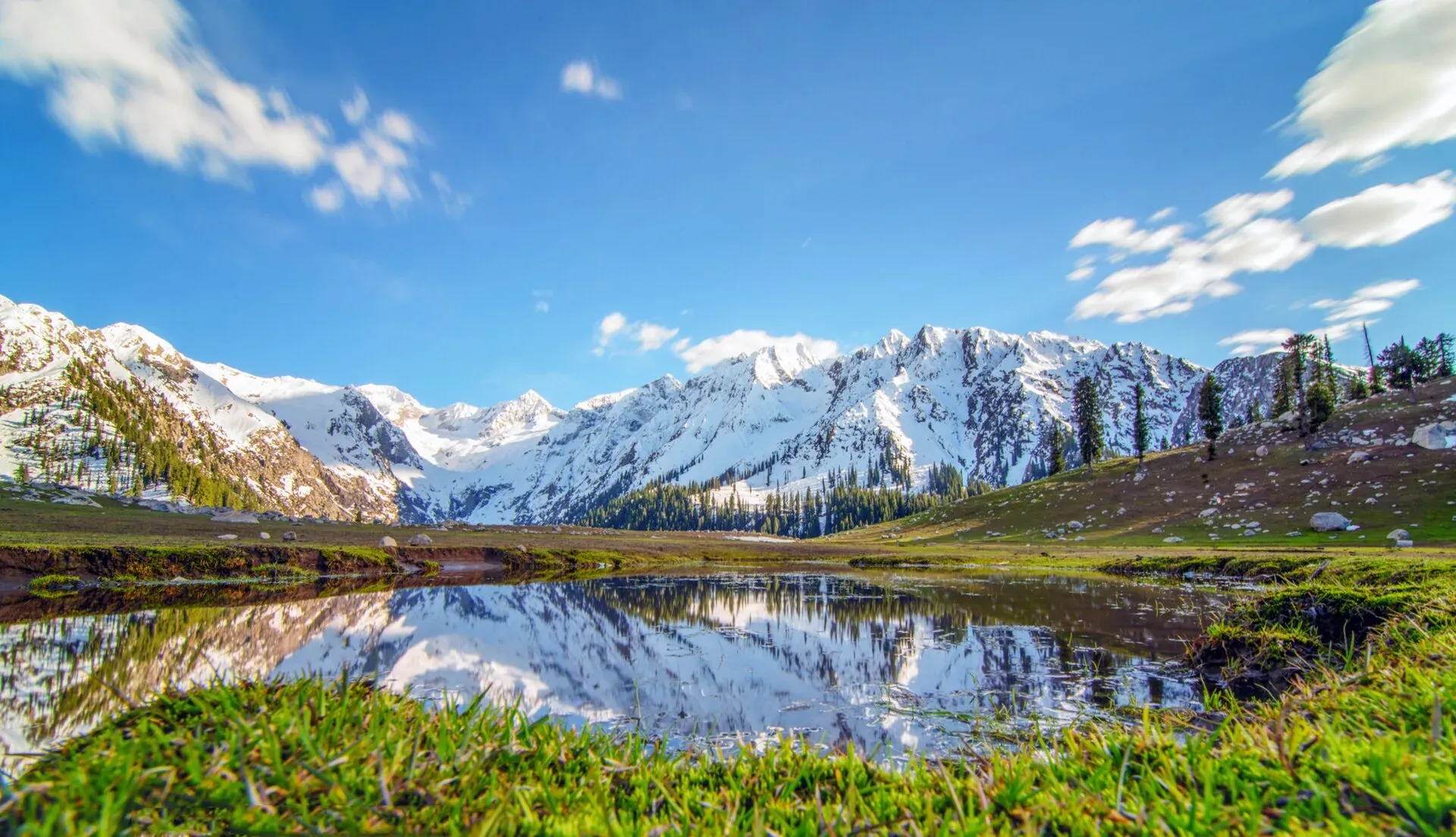
Photo: Shahbaz Aslam, with thanks · CC BY-SA 4.0 · via Wikimedia Commons · temporary stand-in photo

Jahaz Banda
A large high meadow at about 3,100 m in the upper Kumrat Valley, Upper Dir, reached by a rough jeep road and a walk. UK travel advice is against all travel to Upper Dir.
Overview
Jahaz Banda ("ship meadow") is a large meadow at about 3,100 m in the upper reaches of Kumrat Valley, Upper Dir District, Khyber Pakhtunkhwa. Wikipedia describes snow-capped mountains, tall trees and green pastures. It sits above the Kumrat deodar forest and is a common start for the trail towards Katora Lake. The hike has its own page; this page covers the meadow.
Plan your visit
- Nearest town
- Thal
- Getting there
Drive to Dir, then to Thal (OSRM Islamabad to Thal about 363 km and 4.4 hours, optimistic), then take the unpaved road up Kumrat Valley by 4x4 to the meadow approach via Darwaza, Lamoti and Jandrai (Wikipedia),… More
Best months
Jun – Oct
- Jahaz Banda
- Related places nearby: Kumrat Valley, Katora Lake, Dir
The way up
The route in order, as Wikipedia gives it: the main road through Upper Dir to Darwaza village, a fork towards Lamoti, then an unpaved road that jeeps can manage to Jandrai. From Jandrai the way continues on foot to the meadow. Other accounts use Taki Top as the end of the jeep track. Which start point applies depends on the season and the state of the track.
Kumrat Valley is a camping area, and Wikivoyage says most campers bring their own tents. Wikivoyage also lists Upper Dir among the areas that needed a No Objection Certificate (NOC, a government clearance) for foreign visitors, and says it is no longer required outside high-security areas. It does not say which category Kumrat is in, so check the current rule with a licensed operator.
What to see and do
- The meadow. Broad grassland with forest below and snow peaks above.
- Summer pasture. Local families bring animals up in summer. Keep to paths and give herds room.
- Walking. Wikipedia describes the route as a main road through Upper Dir that forks at Darwaza village towards Lamoti, then a rough unpaved road passable by jeep to Jandrai, then a walk. Other sources describe a jeep to Taki Top, then a hike; walking time ranges from 4 to 8 hours depending on the drop-off.
- Camping. Tent camping is the usual way to stay overnight.
When to visit
June to October is the practical window; snow lingers into early summer and the valley is snowbound in winter. The monsoon brings floods and landslides, which have repeatedly cut the road into Kumrat. Check the current position in Thal before you go.
Where to stay and eat
Stay in Thal or at the riverside campsites and huts in Kumrat, then go up with a guide and jeep. There are few shops above Kumrat, so bring food and water. Jeep, guide and camping charges are not confirmed by an official source; current fees will be added soon.
Good to know
- Ask the district administration or local police about current conditions before you go. Travel advice. For foreign visitors: the UK FCDO (updated 27 October 2026, still current when checked on 17 November 2026) advises against all travel to Upper Dir and Lower Dir. Do not plan a trip here without reading the page and the current local position. It also notes Governor's Rule in Khyber Pakhtunkhwa since 11 October 2026.
- Access. Wikipedia's Kumrat Valley page says the valley can be reached only by four-wheel-drive vehicles because the road is unmetalled. A bridge and road washout reports in 2026 left Kumrat cut off at times, according to our Kumrat Valley page.
- Local custom. Upper Dir communities are conservative; dress modestly and ask before photographing people.
- Signal. There is very little mobile coverage.
Highlights
- About 3,100 m in upper Kumrat
- Jeep road and walk from Thal
- Start of the Katora Lake trail
- UK advice against all travel to Upper Dir
Getting there
Drive to Dir, then to Thal (OSRM Islamabad to Thal about 363 km and 4.4 hours, optimistic), then take the unpaved road up Kumrat Valley by 4x4 to the meadow approach via Darwaza, Lamoti and Jandrai (Wikipedia), finishing on foot.
Tips
- Check road status in Thal before leaving.
- Hire a local guide and jeep.
- Read the FCDO advice first.
Photos we still need: the jeep track to Jandrai; tents or herders' huts on the meadow. Send us yours
Sources and last checked
Last checked Confidence medium7 sources4 still to check
- Last checked
- Method
- Desk research from published sources
- Confidence
- medium
- Checked by
- trek.pk research team
Researched from published sources; not yet checked on the ground by our team. Spot something out of date? Report a mistake.
Sources
- Jahaz Banda · Wikipedia · checked
- Kumrat Valley · Wikipedia · checked
- Pakistan Tourism Guide 2021 · TDAP (Trade Development Authority of Pakistan) · checked
- Pakistan travel advice (warnings and insurance; updated 27 October 2026) · UK Foreign, Commonwealth & Development Office · checked
- OSRM driving route service (distances and times, measured 16 November 2026; times are optimistic) · OSRM · checked
- Pakistan travel advice (updated 27 October 2026) · UK FCDO (GOV.UK) · checked
- Kumrat Valley · Wikivoyage · checked
Still to be checked on the ground (4)
- Current road and bridge status to Kumrat (no dated source; the page's note of 2026 washouts is unconfirmed)
- Walking time from the jeep drop-off (no source gives it for Jahaz Banda itself)
- Security and access position in Upper Dir (FCDO advises against all travel; local position not confirmed)
- Whether a NOC is required for foreigners in Upper Dir
Nearby and related

Jahaz Banda Day Hike

Kumrat Valley
The upper Panjkora valley in Upper Dir, known for deodar forest, the Jahaz Banda meadow and Katora Lake. Access has been cut by floods and a collapsed bridge in 2025 and 2026.

Katora Lake
An alpine glacial lake at about 3,500 m above Jahaz Banda in the Kumrat valley, Upper Dir. A trek of several hours from the end of the jeep road.

Dir
The old capital of the princely state of Dir, on the Dir River at the foot of the Lowari Pass, with a palace on the hill above. A stop on the road between Peshawar and Chitral.

Kumrat Valley
A 4-day road trip from Islamabad to Kumrat in Upper Dir: deodar forest, the Panjkora river and waterfalls, via Chakdara, Dir and Thal, with a final jeep leg.