

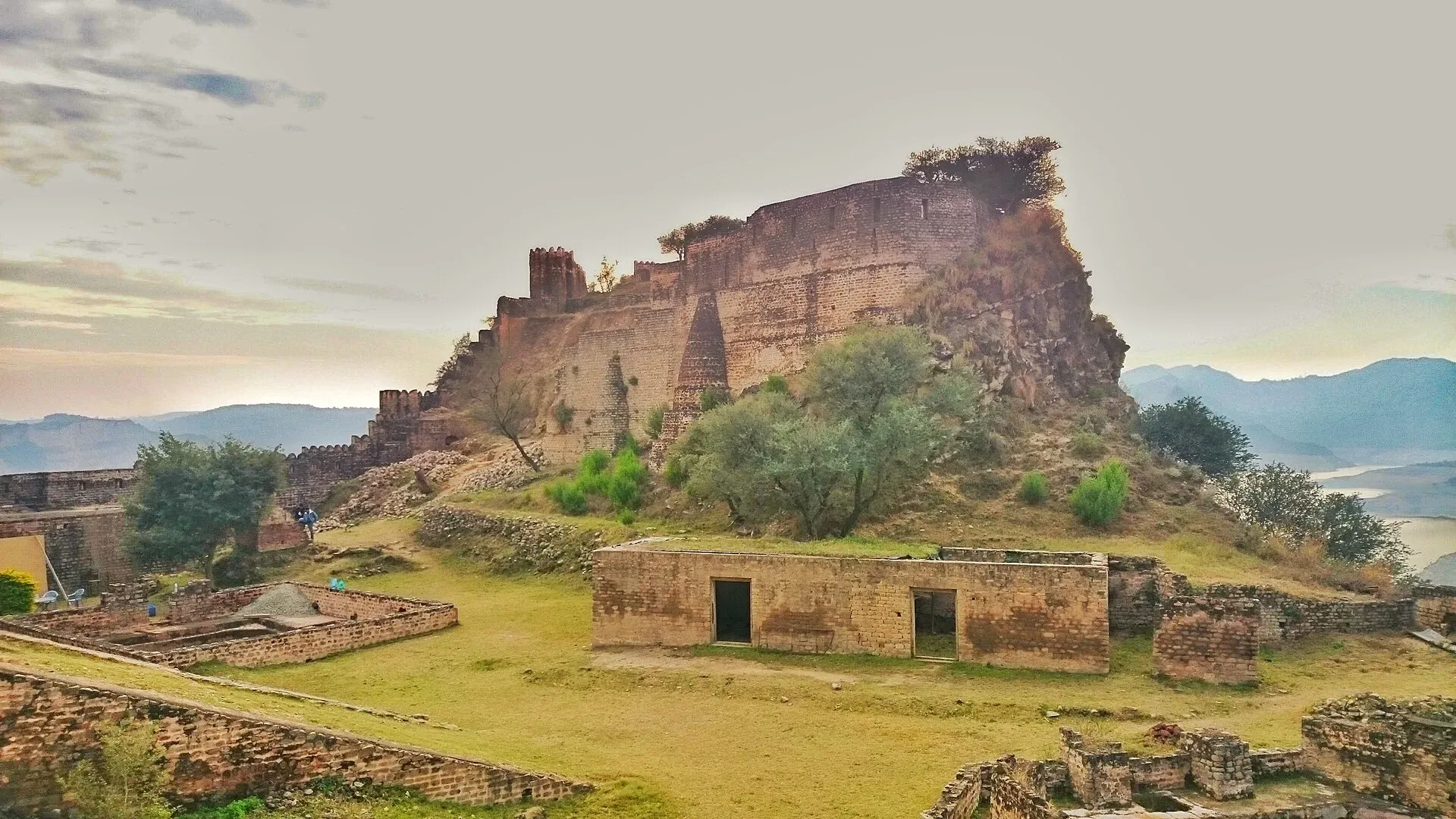
Photo: Fassifarooq, with thanks · CC BY-SA 4.0 · via Wikimedia Commons · temporary stand-in photo

Ramkot Fort
A hilltop fort of uncertain age on a peninsula in Mangla Lake near Mirpur, Azad Kashmir. It is reached by boat or a steep climb of 440 steps to the main gate.
Overview
Ramkot Fort stands on a hill in the Mangla reservoir, about 20 km north-west of Mirpur in Azad Jammu and Kashmir. It is surrounded by the lake and can be reached by boat. A dry route is reported from the side of Dadyal. The Department of Archaeology lists its position as 33.2235 N, 73.6418 E. Three routes lead to it, from Dina, Dadyal and Mirpur, and 440 steps climb to the main gate, which sits on sloping rock.
The lake around it is Mangla Lake, which covers about 250 sq km. It formed when Mangla Dam was built on the Jhelum between 1961 and 1965, and the dam opened in 1967. Mirpur and Dadyal were among the areas submerged. The dam was raised in a project completed in 2009, and the lake level rises and falls through the year.
Plan your visit
- Nearest town
- Mirpur
- Getting there
Mirpur is about 130 km by road from Islamabad (roughly 1 hour 45 minutes, OSRM). The Department of Archaeology places the fort about 20 km north-west of Mirpur, reached by boat. More
Best months
Jul – Sep
History
The age of the fort is disputed. An information board at the entrance dates an earlier fort to the 5th century and says it was taken in 1186 by Sultan Muhammad of Ghor, but that fort no longer survives. In the late 14th century the fort was held by Jasrat, a Khokhar chieftain, and Khokhar forces here are said to have defeated the invading army of Timur in 1398. The present structure probably dates from the 16th century (the Department of Archaeology says 16th or 17th century, built by Muslim rulers of Kashmir and later fortified by the Sikh Maharajas).
Other accounts differ. The geologist Frederick Drew attributed the fort to a Gakhar chief named Taghlu. One account says it was renovated under a Gakhar queen named Mangla. A temple with a large red Shivalinga, said to date from the 5th century, suggests Hindu builders earlier still, and the name may come from Ram Chandra of the Ramayana. The fort lay on one of four ancient routes to Srinagar.
What to see and do
- The main gate. It is built of red brick, while the rest of the fort is stone. That suggests the gate was destroyed and rebuilt at some point.
- The rear gate. A smaller gate at the back is thought to have been an escape route.
- Rainwater ponds. Two large ponds collect rainwater.
- The cannon ramp. A sloped passage was used to haul cannons up, and a donated cannon stands on the rampart.
- The temple. The red Shivalinga inside the fort is the main evidence for its earlier Hindu phase.
- Inside the walls. Collapsed rooms, raw iron deposits and the superintendent's residence can be seen.
- The view. The walls look over Mangla Lake and the dam.
Allow half a day including the boat crossing and the climb.
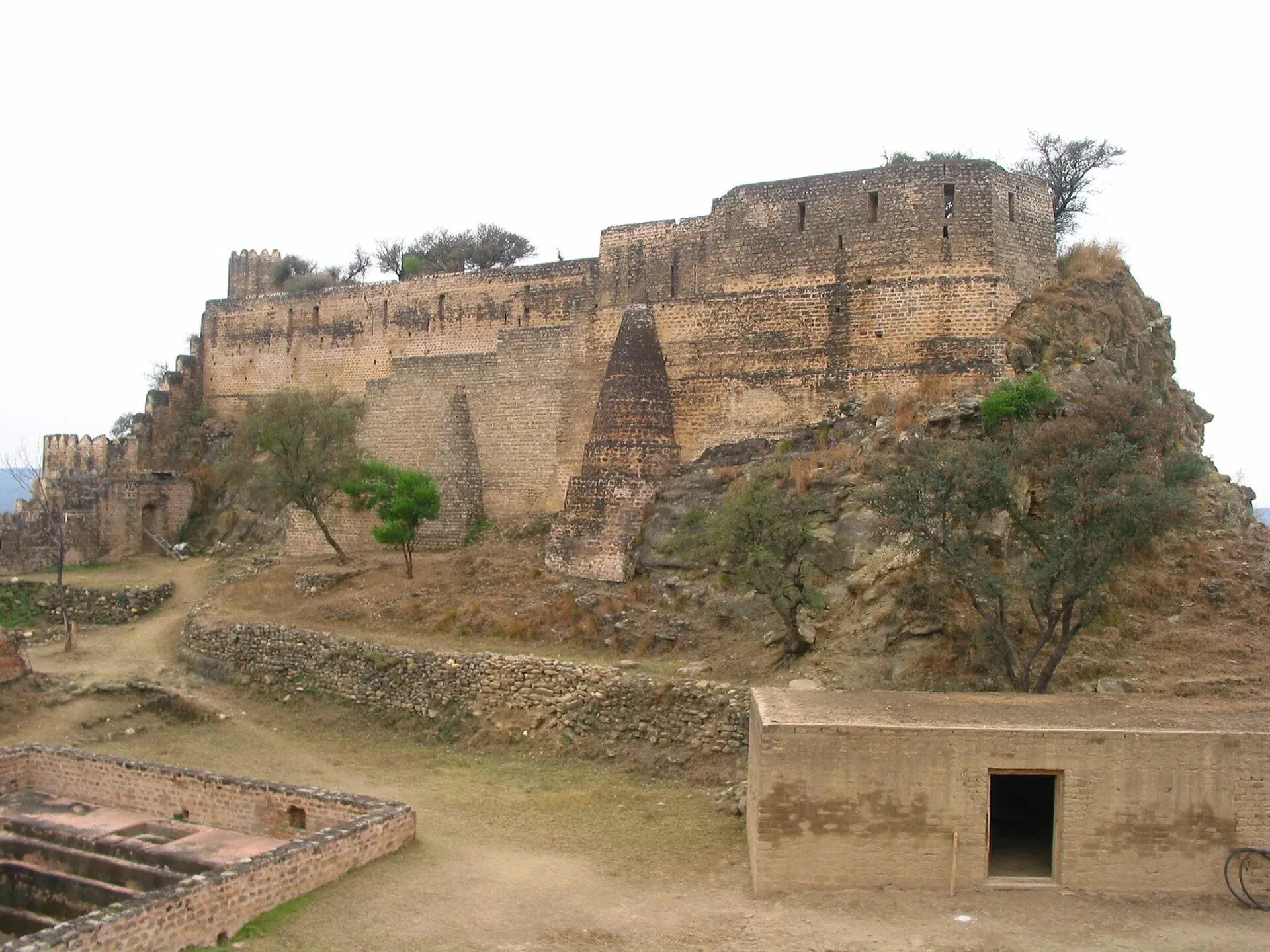
Photo: Shikari7, with thanks · CC BY-SA 3.0 · via Wikimedia Commons · temporary stand-in photo

When to visit
Lake level decides access. One travel guide says the lake can dry back so the walk becomes longer, and suggests July to September for best water. Check locally.
Getting there
Mirpur is the usual base. Boats are reported to leave from near Sukhian and the Mangla water sports area, and a road approach is reported from Dadyal. See the Overview for the three routes named by the Department of Archaeology. Ask locally which suits the lake level.
Where to stay and eat
Mirpur has hotels and restaurants. This site does not list businesses. For another fort in the region, see Pharwala Fort.
Good to know
- Travel advice. For foreign visitors: the UK FCDO (updated 27 October 2026, checked 16 November 2026) advises against all but essential travel to Azad Jammu and Kashmir, and against all travel within 10 miles of the Line of Control. Read the current page before making any plans.
- Boat and fees. Reports of boat prices and entry fees vary widely and none is from an official source. Fees will be added when confirmed. The Department of Archaeology can be reached on +92 51 9252516.
- Etiquette. Keep to the walls and steps, and take your rubbish with you.
- Nearby. Mirpur and the Mangla Dam are close.
Highlights
- Hilltop fort surrounded by Mangla Lake
- 440 steps to the main gate
- Disputed origins from the 5th to 16th centuries
- Red-brick main gate and rainwater ponds
Tips
- Check lake level and boat availability before you go.
- Wear sturdy shoes for the steep climb.
- Confirm the latest advice for Azad Kashmir.
- Take water; there are no facilities on top.
Photos we still need: the red-brick main gate and the 440-step approach; the rainwater ponds and the Shivalinga temple inside the fort. Send us yours
Sources and last checked
Last checked Confidence low4 sources5 still to check
- Last checked
- Method
- Desk research from published sources
- Confidence
- low
- Checked by
- trek.pk research team
Researched from published sources; not yet checked on the ground by our team. Spot something out of date? Report a mistake.
Sources
- Ramkot Fort (Wikipedia) · Wikipedia · checked
- Ramkot Fort: Department of Archaeology listing · Department of Archaeology and Museums, Pakistan · checked
- Pakistan travel advice: warnings and insurance (updated 27 October 2026) · UK Foreign, Commonwealth & Development Office · checked
- Mangla Dam (Wikipedia) · Wikipedia · checked
Still to be checked on the ground (5)
- Origin and date of the fort (board: 5th century earlier fort; Drew: Gakhar chief Taghlu; Department: 16th/17th century with Sikh additions; sources still conflict)
- Boat departure points, times and the dry route (Department says it 'can be approached through boat'; no operators, times or dry-route details from an official source)
- Entry fee and boat prices (none confirmed)
- Best season; one travel guide only
- Date of the Gakhar queen's renovation and her identity (one account only)
Nearby and related

Azad Jammu and Kashmir
A green, hilly region in the Himalayan foothills: Muzaffarabad, the Neelum and Leepa valleys, lakes and waterfalls. Visit with local advice on permission and the Line of Control.

Pharwala Fort
A ruined Gakhar fort above the Soan River, about 35 to 40 km from Rawalpindi. Added to Pakistan's UNESCO tentative list in 2026. Access is rough and the site is still fragile.

Islamabad
Pakistan's green, planned capital at the foot of the Margalla Hills: Faisal Mosque, hillside trails, cafes and the gateway to the north.

Mirpur
District capital of Mirpur in Azad Kashmir, nicknamed Little England for its British Pakistani links, beside Mangla Dam.