

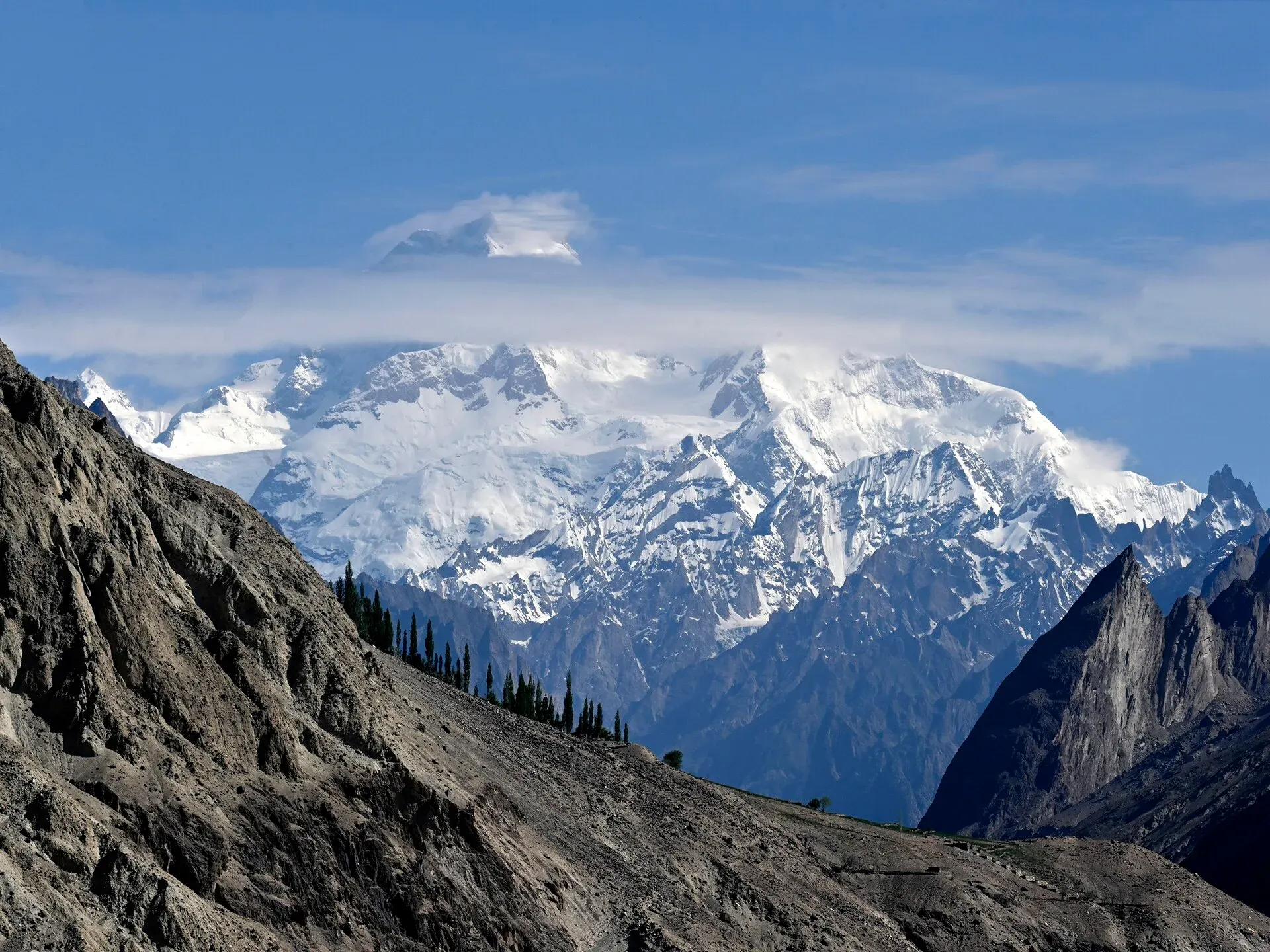
Photo: Moskenes, with thanks · CC BY 4.0 · via Wikimedia Commons · temporary stand-in photo

Masherbrum
Masherbrum (7,821 m), once known as K1, is the 22nd-highest mountain on Earth and rises over the Hushe valley in Ghanche. A four-day trek from Hushe reaches its base camp.
Overview
Masherbrum is a 7,821 m peak in Ghanche District, Gilgit-Baltistan. Wikipedia ranks it 22nd in the world and ninth in Pakistan. The British survey of 1856 called it K1 because it was the first Karakoram peak mapped. The origin of the name is debated: "brum" means mountain in Balti, while "masher" has been explained as a muzzle-loader or as "lady". It is the highest peak of the Masherbrum Mountains, which lie south of the Baltoro Glacier. Nearby 8,000 m giants such as K2 and Gasherbrum I overshadow it in fame.
The normal approach is along the Hushe valley, which runs south from the summit. Fanny Bullock Workman and her husband William reconnoitred the mountain in 1911.
Plan your visit
- Nearest town
- Hushe
- Getting there
Drive from Skardu to Khaplu, then on to Hushe, the last village on the road, which is the start of the Masherbrum Base Camp trek. Ask a licensed operator in Skardu about the road and permits. More
Best months
Jun – Sep
- Masherbrum
- Related places nearby: Khaplu and Hushe, Skardu, Central Karakoram National Park
Getting to Hushe
The Hushe valley is formed by the Hushe River. It runs south from Masherbrum and nearby glaciers to the Shyok River, opposite Khaplu. Hushe village lies in the middle of the valley, and its side valleys include Gondogoro, Charakusa, Nagma, Nanbroq and Mashabrum. Laila Peak, K6 and K7 rise above 6,000 m nearby.
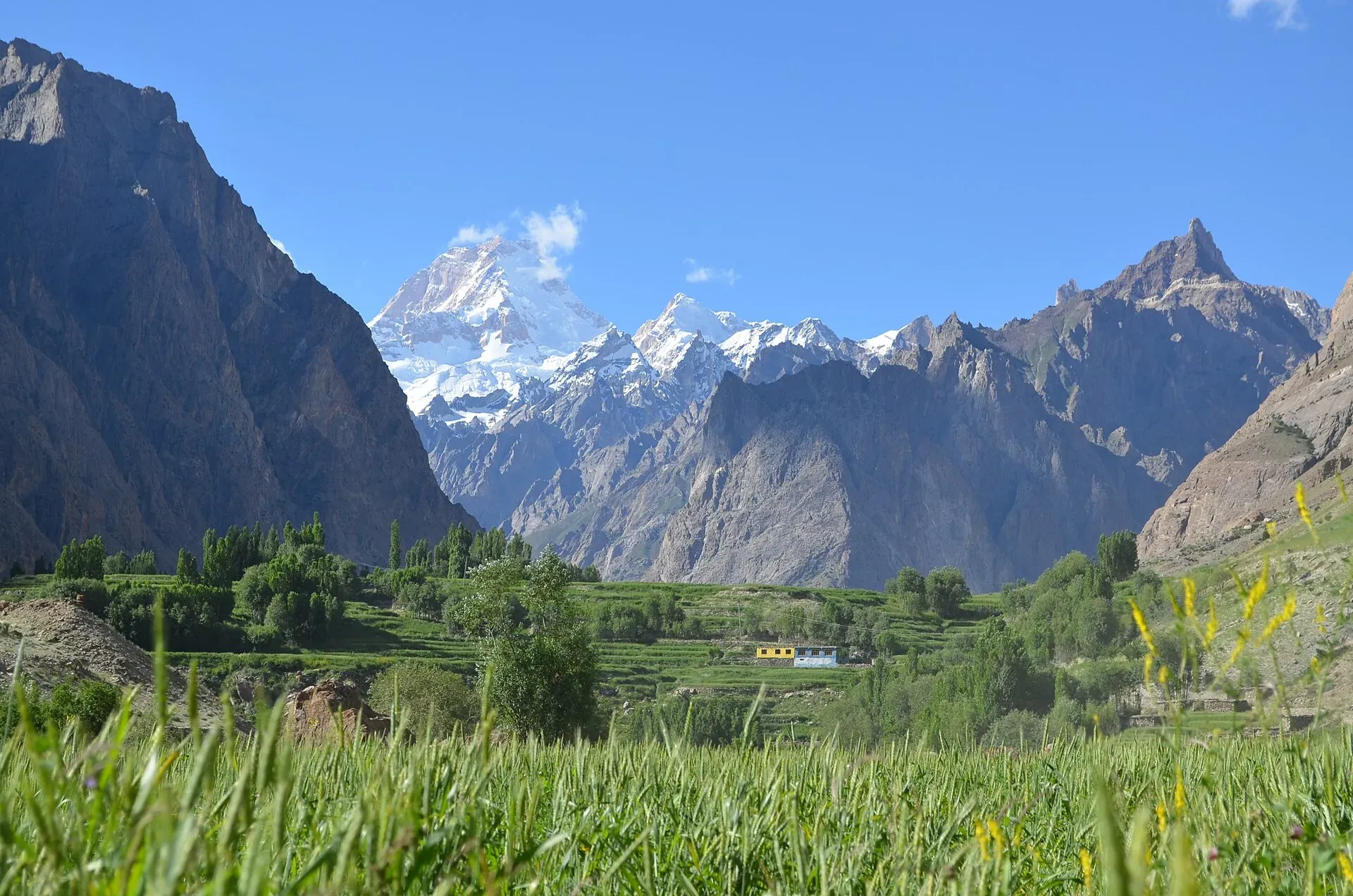
Photo: Zafaryaab, with thanks · CC BY-SA 4.0 · via Wikimedia Commons · temporary stand-in photo

From Skardu the road runs east to Khaplu, then crosses the Shyok and climbs the valley to Hushe, the last village on the road. Our Khaplu and Hushe page gives about 93 km from Skardu to Khaplu and about 36 km on to Hushe (OSRM estimates), and describes the last stretch as a rough jeep road of two to four hours. The Masherbrum Base Camp trek page gives five to six hours by jeep from Skardu to Hushe.
First ascent
George Bell and Willi Unsoeld made the first ascent in 1960 on an American-Pakistani expedition that included Nick Clinch. They climbed the south-east face. Two days later Clinch and Pakistani climber Jawed Akhter also reached the summit. Masherbrum is the highest peak in Pakistan where a Pakistani climber reached the top on the first-ascent expedition.
Earlier attempts and later climbing
The first attempt, in 1938 from the south, was led by James Waller. It failed just short of the summit when J. B. Harrison and R. A. Hodgkin, both badly frostbitten, turned back in bad weather. A New Zealand team reached about 7,000 m in 1955. In 1957 a British team that included Don Whillans came to about 200 m below the summit, and Bob Downes died of altitude sickness.
The Himalayan Index lists three more ascents after 1960 and six failed attempts. From the north the mountain has been climbed by only one route, the north-west ridge and then the upper north-west face to the summit saddle. In 1980 Christine de Colombel and David Belden tried an alpine-style ascent over three months. Avalanches swept their camp and de Colombel was injured, and they made a three-day retreat in a whiteout.
What to see and do
- Masherbrum Base Camp: a four-day return trek from Hushe, short but steep, that puts you close to the south face.
- Baltoro Glacier: the north face of Masherbrum comes into view on the way to Concordia.
- Hushe and Khaplu: the valley road passes farms, with the peak at its head. Khaplu has a restored palace.
The base camp walk
Our Masherbrum Base Camp trek page describes the route in four stages. On day one, a walk of about two hours from Hushe leads along the west bank of the Hushe River, through fields and past stone huts, over the Aling River on a footbridge, to the Parbisan camp site at about 3,300 m. Day two follows the river to the snout of the Masherbrum Glacier, then climbs a steep, faint trail marked by occasional cairns and follows the lateral moraine (the ridge of loose rock beside the ice). Brumbrama, at about 3,900 m, sits at the top of the ablation valley, the trough between the moraine and the hillside.
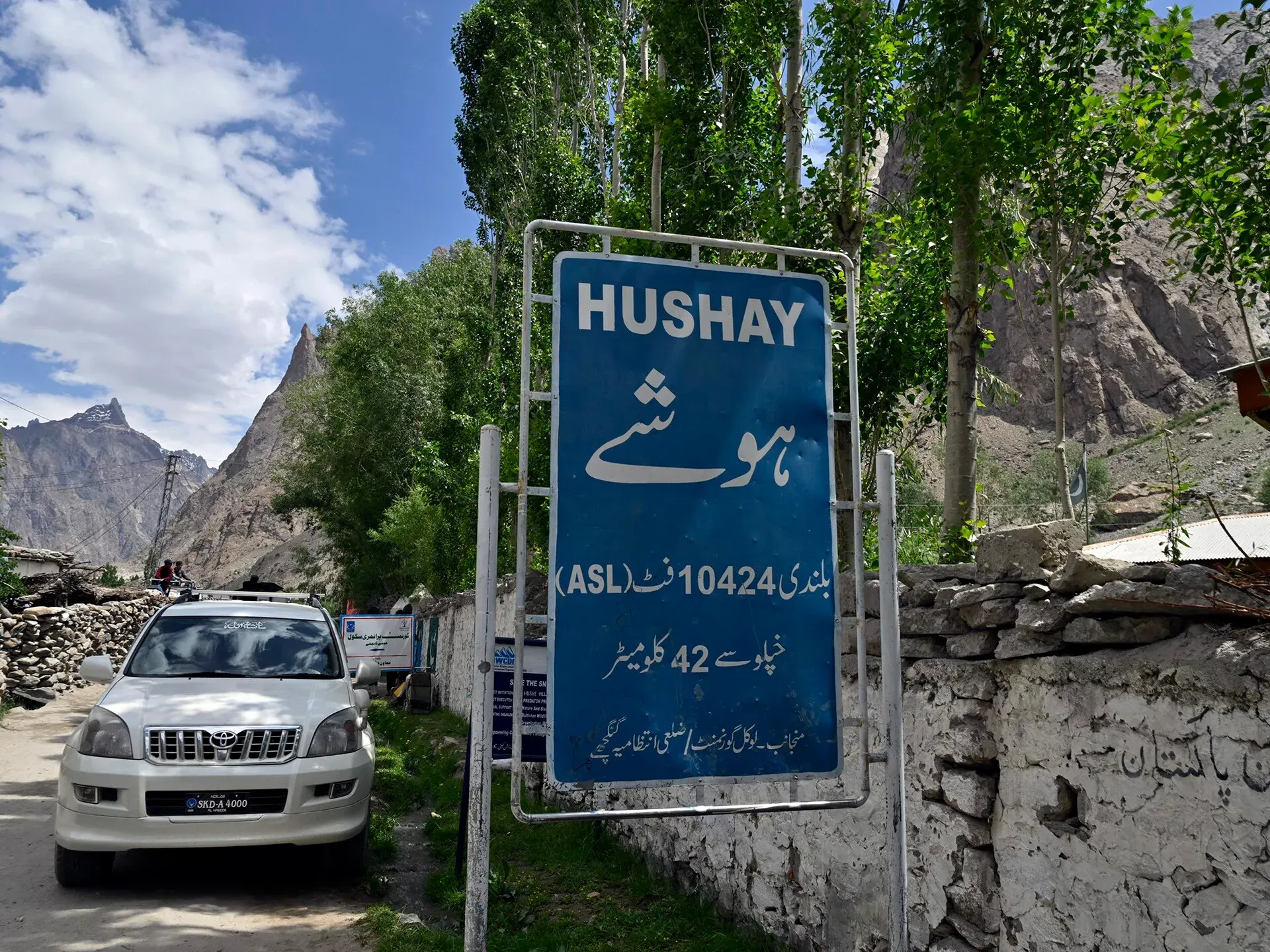
Photo: Moskenes, with thanks · CC BY 4.0 · via Wikimedia Commons · temporary stand-in photo

Day three follows a contouring trail past the Chogospnag meadow, over a last moraine and about 30 minutes across rock-covered ice to base camp at about 4,280 m, on a meadow by a small pool. Day four is a descent to Hushe in five to six hours. Streams rise in the afternoon, so cross early where there is a choice. Hushe has a long tradition of supplying guides and porters to expeditions.
When to visit
Summer, from about June to September, is the trekking season. Higher camps can be cold and snowy at either end.
Where to stay and eat
Hushe and Khaplu have guesthouses. Skardu has more choice. On the trek you camp.
Good to know
Climbing context. Masherbrum is a mountaineering objective, not a trekking peak.
Permits and royalty. Climbing a named peak needs an expedition permit and a royalty, arranged through a licensed Pakistani operator with the Gilgit-Baltistan tourism department. The royalty and trekking fees were raised by 300% under the GB Finance Act 2024, and the Central Karakoram National Park fee was raised too. The Gilgit-Baltistan Chief Court suspended the increases pending a hearing (Dawn, 1 March 2025). In May 2025 the Gilgit-Baltistan Tourism Department notified a reduced fee schedule after a cabinet decision (The News, 25 May 2025). No official schedule for 2026 was found, so current fees will be added soon; ask your operator for the written fee list. Dawn reported on 29 March 2026 that foreign visitors do not need permits in open-zone areas, while treks and climbs in restricted zones need a permit from the tourism department before arrival. The Masherbrum Base Camp trek is a restricted-zone route and needs a permit, a licensed guide and Central Karakoram National Park fees.
Ask the district administration or local police about current conditions before you go. Getting there safely. For foreign visitors: the UK FCDO (updated 27 October 2026) advises against travel on the KKH between Mansehra and Chilas but does not advise against Gilgit-Baltistan as a whole. Ask your operator which route they use.
Highlights
- 22nd-highest mountain, 7,821 m
- Once called K1
- First climbed 1960 by an American-Pakistani expedition
- Four-day base camp trek from Hushe
Getting there
Drive from Skardu to Khaplu, then on to Hushe, the last village on the road, which is the start of the Masherbrum Base Camp trek. Ask a licensed operator in Skardu about the road and permits.
Tips
- Base camp height is about 4,280 m in an older guide, while some operators say 4,500 m.
- Ask your operator how long the drive from Skardu to Hushe takes in current conditions.
- Use the Hushe trek to acclimatise for higher routes.
Photos we still need: Masherbrum Base Camp meadow and the Masherbrum Glacier moraine. Send us yours
Sources and last checked
Last checked Confidence medium9 sources3 still to check
- Last checked
- Method
- Desk research from published sources
- Confidence
- medium
- Checked by
- trek.pk research team
Researched from published sources; not yet checked on the ground by our team. Spot something out of date? Report a mistake.
Sources
- Masherbrum (Wikipedia) · Wikipedia · checked
- List of mountains in Pakistan (heights and prominence) · Wikipedia · checked
- Gilgit-Baltistan tourism bounces back despite Middle East war (permit rules for open and restricted zones, 29 March 2026) · Dawn · checked
- Mountaineering royalty and trekking fee increase challenged in GB Chief Court (1 March 2025) · Dawn · checked
- Pakistan travel advice (updated 27 October 2026) · UK Foreign, Commonwealth and Development Office · checked
- Hushe Valley (Wikipedia) · Wikipedia · checked
- Masherbrum Base Camp trek (trek.pk) · trek.pk · checked
- Khaplu and Hushe (trek.pk) · trek.pk · checked
- GB slashes mountaineering, trekking fees to promote tourism (25 May 2025) · The News · checked
Still to be checked on the ground (3)
- Current royalty and trekking fee amounts (the GB Tourism Department notified a reduced schedule in May 2025 per The News; no official 2026 schedule found)
- Base camp height (4,280 m vs 4,500 m; Wikipedia only cites a Summitpost title that says 4,500 m)
- Road conditions Skardu to Hushe (on the ground)
Nearby and related

Masherbrum Base Camp

Baltoro Glacier and K2 Base Camp

Gondogoro La

Khaplu and Hushe
Khaplu, the old Yabgo capital on the Shyok River with its restored palace and mosque, and the Hushe valley beyond, the road end for Masherbrum, K6, K7 and the Gondogoro La.

Skardu
The main town of Baltistan, where the Indus meets the Shigar river. Skardu is the base for the Deosai Plains, the Kachura and Satpara lakes, Shigar, and the K2 and Baltoro treks.

Central Karakoram National Park
Pakistan's largest protected area, covering about 10,500 square kilometres of the highest mountains on earth: K2, Gasherbrum I and II, Broad Peak and the Baltoro, Biafo and Hispar glaciers.