

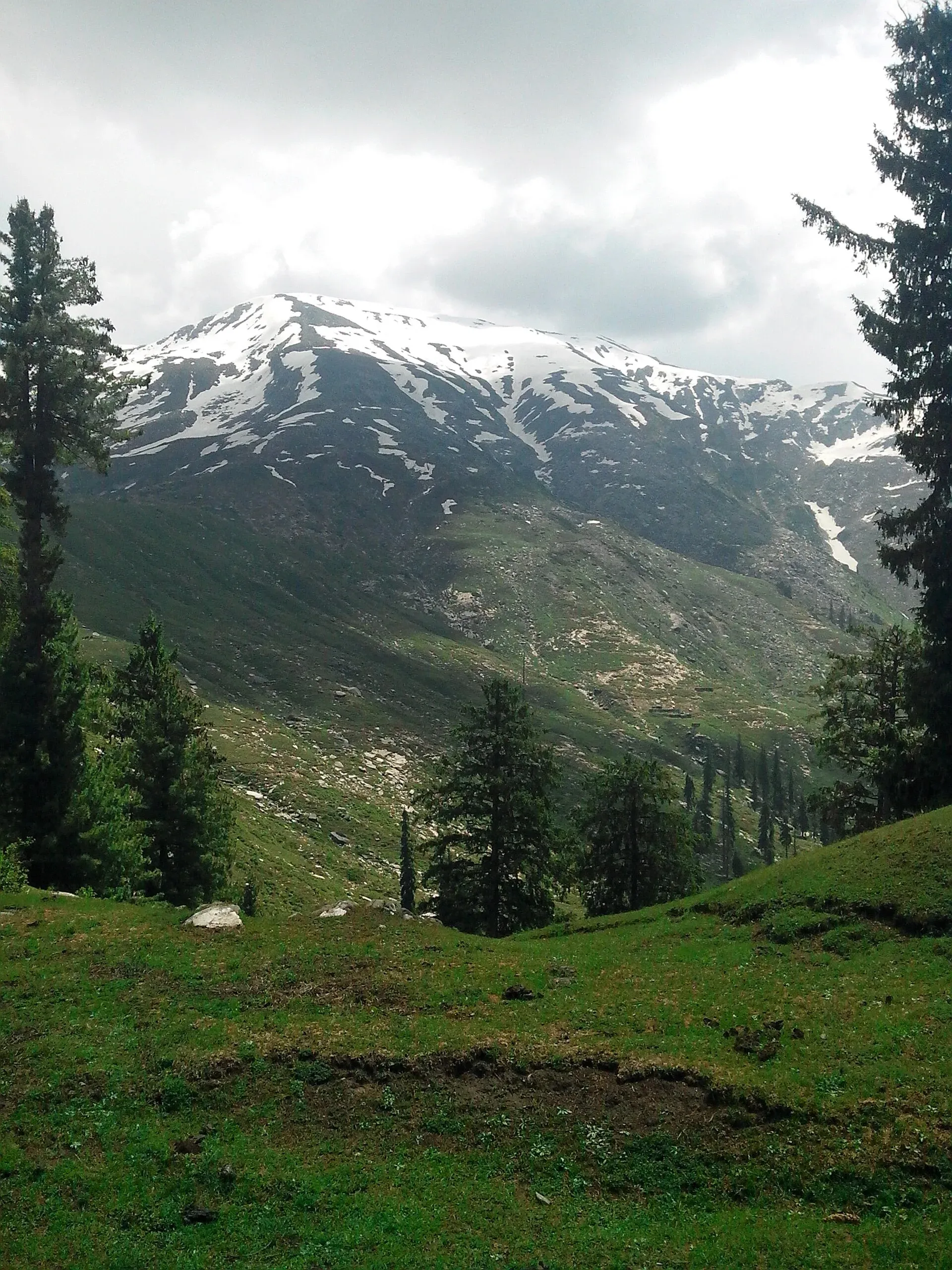
Photo: Waqaskhan991, with thanks · CC BY-SA 4.0 · via Wikimedia Commons · temporary stand-in photo

Musa ka Musalla
Musa ka Musalla ('Moses' mat') is a white-topped peak of about 4,060 m between the Siran and Kaghan valleys, popular as a summer trek and visible from Balakot. Its height varies by source.
Overview
Musa ka Musalla means "Moses' mat". It rises to about 4,060 m (Wikipedia) near Baffa and Balakot, at the junction of the Siran Valley and the Kaghan area in Mansehra District. Wikipedia gives 13,320 ft (4,060 m), citing The News on Sunday, and a 1965 Himalayan Journal report gives 13,374 ft, which is about 4,076 m. Some sources give about 4,080 m, not traced to a survey. Treat the height as approximate.
Plan your visit
- Nearest town
- Balakot
- Getting there
Drive from Islamabad via Abbottabad and Mansehra to Balakot or Shinkiari, the usual starts. Roads and trailheads are best confirmed locally. More
Best months
Jun – Sep
- Musa ka Musalla
- Related places nearby: Balakot, Mansehra, Kaghan Valley (with Naran)
Name and legend
Local legend says a shepherd called Musa prayed on the peak, and a shrine at the top is believed to honour him as a saint. An Express Tribune writer (30 September 2017) was told that fairies play on the large, flat summit plain, and that storms are sent to keep intruders away. These are local stories, not documented history.
What to see and do
Seeing it. The 1965 Himalayan Journal author saw it from Balakot as a "dazzling white hogsback" at sunset, about 12 miles to the north-west. It stands above the Siran Valley. From the Maanshe plains, on the Paras side, the Tribune writer could see Shogran, Siri and Paye across the Kunhar river. See the pages on Balakot, the Siran Valley, Mansehra, Shogran and the Kaghan Valley.
Walking up. Several summer routes exist and all need hours of trekking:
- Shinkiari to Mandagucha. The most common route, and the one used in winter. The Tribune writer took a van about 1.5 hours from Shinkiari to Mandagucha, then a jeep for about 30 minutes to the start of the trail. The walk to Dorh, an open valley with a motel, took about one hour; the base camp at Gali was reached at about 7 pm on the second day. From Gali the round trip to the top took six to seven hours, starting at 8 am. Locals in Sharran had warned that the slopes were steep and icy and that lightning was a danger, which is why the group changed route.
- Balakot via Nadi Bungalow. A jeep from Balakot crosses Kachal Katha to a point just below Maidan, above Sikkiyan Katha. The route is over 7.5 km each way with more than 1,500 m of climbing. Estimated minimum times in good conditions are 1.5 hours to Naaga Mosque, 2 hours on to the base-camp mosque, and 2 hours to the top, so 11 hours or more for the round trip. Others start from Paras, through Sharran forest.
- Terrain. Reports describe dense pine forest, meadows, streams and open valley below the top. Snow and fog make the upper slopes risky, and reports from 2016 and 2017 mention rain and thunderstorms.
Further up the Siran Valley. A Dawn account (11 December 2017) follows the same Mandagucha start towards places higher in the valley. Mansehra to Jabori is about 40 km (about one hour by car), and Jabori to Mandagucha about 19 km (about 30 minutes by minivan). Walking stages then run to Jacha, Dhor (beside the Siran River) and a forest meadow, followed by a steep climb of about five hours that crosses the forest line into the snow line. Khanda Gali, with meadows, is given as about 14,200 ft, and beyond it lie Darwaza Gali, marked by a door-shaped stone, and the glacier-fed meadow of Neeli Nadi. This account describes a longer trek that is not the summit climb.
Local setting. The Siran Valley below is a forested valley of villages and pastures. Dawn describes stone houses, usually three to a family, one for the family, one for animals and one used as a mosque for travellers, and villagers who offer guest rooms or mosque space to walkers. Walnuts are plentiful at Mandagucha, and meals on the trek included yoghurt, buttermilk, roti and rice with beans. The summit shrine draws local pilgrims in summer. Visitors should be respectful at the shrine and dress modestly.
Climbing context. It is a steep trekking peak, not a technical climb, but snow and fog make it risky. There is no known documented first ascent.
When to visit
Summer, about June to September, is easier. The Shinkiari route is used in winter, with snow.
Where to stay and eat
Balakot and Shinkiari have hotels and guesthouses. Reports mention a motel at Dorh, a campsite at Gali, and mosques or village guest rooms used as shelter higher up. Ponies and donkeys can carry luggage.
Good to know
- Permits. There is no confirmed official permit or fee. Current fees will be added soon; ask the district administration or KP Tourism.
- Safety. It is a long, tiring day with fast weather change. Go with a guide.
- Travel advice. For foreign visitors: the UK FCDO does not list Mansehra district's Kaghan road by name, but it advises against all travel on the Karakoram Highway between Mansehra and Chilas and against all travel to Swat and other listed KP districts (page updated 27 October 2026, checked 17 November 2026). Read the live page before you plan.
Highlights
- About 4,060 m, name means Moses' mat
- Between the Siran and Kaghan valleys
- Seen from Balakot
- Shinkiari to Mandagucha is the common route
- Heights vary: 4,060 to 4,080 m
Getting there
Drive from Islamabad via Abbottabad and Mansehra to Balakot or Shinkiari, the usual starts. Roads and trailheads are best confirmed locally.
Tips
- Allow a full day or an overnight camp.
- Check snow cover before you go.
- Hire a guide from Balakot or Shinkiari.
Photos we still need: the trail through the forest from Mandagucha, the Gali base camp and the summit plain. Send us yours
Sources and last checked
Last checked Confidence low5 sources4 still to check
- Last checked
- Method
- Desk research from published sources
- Confidence
- low
- Checked by
- trek.pk research team
Researched from published sources; not yet checked on the ground by our team. Spot something out of date? Report a mistake.
Sources
- Musa ka Musalla · Wikipedia · checked
- Mountains of Kaghan, 1965 · The Himalayan Journal, vol. 26 · checked
- Pakistan travel advice: warnings and insurance · UK Foreign, Commonwealth & Development Office (FCDO) · checked
- Trekking to Siran Valley is a dream come true for adventure junkies and photo enthusiasts alike · Dawn, 11 December 2017 · checked
- Musa ka Musalla: Pakistan's playground where fairies come to play · The Express Tribune, 30 September 2017 · checked
Still to be checked on the ground (4)
- Height: 4,060 m (Wikipedia, citing The News on Sunday) versus 4,076 m (Himalayan Journal, 1965) versus about 4,080 m (not traced); no survey figure found
- First ascent not documented (neither Wikipedia nor the 1965 Himalayan Journal article mentions one)
- Permit and current trail timings (Wikipedia gives trailheads and the Balakot route time of 11 hours or more, but no permit information; no official source found)
- Which season each route is used and whether jeeps run to the trailheads (reports are from 2016 and 2017)
Nearby and related

Siran Valley
A quiet forested valley in Mansehra District, west of Kaghan, with deodar forest, meadows (galis) and peaks such as Musa ka Musalla. Roads are poor, and few visitors come.

Balakot
The gateway to the Kaghan Valley, on the Kunhar River in Mansehra District. Balakot was destroyed in the 2005 earthquake and is the last big town before Naran, Shogran and Siri Paye.

Mansehra
The headquarters of Mansehra District in Hazara, famous for the Ashoka rock edicts near the city. A big market town and the usual stop before Balakot, Naran and the Karakoram Highway.

Kaghan Valley (with Naran)
A 155 km Himalayan valley above Balakot along the Kunhar River, with Shogran, Naran, Saiful Muluk and Lulusar lakes, and the road to Babusar Pass. Open mainly from May to October.