

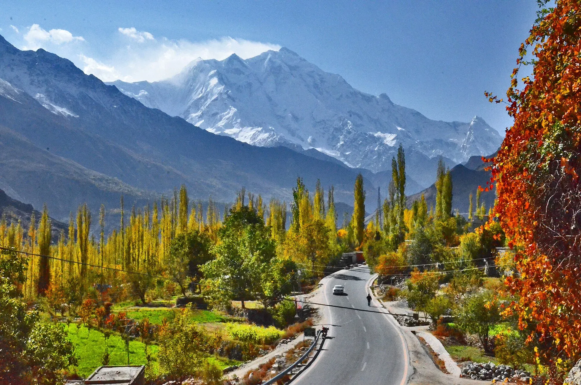
Photo: Muhammad Akram Attari, with thanks · CC BY-SA 4.0 · via Wikimedia Commons · temporary stand-in photo

Nagar (district HQ)
Nagarkhas, also called Oyum-Nagar, the administrative centre of Nagar District in Gilgit-Baltistan and the old capital of the Nagar state, beneath Rakaposhi.
Overview
Nagarkhas, also called Oyum-Nagar, is the administrative centre of Nagar District in Gilgit-Baltistan and was the capital of the former princely state of Nagar. It lies in the Nagar River valley at about 2,688 m, near the Karakoram Highway, about five miles south-east of where the Nagar River meets the Hunza River just below Baltit. Nagar District was created in 2015, when Hunza-Nagar was divided into Hunza and Nagar, and Wikipedia gives it a 2023 population of 87,410. There is no known figure for the town itself.
Plan your visit
- Nearest town
- Nagarkhas
- Getting there
Road: about 108 km from Gilgit (OSRM about 1 h 25 min, optimistic) on the KKH, and about 15 km from Karimabad (about 20 min). More
Best months
Apr – Oct
- Nagar (district HQ)
- Related places nearby: Nagar Valley, Karimabad (Hunza), Aliabad (Hunza), Gilgit
History
Nagar was a princely state ruled by a branch of the Trakhan dynasty of Gilgit. After the Hunza-Nagar campaign of 1889 to 1892 (the Anglo-Burusho war), it came under British influence as a vassal of the Kashmir durbar, and the Nagar royal family kept ruling. Local resistance in 1891 was led by the Tham (chief) Azur Khan, and over 100 people from Nagar died in the fighting at Nilt. The state acceded to Pakistan in 1947. In 1974 the states of Nagar and Hunza were dissolved and given representation in the Northern Areas Council, now the Gilgit-Baltistan Legislative Assembly. The old name of the valley is Broshal.
What to see and do
Nagarkhas is a small administrative and village town. It has a royal palace of the former rulers. The Nagar valley is better known for Rakaposhi viewpoints and short walks, which are described on the Nagar Valley page. The villages most often named for visitors are Ghulmet, Minapin, Bar, Chaprote and Hoper, and the Sumayyar valley. Rakaposhi (7,788 m), Diran and Spantik (also called Golden Peak) rise within the district, and the Hispar-Biafo glacier system lies to the north-east. Karimabad, with its forts, is just across the river.
Minapin and Pisan are known for marble deposits, and jet and marble occur around Nagarkhas and Chalt, according to Wikipedia.
Getting there
- From Gilgit: about 108 km, OSRM about 1 hour 25 minutes (an optimistic estimate, without stops).
- To Karimabad: about 15 km, OSRM about 20 minutes (estimate).
- Vans run along the KKH from Gilgit and Aliabad.
When to visit
April to October is the main season. Winters are cold, and some roads close.
Where to stay and eat
There are a few guesthouses and tea shops. Most visitors stay in Karimabad or at one of the Nagar villages with Rakaposhi views.
Basic services
Services are limited. Hospitals, pharmacies, fuel stations and ATMs are normal in a district headquarters, but none is confirmed for this town from an official source. Ask at your hotel, and use the business listings on this site.
Safety and good to know
For foreign visitors: the UK FCDO (updated 27 October 2026, checked 16 November 2026) does not advise against Gilgit-Baltistan in general and does not name Nagar. This is government advice. Check road news and weather, especially in the monsoon.
Highlights
- Administrative centre of Nagar District
- Old capital of the Nagar state
- Views toward Rakaposhi
Stay, eat and essentials near Nagar (district HQ)
Within 8 km of Nagar (district HQ), nearest first.
Places to stay
- Eagle's Nest Hotel HunzaCall Eagle's Nest Hotel HunzaMap of Eagle's Nest Hotel Hunza in Google Maps
- Karakoram Highway Inn HunzaCall Karakoram Highway Inn HunzaMap of Karakoram Highway Inn Hunza in Google Maps
- Hard Rock Hunza-Resort & VillasCall Hard Rock Hunza-Resort & VillasMap of Hard Rock Hunza-Resort & Villas in Google Maps
- Karakorum View Hotel Karimabad HunzaCall Karakorum View Hotel Karimabad HunzaMap of Karakorum View Hotel Karimabad Hunza in Google Maps
- Legend HVHCall Legend HVHMap of Legend HVH in Google Maps
- Hunza Embassy Hotel by ZeezCall Hunza Embassy Hotel by ZeezMap of Hunza Embassy Hotel by Zeez in Google Maps
Places to eat
- Kha Basi CaféCall Kha Basi CaféMap of Kha Basi Café in Google Maps
- Cafe Culture HunzaCall Cafe Culture HunzaMap of Cafe Culture Hunza in Google Maps
- The Yak Cafe HunzaCall The Yak Cafe HunzaMap of The Yak Cafe Hunza in Google Maps
- SIPS & BITESCall SIPS & BITESMap of SIPS & BITES in Google Maps
- Rewayat Restaurant Ganish HunzaCall Rewayat Restaurant Ganish HunzaMap of Rewayat Restaurant Ganish Hunza in Google Maps
- Café De HunzaCall Café De HunzaMap of Café De Hunza in Google Maps
Essential services fuel stations, ATMs and hospitals and clinics
Fuel
- Passu Petrol Filling StationMap of Passu Petrol Filling Station in Google Maps
Hospitals and clinics
- Civil Hospital Nagar khasMap of Civil Hospital Nagar khas in Google Maps
- Govt Civil Hospital AskurdasMap of Govt Civil Hospital Askurdas in Google Maps
Listings come from Google Maps data and are unverified: phone numbers, opening months and prices may have changed. Report a problem · Own one of these? Claim it
Tips
- Check road news for landslides before travelling.
- Use Karimabad as your base for supplies.
- See the Nagar Valley page for walks.
- Ask permission before photographing people.
Photos we still need: Nagarkhas town or its royal palace (for the History section). Send us yours
Sources and last checked
Last checked Confidence low5 sources4 still to check
- Last checked
- Method
- Desk research from published sources
- Confidence
- low
- Checked by
- trek.pk research team
Researched from published sources; not yet checked on the ground by our team. Spot something out of date? Report a mistake.
Sources
- Nagarkhas · Wikipedia · checked
- Nagar District · Wikipedia · checked
- Pakistan travel advice (updated 27 October 2026) · UK Foreign, Commonwealth & Development Office · checked
- OSRM driving route service: distances and times measured 16 November 2026 (times are optimistic, without stops) · OSRM / OpenStreetMap · checked
- Nagar Valley / Hunza Valley (Wikipedia) · Wikipedia · checked
Still to be checked on the ground (4)
- Which town is the official district headquarters (Wikipedia is inconsistent: Nagarkhas in text, Harespo in the summary box, 'Nagar' in the places list)
- Hotels and services
- Population of the town (Wikipedia gives only the district: 87,410 in 2023)
- Spelling and details of the Anglo-Burusho war casualty figure (Wikipedia's Hunza Valley article gives over 100 Nagaris dead)
Nearby and related

Nagar Valley
The quieter bank of the Hunza River, facing Karimabad: Minapin, Hoper and Hispar villages, Rakaposhi viewpoints and easy treks below Rakaposhi, Diran and Spantik.

Karimabad (Hunza)
The main town of Hunza, set on a terrace below Baltit Fort with Rakaposhi, Ultar and Diran in view. A good base for forts, viewpoints, Attabad Lake and the road to Gojal.

Aliabad (Hunza)
The commercial hub of Hunza, on the Karakoram Highway about 9 km from Karimabad, with the main bazaar, transport offices and a base for Hunza and Nagar.

Gilgit
Gateway to Gilgit-Baltistan on the Karakoram Highway: a busy mountain town with the Kargah Buddha and the base for Hunza, Naltar and Skardu.

Gilgit-Baltistan
Pakistan's far north: three great ranges meet here, with K2, Nanga Parbat, giant glaciers, the Karakoram Highway and the valleys of Hunza, Skardu and Gilgit.