

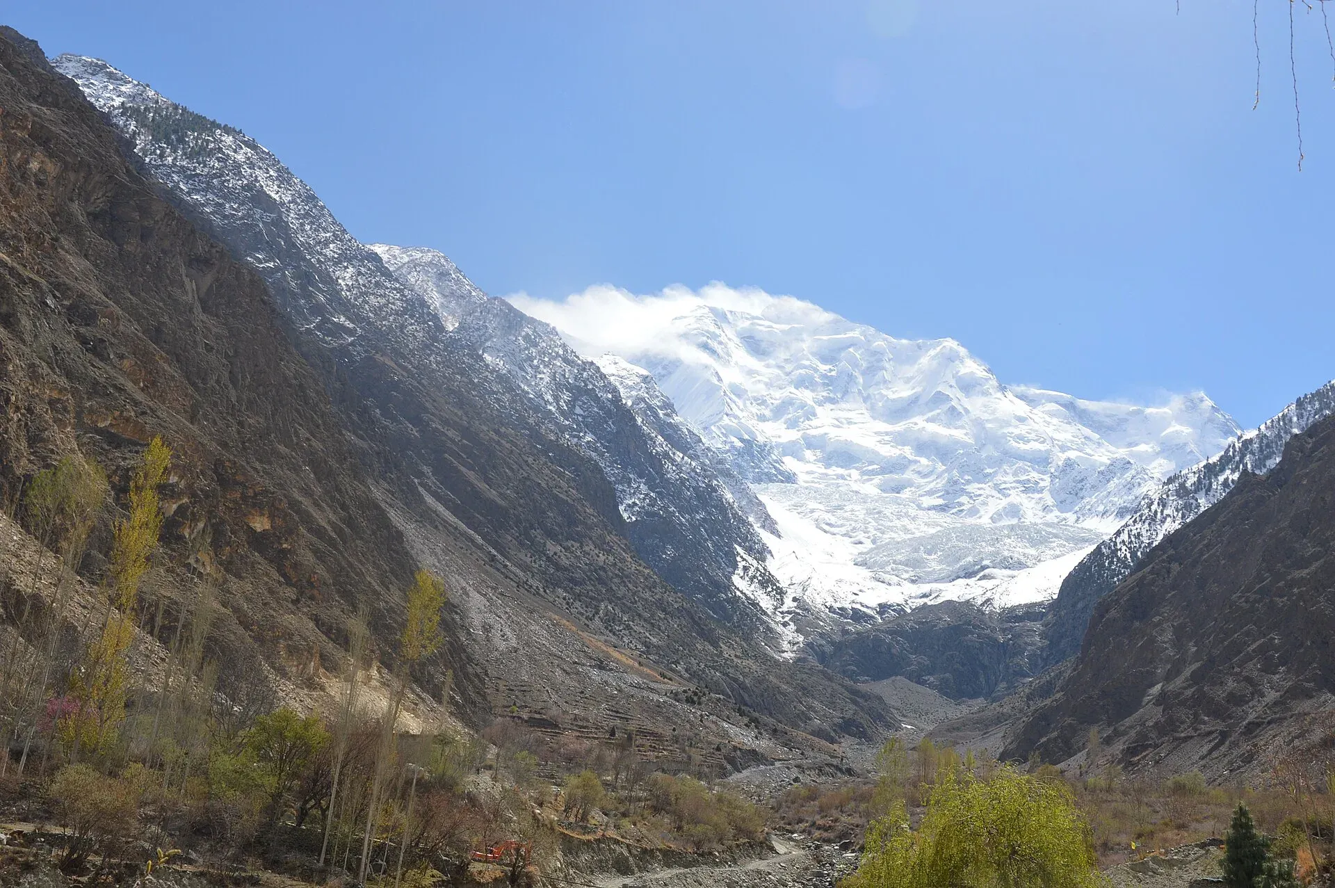
Photo: Maria.khanum1983, with thanks · CC BY-SA 4.0 · via Wikimedia Commons · temporary stand-in photo

Nagar Valley
The quieter bank of the Hunza River, facing Karimabad: Minapin, Hoper and Hispar villages, Rakaposhi viewpoints and easy treks below Rakaposhi, Diran and Spantik.
Overview
Nagar is the valley on the south and east bank of the Hunza River, facing Karimabad across the gorge. For centuries it was a princely state of its own, a rival of Hunza, until both were dissolved in 1974. Today it is a district with its headquarters at Nagarkhas, about 87,000 people at the 2023 count, and a landscape of steep side valleys, glaciers and terraced villages below Rakaposhi (7,788 m), Diran (7,266 m) and Spantik, also called Golden Peak (7,027 m).
Nagar gets fewer visitors than Hunza and feels quieter. It is a good choice for views of the whole Hunza side of the Karakoram, for easy treks, and for staying in a village.
Plan your visit
- Nearest town
- Nagarkhas
- Getting there
From Gilgit, Minapin is about 75 km on the Karakoram Highway (OSRM models about 1 h), Nagarkhas about 109 km and Hoper about 119 km (OSRM models about 1 h 35). The tourism sheet gives 60 km to the Rakaposhi viewpoint. More
Best months
May – Oct
- Nagar Valley
- Related places nearby: Hunza Valley, Rush Lake, Gilgit, Bagrot Valley, Chaprot Pass, Nagar (district HQ), Tagaphari (Rakaposhi Base Camp)
History in brief
Nagar and Hunza were rival princely states. In December 1891 British and Dogra forces fought Nagar's chief, Tham Azur Khan, at Nilt, in a campaign known locally as the Anglo-Brusho war (Jangir-e-Lae), which lasted from 1 to 23 December (Wikipedia, Hunza Valley article). Over 100 Nagaris died and 127 were imprisoned, and four British officers and more than 50 Dogra levies also died. The British kept Nagar as a principality. On 25 September 1974 the princely states of Nagar and Hunza were dissolved. Wikipedia's Hunza Valley article shows the Nilt forts as one of the historic sites on this side of the gorge.
Getting there
The Karakoram Highway runs along the Nagar bank for the first part of the valley, from Chalt to Minapin and Ghulmet. By OSRM, Minapin is about 75 km from Gilgit (modelled at about 1 hour), Nagarkhas about 109 km and Hoper about 119 km. The tourism sheet for Nagar gives 60 km from Gilgit to the Rakaposhi viewpoint, about one hour. Real times are longer than the models; allow two hours or more to the upper villages. Public transport thins out beyond the KKH. In Hopar and the side valleys, jeeps are the usual way to travel.
From Karimabad, a bridge and road link Hunza and Nagar. Taking a taxi across for a day is common.
Villages and sights
- Rakaposhi viewpoint and Ghulmet. A roadside viewpoint near the KKH gives one of the closest views of the mountain's long ridge. Many travellers stop here on the way from Gilgit.
- Minapin. The village and trailhead for Rakaposhi Base Camp (Taghafari), an easy trek with a view of Rakaposhi and Diran.
- Nilt. Old forts, and the site of a battle in December 1891 that is still part of local memory.
- Nagarkhas and Hoper (Hopar). Hoper is a bowl-shaped valley at the end of a rough jeep road, about 10 km from Nagarkhas (45 minutes by jeep, according to the tourism sheet), with a large glacier and village homestays. It is the start for Barpu Glacier and the high Rush Phari trek.
- Chaprote. One of Nagar's older villages, reached 17 km from Gouro, with farms and cultural interest.
- Hispar. A remote valley at the head of the Hispar Glacier; the road reaches only part of the way (the sheet gives 34 km from Nagarkhas). It is the end point of the Hispar La crossing.
- Gemstones. The official sheet notes that Nagar is known for gemstones such as aquamarine, topaz and quartz, found in its high valleys. Wikipedia adds that jet is found at Minapin, Chalt and Nagar Khas, and marble at Pisan, Minapin, Nagar Khas and Sumayar.
Treks from the valley
- Rakaposhi Base Camp from Minapin: an easy and popular introduction to Karakoram trekking.
- Barpu Glacier from Hoper: a moderate trek beneath Spantik.
- Rush Phari and Daintar Pass are harder, with high camps.
- Smaller Nagar walks (Chaprote, Bar valley, the Bualtar and Toltar glaciers) are in the Other treks in Nagar page.
- Hispar La crosses the Hispar Glacier to Biafo and ends in Nagar.
- Rush Lake is a high lake reached by a long walk, and is covered on its own page.
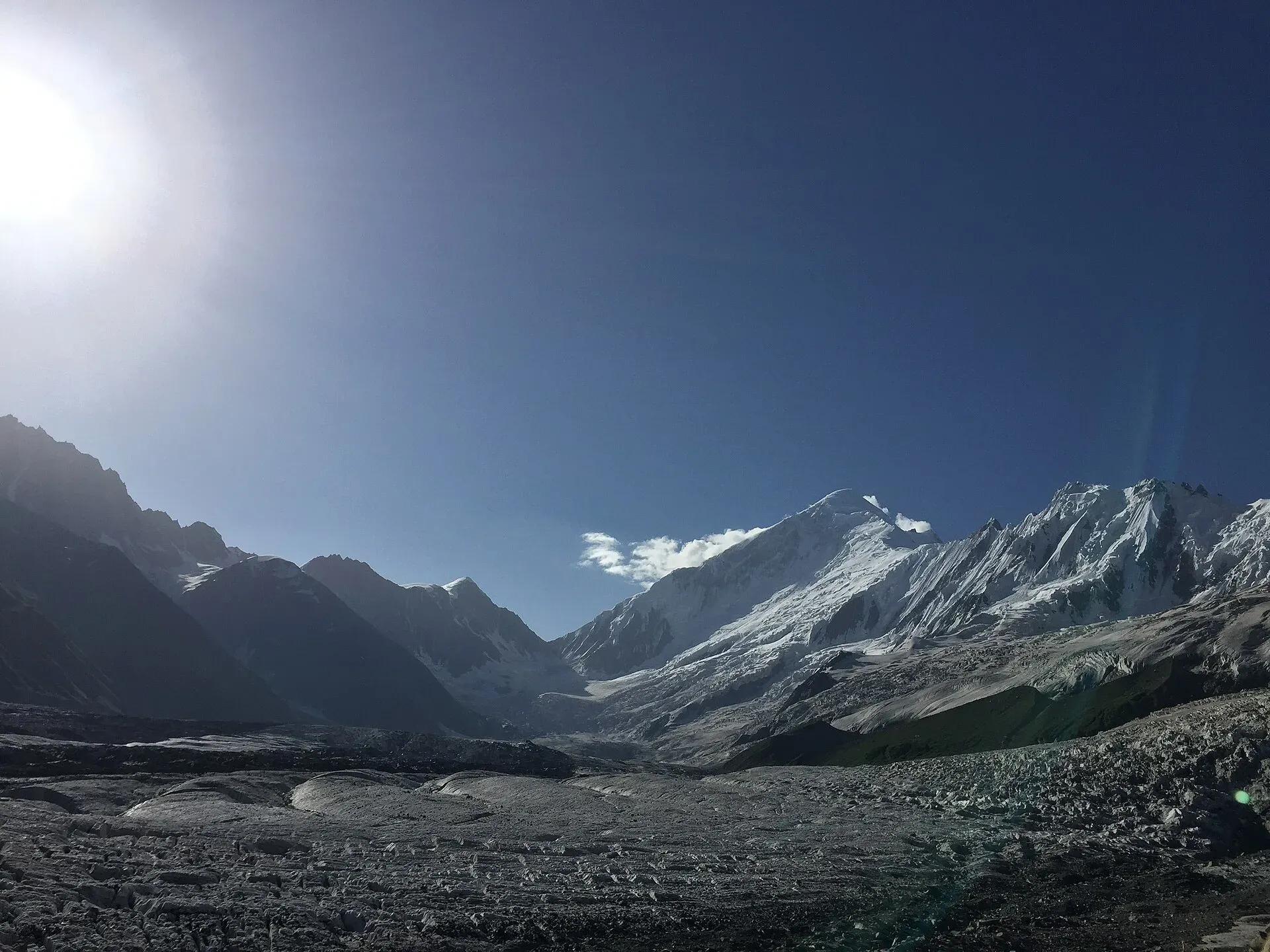
Photo: Chaudharybilal, with thanks · CC BY-SA 4.0 · via Wikimedia Commons · temporary stand-in photo

Glaciers and peaks you can see
Nagar's side valleys carry some of the Karakoram's best-known glaciers. Wikipedia names the Hopar, Barpu, Minapin and Hispar glaciers among those in the Hunza and Nagar area, and lists Rakaposhi (7,788 m), Diran (7,265 m) and Golden Peak (7,027 m) among the summits. The Hispar Glacier lies at the head of its own valley and is the route for the Hispar La crossing. See Rakaposhi view point, Tagaphari and Rush Lake.
When to go
May to October. Apricots and cherries are harvested in summer; the autumn colour in October is strong. High treks such as Rush Phari are best in July and August. Winters are cold, snowy and quiet.
Where to stay and eat
Most visitors stay in Karimabad on the Hunza side and cross for the day, but guest houses and homestays are available in Minapin, Nagarkhas and Hoper. Services are simpler than in Karimabad, so bring cash and plan meals. Nagar food is similar to Hunza's: bread, soups, dried apricots, walnuts, and fresh fruit.
Culture and languages
Most people speak Burushaski, and Shina is spoken in parts of lower Nagar. English and Urdu are understood in most places visitors go. Communities in Nagar and Hunza follow different branches of Islam, and visitors should dress modestly, ask before photographing homes and religious sites, and avoid public displays of affection or alcohol.
Safety and practical points
- Rockfall and glacier floods can damage the side roads. In July and August, check with your hotel before going up to Hoper or Hispar.
- The Hoper road is rough and narrow; hire an experienced driver.
- Foreign visitors have not needed an NOC for Gilgit-Baltistan since March 2019, but border strips remain restricted. Trekking permit rules and fees change; ask a licensed operator and GB Tourism. Dawn (1 February 2026) reported sharp permit fee rises in Gilgit-Baltistan and no foreign trekking permits issued in the last winter.
- The GB Tourist Police helpline is 1422.
Highlights
- Closest road views of Rakaposhi (7,788 m)
- Minapin trailhead for the easy Rakaposhi Base Camp trek
- Hoper valley, its glacier and village homestays
- Hispar and the end of the Hispar La crossing
- Old forts at Nilt and quieter villages than Hunza
Tips
- Stay in Minapin or Hoper for a village experience, or cross from Karimabad for the day.
- Use an experienced driver for the rough Hoper and Hispar roads.
- Carry cash; side valleys have few banks or cash machines.
- Ask your operator about current permits before going beyond the base camps.
Photos we still need: the Nilt forts, Minapin village and the Hopar jeep road. Send us yours
Sources and last checked
Last checked Confidence medium9 sources4 still to check
- Last checked
- Method
- Desk research from published sources
- Confidence
- medium
- Checked by
- trek.pk research team
Researched from published sources; not yet checked on the ground by our team. Spot something out of date? Report a mistake.
Sources
- Land of Jewels: District Nagar tourist guide sheet · Tourism & Culture Department, Gilgit-Baltistan · checked
- Nagar District (Wikipedia) · Wikipedia · checked
- Hunza Valley (Wikipedia) · Wikipedia · checked
- Rakaposhi (Wikipedia) · Wikipedia · checked
- Hopar Valley (Wikipedia) · Wikipedia · checked
- OSRM driving routes (distances and modelled times between towns) · OSRM / OpenStreetMap · checked
- NOC requirements for foreigners visiting Pakistan abolished (26 March 2019) · Dawn · checked
- GB winter adventure tourism hit by soaring permit fee, visa delays (1 Feb 2026) · Dawn · checked
- Hispar Glacier · Wikipedia · checked
Still to be checked on the ground (4)
- Real driving times to Minapin, Nagarkhas and Hoper (OSRM models 1 to 1 h 35; the official sheet PDF could not be read as text)
- How far the road reaches up the Hispar valley (the official sheet gives 34 km from Nagarkhas, as on the page; Wikipedia says nothing)
- Current guest house options in Hoper and Minapin (no dated source opened)
- Current trekking permit rules and fees (no official page opened; Dawn, 1 Feb 2026, reports fee rises)
Nearby and related

Rakaposhi Base Camp

Barpu Glacier

Rush Phari (Rush Lake)

Daintar Pass

Other treks in Nagar

Hispar La (Biafo–Hispar traverse)

Hunza Valley
A long Karakoram valley on the Karakoram Highway, with Karimabad, Baltit and Altit forts, Ganish village and Attabad Lake, below Rakaposhi and Ultar Sar. About 100 km from Gilgit.
Rush Lake
One of the highest lakes in Pakistan, at about 4,694 m, above the Hopar Valley in Nagar. It can only be reached on a hard five-day trek with views of the Hunza giants and, on clear days, K2.

Gilgit
Gateway to Gilgit-Baltistan on the Karakoram Highway: a busy mountain town with the Kargah Buddha and the base for Hunza, Naltar and Skardu.

Bagrot Valley
A high valley about 30 km from Gilgit, running up to Rakaposhi and Diran, with farming villages, Gargo meadow and the open trek to Diran Base Camp from Chirah.
Chaprot Pass
A high pass of about 4,900 m linking the Chaprot valley in Nagar with the Naltar valley. Little documented.

Hopar Glacier (Bualtar)
The Bualtar or Hopar Glacier fills the head of the Hopar valley in Nagar, below Diran and Miar peaks. A quick viewpoint trip from Nagar, and the start of the Barpu Glacier trek. Its length is not well documented.
Minapin Glacier
The glacier that sweeps down from the Rakaposhi-Diran ridge above Minapin village in Nagar. An easy three-day trek to Tagaphari looks across it, and Diran Base Camp lies over its upper ice.

Nagar (district HQ)
Nagarkhas, also called Oyum-Nagar, the administrative centre of Nagar District in Gilgit-Baltistan and the old capital of the Nagar state, beneath Rakaposhi.
Tagaphari (Rakaposhi Base Camp)
The meadow at the end of the Rakaposhi Base Camp trek above Minapin, about 3,260 m, facing the Rakaposhi-Diran ice ridge.

Hunza and Khunjerab (KKH)
A 7-8 day road trip from Islamabad up the Karakoram Highway to Hunza and on to Khunjerab Pass (4,693 m), with overnight stops at Besham, Chilas and Gilgit.