

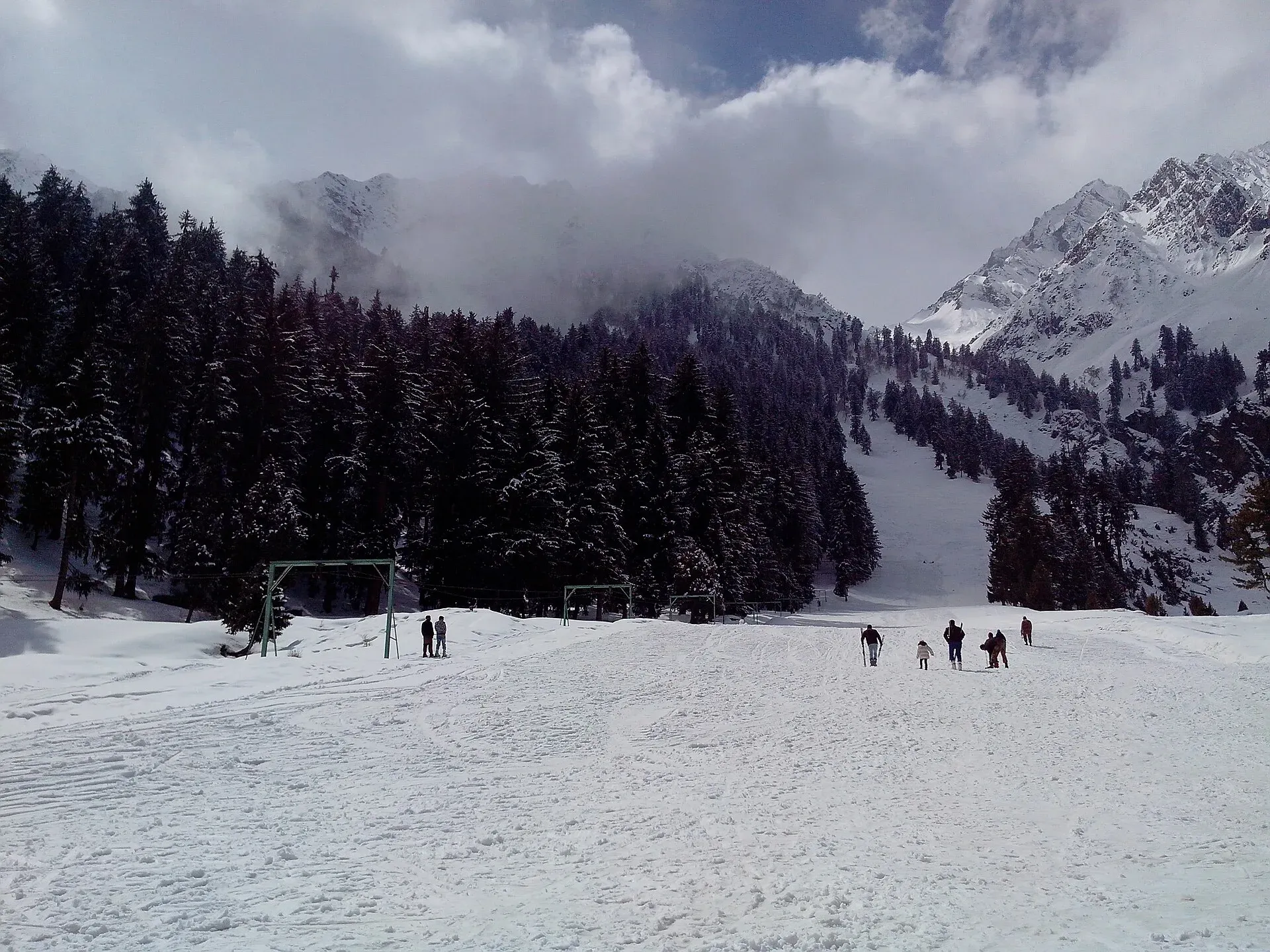
Photo: Mr Haseeb Ahmed, with thanks · CC BY-SA 3.0 · via Wikimedia Commons · temporary stand-in photo

Naltar Meadows
Grazing meadows and pine woods in the Naltar Valley north of Gilgit, between the Nomal turn-off and the lakes, used for summer pasture and camping.
Overview
Naltar is a forested side valley north of Gilgit, known for its lakes and ski slopes. Its meadows lie along the stream between Naltar Paain (lower) and Naltar Bala (upper) and on towards the lakes. No source gives a single altitude for the meadows, so none is given; the lakes beyond are around 3,050 to 3,150 m on the Naltar Lakes page. See also the Naltar Valley page.
Plan your visit
- Nearest town
- Gilgit
- Getting there
From Gilgit drive about 26 km on the KKH to Nomal, then up the Naltar road. Naltar Bala is about 34 km from Gilgit (Wikipedia) or 54 km (official district sheet), about an hour by jeep. More
Best months
Jun – Oct
Farming and grazing
Summer grazing is part of village life, so expect cattle and yaks on the open slopes. Potatoes are the staple crop across the Northern Areas, and small clearings in the valley are farmed for them. The Pakistan Air Force runs a rest house (the Mess) with a lawn between the lower and upper settlements, and it also runs the ski facilities.
What to see and do
- Pasture and yaks. Open slopes with grazing animals in summer.
- Forest walks. Spruce, juniper and mixed woods between the meadows.
- Camping. Several rest houses and camping places exist. See Naltar Valley campsites.
- The lakes. About 13 km beyond Naltar Bala on a rough road lie the Satrangi, Blue and Bodlok lakes.
- Shani Glacier. Meltwater from the Shani Glacier feeds the Naltar River and the lakes. Reaching it means walking on the Pakora Pass trek.
- Treks. The Pakora Pass and Daintar Pass routes start in the upper valley.
When to visit
June to September for the meadows and lakes; October for autumn colour. In winter deep snow covers the valley and visitors come mainly for skiing, which the Pakistan Air Force runs. Check dates each year.
Getting there
Naltar leaves the Karakoram Highway at Nomal, about 26 km from Gilgit by OSRM, where visitors usually hire a 4x4 jeep. Distances to Naltar vary by source, from about 34 km (Wikipedia, Naltar Bala) to 54 km (Gilgit district sheet, about 1 hour by jeep). The last stretch is rough and narrow; a 4x4 with an experienced driver is recommended. Wikipedia describes an unpaved road, with snow 10 to 15 feet deep in winter.
Where to stay and eat
Naltar has government rest houses and private guesthouses, with simple restaurants in season. Book ahead in July and August. Camping is possible with permission from the owner of the land. Current room, camping and jeep fees will be added soon.
Good to know
- Wildlife. Naltar Wildlife Sanctuary covers much of the valley. Do not feed or disturb animals.
- Advice. For foreign visitors: the UK FCDO (updated 27 October 2026, checked 16 November 2026) does not advise against Gilgit-Baltistan generally. Check the page, and road and weather conditions, before you travel.
- Altitude. Mild at the meadows, higher at the lakes.
Highlights
- Summer pasture and forest north of Gilgit
- Yaks and village grazing
- Gateway to the Naltar lakes
- Start of the Pakora Pass trek
Tips
- Hire a 4x4 with a local driver in Gilgit.
- Book rest houses early for summer.
- Ask before camping on private pasture.
Photos we still need: a second photo of the meadows, forest and grazing animals (the one photo is also used on several other Naltar pages). Send us yours
Sources and last checked
Last checked Confidence low5 sources3 still to check
- Last checked
- Method
- Desk research from published sources
- Confidence
- low
- Checked by
- trek.pk research team
Researched from published sources; not yet checked on the ground by our team. Spot something out of date? Report a mistake.
Sources
- Naltar Valley · Wikipedia · checked
- District Gilgit tourist guide sheet · Tourism Department, Gilgit-Baltistan · checked
- Pakistan travel advice (warnings and insurance; updated 27 October 2026) · UK Foreign, Commonwealth & Development Office · checked
- OSRM driving route service (distances and times, measured 16 November 2026; times are optimistic) · OSRM · checked
- Journey to the Naltar Valley (1 October 2022) · The Friday Times · checked
Still to be checked on the ground (3)
- Altitude and exact location of the meadows (no source gives either)
- Camping rules and fees
- Current road condition beyond Naltar Bala
Nearby and related

Pakora Pass

Naltar Valley
A forested valley north of Gilgit with Naltar Paain and Naltar Bala villages, a wildlife sanctuary, the colourful Satrangi and Blue lakes and the PAF-run ski resort.
Naltar Lakes
A group of three lakes at about 3,050 to 3,150 m above Naltar Valley near Gilgit. The Bashkiri lakes, including Satrangi and Blue Lake, are reached by a rough jeep road and are known for their colours.

Gilgit
Gateway to Gilgit-Baltistan on the Karakoram Highway: a busy mountain town with the Kargah Buddha and the base for Hunza, Naltar and Skardu.