

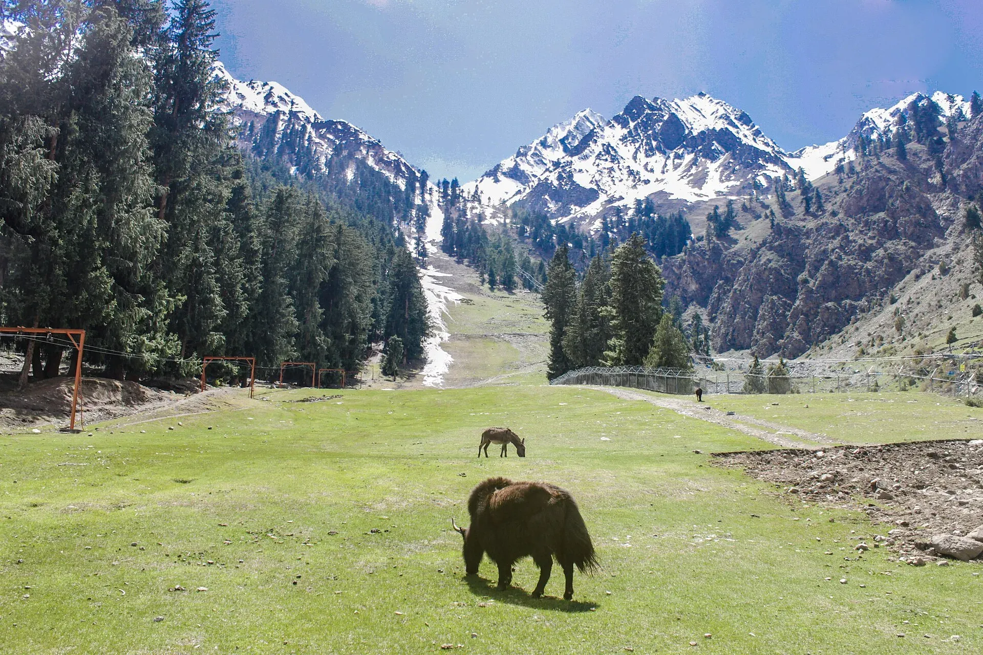
Photo: Irfansheen, with thanks · CC BY-SA 4.0 · via Wikimedia Commons · temporary stand-in photo

Naltar Valley Campsites
Camping places in the upper Naltar Valley, near the Naltar lakes and meadows, about an hour by jeep from Gilgit. Camping is under GB rules for designated areas and permits.
Overview
Naltar is a forested side valley north of Gilgit. The upper valley, beyond Naltar Bala, has meadows and the coloured Naltar (Bashkiri) lakes at roughly 3,050 to 3,150 m. People camp near the lakes and on meadows, and the valley is the start of the Daintar and Pakora pass treks. A wildlife sanctuary of about 27,200 hectares, set up on 22 November 1975, protects much of the area.
Plan your visit
- Nearest town
- Gilgit
- Getting there
From Gilgit take the Karakoram Highway to Nomal, then the Naltar road. The district sheet gives 54 km and about 1 hour by jeep. Jeeps can be hired in Gilgit. More
Best months
Jun – Sep
Access
The Gilgit district tourist sheet gives Naltar as 54 km from Gilgit, about 1 hour by jeep. Wikipedia's Naltar Valley page gives about 34 km to Naltar Bala (the upper settlement) and about 40 km to lower Naltar (Paain), with the lakes about 13 km beyond Naltar Bala. It describes the Naltar Expressway running from Gilgit through Nomal and Faizabad. The two sources differ by 20 km, so treat both as approximate. The lakes lie some 12 to 13 km beyond Naltar Bala on a narrow, rough road that needs a 4x4. Heavy snow cuts the road in winter.
The lakes and what surrounds them
The Naltar lakes, also called the Bashkiri lakes, lie about 12 to 13 km beyond Naltar Bala. The first and largest, Satrangi ("seven-coloured") Lake, takes its name from the many shades of blue and green on its surface. The second is Blue Lake and the third Feroza ("azure") Lake. Wikipedia lists three more, named Halima, Bodo and Dhudia, among six lakes in the valley. Dense pine forest surrounds them, and the road to them is a dirt track beside a stream. Higher slopes carry spruce and juniper forest, with birch, willow and poplar lower down. About 35 bird species have been recorded, and the sanctuary also holds Astor markhor, ibex, snow leopard, brown bear and wolf.
Naltar also has rest houses run by several organisations, and private guesthouses, if a bed is preferred to a tent. Ski competitions are held in the valley; see Naltar Ski Resort. Wikipedia notes snow of 10 to 15 feet in winter, which makes the road almost impassable for vehicles.
Who manages it, and the rules
There is no known official list of Naltar campsites or the body that manages them. What is known:
- GB camping rule. The GB Tourism Department FAQ says camping is allowed in designated camping areas, and tourists must get a permit from the department before pitching tents. Ask the Gilgit tourism office which areas in Naltar are designated.
- Landowners. Meadows and pastures belong to local communities and are grazed in summer. Ask permission and keep clear of livestock.
- Sanctuary. Hunting is not allowed. Do not disturb wildlife. The sanctuary holds Astor markhor, ibex, snow leopard, brown bear and wolf, so you are unlikely to see them, but keep food sealed.
- Fires and waste. The district sheet asks visitors to cook on LPG or kerosene rather than firewood, to dispose of litter properly and to leave campsites clean. Carry out everything you carry in.
- Fees. Camping and vehicle charges may apply; current fees will be added soon. Ask the Gilgit tourism office.
Best months
June to September for the lakes and high meadows; October for autumn colour. Nights are cold and the lakes are above 3,000 m, so take warm gear and go up gradually.
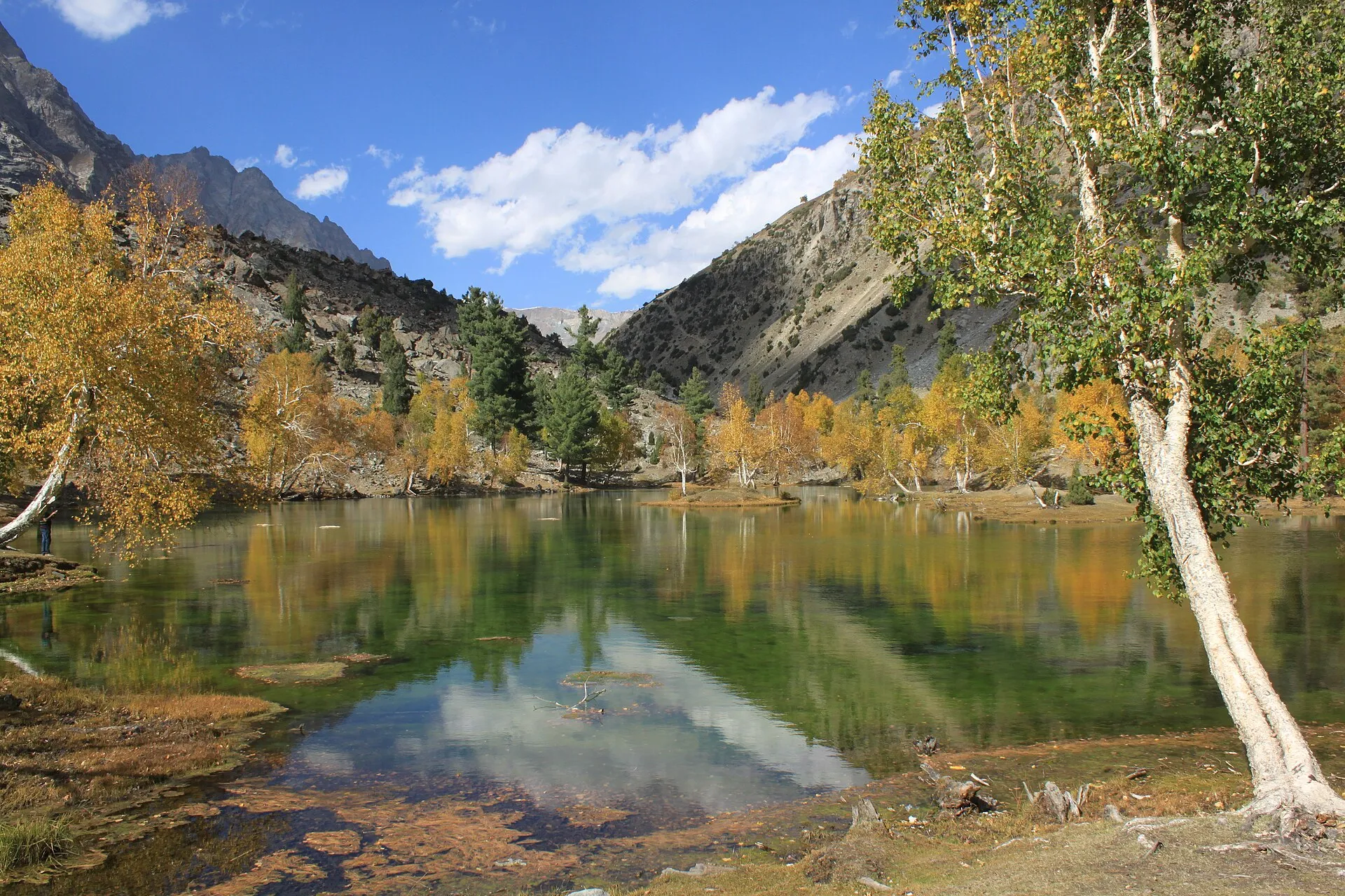
Photo: Tipuabdul, with thanks · CC BY-SA 3.0 · via Wikimedia Commons · temporary stand-in photo

Safety
- Rock and mud slides can close the road after rain.
- Weather changes fast; storms at the lakes can be severe.
- Tell your host where you are camping and hire a local guide for any trek (the district sheet advises this too).
- For foreign visitors: the UK FCDO (updated 27 October 2026) does not advise against Gilgit-Baltistan generally.
Nearby
Naltar Lakes, Naltar Meadows, Naltar Pine Forest, the ski area, the wider Naltar Valley, and the Daintar Pass, Pakora Pass and Naltar lakes walk treks. Gilgit is the nearest town.
Highlights
- Camping near the Naltar lakes at about 3,050 to 3,150 m
- 54 km from Gilgit, about 1 hour by jeep (district sheet)
- Start of the Daintar and Pakora pass treks
- Wildlife sanctuary set up in 1975
Getting there
From Gilgit take the Karakoram Highway to Nomal, then the Naltar road. The district sheet gives 54 km and about 1 hour by jeep. Jeeps can be hired in Gilgit.
Tips
- Confirm designated sites and permits with the Gilgit tourism office.
- Use a 4x4 for the road above Naltar Bala.
- Cook on a stove and carry all rubbish out.
Photos we still need: a camping area at Naltar with tents (none found with an open licence). Send us yours
Sources and last checked
Last checked Confidence medium7 sources3 still to check
- Last checked
- Method
- Desk research from published sources
- Confidence
- medium
- Checked by
- trek.pk research team
Researched from published sources; not yet checked on the ground by our team. Spot something out of date? Report a mistake.
Sources
- Land of Diversity: District Gilgit tourist guide sheet · Tourism & Culture Department, Gilgit-Baltistan · checked
- Frequently asked questions (camping in designated areas, permit from the tourism department) · Tourism Department, Government of Gilgit-Baltistan · checked
- Naltar Wildlife Sanctuary · Wikipedia · checked
- Naltar Lakes · Wikipedia · checked
- Pakistan travel advice: warnings and insurance (updated 27 October 2026) · UK Foreign, Commonwealth & Development Office · checked
- OSRM driving route service (distances and times measured 16 November 2026; times are optimistic) · OSRM · checked
- Naltar Valley · Wikipedia · checked
Still to be checked on the ground (3)
- Which sites in Naltar are officially designated for camping (none listed in any source opened; GB tourism FAQ page returned 404 this time)
- Who manages the sites and what they charge
- Distance from Gilgit: 54 km (district sheet) vs about 34 km to Naltar Bala (Wikipedia, citing The News, which blocked us); no official reconciliation
Nearby and related

Daintar Pass

Pakora Pass
Naltar Valley
A forested valley north of Gilgit with Naltar Paain and Naltar Bala villages, a wildlife sanctuary, the colourful Satrangi and Blue lakes and the PAF-run ski resort.
Naltar Lakes
A group of three lakes at about 3,050 to 3,150 m above Naltar Valley near Gilgit. The Bashkiri lakes, including Satrangi and Blue Lake, are reached by a rough jeep road and are known for their colours.

Naltar Meadows
Grazing meadows and pine woods in the Naltar Valley north of Gilgit, between the Nomal turn-off and the lakes, used for summer pasture and camping.
Naltar Ski Resort
Pakistan's oldest ski resort, run with the Pakistan Air Force at about 2,900 m in Naltar Valley near Gilgit. It hosts national ski and ice-sport events each winter; public access and lift times should be confirmed first.

Gilgit
Gateway to Gilgit-Baltistan on the Karakoram Highway: a busy mountain town with the Kargah Buddha and the base for Hunza, Naltar and Skardu.