

Photo: Mehrunisa Reimoo, with thanks · CC BY-SA 4.0 · via Wikimedia Commons · temporary stand-in photo

Passu Camping Area
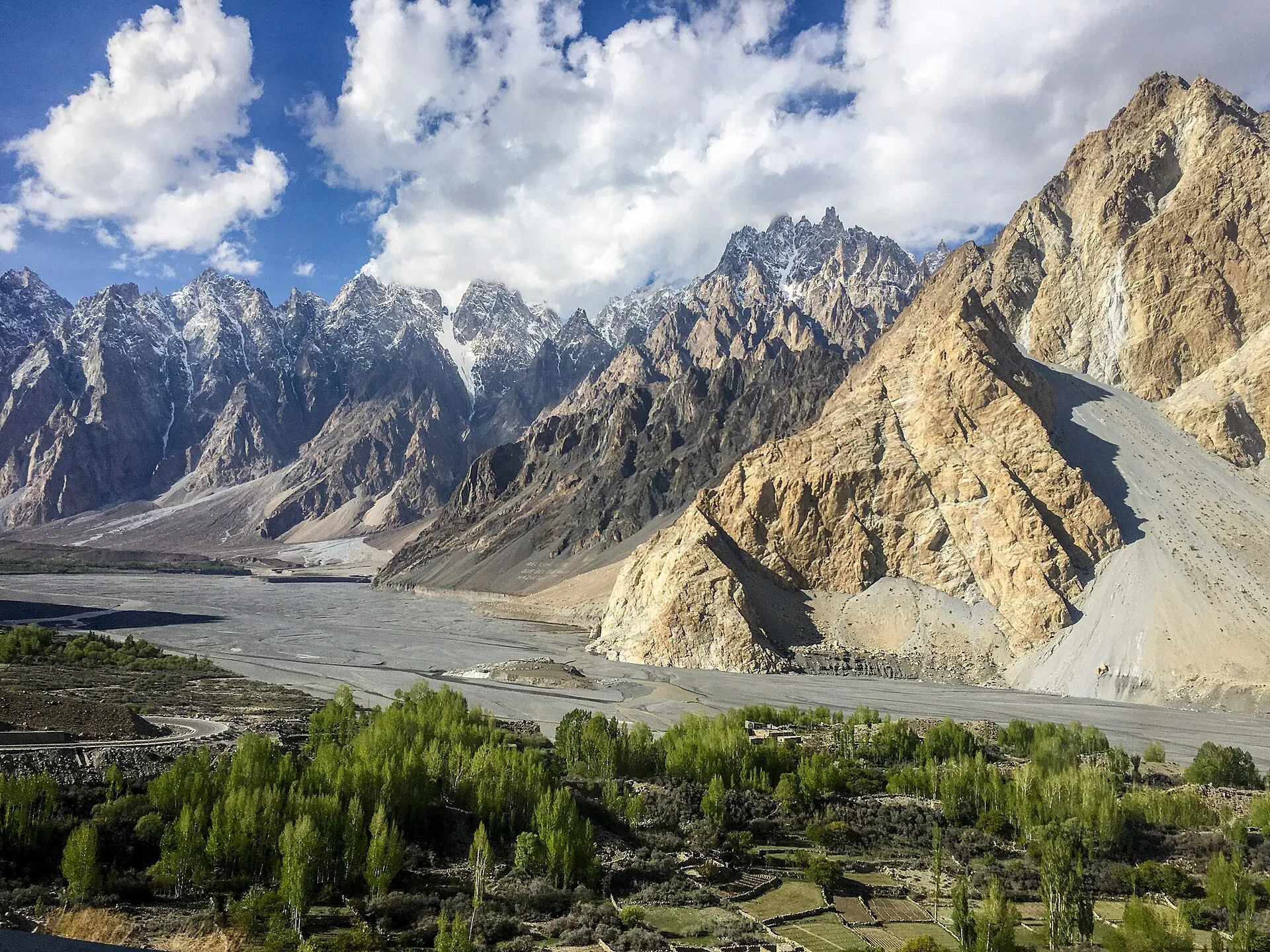
Camping beside Passu village in Gojal, below the Passu Cones and Passu Glacier. Tent space is offered by local guesthouses; there is no known official site list.
Overview
Passu is a Wakhi village in Gojal (Upper Hunza), about 147 km up the valley from Gilgit, on the Karakoram Highway. The Wakhi people migrated here from the Wakhan between 1870 and 1948, speak the Wakhi language and are almost entirely Ismaili. The village stands at about 2,500 m (approximate). To the north rises Tupopdan, also called the Passu Cones or Passu Cathedral, at 6,106 m. The Passu Glacier ends just south of the village, and the long Batura Glacier (56 km) lies just to the north.
Camping here means tent space at village guesthouses, or camps used on treks. There is no known official, government-approved campground at Passu, and the evidence is from operator listings, so confidence is low.
Plan your visit
- Nearest town
- Sost
- Getting there
From Gilgit or Karimabad, take the Karakoram Highway north. The district sheet gives Passu as 50 km from Aliabad, about 1 hour 10 minutes. Buses and vans run along the KKH to Sost. More
Best months
May – Oct
- Passu Camping Area
- Related places nearby: Passu, Passu Glacier, Passu Cones Viewpoint, Gulmit, Borith Lake, Hunza Valley
The setting
- Passu Cones. The jagged skyline above the village is the most photographed view in Gojal. Passu Sar (7,478 m) and Shispare Sar are among the higher peaks nearby.
- Passu Glacier. Meltwater feeds the fields, and villagers built an irrigation system centuries ago to carry it. A small lake sits at the glacier's front and drains into the Hunza River. Dutch geographer Philips Visser and his wife surveyed about two-thirds of the glacier in 1925.
- Borith Lake. A saline lake at about 2,600 m lies below Hussaini village, a short drive away.
Access
The Hunza district sheet gives Passu as 50 km from Aliabad, about 1 hour 10 minutes by car. OSRM puts Karimabad to Passu at about 49 km and 39 minutes, and Gilgit to Passu at about 145 km and 107 minutes. Both are estimates and optimistic. The road is the paved Karakoram Highway.
Who manages it, and the rules
- Village camps. Sites belong to families and village guesthouses. Agree the spot and any charge with the owner first.
- Permit. No permit rule for camping at Passu has been confirmed. Ask the Hunza tourism office what applies.
- Fires. Use LPG or kerosene rather than wood, as the district sheet asks.
- Waste. Carry out rubbish and leave the site clean. There is little waste collection at remote camps.
- Fees. Camping charges may apply; current fees will be added soon.
Glacier camps
Treks that cross the Passu Glacier use higher camps, around 3,500 m on one operator itinerary. Glacier ice has crevasses and moves; do not walk on it without a guide. The district sheet advises a local guide for trekking and camping.
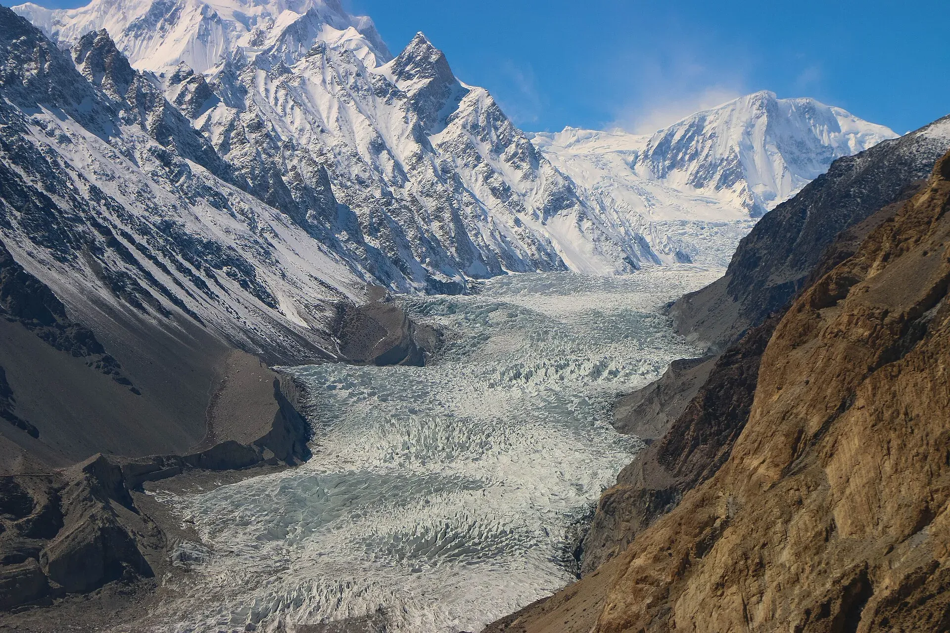
Photo: Akbar Khan Niazi, with thanks · CC BY-SA 3.0 · via Wikimedia Commons · temporary stand-in photo

Best months
May to October. Snow closes high camps outside summer, and the highway can be affected by landslides at any time.
Safety
- Wind comes down the valley in the afternoon. Peg tents well.
- Do not camp in dry stream beds or below steep slopes; flash floods and rockfall happen.
- For foreign visitors: the UK FCDO (updated 27 October 2026) does not advise against Gilgit-Baltistan generally. Check the live page.
Nearby
Passu Glacier, the Passu Cones viewpoint, Gulmit, Borith Lake and Ghulkin Glacier.
Highlights
- Camping below the Passu Cones in Gojal
- About 50 km from Aliabad (district sheet)
- Village tent space; no official site list
- Glacier treks use higher camps with a guide
Getting there
From Gilgit or Karimabad, take the Karakoram Highway north. The district sheet gives Passu as 50 km from Aliabad, about 1 hour 10 minutes. Buses and vans run along the KKH to Sost.
Tips
- Agree site and price with the owner before pitching.
- Go with a guide on the glacier.
- Check for rockfall and flash-flood risk before choosing a spot.
Photos we still need: a tent site or camp at Passu village, and a glacier-side camp. Send us yours
Sources and last checked
Last checked Confidence low6 sources3 still to check
- Last checked
- Method
- Desk research from published sources
- Confidence
- low
- Checked by
- trek.pk research team
Researched from published sources; not yet checked on the ground by our team. Spot something out of date? Report a mistake.
Sources
- Land of Culture: District Hunza tourist guide sheet · Tourism & Culture Department, Gilgit-Baltistan · checked
- Passu · Wikipedia · checked
- Karakorum Jeep Safari (itinerary naming a camp near 3,500 m) · 10 Adventures (operator) · checked
- Pakistan travel advice: warnings and insurance (updated 27 October 2026) · UK Foreign, Commonwealth & Development Office · checked
- OSRM driving route service (distances and times measured 16 November 2026; times are optimistic) · OSRM · checked
- Passu Glacier · Wikipedia · checked
Still to be checked on the ground (3)
- Which Passu sites are licensed or designated (no official list found; the GB Tourism Department FAQ link returned HTTP 404)
- Current camping charges
- Height of glacier-side camps (no published height other than one operator itinerary, about 3,500 m)
Nearby and related

Passu
A Wakhi village in Gojal beside the Passu Glacier, below the jagged Passu Cones (Tupopdan, 6,106 m). Known for Hussaini Suspension Bridge, glacier walks and Batura views.

Passu Glacier
A glacier south of Passu village in Gojal that you can see from the KKH and reach on a short walk. It lies below Passu Sar and has been retreating, so its length depends on the source.

Passu Cones Viewpoint
A roadside viewpoint on the Karakoram Highway at Passu in Gojal, facing the jagged Passu Cones (Tupopdan, 6,106 m) above the Hunza River. Easy to reach by car.

Gulmit
The administrative centre of Gojal (Upper Hunza), at 2,465 m on the Karakoram Highway. A calm base for Ghulkin, Borith Lake, the museum and fort walks.

Borith Lake
A small lake in Gojal, upper Hunza, a short walk from Hussaini and Gulmit. It lies at about 2,600 m, fed by meltwater from Hussaini Glacier, and is a resting stop for migrating wildfowl.

Hunza Valley
A long Karakoram valley on the Karakoram Highway, with Karimabad, Baltit and Altit forts, Ganish village and Attabad Lake, below Rakaposhi and Ultar Sar. About 100 km from Gilgit.