

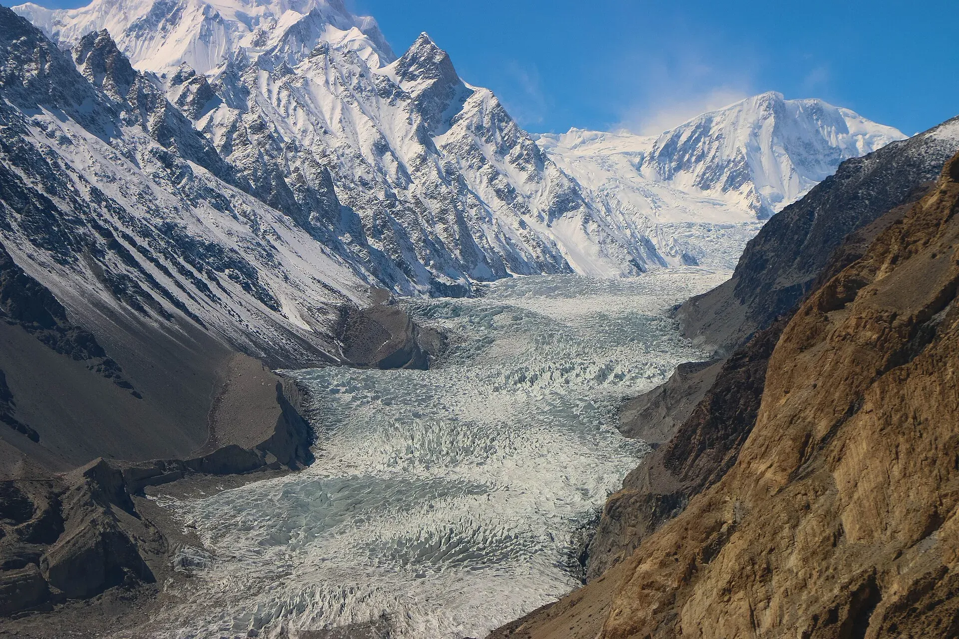
Photo: Akbar Khan Niazi, with thanks · CC BY-SA 3.0 · via Wikimedia Commons · temporary stand-in photo

Passu Sar
Passu Sar (7,478 m) is the high point of the Passu massif in the Batura Muztagh, above Passu village and the Passu Glacier in Gojal. The date of its first ascent is disputed.
Overview
Passu Sar, also Passu I, is 7,478 m high and ranked 54th among the world's highest mountains, with a prominence of 647 m. It is the top of the Passu massif in the Batura Muztagh, a sub-range of the Karakoram, in Hunza District, about 7 km east of Batura Sar. Older guides round it to "about 7,500 m".
Plan your visit
- Nearest town
- Passu
- Getting there
Drive the Karakoram Highway north from Karimabad or Gilgit to Passu in Gojal. Check road status before you go. More
Best months
May – Oct
- Passu Sar
- Related places nearby: Passu, Passu Glacier, Gojal and Shimshal, Batura Glacier, Hunza Valley
Seeing it from Passu
The nearest village is Passu on the Karakoram Highway in Gojal, set on a large meander of the Hunza River. The massif rises above the Passu Glacier. The jagged Passu Cones (Tupopdan, 6,106 m, also called Passu Cathedral) are a different, lower peak in front of it. Do not confuse the two. The massif also includes Passu Diar, also called Passu East or Passu II.
The Passu Glacier is linked to the Batura Glacier and several smaller glaciers, and it has been retreating, so what you see on the ground changes from year to year.
Walks around Passu
- Borith Lake. A road climbs the hillside from Husseini to the lake, which has a campground, a restaurant and summer swimming. A trail beyond leads up towards the Passu Glacier and, according to Wikivoyage, offers some of the best views in the area. See Borith Lake.
- Suspension bridge. A cable-and-plank footbridge crosses the Hunza River, reached by a path from the first hairpin south of Passu. Crossing the Husseini bridge further downstream makes a circular walk. See Passu suspension bridge.
- Yunz Valley. Lies between the Passu and Batura glaciers, behind Zard Sar, on a trail marked by cairns.
- Local guides. Guesthouses can help find one. Do not go onto the glacier without a guide.
The turn-off for the Shimshal road is about 5 km north of Passu. See also the Passu, Passu Glacier and Gojal and Shimshal pages.
Climbing
Sources disagree about the first ascent. One report says a Japanese–Pakistani team climbed it in 1978, in an expedition that lost Toshio Takahashi, who fell into a crevasse at about 5,800 m. Another gives 7 August 1994 for the first ascent, by Germans Max Wallner, Dirk Naumann, Ralf Lehmann and Volker Wurnig. This page uses both and treats the question as open.
When to visit
Passu village is easiest from late spring to autumn, and the KKH may close in bad weather. Mountaineering is a summer activity.
Where to stay and eat
Passu and nearby Gulmit have guesthouses and simple restaurants. Gojal is also reached from Karimabad.
Good to know
- Permits. A climbing permit is required above 6,500 m through a licensed operator. Current fees will be added soon; ask Gilgit-Baltistan Tourism.
- Safety. Landslides on the KKH and glacier hazards are the main risks. Do not go onto the glacier without a guide.
- Travel advice. For foreign visitors: the UK FCDO does not advise against Gilgit-Baltistan generally (page updated 27 October 2026, checked 16 November 2026) but warns against the KKH between Mansehra and Chilas. Read the live page.
Highlights
- High point of the Passu massif, 7,478 m
- Seen from Passu village and the KKH
- Above the Passu Glacier
- First ascent date disputed (1978 or 1994)
- Not the same as the Passu Cones
Getting there
Drive the Karakoram Highway north from Karimabad or Gilgit to Passu in Gojal. Check road status before you go.
Tips
- Use morning light for photographs from Passu.
- Check KKH landslide news before driving from Hunza.
- Treat guidebook heights (about 7,500 m) as rounded.
Photos we still need: Passu Sar or the Passu massif from the Karakoram Highway or Borith Lake. Send us yours
Sources and last checked
Last checked Confidence medium4 sources3 still to check
- Last checked
- Method
- Desk research from published sources
- Confidence
- medium
- Checked by
- trek.pk research team
Researched from published sources; not yet checked on the ground by our team. Spot something out of date? Report a mistake.
Sources
- Passu Sar · Wikipedia · checked
- Pakistan travel advice: warnings and insurance · UK Foreign, Commonwealth & Development Office (FCDO) · checked
- Fees and Paperwork for a Karakorum Trek (peaks above 6,500 m need a climbing permit; Alpine Club of Pakistan quoted) · ExplorersWeb · checked
- Passu (walks, Borith Lake, bridge, Yunz Valley, Shimshal turn-off) · Wikivoyage · checked
Still to be checked on the ground (3)
- First ascent date (1978 Japanese-Pakistani vs 7 August 1994 German team; Wikipedia calls it disputed, cites AAJ 1995 for 1994; the AAJ page could not be opened)
- Best viewpoint in Passu
- Climbing permit rules (not in Wikipedia; no official GB Tourism notification opened)
Nearby and related

Passu
A Wakhi village in Gojal beside the Passu Glacier, below the jagged Passu Cones (Tupopdan, 6,106 m). Known for Hussaini Suspension Bridge, glacier walks and Batura views.

Passu Glacier
A glacier south of Passu village in Gojal that you can see from the KKH and reach on a short walk. It lies below Passu Sar and has been retreating, so its length depends on the source.

Gojal and Shimshal
Upper Hunza: Gulmit, Ghulkin, Passu and Sost on the Karakoram Highway, with big glaciers and the Passu Cones, plus the remote Shimshal valley, its Wakhi village and its mountaineering community.

Batura Glacier
About 57 km long, the Batura is one of the longest glaciers outside the polar regions. Its snout is close to the KKH in Gojal, and a five-day trek leads beside it to Guchesham beneath the Batura Wall.

Hunza Valley
A long Karakoram valley on the Karakoram Highway, with Karimabad, Baltit and Altit forts, Ganish village and Attabad Lake, below Rakaposhi and Ultar Sar. About 100 km from Gilgit.