

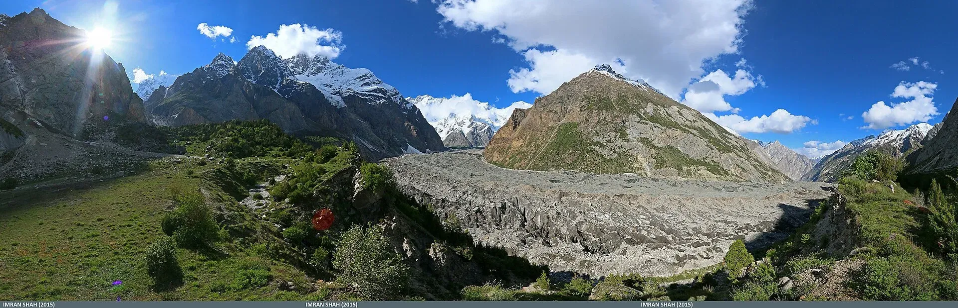
Photo: Imran Shah from Islamabad, Pakistan, with thanks · CC BY-SA 2.0 · via Wikimedia Commons · temporary stand-in photo

Batura Glacier
About 57 km long, the Batura is one of the longest glaciers outside the polar regions. Its snout is close to the KKH in Gojal, and a five-day trek leads beside it to Guchesham beneath the Batura Wall.
Overview
The Batura Glacier flows east from the Batura Muztagh in Gojal, upper Hunza, ending just north of Passu beside the Karakoram Highway. Wikipedia gives its length as 57 km; a later review of regional studies gives about 58 km. Wikipedia says the terminus was about 0.5 km above the KKH in 1984 and has since retreated, with both backwasting and downwasting. A study of hazards along the KKH puts the glacier less than 300 m from the highway.
The peaks above it are the Batura Wall: Batura Sar (7,795 m) and Passu Sar (about 7,500 m), with Kampir Dior (7,168 m) towards the head of the valley.
Plan your visit
- Nearest town
- Passu
- Getting there
From Gilgit, the KKH (N-35) runs north through Hunza to Passu, a few hours' drive. The glacier is on the highway just north of Passu. Shared vans run along the KKH. More
Best months
Jun – Oct
- Batura Glacier
- Related places nearby: Passu, Gojal and Shimshal, Borith Lake, Hunza Valley
How the glacier behaves
Wikipedia describes the Batura as a mountain glacier running from west to east. Two-thirds of its middle and lower stretch is buried under thick debris, which is why much of it looks like a river of grey rubble rather than ice. A thin strip of clean ice about 700 m wide comes within 4 km of the snout. The valley floor receives only about 10 cm of precipitation a year, while the mountains above get 100 to 130 cm of snow, and the freezing level sits at about 4,200 m. The upper glacier is the coldest part; the middle and lower reaches are more temperate.
The Batura Muztagh
The Batura Muztagh is the westernmost sub-range of the Karakoram, running from Chalt in the Bar valley in the east to Kampir Dior in the Kurumbar valley in the west. Batura Sar, 7,795 m, is its highest peak and was first climbed in 1976. Shispare (7,611 m) was first climbed in 1974 and Passu Sar (7,476 m) in 1994. Closer to the road, Ultar Sar (7,388 m) was first climbed in 1996 and Bublimotin, the Ladyfinger Peak (about 6,000 m), in 1982.
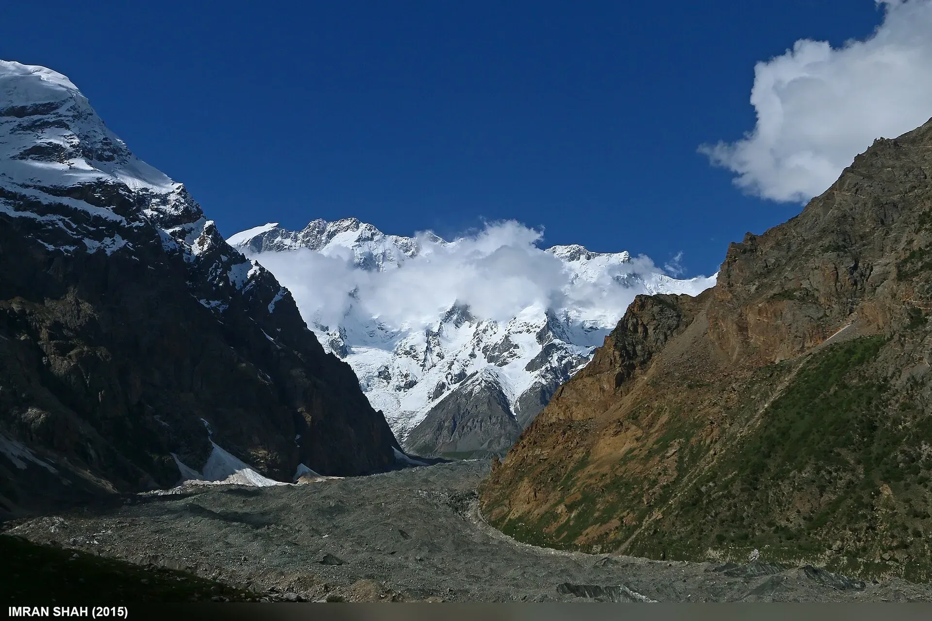
Photo: Imran Shah, with thanks · CC BY-SA 2.0 · via Wikimedia Commons · temporary stand-in photo

What to see and do
- From the road. The ice front can be seen from the KKH near Passu, with the Batura Wall behind.
- Passu. Passu is a village in Gojal about 20 km from Gulmit and 147 km up the Hunza River from Gilgit. Its people are mostly Wakhi, who migrated from the Wakhan between 1870 and 1948, speak Wakhi and are almost all Ismaili. The Passu Cones, a jagged peak of 6,106 m also known as Tupopdan or Passu Cathedral, is called the most photographed peak of the region. Borith Lake, a saline lake at 2,600 m below Hussaini village, lies near Passu.
- Trek. Our Batura Glacier trek is a five-day return walk of about 65 km from China Camp near Passu along the north margin of the glacier to Guchesham (3,630 m), through juniper and pasture, with views of the Batura ice floes. It is moderate, with one glacier crossing.
- Higher options. Patundas, a ridge pasture between the Passu and Batura glaciers, gives a very big view and a hard climb. A longer return crosses the glacier at Piyakh Sheet. The Werthum Pass leads to Chapursan.
When to visit
June to October. Autumn is clear but cold.
Where to stay and eat
Stay in Passu, Gulmit or Sost, with guesthouses and small restaurants. Sost is the last town on the Pakistani stretch of the KKH. On the trek you camp or use local huts, with a guide.
Good to know
- Permits. The old guidebook lists no permit; local people expect a Passu guide or porter on the ice. Rules for foreigners changed in 2024 and were later challenged, and there is no known official current list, so ask the Gilgit-Baltistan Tourism Department or a licensed operator. Current fees will be added soon.
- Floods. The Batura has caused damage before. A study of KKH hazards records glacial floods in 1972 and 1973 that damaged the road, bridges and culverts. The same study notes two surges about 40 years apart.
- Climate. Glaciers in the central and western Karakoram have behaved differently from most of the world's glaciers. Some studies report them holding steady or even gaining mass, which is called the "Karakoram anomaly"; eastern Karakoram glaciers have been retreating more clearly. Even so, rising temperatures bring hazards. Pakistan's climate ministry and UNDP report 3,044 glacial lakes in Gilgit-Baltistan and Khyber Pakhtunkhwa, of which 33 were assessed as prone to dangerous outburst floods (GLOFs). The UNDP-run GLOF II project, funded by the Green Climate Fund, covers 24 valleys with early-warning systems.
- Travel advice. For foreign visitors: the UK FCDO page for Pakistan (updated 27 October 2026, checked 16 November 2026) does not advise against Gilgit-Baltistan as a whole. It does advise against all travel on the Karakoram Highway (KKH) between Mansehra and Chilas, the usual road route from Islamabad, so check the live page before you plan and consider flying to Gilgit or Skardu (weather permitting).
Highlights
- About 57 km long
- Ice front close to the KKH near Passu
- Batura Wall peaks above 7,000 m
- Five-day trek to Guchesham
Getting there
From Gilgit, the KKH (N-35) runs north through Hunza to Passu, a few hours' drive. The glacier is on the highway just north of Passu. Shared vans run along the KKH. For foreign visitors: the UK FCDO page for Pakistan (updated 27 October 2026, checked 16 November 2026) does not advise against Gilgit-Baltistan as a whole. It does advise against all travel on the Karakoram Highway (KKH) between Mansehra and Chilas, the usual road route from Islamabad, so check the live page before you plan and consider flying to Gilgit or Skardu (weather permitting).
Tips
- Take a local guide; the route across ice shifts.
- Start early on trek days; streams rise by afternoon.
- Check the KKH road status before driving up to Passu.
- Read our glacier travel basics first.
Photos we still need: the Batura snout and the KKH, and the trail to Guchesham. Send us yours
Sources and last checked
Last checked Confidence medium10 sources3 still to check
- Last checked
- Method
- Desk research from published sources
- Confidence
- medium
- Checked by
- trek.pk research team
Researched from published sources; not yet checked on the ground by our team. Spot something out of date? Report a mistake.
Sources
- Batura Glacier · Wikipedia · checked
- Glacier-Related Hazards Along the International Karakoram Highway: Status and Future Perspectives · Frontiers in Earth Science (2021) · checked
- Batura Glacier (old trek.pk page, text from Lonely Planet Trekking in the Karakoram and Hindukush, c. 2002; facts only) · trek.pk / Lonely Planet · checked
- Glacial Lake Outburst Flood GLOF-II · Ministry of Climate Change and Environmental Coordination, Pakistan · checked
- Scaling-up of GLOF risk reduction in Northern Pakistan (GLOF II) · UNDP Pakistan · checked
- Pakistan travel advice · UK Foreign, Commonwealth & Development Office · checked
- Karakoram glacier lengths (Cambridge review: Baltoro and Batura both about 58 km) · Cambridge University Press · checked
- Batura Muztagh (Wikipedia) · Wikipedia · checked
- Passu (Wikipedia) · Wikipedia · checked
- Karakoram Highway (Wikivoyage) · Wikivoyage · checked
Still to be checked on the ground (3)
- Glacier area (not given by Wikipedia or the hazards paper)
- Current position of the snout relative to the KKH (only the 1984 figure of about 0.5 km and a 'less than 300 m' hazards-paper figure are available)
- Permit rules and fees for foreigners (gbtourism.gov.pk could not be reached)
Nearby and related

Batura Glacier

Patundas

Werthum Pass

Boibar

Passu Glacier and Borith Lake Walk
Passu
A Wakhi village in Gojal beside the Passu Glacier, below the jagged Passu Cones (Tupopdan, 6,106 m). Known for Hussaini Suspension Bridge, glacier walks and Batura views.

Gojal and Shimshal
Upper Hunza: Gulmit, Ghulkin, Passu and Sost on the Karakoram Highway, with big glaciers and the Passu Cones, plus the remote Shimshal valley, its Wakhi village and its mountaineering community.
Borith Lake
A small lake in Gojal, upper Hunza, a short walk from Hussaini and Gulmit. It lies at about 2,600 m, fed by meltwater from Hussaini Glacier, and is a resting stop for migrating wildfowl.

Hunza Valley
A long Karakoram valley on the Karakoram Highway, with Karimabad, Baltit and Altit forts, Ganish village and Attabad Lake, below Rakaposhi and Ultar Sar. About 100 km from Gilgit.