

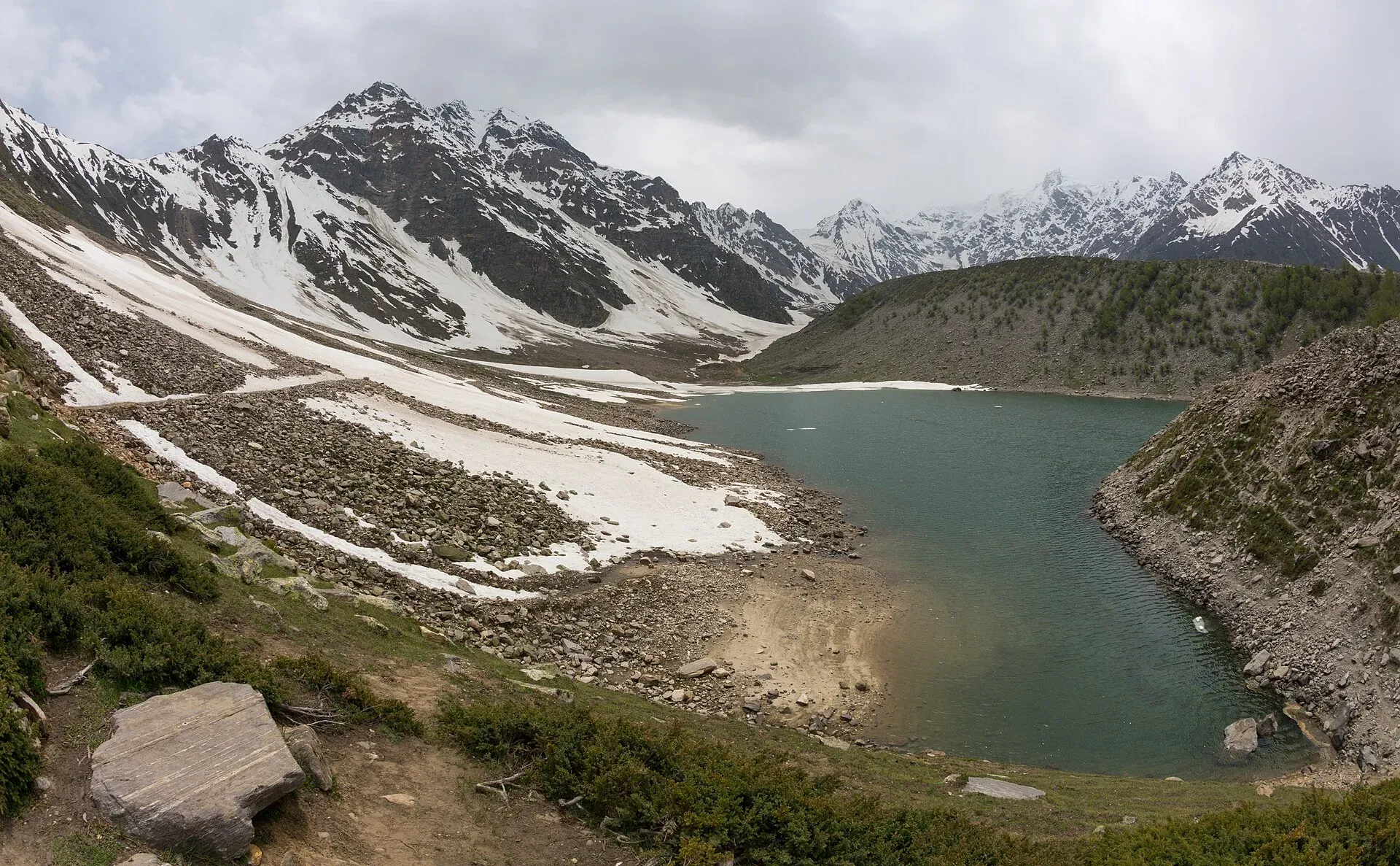
Photo: Ahmed Sajjad Zaidi, with thanks · CC BY-SA 3.0 · via Wikimedia Commons · temporary stand-in photo

Rama Lake
A high lake in the Rama Valley near Astore, at about 3,300 m. Snow covers the valley for seven to eight months of the year, and it is also a route towards the eastern side of Nanga Parbat.
Overview
Rama Lake lies in the Rama Valley above Astore, near the settlement of Choungrah. Wikipedia puts the valley at about 3,300 m. The valley is covered in snow for seven to eight months of the year, then turns green in summer, which benefits local shepherds. Pine, cedar, fir and juniper forest, with a meadow, leads up to the lake, and Nanga Parbat country lies to the west. The people of Choungrah are known as Choungroch (Wikipedia).
Plan your visit
- Nearest town
- Astore
- Getting there
From Astore, take the jeep road through Rama village up the Rama Valley, passing the Sarot lakes. The drive is rough and usually about an hour by 4x4 (check locally). More
Best months
Jun – Sep
- Rama Lake
- Related place nearby: Sachen Glacier (Rama, Astore)
Getting to the valley
The road runs from Astore through Rama village into the valley. On the way up from Astore you pass three small lakes known locally as Sarot, a name in the Shina language. The drive from Astore is about an hour by jeep, then a short walk. Check locally, as the road is rough. OSRM measures the lake about 12 km from Astore (40 minutes of driving without stops, so treat this as an optimistic figure). See Astore and Astore Valley for the surrounding villages. The area around Astore has more than 50 small villages, including Chilm, Bubin, Gorikot, Eid Ghah, Fena, Bulen, Choungrah and Parishing.
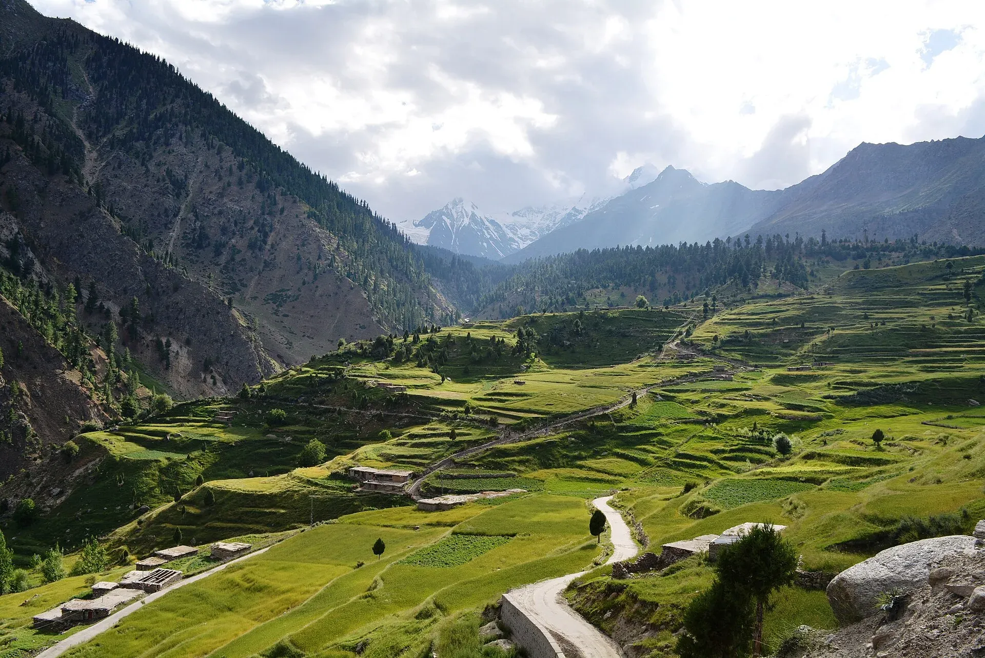
Photo: Obaid Hassan Qureshi, with thanks · CC BY-SA 4.0 · via Wikimedia Commons · temporary stand-in photo

Forest and meadow
The forest is part of the reason people come. Wikipedia's article on the lake also notes that by 2013 the Astore Valley had suffered from deforestation and illegal logging. The Rama Meadows page covers the meadow itself, and Rama Campsite and Rama Ski Area cover the other sites in the valley.
What to see and do
- The lake and meadow. A calm lake framed by meadow and forest.
- Sarot lakes. Three small lakes on the way up from Astore.
- Walks. The valley is a trekking route to the eastern side of Nanga Parbat, the ninth-highest mountain in the world.
- Picnics and camping. A common day trip from Astore in summer.
When to visit
June to September. The valley is snowbound for most of the year and the road may not open until June. Ask locally about snow before you drive up.
Where to stay and eat
Stay in Astore (Eidgah) or Gilgit. Simple hotels and guesthouses are available there, and there are small stalls in summer. For camping near the lake, ask local people first.
Good to know
- Getting there: Astore is reached from Gilgit by road, about 111 km by OSRM (1 hour 30 minutes of pure driving).
- Altitude: the lake is above 3,000 m. Go slowly and drink water.
- Fees: there is no confirmed information on any entry or camping fee. Current fees will be added soon. Ask at Astore.
- Weather: rain and cold can come in any month.
- Respect: keep the pasture clean and do not light fires on the meadow.
Highlights
- About 3,300 m in the Rama Valley near Astore
- Meadow and pine forest setting
- Three small Sarot lakes on the way
- Route to Nanga Parbat's eastern side
Getting there
From Astore, take the jeep road through Rama village up the Rama Valley, passing the Sarot lakes. The drive is rough and usually about an hour by 4x4 (check locally). Astore is reached from Gilgit by road, about 111 km by OSRM (1 hour 30 minutes of pure driving). OSRM measures the lake about 12 km from Astore (40 minutes of driving without stops).
Tips
- Hire a jeep from Astore and ask about road conditions.
- Go between June and September.
- Carry warm clothes and rain gear.
Photos we still need: the Sarot lakes on the road up from Astore. Send us yours
Sources and last checked
Last checked Confidence low4 sources4 still to check
- Last checked
- Method
- Desk research from published sources
- Confidence
- low
- Checked by
- trek.pk research team
Researched from published sources; not yet checked on the ground by our team. Spot something out of date? Report a mistake.
Sources
- Rama Lake (Pakistan) · Wikipedia · checked
- Pakistan Tourism Guide 2021 · TDAP (Trade Development Authority of Pakistan) · checked
- OSRM driving route service: road distances and times measured 16 November 2026 (driving only, optimistic on mountain roads) · OSRM / OpenStreetMap contributors · checked
- Astore District · Wikipedia · checked
Still to be checked on the ground (4)
- Lake altitude (Wikipedia gives only the valley, about 3,300 m; no figure for the lake itself)
- Drive time and road state from Astore (OSRM: about 12 km, 40 minutes; no source for the real jeep time)
- Whether jeeps can reach the lake or only the meadow (Wikipedia silent)
- Fees, camping rules and permits for foreigners (no official source found)