

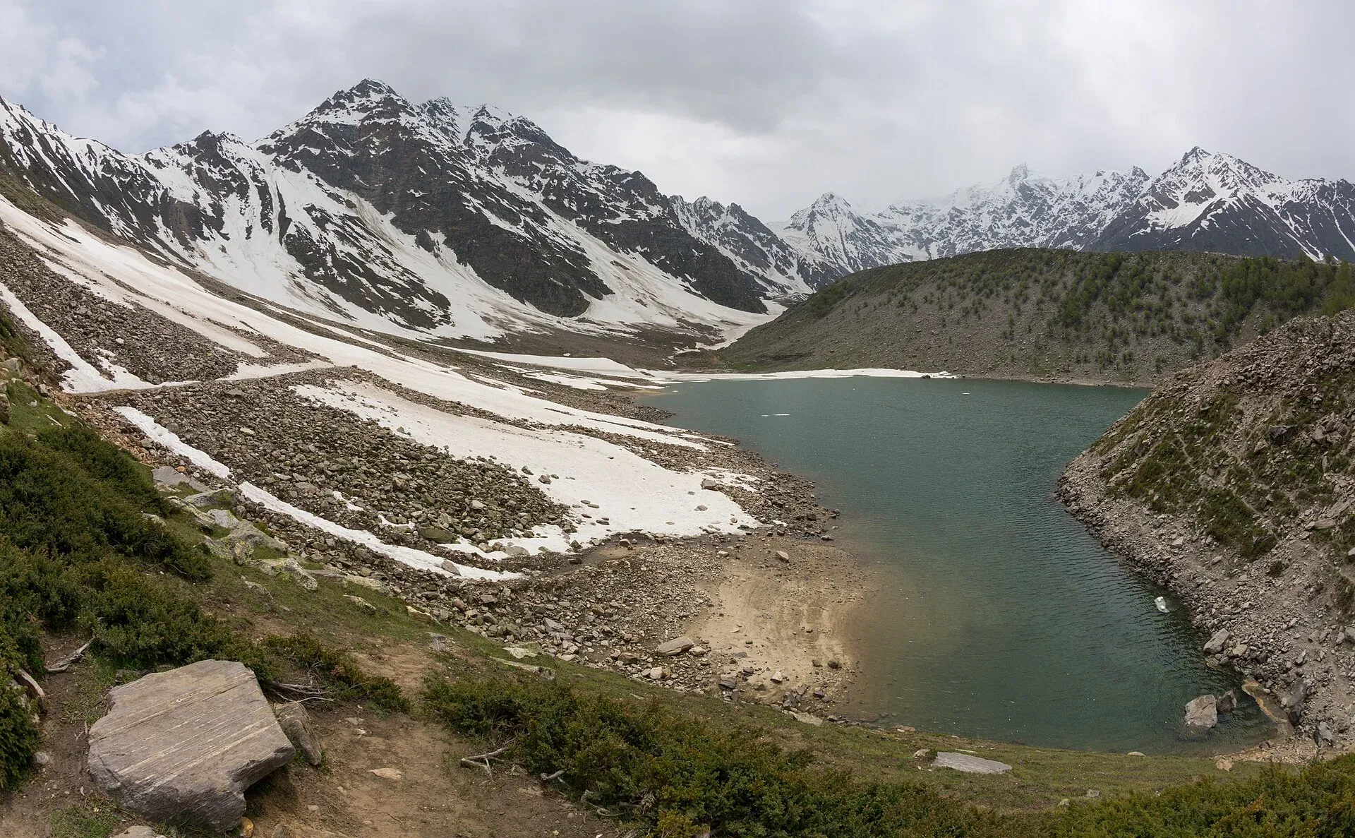
Photo: Ahmed Sajjad Zaidi, with thanks · CC BY-SA 3.0 · via Wikimedia Commons · temporary stand-in photo

Astore Valley (with Rama)
A forested valley south-east of Gilgit on the eastern side of Nanga Parbat, with Rama Meadows and Rama Lake, the Rupal and Rattu valleys and the seasonal road over the Deosai plateau.
Overview
Astore is the green, forested valley south-east of Gilgit, on the eastern side of Nanga Parbat. The district has about 111,500 people (2023 census), covers more than 5,400 square kilometres and has its headquarters at Eidgah. The valley floor is at roughly 2,400 to 2,600 m, and snow-fed streams run through pine and juniper forest to high pastures. From here you can reach Rama Meadows and Rama Lake, the Rupal valley (see its own page), the Rattu area, and the Deosai plateau on the old road to Skardu.
Astore has its own ruling history. Ali Sher Khan Anchan of Skardu (ruled 1595 to 1633) is said to have conquered the valley and given it to his grandson Shah Sultan, who founded the line of Astore rulers. They kept internal independence until the Sikh empire annexed Astore in 1842. In 1846 it passed to the princely state of Jammu and Kashmir, and after the 1947 Gilgit rebellion it joined Pakistan. It became a district in 2004.
Astore is quieter than Hunza or Skardu, and most of its visitors are Pakistani families in summer. It is a good base for easy forest walks and for views of Nanga Parbat (8,126 m) from a different side than Fairy Meadows.
Plan your visit
- Nearest town
- Astore
- Getting there
Leave the Karakoram Highway at Jaglot, south of Gilgit. Gilgit to Astore town is about 111 km (OSRM models about 1.5 h; allow about 4 h in practice). The road over Deosai to Skardu is closed from about November to June. More
Best months
May – Oct
- Astore Valley (with Rama)
- Related places nearby: Rama Lake, Deosai National Park, Sheosar Lake, Rupal Valley, Gilgit, Astore, Himalaya National Park, Gorikot Valley
Getting there
The road leaves the Karakoram Highway at Jaglot, south of Gilgit, and climbs to Astore town. OSRM gives Gilgit to Astore town as about 111 km, modelled at about 1.5 hours; Wikipedia gives about 128 km to the district headquarters, and the CKNP (Central Karakoram National Park) site says about 4 hours from Gilgit in practice and 7 to 8 hours from Islamabad. The road is open all year except in heavy snow. The Astore to Skardu road over Deosai (about 143 km) is closed from about November to June by snow.
Distances from Astore city, from the official district sheet: Rama Meadow 25 km (about 1 hour, car or jeep), Rattu 33 km (1 hour 30 minutes), Rupal valley 42 km (2 hours), Chilim 55 km (2 hours), Sheosar Lake at Deosai 69 km (2 hours 40) and Minimarg 88 km (3 hours, jeep).
Sights
- Rama Meadows and Rama Lake. Rama is a large meadow at about 3,300 m among pine, cedar and juniper, with Nanga Parbat on the southern skyline. The lake is a short walk above. Wildflowers are at their best in June and July. The CKNP site describes the lake as a small alpine pond about half an hour above the meadow, and says some juniper trees around the meadow are over 1,000 years old. A PTDC motel and camping are reported near the meadow; check what is open. The road is jeep-only past Tarishing, rough but passable in summer. Astore town to Rama is one day by jeep, or a day on foot at an easy grade.
- Rupal valley and Tarishing. The village of Tarishing and the Rupal Face of Nanga Parbat. See the Rupal Valley page.
- Gorikot, Rattu, Chilim, Dashkin and Domail. Other villages and valleys listed by the tourism department for walking, fishing and camping.
- Deosai National Park. The high plateau, Pakistan's last stronghold of the Himalayan brown bear, with an estimated 50 to 80 on the plateau, according to the CKNP, can be reached from Astore by a seasonal jeep road. Sheosar Lake lies on the plateau.
- Markhor country. The Astore markhor, the wild goat related to Pakistan's national animal, lives in these valleys. The CKNP estimates 1,500 to 2,000 animals, recovered through a community conservancy programme. It says visitors may see them on cliff slopes above the river at dawn, and that day visits can be arranged with local conservancy guides.
Treks from the valley
- Rama to Deosai: a moderate multi-day trek.
- Rupal (the Rupal Face and base camp) and Mazeno La are in the Rupal Valley.
- Rama Lake, Muthat Pass and other short routes are described in Other treks in Diamer.
- Fairy Meadows is on the other, northern side of Nanga Parbat and is reached from the KKH.
Walking and slow travel
The CKNP suggests two or three days of slow walking on the slopes above Chilim and Rama, ideally with a field guide, for plants and birds. A longer historical route runs from Astore through Chilim to Burzil Pass, once a caravan road. Rama to Deosai takes three to five nights at a moderate grade and can continue to Sheosar Lake. No CKNP trekking permit is needed for Rama or Deosai, but Deosai charges its own park entry fee, and higher routes inside the park boundary may need a permit.
When to go
May to October. The CKNP gives Rama's best time as June and July, and says Rama is busy on August holiday weekends. Avoid public holiday weekends in August if you want quiet. In winter, snow closes the high roads and most guest houses.
Where to stay and eat
Astore town and the larger villages have small hotels and guest houses. Expect basic rooms and simple meals of bread, rice, curry and dairy. In Rama, Rattu and Rupal, accommodation is basic and camping is common. Mobile signal is available in Astore town and patchy above it.
Culture and languages
Shina is the local language, and Urdu and English are used for communication with visitors. People live by farming, livestock and seasonal migration to high pastures. Dress modestly and ask before photographing people, especially women.
Safety and practical points
- Jeep roads above the main valley are rough, and rockfall or streams can close them.
- Heavy rain and snow can block the Deosai road even in summer. Ask about conditions in Astore town.
- Some areas beyond Chilim towards Minimarg have been reported as restricted; check with the district tourism office (Astore, 05817-922968) before you go.
- Altitude: Rama is at about 3,300 m, so rest on the first night.
- The GB Tourist Police helpline is 1422.
Highlights
- Rama Meadows and Rama Lake at about 3,300 m
- Views of Nanga Parbat (8,126 m) from the east and south
- Gateway to the Rupal valley and the Rupal Face
- Seasonal jeep road over the Deosai plateau to Skardu
- Astore markhor and brown bear country
Tips
- Ask in Astore town about road conditions before going up to Rama, Rupal or Deosai.
- Go in June or July for wildflowers at Rama.
- Rest a night at Astore before climbing to 3,000 m or more.
- Bring cash and supplies; options above Astore are basic.
Photos we still need: Chilim or Gorikot village; Rama Lake itself (current photo set shows Rama meadows and the valley). Send us yours
Sources and last checked
Last checked Confidence medium7 sources6 still to check
- Last checked
- Method
- Desk research from published sources
- Confidence
- medium
- Checked by
- trek.pk research team
Researched from published sources; not yet checked on the ground by our team. Spot something out of date? Report a mistake.
Sources
- Land of Pastures: District Astore tourist guide sheet · Tourism & Culture Department, Gilgit-Baltistan · checked
- Astore District (Wikipedia) · Wikipedia · checked
- Astore Valley (Wikipedia) · Wikipedia · checked
- Astore Valley, Rama, Deosai and markhor · Central Karakoram National Park (CKNP) · checked
- OSRM driving routes (distances and modelled times between towns) · OSRM / OpenStreetMap · checked
- NOC requirements for foreigners visiting Pakistan abolished (26 March 2019) · Dawn · checked
- Astore Valley (history) · Wikipedia · checked
Still to be checked on the ground (6)
- Astore town altitude: Wikipedia gives 2,600 m (valley floor) and CKNP gives about 2,400 m; no survey figure found
- Gilgit to Astore driving time: OSRM models about 1.5 h for about 111 km; CKNP says roughly 4 h
- Rama Meadows distance from Astore: 25 km on the official sheet, 10 to 11 km in some guides; CKNP gives no distance
- Exact open dates of the Deosai road (CKNP gives the general season as May to October, jeep only and weather-dependent)
- Restrictions beyond Chilim and Minimarg (CKNP says routes inside the park boundary may need a permit; nothing specific found)
- Current Deosai park entry fee (CKNP says a fee applies; no amount)
Nearby and related

Rupal Valley and Nanga Parbat Rupal Face
Mazeno La

Other treks in Diamir

Fairy Meadows and Nanga Parbat Base Camp

Rama Lake
A high lake in the Rama Valley near Astore, at about 3,300 m. Snow covers the valley for seven to eight months of the year, and it is also a route towards the eastern side of Nanga Parbat.

Deosai National Park
A vast high plateau at about 4,100 m above Skardu and Astore, covered in wildflowers in summer. Created in 1993 to protect the Himalayan brown bear. Open only in summer.

Sheosar Lake
An alpine lake at about 4,250 m on the western side of Deosai National Park. It is reached by jeep from Skardu or Astore in summer and is usually snowbound from November to May.
Rupal Valley
The valley below the south face of Nanga Parbat, reached from Astore by a rough road to Tarishing. The Rupal Face rises about 4,600 m; an easy trek leads to the German base camp and Shaigiri.

Gilgit
Gateway to Gilgit-Baltistan on the Karakoram Highway: a busy mountain town with the Kargah Buddha and the base for Hunza, Naltar and Skardu.
Astore
Main town of Astore District in Gilgit-Baltistan, at about 2,546 m. It is the base for the Astore valley, Rupal valley, Rama Meadows and the road to Deosai.
Himalaya National Park
A high-mountain park of about 2,263 sq km in Astore district, announced in December 2020, covering the upper Astore valley near Minimarg and Rama and running towards Deosai.
Gorikot Valley
A village and valley in Astore District, listed by the tourism department for walking, fishing and camping. Few published details.

Skardu, Shigar and Deosai
A 7-day road trip from Islamabad to Skardu, the Shigar valley and the high Deosai Plains, with day-by-day distances, road conditions and the summer-only Deosai season.

Fairy Meadows and Nanga Parbat View
A 5-day trip from Islamabad on the Karakoram Highway to Raikot Bridge, a jeep and short hike to Fairy Meadows, and the north face of Nanga Parbat (8,126 m).