

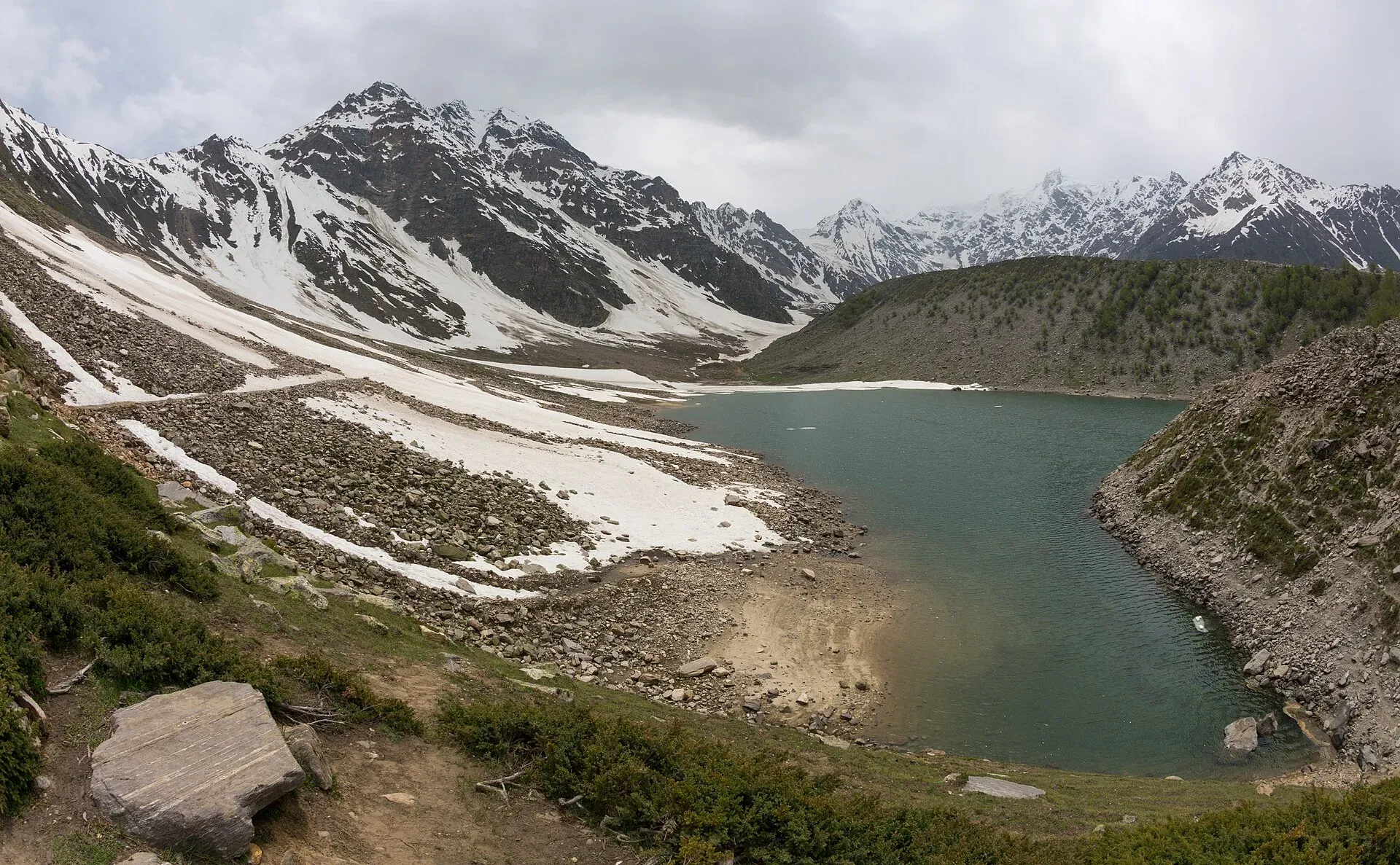
Photo: Ahmed Sajjad Zaidi, with thanks · CC BY-SA 3.0 · via Wikimedia Commons · temporary stand-in photo

Rama Meadows
A forest-edged meadow in the Rama valley above Astore, about 25 km from the town by road, with pine and juniper woods and views towards Nanga Parbat country.
Overview
Rama Meadows lie in the Rama valley west of Astore town, towards Nanga Parbat in Gilgit-Baltistan. The official Gilgit-Baltistan tourist sheet for Astore lists Rama Meadow as 25 km from Astore city, reached by car or jeep in about an hour. Wikipedia gives the Rama valley as about 3,300 m, and one travel guide gives the same figure for the meadow. Neither is a survey height.
Plan your visit
- Nearest town
- Astore
- Getting there
From Astore (Eidgah) take the Rama road west up the valley: 25 km, about an hour by car or jeep (Gilgit-Baltistan tourist sheet). Astore is about 110 km from Gilgit by road. A jeep is more reliable than a saloon car. More
Best months
Jun – Sep
- Rama Meadows
- Related places nearby: Rama Lake, Astore Valley (with Rama), Deosai National Park, Nanga Parbat, Gilgit
The Rama valley
The valley is thickly forested with large pine, cedar, fir and juniper (Wikipedia). It lies in the area of Choungrah, a village of Astore, whose people are called Choungroch. On the way in from the Astore valley are three small lakes, known locally as Sarot in Shina. Snow covers the valley for 7 to 8 months of the year, and in summer it turns green and is used by shepherds. Wikipedia notes significant deforestation as of 2013, largely from illegal logging, so keep to paths and do not cut trees.
Rama is also the start of a trekking route to the eastern side of Nanga Parbat, the ninth highest mountain in the world (Wikipedia).
What to see and do
- The meadow itself. A wide grassy clearing among conifers. In summer wildflowers cover it from about late June to early August, according to a travel guide.
- Rama Lake. The valley's best-known sight lies a short distance on. It has its own page: Rama Lake.
- Walks. Forest paths lead to viewpoints. Take a local guide if you plan to go beyond the road end.
- Camping and picnics. A travel guide lists campsites at the meadow, and it is a common day trip and camping spot for families from Astore and Gilgit. See Rama campsite.
- Summer pasture. As across Astore, livestock graze the high grass in summer. Give herders and animals space.
When to visit
June to September is the usual window. Snow covers the valley for much of the year, and the road may not be clear until June. Rain can make the track slippery.
Where to stay and eat
Most visitors stay in Astore (Eidgah) or Gilgit, where there are hotels and guesthouses, and drive up for the day. One travel guide suggests allowing 2 to 3 days for the meadows and lake together. Camping on the meadow is possible with your own gear; ask local residents and the district tourism office first. Facilities at the meadow are minimal, so bring food and water. Camping and vehicle charges, if any, will be added soon.
Good to know
- Road. Rama Road starts at Astore and is rough in places. A 4x4 with a local driver is the safe choice. OSRM measures about 12.5 km from Astore to Rama Lake in about 40 minutes, which is optimistic for a jeep track.
- Altitude. Above 3,000 m, go slowly and drink water.
- Weather. Cold and wet days can arrive in any month.
- Leave no trace. Do not cut trees or light fires on the meadow; use stove fuel.
- Advice. For foreign visitors: the UK FCDO page does not list Astore or Gilgit-Baltistan generally. Ask in Astore about road and snow conditions before you go.
Highlights
- 25 km from Astore by car or jeep (official sheet)
- Pine, cedar and juniper forest around the meadow
- Summer wildflowers
- Leads on to Rama Lake
Getting there
From Astore (Eidgah) take the Rama road west up the valley: 25 km, about an hour by car or jeep (Gilgit-Baltistan tourist sheet). Astore is about 110 km from Gilgit by road. A jeep is more reliable than a saloon car.
Tips
- Hire a local jeep and driver in Astore.
- Start early; afternoon cloud and rain are common.
- Carry warm clothes even in July.
Photos we still need: Rama Meadows themselves (the current photo shows Rama Lake); forest on the road to Rama. Send us yours
Sources and last checked
Last checked Confidence low7 sources5 still to check
- Last checked
- Method
- Desk research from published sources
- Confidence
- low
- Checked by
- trek.pk research team
Researched from published sources; not yet checked on the ground by our team. Spot something out of date? Report a mistake.
Sources
- Land of Pastures: District Astore tourist guide sheet · Tourism & Culture Department, Gilgit-Baltistan · checked
- Rama Lake and Rama Meadows · TravelPakistani · checked
- Rama Meadows travel guide · Pakistan Traveler · checked
- Pakistan travel advice (warnings and insurance; updated 27 October 2026) · UK Foreign, Commonwealth & Development Office · checked
- OSRM driving route service (distances and times, measured 16 November 2026; times are optimistic) · OSRM · checked
- Astor-Rama Lake and Rama village (OpenStreetMap Nominatim) · OpenStreetMap · checked
- Rama Lake (Pakistan) · Wikipedia · checked
Still to be checked on the ground (5)
- Altitude of the meadow (single source, about 3,300 m)
- Exact coordinates of the meadow (OSM has Rama village at 35.355, 74.803 and the Astor-Rama Lake road at 35.360, 74.834; the page pin 35.28, 74.9 is several km from both and the direction from Astore is unchecked)
- Whether any camping or entry fee applies
- Current road condition
- Astore to Gilgit distance: 110 km (this page) against 60 km (TravelPakistani)
Nearby and related

Rama Lake
A high lake in the Rama Valley near Astore, at about 3,300 m. Snow covers the valley for seven to eight months of the year, and it is also a route towards the eastern side of Nanga Parbat.
Astore Valley (with Rama)
A forested valley south-east of Gilgit on the eastern side of Nanga Parbat, with Rama Meadows and Rama Lake, the Rupal and Rattu valleys and the seasonal road over the Deosai plateau.

Deosai National Park
A vast high plateau at about 4,100 m above Skardu and Astore, covered in wildflowers in summer. Created in 1993 to protect the Himalayan brown bear. Open only in summer.

Nanga Parbat
Nanga Parbat (8,126 m), the ninth-highest mountain on Earth, rises above the Indus in Diamer and Astore. Fairy Meadows and the Rupal Valley give the best treks to its north and south faces.

Gilgit
Gateway to Gilgit-Baltistan on the Karakoram Highway: a busy mountain town with the Kargah Buddha and the base for Hunza, Naltar and Skardu.