

Photo: Mjakhro, with thanks · CC BY-SA 3.0 · via Wikimedia Commons · temporary stand-in photo

Rann of Kutch Wildlife Sanctuary
Sindh's largest Ramsar site (566,375 ha): salt marsh, dunes and the Karunjhar hills on the Indian border. Flamingos, winter waterbirds and rare desert birds, but remote and close to the border.
Overview
The Rann of Kutch Wildlife Sanctuary covers the Pakistani side of the great salt marsh and desert edge in south-eastern Sindh. The Sindh government declared it a wildlife sanctuary in 1980, and it was listed as a Wetland of International Importance on 5 November 2002 (Ramsar site no. 1285). At 566,375 hectares it is the largest Ramsar site in Sindh. The Ramsar sheet places it in the Mithi, Diplo and Nagarparkar talukas of Tharparkar District, while Wikipedia places it in Badin District. The site spans a wide area near the Indian border, so check the exact boundary with the department.
Plan your visit
- Nearest town
- Mithi
- Getting there
The sanctuary lies in the Thar region of eastern Sindh. The Ramsar sheet gives about 570 km from Karachi, with Mithi, Islamkot, Nagarparkar and Diplo as the nearest towns. More
Best months
Oct – Mar
- Rann of Kutch Wildlife Sanctuary
- Related place nearby: Mithi
Landscape
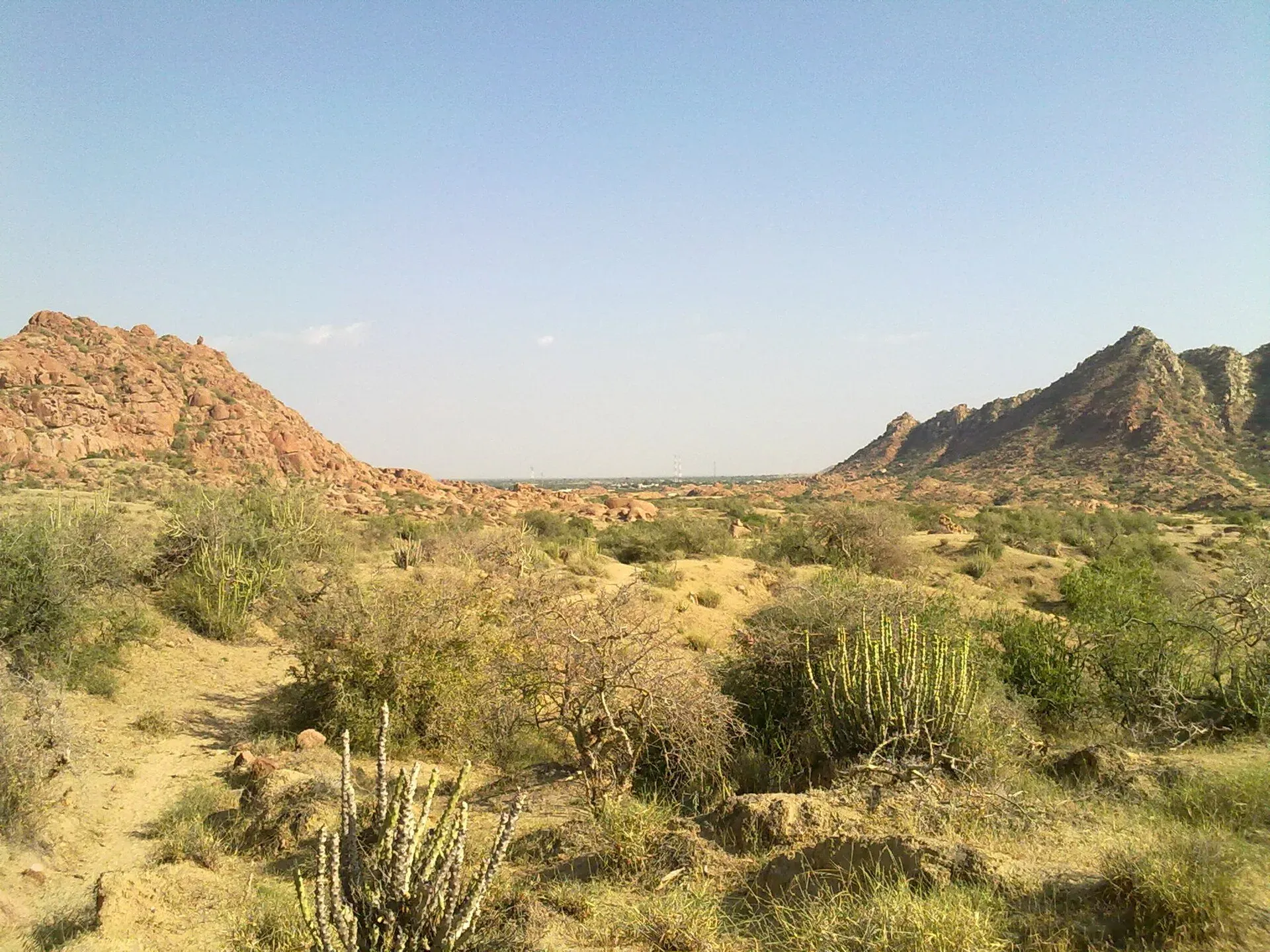
The habitat is a mix of tidal mudflats and saline marsh in the south, with old stabilised sand dunes running north-east to south-west inland. Wikipedia describes the marshy Rann and the surrounding Thar Desert edge as one of the best potential habitats for animals and birds in Sindh. Grasses and dry thorny scrub cover the dry ground, with larger trees in the desert area.
Near Nagarparkar, isolated granite hills rise from the plain, the highest being Karunjhar at 356 m. Water is scarce. Rain falls mainly in the monsoon, from mid-June to mid-September, and the Ramsar sheet notes that long dry spells have hurt wildlife.
Birds
Flamingos are the main draw. The Ramsar sheet reports greater and lesser flamingos feeding in the Pakistani Rann, with more than 1 per cent of each population counted in some years. Wikipedia calls the area a breeding ground for flamingos and a staging ground for pelicans, cranes, storks and many waterfowl. Lesser flamingo is Near Threatened on the IUCN Red List. Counts have swung widely, and the published figures are from 1990 to 2003, so numbers are not guaranteed.
From October to March the sheet records more than 40,000 waterbirds, including teal, shelduck, mallard, pochard and pelicans. Great Indian bustard (Critically Endangered), Asian houbara (Vulnerable) and sarus crane (Vulnerable) were recorded in 2002. Wikipedia says sarus cranes and houbara are now seen only occasionally on the outskirts, and bustards are extremely scarce, so this is a place for very patient birders.
Mammals and plants
The Ramsar sheet lists striped hyena, wolf, caracal and desert cat. The Indian wild ass was once thought to have its only Pakistani population here and is believed to have been exterminated. Wikipedia names grasses such as Dichanthium annulatum and Panicum antidotale among the plants of the dry ground.
Nagarparkar and the Karoonjhar hills
Nagarparkar is a tehsil at the foot of the Karoonjhar hills, in the far east of Tharparkar and of Sindh. Wikipedia puts it about 129 km from Mithi, with Rajasthan to the east and the Rann of Kutch and Gujarat to the south. It gives the origin of the name as "Nangar Parkar", where parkar means "to cross over", because the area was once under the sea.
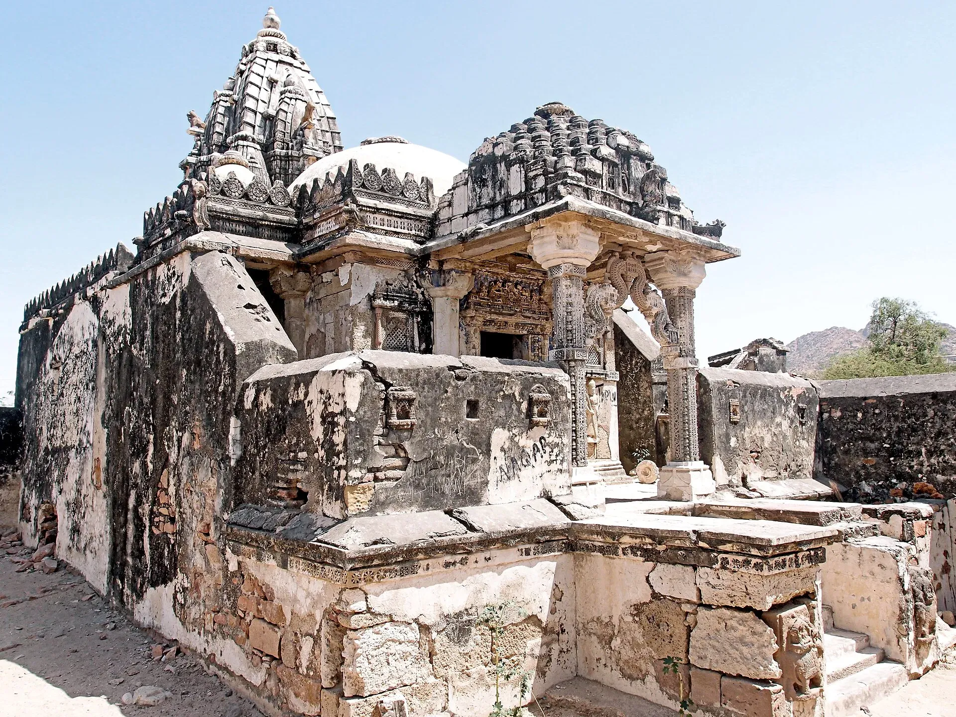
Photo: Saqib Qayyum, with thanks · CC BY-SA 3.0 · via Wikimedia Commons · temporary stand-in photo

The hills are known for granite, which Wikipedia says is used to make tiles. It also reports that pilgrims have protested against government-leased dynamite mining on the hills, which they say threatens the temples. At Choryo village the Churrio Jabal Durga Mata temple draws about 200,000 pilgrims at Shivratri, according to Wikipedia. The area also holds ruined Jain temples and a mosque; see Nagarparkar Jain temples. At the 2017 census Hindus were about 64 per cent of Nagarparkar tehsil and Muslims about 36 per cent. Local languages include Sindhi, Marwari, Gujarati and the Koli dialects.
Threats and conservation
The Ramsar sheet and Wikipedia list grazing, tree cutting, vehicle traffic and plans for more salt extraction as threats, along with water scarcity, which Wikipedia calls the most important potential threat. WWF-Pakistan and Sindh authorities have run studies and monitored waterfowl in the Rann, and a management plan has been under preparation.
When to visit
Go between October and March, when daytime temperatures are bearable and migratory birds are present. Summers are extremely hot, reaching 45 to 50 degrees Celsius, and monsoon rains can cut off tracks.
Where to stay and eat
Mithi and Nagarparkar are the nearest towns and offer basic lodging and food. Carry water, fuel and spare food, because distances are long and services thin.
Good to know
- The sanctuary is managed by the Sindh Wildlife Department. Ask its Karachi office about entry arrangements, permits and local guides before you go. A fee may apply: current fees will be added soon.
- Hunting is not allowed. Stay on existing tracks and do not disturb nesting or feeding birds. Ask before flying a drone, especially near the border.
- Ask the district administration or local police about current conditions before you go.
- Use a local guide with a 4x4. Tracks across the dunes and mudflats are unmarked.
- Safety. For foreign visitors: the UK FCDO page (updated 27 October 2026, checked 16 November 2026) advises against all but essential travel to Sindh north of and including Nawabshah, which does not include Tharparkar. It also lists a 5-mile India-border zone, and parts of the Rann lie right on the border. Ask the Sindh Wildlife Department and local police which areas are open and whether registration is needed, and read the current FCDO page before travel.
Highlights
- Ramsar site no. 1285, designated 5 November 2002
- Largest Ramsar site in Sindh
- Flamingo feeding grounds
- Karunjhar hills rise 356 m from the plain
- Declared a sanctuary in 1980
Getting there
The sanctuary lies in the Thar region of eastern Sindh. The Ramsar sheet gives about 570 km from Karachi, with Mithi, Islamkot, Nagarparkar and Diplo as the nearest towns. OSRM models about 348 km (4.7 hours) from Karachi to Mithi, about 187 km (2.9 hours) from Hyderabad to Mithi, and about 131 km (2.1 hours) from Mithi to Nagarparkar. Buses run from Hyderabad to Mithi; for the sanctuary itself you need a local 4x4 and a guide.
Tips
- Visit October to March
- Ask the Sindh Wildlife Department about permits and access
- Use a local guide with a 4x4
- Carry water, fuel and food
- Check border-zone rules before you travel
Wildlife
Facilities
- Basic lodging in Mithi and Nagarparkar
Photos we still need: flamingos or wetland in the Pakistani Rann; dunes and mudflat habitat. Send us yours
Sources and last checked
Last checked Confidence medium10 sources7 still to check
- Last checked
- Method
- Desk research from published sources
- Confidence
- medium
- Checked by
- trek.pk research team
Researched from published sources; not yet checked on the ground by our team. Spot something out of date? Report a mistake.
Sources
- Ramsar Sites Information Service: Rann of Kutch (site 1285) · Ramsar Convention Secretariat · checked
- Ramsar Information Sheet: Runn of Kutch · Ramsar Convention Secretariat / IUCN-Pakistan · checked
- Rann of Kutch Wildlife Sanctuary · Wikipedia · checked
- Great Indian bustard · Wikipedia (cites IUCN Red List assessment) · checked
- Asian houbara · Wikipedia (cites IUCN Red List assessment) · checked
- Sarus crane · Wikipedia (cites IUCN Red List assessment) · checked
- Lesser flamingo · Wikipedia (cites IUCN Red List assessment) · checked
- Pakistan travel advice · UK Foreign, Commonwealth & Development Office (FCDO) · checked
- OSRM routing (driving distance and time estimates) · OpenStreetMap / Project OSRM · checked
- Nagarparkar · Wikipedia · checked
Still to be checked on the ground (7)
- District: the Ramsar sheet says Mithi, Diplo and Nagarparkar talukas of Tharparkar; Wikipedia says Badin District; unresolved
- Which part is open to visitors and any permit or registration rule (neither Wikipedia nor Ramsar sheet says)
- Whether sarus crane and great Indian bustard still occur (Wikipedia says sarus cranes and houbara are occasionally seen on the outskirts)
- Current flamingo counts (figures are 1990 to 2003)
- Border-zone rules
- Road and track conditions
- Accommodation
Nearby and related

Mithi
The district headquarters of Tharparkar in Sindh, a Hindu-majority town in the Thar Desert and the practical base for Islamkot, Nagarparkar and the green desert after the monsoon.

Sindh
Pakistan's south-east: Karachi's beaches and markets, the Indus Valley city of Moenjodaro, Thatta's Makli tombs, Sufi shrines, the Thar desert and the Indus delta.

Karachi
Pakistan's largest city and main port: colonial buildings, museums, beaches, busy bazaars and some of the country's best food.

Hyderabad
Sindh's second-largest city, founded in 1768 and famous for its glass bangles, Pacco Qillo fort and Talpur tombs, about 160 km from Karachi.