

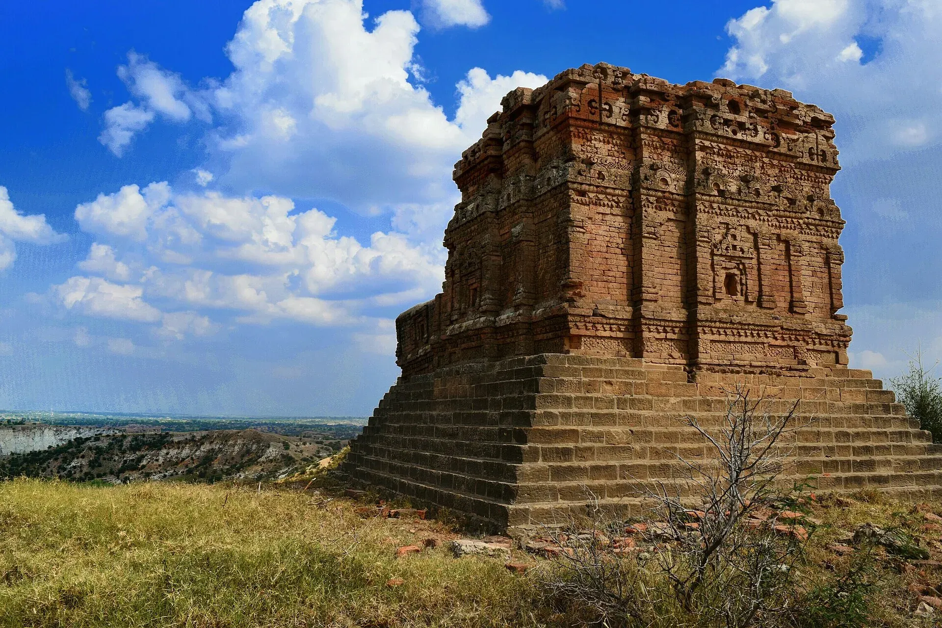
Photo: Talagang District, with thanks · CC BY-SA 3.0 · via Wikimedia Commons · temporary stand-in photo

Talagang
District capital on the Potohar plateau, north of the Salt Range. Peanut country and a transit stop between Islamabad, Chakwal and Mianwali, near Kallar Kahar Lake.
Overview
Talagang is the administrative headquarters of Talagang District in north Punjab. The town stands on the Potohar plateau, north of the Salt Range and east of the Kala Chitta range, near the M-2 motorway. The 2023 census counted 79,431 people, up from 37,766 in 1998. Talagang District was declared on 14 October 2022 and carved out of Chakwal District, with two tehsils (sub-districts), Talagang and Lawa. Older guides therefore still describe the town as part of Chakwal.
Plan your visit
- Getting there
From Islamabad: about 137 km, roughly 1 hour 40 minutes (OSRM, optimistic, checked 16 November 2026). To Kallar Kahar: about 35 km, 35 minutes. To Chakwal: about 46 km, 45 minutes. More
Best months
Oct – Mar
- Talagang
- Related places nearby: Chakwal, Kallar Kahar Lake, Katas Raj Temples, Chinji National Park
History and people
The town's historical name is Awan Mahal, a reference to the Awan tribe that settled the area. Many Awan families trace their descent to Ali ibn Abi Talib, the cousin and son-in-law of the Prophet Muhammad. Talagang was long an agricultural and administrative centre, and during the British period the surrounding district supplied many recruits to the army. It is also known for a literary tradition, and the poet and writer Satyapal Anand is among the people associated with the town.
Peanuts and the local economy
Dryland farming, livestock, trade and government jobs support the town. Peanut growing is the best-known activity: Talagang is the largest peanut-producing area in Rawalpindi Division, grows roughly 70 per cent of the district's crop, and has about 42,000 acres under the crop in the tehsil. Wheat and other rain-fed crops are grown too. The land is dry and open, which suits groundnuts better than irrigated crops.
What to see and do
There are no major sights in town, so Talagang works best as a stop for food and fuel. The surrounding area is named for several places that are covered on other pages: Kallar Kahar Lake and the Salt Range scenery are about 35 km away, Chakwal about 46 km, and the Katas Raj temples are in the same part of the Salt Range. Chinji National Park lies in the district, and Namal Lake is on the Talagang to Mianwali road. Ghabir Dam, Nala Ankar Bridge and Kot Kalan Forest are also listed as notable places in the district, but no visitor information has been found for them.
The area has long been known for game birds such as black francolin, white-throated francolin and quail, as well as hare. Hunting needs the correct licences and seasons; ask the district wildlife office.
A day around Talagang
A realistic plan is a day trip on the road between Islamabad and Mianwali: leave Islamabad early, stop in Talagang for a meal, then continue to Kallar Kahar Lake in the afternoon and return by the same road. Visitors with more time can add Katas Raj, which is better treated as a separate half-day.
When to visit
October to March. Summers are hot, and the land is dry farming country.
Where to stay and eat
Expect basic hotels and roadside restaurants. No verified names are available. Most visitors stay in Islamabad or Chakwal.
Good to know
As a district headquarters it should have a government hospital, pharmacies, banks with ATMs and fuel stations, but details are not verified, so check on arrival and fill up and withdraw cash before heading into the countryside. Safety: The UK FCDO Pakistan page (updated 27 October 2026, checked 17 November 2026) advises against all but essential travel to Dera Ghazi Khan, the only Punjab area it lists, and against all but essential travel within 5 miles of the India border. Talagang is not named on the page. Check the live page before you go.
Highlights
- Peanut-growing Potohar plateau town
- Near Kallar Kahar Lake and the Salt Range
- On the Islamabad to Mianwali route
Getting there
From Islamabad: about 137 km, roughly 1 hour 40 minutes (OSRM, optimistic, checked 16 November 2026). To Kallar Kahar: about 35 km, 35 minutes. To Chakwal: about 46 km, 45 minutes. Buses and vans run on the Rawalpindi road.
Hotels, food, fuel and services in Talagang
Places to stay
- Bismillah Guest HouseCall Bismillah Guest HouseMap of Bismillah Guest House in Google Maps
- Barani Science College TalagangCall Barani Science College TalagangMap of Barani Science College Talagang in Google Maps
Places to eat
- Awan International HotelCall Awan International HotelMap of Awan International Hotel in Google Maps
- Bakes WayCall Bakes WayMap of Bakes Way in Google Maps
- Rahat Bakers & SweetsCall Rahat Bakers & SweetsMap of Rahat Bakers & Sweets in Google Maps
- Dil pasand cold bar and hotelCall Dil pasand cold bar and hotelMap of Dil pasand cold bar and hotel in Google Maps
- Sami-Ullah HotelMap of Sami-Ullah Hotel in Google Maps
Essential services fuel stations, pharmacies and hospitals and clinics
Fuel
- PSO Petrol Pump Al-Syed F/SMap of PSO Petrol Pump Al-Syed F/S in Google Maps
- Alnoor Filling StationCall Alnoor Filling StationMap of Alnoor Filling Station in Google Maps
- Al-Saifi CNG Filling StationCall Al-Saifi CNG Filling StationMap of Al-Saifi CNG Filling Station in Google Maps
- Oxygen CNG StationMap of Oxygen CNG Station in Google Maps
Pharmacies
- Bilal Pharmacy TalagangCall Bilal Pharmacy TalagangMap of Bilal Pharmacy Talagang in Google Maps
Hospitals and clinics
- Nawaz Memorial Hospital TalagangCall Nawaz Memorial Hospital TalagangMap of Nawaz Memorial Hospital Talagang in Google Maps
- Child Care HospitalCall Child Care HospitalMap of Child Care Hospital in Google Maps
- Dr.Ameer Ali,Ex ENT& Physician Aga khan Hospital University Karachi.Jinah Hospital Karachi,RMO NICVDCall Dr.Ameer Ali,Ex ENT& Physician Aga khan Hospital University Karachi.Jinah Hospital Karachi,RMO NICVDMap of Dr.Ameer Ali,Ex ENT& Physician Aga khan Hospital University Karachi.Jinah Hospital Karachi,RMO NICVD in Google Maps
- Al Ain HospitalCall Al Ain HospitalMap of Al Ain Hospital in Google Maps
- Shafiq Medical Complex (S.M.C) , Dr. Rao M Shafiq Eye HospitalCall Shafiq Medical Complex (S.M.C) , Dr. Rao M Shafiq Eye HospitalMap of Shafiq Medical Complex (S.M.C) , Dr. Rao M Shafiq Eye Hospital in Google Maps
- Al Abbas HospitalCall Al Abbas HospitalMap of Al Abbas Hospital in Google Maps
Listings come from Google Maps data and are unverified: phone numbers, opening months and prices may have changed. Report a problem · Own one of these? Claim it
Tips
- Combine with Kallar Kahar and Katas Raj.
- Fill up fuel before the Salt Range roads.
- Best October to March.
Photos we still need: Talagang town or a peanut field on the Potohar plateau. Send us yours
Sources and last checked
Last checked Confidence medium4 sources3 still to check
- Last checked
- Method
- Desk research from published sources
- Confidence
- medium
- Checked by
- trek.pk research team
Researched from published sources; not yet checked on the ground by our team. Spot something out of date? Report a mistake.
Sources
- Talagang · Wikipedia · checked
- OSRM driving routes (road distances and times, optimistic) · Project OSRM · checked
- Pakistan travel advice: warnings and insurance · UK FCDO (GOV.UK) · checked
- Talagang District · Wikipedia · checked
Still to be checked on the ground (3)
- Hotels and services (no source gives any)
- Rail or bus timetables (Wikipedia gives only road connections to Islamabad, Rawalpindi, Chakwal and Mianwali)
- Road distance to Islamabad: Wikipedia gives about 112 km, OSRM about 137 km by the route used
Nearby and related

Chakwal
District capital on the Pothohar plateau, about 125 km from Islamabad, and a base for the Salt Range sights at Kallar Kahar and Katas Raj.

Kallar Kahar Lake
A shallow salt lake beside the town of Kallar Kahar in the Salt Range, minutes from the M-2 motorway. Known for its peacocks and the Mughal-era Takht-e-Babri.

Katas Raj Temples
A group of Hindu temples around a sacred pond in the Salt Range near Kallar Kahar, dating from about the 6th to 10th centuries. Important to Hindus and visited by pilgrims each year. Near the M2 motorway.

Islamabad
Pakistan's green, planned capital at the foot of the Margalla Hills: Faisal Mosque, hillside trails, cafes and the gateway to the north.

Mianwali
District capital east of the Indus in north-west Punjab. A farm and air-force town with the Chashma and Jinnah barrages nearby.

Chinji National Park
A dry, eroded hill park in Talagang, Punjab, set up in 1987. About 61 square kilometres on the Salt Range side of the Soan valley, near the village that gave its name to the Chinji fossil beds.