

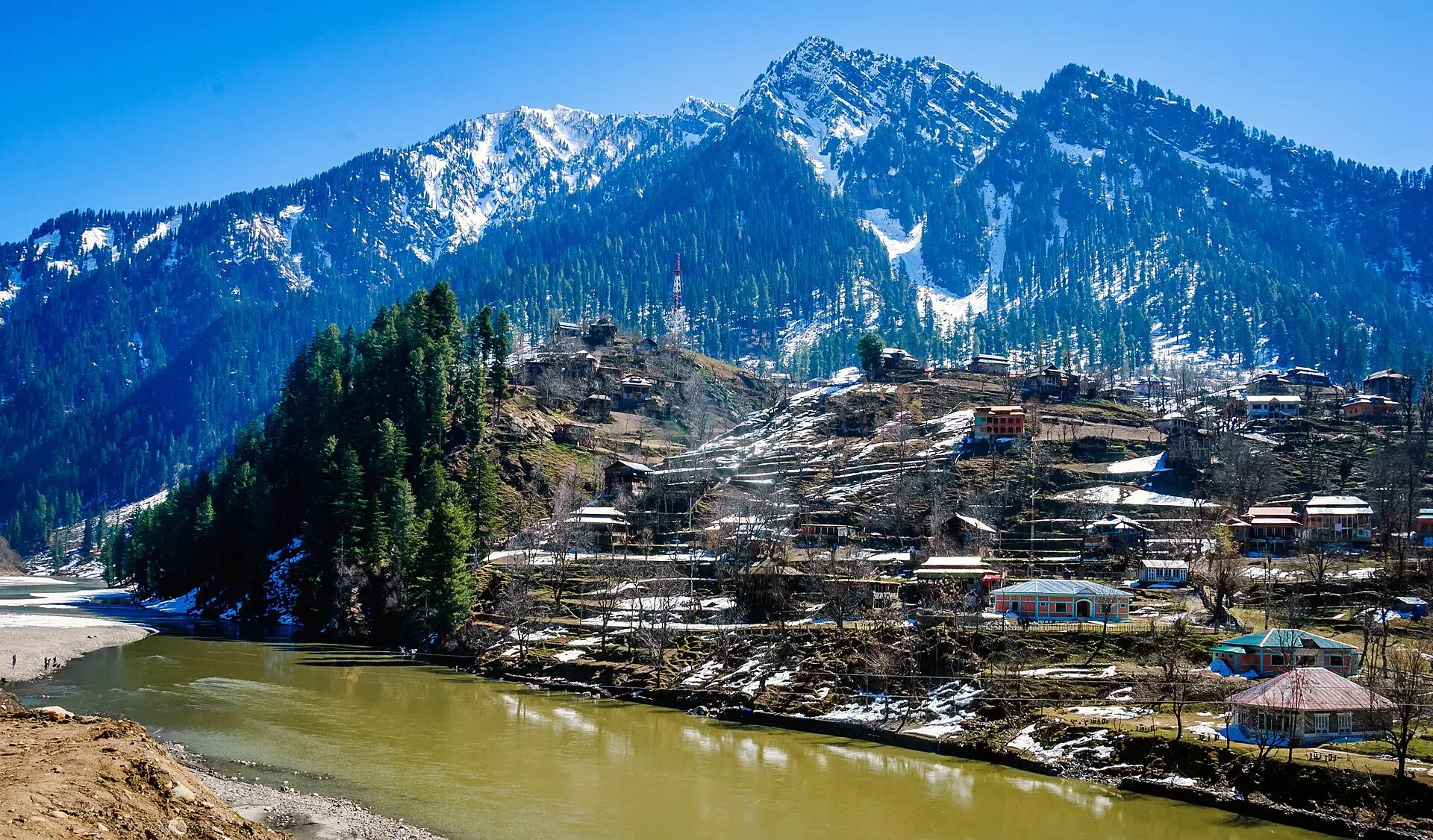
Photo: Designer429, with thanks · CC BY-SA 3.0 · via Wikimedia Commons · temporary stand-in photo

Neelum River
A 245 km river called the Kishanganga in India. About 195 km flows through Azad Kashmir's Neelum Valley before it joins the Jhelum at Muzaffarabad. Border-zone travel advice applies.
Overview
The Neelum River is about 245 km long. It rises at Krishansar Lake near Sonamarg at about 3,710 m, in Indian-administered Kashmir, where it is called the Kishanganga. It flows north through the Tulail Valley, then west beside the Line of Control. It enters Pakistan-administered Kashmir in the Gurez sector, passes Sharda, bends south-west near Tithwal, then arcs north-west to Muzaffarabad. About 50 km lies on the Indian-administered side and about 195 km on the Pakistan-administered side, in the Neelum Valley. It was renamed Neelum in Pakistan in 1956. Its mouth at Muzaffarabad is about 750 m above sea level and its average flow there is about 465 cubic metres a second.
Plan your visit
- Nearest town
- Muzaffarabad
- Getting there
Muzaffarabad is reached from Islamabad via Murree and Kohala, or via Abbottabad. The Neelum Valley road runs north-east from Muzaffarabad towards Athmuqam, Kel and beyond. More
Best months
May – Oct
Course and tributaries
The Neelum is the biggest tributary of the Jhelum, which it meets near Muzaffarabad. The Kunhar, from the Kaghan Valley, joins the Jhelum nearby; see Kunhar River and Jhelum River.
In India the river is still called the Kishanganga. Pakistan renamed it the Neelum in 1956. Its drainage basin has the older name Shardadesh, after the Sharada shrine.
On the Pakistan-administered side the river flows through the Neelum Valley, a Himalayan gorge. The valley is cut off from the outside world in bad winters and landslides. Generally the valley is said to start just after Muzaffarabad, but the administrative map is different: the stretch from Muzaffarabad to Chelhana is called the Kotla valley, and Neelum District runs from Chelhana up to Taobutt. There are two ways in. One is the Neelum Road from Muzaffarabad. The other is the Jalkhad Road from the Kaghan Valley. The 2005 earthquake badly affected the valley, blocking roads and paths with rubble and cutting it off.
Places on the river that have their own pages include Athmuqam, Keran, Sharda, Arang Kel, Kutton Waterfall and Taobat.
What to see and do
- Neelum Valley. The road beside the river passes Sharda, Kel and Arang Kel; see the Neelum Valley page for the valley in detail.
- Muzaffarabad. The Red Fort and the confluence area are near the end of the river. See the Muzaffarabad pages.
- Sharda. Sharada Peeth is a Hindu pilgrimage site and was once a notable centre of learning, in the same company as Nalanda and Taxila according to Wikipedia. The Sharada script used for Kashmiri is named after its goddess. The temple was damaged in the 2005 earthquake, and the Supreme Court of Pakistan has ordered the government to conserve it. Ask locally about access.
- Trout. Brown trout, rainbow trout and snow trout live in the river, along with other fish known locally as Shuddgurn and Anyour. Licences are generally needed and closed seasons apply. Current fees will be added soon; ask the AJK fisheries or tourism department.
- Rafting. There is no known official source describing rafting on the Neelum.
Water and hydropower
The 969 MW Neelum–Jhelum project in Pakistan, built by a Chinese consortium, diverts the river through tunnels (see the plant page). Wikipedia says all four units were running by August 2018, that the tail race tunnel collapsed in July 2022, and that generation resumed in August 2023. Output was restricted in April 2024 and stopped for inspection in May 2024; there is no known later status.
India's 330 MW Kishanganga project, upstream in Gurez, dams the river and diverts its water through a 24 km tunnel toward Bandipore, Wular Lake and then the Jhelum. The proposed reservoir would submerge part of the Gurez valley. Pakistan says the project breaches the Indus Waters Treaty and has pursued formal arbitration. This does not affect travellers, but it may explain why the river looks lower in some stretches.
When to visit
May to October is the usual window. The valley is cold and snowy in winter, and landslides can close the road in monsoon. Water is clear in autumn and in the dry season.
Where to stay and eat
Muzaffarabad has hotels, and the valley has guesthouses at Kel, Sharda and other villages. Facilities are basic outside the main stops.
Good to know
- Ask the district administration or local police about current conditions before you go. Safety. For foreign visitors: the UK FCDO (updated 27 October 2026, checked 17 November 2026) advises against all travel to within 10 miles of the Line of Control and against all but essential travel to Azad Jammu and Kashmir. Much of the Neelum Valley runs close to the Line, so check the advice, and any permission needed, before you plan a visit.
- Landslides, floods and earthquakes can affect the valley road. See the river crossings guide for safe river practice.
Highlights
- About 245 km, of which about 195 km is in Azad Kashmir
- Called the Kishanganga on the Indian side
- Joins the Jhelum at Muzaffarabad
- Neelum Valley road follows it
- Brown, rainbow and snow trout
Getting there
Muzaffarabad is reached from Islamabad via Murree and Kohala, or via Abbottabad. The Neelum Valley road runs north-east from Muzaffarabad towards Athmuqam, Kel and beyond. Because the valley lies near the Line of Control, confirm access and permissions with the AJK authorities.
Tips
- Check FCDO advice and any permissions for the valley first
- Travel in the dry months and avoid heavy rain
- Drive carefully; landslides block the road
- Ask the AJK fisheries department about licences
Sources and last checked
Last checked Confidence medium4 sources4 still to check
- Last checked
- Method
- Desk research from published sources
- Confidence
- medium
- Checked by
- trek.pk research team
Researched from published sources; not yet checked on the ground by our team. Spot something out of date? Report a mistake.
Sources
- Neelum River (Wikipedia) · Wikipedia · checked
- Jhelum River (Wikipedia) · Wikipedia · checked
- Pakistan travel advice: warnings and insurance (updated 27 October 2026) · UK Foreign, Commonwealth & Development Office · checked
- Neelum–Jhelum Hydropower Plant · Wikipedia · checked
Still to be checked on the ground (4)
- Whether the valley is open to visitors and any permission needed (FCDO, 27 October 2026: all but essential travel to AJK advised against, all travel within 10 miles of the Line of Control, demonstrations reported; Wikipedia gives no permit rules; no AJK official notice found)
- Trout licence rules (not on Wikipedia; no official page found)
- Neelum-Jhelum plant status after May 2024 (no later source)
- Name of the Muzaffarabad confluence: Wikipedia says only 'near the city of Muzaffarabad'
Nearby and related

Neelum Valley
A long, forested river valley in Azad Kashmir running north-east from Muzaffarabad to Sharda, Kel and Arang Kel. It runs close to the Line of Control, so check access before you go.

Muzaffarabad
The capital of Azad Jammu and Kashmir, at 737 m where the Neelum and Jhelum rivers meet. It is the gateway to the Neelum Valley and a rebuilt city after the 2005 earthquake.

Muzaffarabad Red Fort
A 16th-century fortress on the Neelum river in Muzaffarabad, begun by the Chak rulers of Kashmir in 1559 and finished in 1646. Earthquake damage and neglect mean access and condition need checking.

Azad Jammu and Kashmir
A green, hilly region in the Himalayan foothills: Muzaffarabad, the Neelum and Leepa valleys, lakes and waterfalls. Visit with local advice on permission and the Line of Control.

Jhelum River
A river of about 725 km that rises at Verinag in Kashmir, passes Srinagar and Muzaffarabad, fills Mangla Dam, crosses Punjab past Jhelum city and joins the Chenab at Trimmu.

Kunhar River
A snowmelt river of about 177 km that rises at Lulusar Lake, runs the length of the Kaghan Valley past Naran and Balakot, and joins the Jhelum near Muzaffarabad.
Neelum-Jhelum Hydropower Plant
A 969 MW plant that diverts the Neelum River through a 28.5 km tunnel to a powerhouse on the Jhelum, completed in 2018. It lies in Azad Kashmir; FCDO advises against all but essential travel there.

Neelum Valley
A 4-5 day road trip from Islamabad to Muzaffarabad and up the Neelum River by Athmuqam, Keran, Sharda and Kel, about 275 km, with a jeep track beyond Kel. Check current advice: the valley runs close to the Line of Control.