

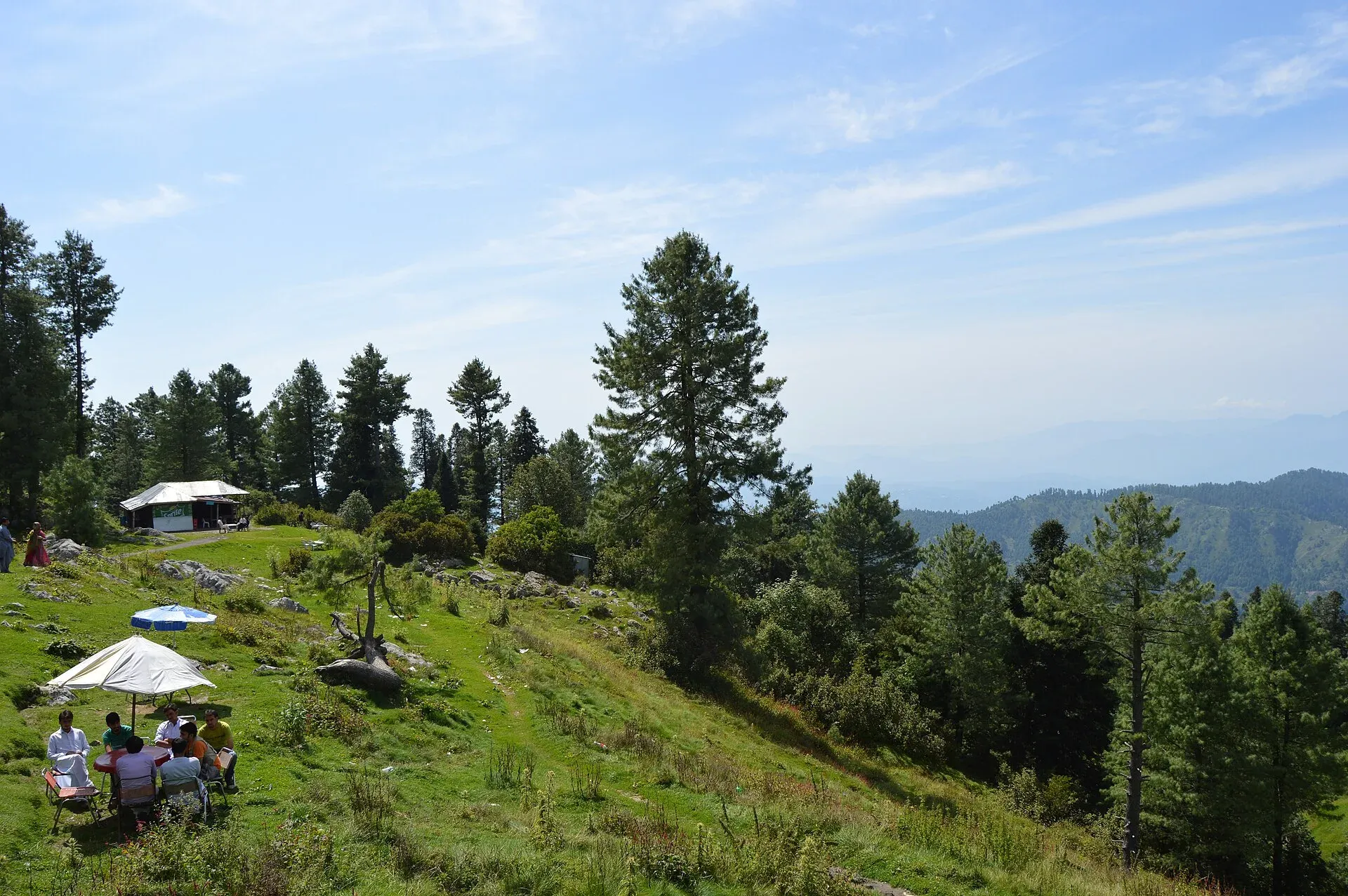
Photo: Scifikid, with thanks · CC BY-SA 4.0 · via Wikimedia Commons · temporary stand-in photo

Thandiani
A thickly forested hill station at about 2,750 m above Abbottabad, started by British missionaries and a sanatorium. Snow can close the road for days, so check conditions in winter.
Overview
Thandiani is a hill station in the Galyat area, in the Himalayan foothills above Abbottabad, at about 2,750 m (Wikipedia). It is among the highest of the Galyat settlements. The mountains around it are more thickly forested than most hill stations nearby, many of which have lost forest cover.
Plan your visit
- Nearest town
- Abbottabad
- Getting there
Thandiani is north-east of Abbottabad. Wikipedia gives about 37.5 km; More
Best months
May – Jul, Sep – Oct
- Thandiani
- Related places nearby: Abbottabad, Nathia Gali, Ayubia National Park, Murree, Miranjani
History
The land was first leased to members of the Battye family, missionaries who also served in British civil and military posts. They passed it to the Anglican church, which set up a sanatorium. There were also private European houses, a camping ground, a small bazaar and a small seasonal church, Francis Xavier in the Wilderness. The houses and church were used only in summer. Thandiani and the villages around it were damaged by the 2005 Kashmir earthquake.
Forest and wildlife
Wikipedia lists leopards, monkeys, several pheasant species, flying squirrels and pine martens in the forest. Leopards and pine martens are shy and are rarely seen by day visitors.
What to see and do
- Forest walks and viewpoints. Quiet paths through dense pine and fir; the long views over the Hazara hills are best on clear mornings.
- Old colonial places. Look for the remains of the sanatorium era, but ask locally what can be visited.
- Treks. A longer walk links Thandiani with Nathia Gali via Dagri Naka (reported by Wikipedia). Go with someone who knows the route.
- Geology. The area gives its name to the Thandiani Group, a Jurassic limestone-rich rock unit described by Charles Stewart Middlemiss in 1896 (Wikipedia).
When to visit
May to September is cool and green. Monsoon rain brings cloud and landslide risk on the access road. Winter is cold with heavy snow; the main road above Kala Pani has been shut for long spells.
Winter roads and safety
On 11 February 2026 The News reported one to 1.5 feet of snow at Thandiani and Nathia Gali, with link roads blocked and power and phone lines down. The Abbottabad to Nathia Gali to Murree road was closed to tourists, and the main Thandiani road had not been fully reopened. An APP report datelined Abbottabad, 1 February (the year is not printed on the page; its files point to 2026) described the Thandiani to Ukhrila to Andarsiri road as closed for 14 days by heavy snowfall. Authorities repeatedly advise chains, full fuel tanks and avoiding non-essential travel. If you are stuck, do not sit with the engine running and windows shut; exhaust fumes killed people in the January 2022 Murree snowstorm (at least 22 deaths).
In 2020 residents asked for the Thandiani to Muzaffarabad road to be rebuilt after earthquake damage from 2005 (Wikipedia). Do not assume that link is passable.
For foreign visitors: the UK FCDO (checked 16 November 2026) does not name Abbottabad or Thandiani in its advice against travel, but notes emergency measures in Khyber Pakhtunkhwa.
Where to stay and eat
There are a few guesthouses and tea stalls; facilities are simpler than at Nathia Gali. Bring snacks and cash, and book ahead for holidays.
Good to know
Phone and mobile data coverage is patchy. Any entry fee is unconfirmed; current fees will be added soon.
Highlights
- Dense forest at about 2,750 m
- Colonial sanatorium and missionary history
- Leopards, pheasants and pine martens in the forest
- Trek towards Nathia Gali via Dagri Naka
Getting there
Thandiani is north-east of Abbottabad. Wikipedia gives about 37.5 km; OSRM models about 26 km and 44 minutes from central Abbottabad (measured 17 November 2026), so expect roughly 30 to 38 km and an hour or more on the mountain road (OSRM checked 16 November 2026). From Islamabad OSRM gives about 131 km and 2 hours, and local guides say about 3 to 4 hours is realistic. Vans run from Abbottabad.
Stay, eat and essentials near Thandiani
Within 8 km of Thandiani, nearest first.
Places to stay
- Grand Montis Hotel ThandianiCall Grand Montis Hotel ThandianiMap of Grand Montis Hotel Thandiani in Google Maps
Listings come from Google Maps data and are unverified: phone numbers, opening months and prices may have changed. Report a problem · Own one of these? Claim it
Tips
- Allow extra time: the road climbs steeply and is often slow.
- Check snow and landslide reports before travelling in winter.
- Carry food and warm layers; services are limited.
Photos we still need: the forest road or a viewpoint at Thandiani; the old sanatorium-era buildings, if they survive. Send us yours
Sources and last checked
Last checked Confidence medium6 sources3 still to check
- Last checked
- Method
- Desk research from published sources
- Confidence
- medium
- Checked by
- trek.pk research team
Researched from published sources; not yet checked on the ground by our team. Spot something out of date? Report a mistake.
Sources
- Thandiani (Wikipedia) · Wikipedia · checked
- Heavy snowfall disrupts life in Galiyat and Thandiani · The News (11 February 2026) · checked
- After 14 days of snowfall misery, Thandiani–Ukhrila–Andarsiri road reopened (1 February, year not stated) · APP · checked
- Tragedy befalls Murree as 22 die trapped in snowfall (9 January 2022) · Dawn · checked
- Pakistan travel advice (updated 27 October 2026) · UK Foreign, Commonwealth & Development Office · checked
- OSRM driving routes (distances and modelled times) · OSRM / OpenStreetMap · checked
Still to be checked on the ground (3)
- Road distance from Abbottabad (Wikipedia 37.5 km; OSRM about 26 km to the map pin; no official figure)
- Whether the Dagri Naka trek is walkable (Wikipedia mention only; no trail report)
- Guesthouses and fees (no source found)
Nearby and related

Abbottabad
A cool, green cantonment city at about 1,256 m in Hazara, the military academy town and the main gateway to Nathia Gali, Thandiani, Ayubia National Park and the Kaghan Valley.

Nathia Gali
A pine-forest hill station at about 2,410 m in the Galyat hills, with a wooden colonial church, walks to Miranjani and Mukeshpuri, and snow from December to February. Roads often close in heavy snow.

Ayubia National Park
A cool pine and fir forest park in the Galyat hills above Abbottabad, with the Pipeline Track, a chairlift, leopards and many birds. Established 1984, about 33 square kilometres.

Murree
Hill resort and district capital at about 2,300 m in the Galyat hills above Islamabad. Mall Road, viewpoints, cool summers and winter snow; busy at weekends.

Miranjani
Miranjani (2,992 m) is the highest peak in the Galyat hills, in Ayubia National Park above Nathia Gali. It is a half-day forest hike with views on clear days.