

Photo: Zaferauf, with thanks · CC BY-SA 4.0 · via Wikimedia Commons · temporary stand-in photo

Thar Desert
Pakistan's share of the Thar is a sandy, semi-arid plain in south-east Sindh. Tharparkar district has about 1.8 million people, nearly half of them Hindu, and rain falls mainly July to September.
Overview
The Thar is a large sandy desert that spans the Indian subcontinent's north-west. According to Wikipedia, about two-thirds lies in India and one-third in Pakistan, and it receives under 500 mm of rain a year with frequent droughts. On the Pakistani side it lies mostly in Tharparkar district in south-east Sindh, which has an area of 19,637 km2 and, in the 2023 census, 1,778,407 people. Tharparkar is one of the few places where it is hard to imagine a desert without villages: most people live in rural settlements, and the district is about 54 per cent Muslim and 46 per cent Hindu.
Plan your visit
- Nearest town
- Mithi
- Getting there
From Karachi, Mithi is about 345 km and 4.7 hours by road (OSRM); from Hyderabad about 185 km and 2.9 hours. Nagarparkar is about 130 km from Mithi by road (OSRM gives 132 km; More
Best months
Oct – Mar
Landscape and wildlife
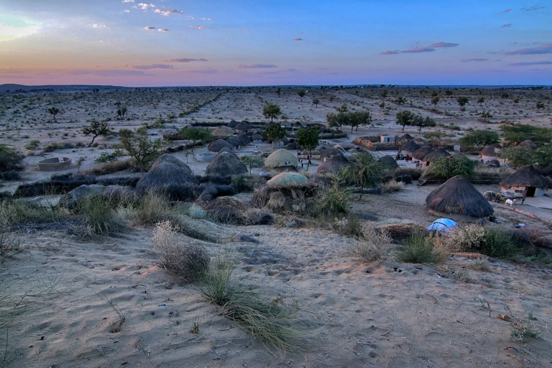
The land is sand plains and dunes with thorn scrub, and the low Karoonjhar hills near Nagarparkar. Wikipedia lists khejri, acacia and tamarisk among the desert's plants. Animals include chinkara, desert fox, desert hare and the Indian peafowl. Rain across the desert is about 100 to 300 mm a year, mostly in the monsoon, and varies widely. Rain is erratic; the district has had official drought years several times, including 2012 to 2015 and 2018. Most rain falls from July to September, when the desert turns green for a few weeks. The district has a Chinkara Wildlife Sanctuary of 940 km2, and peafowl are a symbol of the district. It is also described as an important area for endangered vultures.
People and culture
Sindhi is the main language recorded, and Dhatki, close to Marwari, is the most widely used local dialect. Hindu and Muslim communities live side by side. Mithi, the district headquarters, is about 70 per cent Hindu. Our separate pages cover Mithi and the Jain temples at Nagarparkar in more detail.
Water and village life
Water is scarce. The water table lies 10 to 40 m down and is mostly brackish, so villages depend on temporary wells and storage ponds, and fetching water takes much of the day. Most people herd animals, farm a little or make handicrafts, and some communities move with their stock. Crops include millets, sesame, green gram and cluster beans. Traditional huts are round with conical thatched roofs, and khejri wood is used for building and fuel. The Tharparkar breed of cattle takes its name from the district.
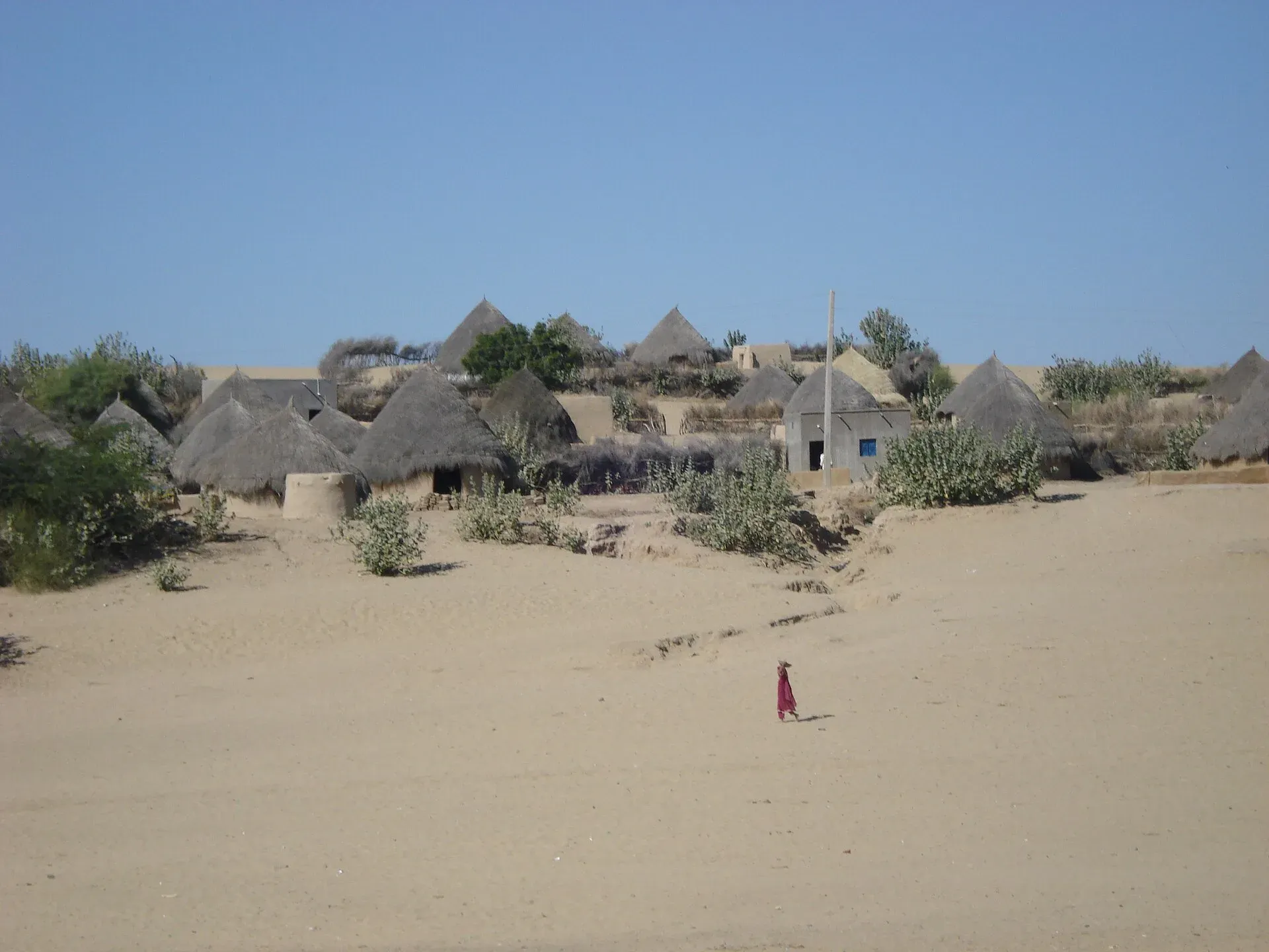
Photo: Baig Aamir, with thanks · CC BY-SA 4.0 · via Wikimedia Commons · temporary stand-in photo

What to see and do
- Drive the desert roads out of Mithi and see village settlements and the dunes.
- Visit the old Jain temples and the Karoonjhar hills near Nagarparkar.
- Watch for peacocks and chinkara in the early morning and at dusk.
- Visit after the monsoon for green landscapes and birds.
Nagarparkar and the Karoonjhar hills
Nagarparkar is the eastern-most part of Sindh, at the foot of the Karoonjhar hills, about 129 km from Mithi. Wikipedia reports that the hills' granite is used for tiles. The 2017 census gave the tehsil 259,880 people, 63.57 per cent Hindu and 36.20 per cent Muslim, speaking a mix of Sindhi, Marwari and Gujarati, including Parkari Koli and Wadiyara Koli. Remains of several Jain temples are heritage sites; see Nagarparkar Jain temples. At Choryo, the Churrio Jabal Durga Mata temple draws about 200,000 pilgrims at Shivratri, and pilgrims have protested against dynamite mining in the hills around it.
When to visit
October to March is the comfortable period. Winter highs average about 28 C, with lows near 9 C, according to Wikipedia. April to June is the hottest period. July to September brings rain, and roads can become difficult.
Where to stay and eat
Rooms are limited outside Mithi, and Nagarparkar has basic options. Meals are simple Sindhi and Thari food. Ask locally before camping.
Good to know
- For foreign visitors: the UK FCDO does not advise against Tharparkar, but it advises against all but essential travel to Sindh north of and including Nawabshah. Check the page before you go.
- The area has a history of drought and food-water stress. Be respectful of water use.
- The Pakistan–India border lies to the south and east. Check with local police for any restricted border areas and do not enter without permission.
- Current entry fees for sanctuary areas will be added soon.
Highlights
- Sand plains, dunes and scrub in Tharparkar district
- Mithi, the district headquarters, and the Jain temples at Nagarparkar
- Peacocks and chinkara, and the Chinkara Wildlife Sanctuary
- Monsoon greening, July to September
- One of the most mixed Hindu and Muslim districts in Pakistan
Getting there
From Karachi, Mithi is about 345 km and 4.7 hours by road (OSRM); from Hyderabad about 185 km and 2.9 hours. Nagarparkar is about 130 km from Mithi by road (OSRM gives 132 km; the Nagarparkar article on Wikipedia says 129 km, while the Tharparkar District article says 150 km). Buses and vans run from Hyderabad and Karachi to Mithi. Check current road and weather conditions before leaving.
Tips
- Go between October and March; April to June is the hottest time.
- Carry more water than you expect and avoid driving at night.
- Ask permission before photographing people, especially women, and dress modestly.
- Do not drive on cultivated land or disturb peacocks and chinkara.
- Fill your fuel tank in Mithi or Hyderabad; distances between towns are long.
Photos we still need: Karoonjhar hills at Nagarparkar; Mithi or Thari village houses. Send us yours
Sources and last checked
Last checked Confidence medium6 sources3 still to check
- Last checked
- Method
- Desk research from published sources
- Confidence
- medium
- Checked by
- trek.pk research team
Researched from published sources; not yet checked on the ground by our team. Spot something out of date? Report a mistake.
Sources
- Thar Desert · Wikipedia · checked
- Tharparkar District · Wikipedia · checked
- Pakistan Tourism Guide 2021 · TDAP Pakistan · checked
- OSRM driving route calculation · OpenStreetMap / OSRM project · checked
- Pakistan travel advice (updated 27 Oct 2026) · UK Foreign, Commonwealth & Development Office · checked
- Nagarparkar · Wikipedia · checked
Still to be checked on the ground (3)
- Current road conditions and bus services to Mithi and Nagarparkar (not in Wikipedia; no official source found)
- Entry rules for Chinkara Wildlife Sanctuary and any border-area restrictions (Wikipedia: hunting banned in the 940 km2 sanctuary; no entry or border-area rules found)
- Photo reuse: village photo appears on three pages
Nearby and related

Mithi
The district headquarters of Tharparkar in Sindh, a Hindu-majority town in the Thar Desert and the practical base for Islamkot, Nagarparkar and the green desert after the monsoon.

Umerkot
Fort city in the Thar region of Sindh, where Emperor Akbar was born in 1542; district headquarters with 144,558 residents in 2023, Hindu temples and an old fort.

Nagarparkar Jain Temples
Ruined Jain temples and a marble mosque around Nagarparkar in the Karoonjhar hills of Tharparkar, from about the 12th to 15th centuries. The Nagarparkar Cultural Landscape is on Pakistan's UNESCO tentative list (2016).
Umerkot Fort
A rectangular brick fort in the Thar desert town of Umerkot, linked to the birth of the Mughal emperor Akbar in 1542. Listed on Pakistan's UNESCO tentative list (2026, per Wikipedia).

Cholistan Desert Camp (Derawar)
A camping area at the TDCP tourist resort beside Derawar Fort in the Cholistan Desert, about 96 km by road from Bahawalpur. Best from October to March.
Naukot Fort
A burnt-brick Talpur fort of 1814 at the edge of the Thar Desert in Tharparkar, with nine semicircular bastions. Added to Pakistan's UNESCO tentative list in 2026.
Shakoor Lake (Rann of Kutch)
A seasonal lake in the Rann of Kutch on the Sindh-Gujarat border, about 300 sq km, with roughly 90 sq km on the Pakistan side. It is a border area with no tourism set-up.
Nara Desert
A sandy desert of about 23,000 km2 in Khairpur and Sanghar districts, Sindh, northeast of the Indus. Very hot and dry, with little tourism. The FCDO advises against all but essential travel to this part of Sindh.