

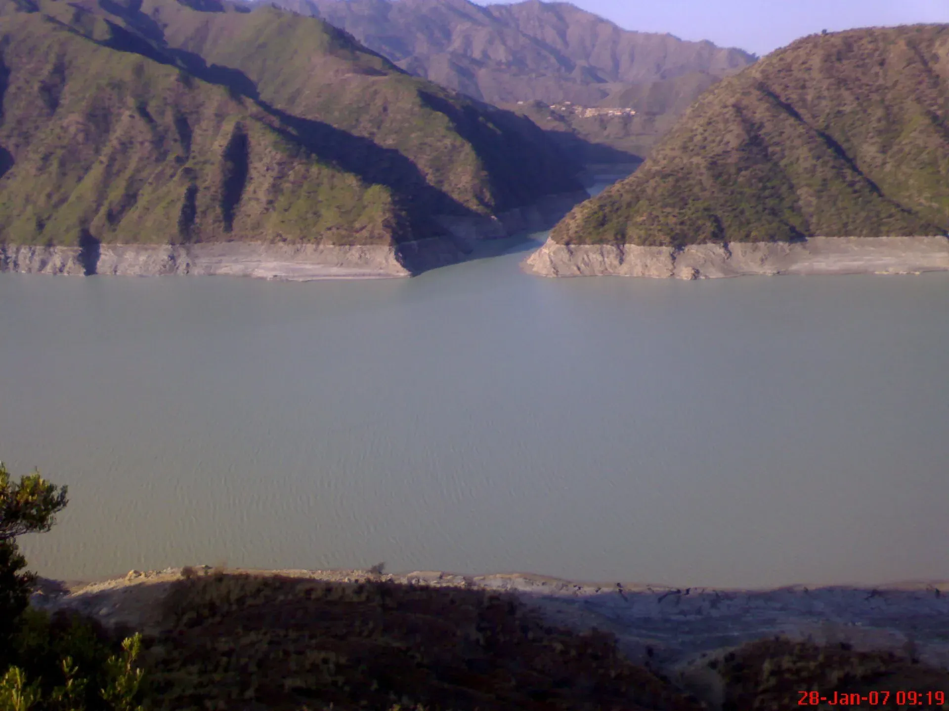
Photo: Hasanzay, with thanks · CC BY 3.0 · via Wikimedia Commons · temporary stand-in photo

Torghar District
Torghar, once called Kala Dhaka or the Black Mountain, is a small rural district in Hazara, Khyber Pakhtunkhwa, with its headquarters at Judba. It has no developed visitor facilities. Not the same as the Torghar markhor conservancy in Balochistan.
Overview
Torghar is a small, mountainous and entirely rural district in the Hazara Division of Khyber Pakhtunkhwa. It was created in 2011 out of Mansehra District and was long known as Kala Dhaka, which English-language sources translate as the Black Mountain. Wikipedia says the name Torghar comes from Pashto words meaning "dark mountain". The district headquarters is Judba, which Wikipedia places at about 1,088 m above sea level.
The district lies close to the Indus, between Buner, Battagram, Mansehra (Agror and Tanawal) and, across the river, Shangla. Wikipedia gives its area as 497 sq km and its 2023 census population as 200,445, all rural. Sources disagree on the tehsils (subdivisions). The district's local-government page (2017 figures) lists two, Judba and Khander, while the 2023 census lists three, Daur Maira, Judba and Khander Hassanzai, with Khander Hassanzai the largest. The local-government page also gives 497 sq km. Wikipedia's tehsil areas add up to only 454 sq km.
Plan your visit
- Nearest town
- Judba
- Getting there
Torghar is reached from the Hazara side. The main road runs from Judba to Darband (near the Tarbela side of the Indus) and links to Oghi, Mansehra and the Hazara Expressway; More
- Torghar District
- Related places nearby: Mansehra, Tarbela Dam, Besham, Oghi
Two places called Torghar
Do not mix this district up with the Torghar Conservancy, a community-run markhor and urial conservation area in the Toba Kakar hills of Killa Saifullah, Balochistan. They share a name (it simply means black mountain in Pashto) but lie in different provinces and have nothing to do with each other.
A second mix-up is worth clearing up. Some lists show "Mani Khwa" as a district headquarters beside Torghar. Manikhwa (Manikhawa) is a union council in Sherani District, Balochistan. It is not the headquarters of Torghar and has no link to it. The headquarters of Torghar District is Judba.
People and language
Wikipedia gives the 2023 census population as 200,445 in 29,410 households, all rural. Pashto is the first language of about 97 per cent of residents, and Hindko of about 2 per cent. Gujjars and Pashtuns are the two main groups. Gujjars live mostly on the eastern slopes, and Pashtun tribes, among them the Madakhel, Hassanzai, Akazai, Nusratkhel and Basikhel, dominate the western slopes. Overall literacy was recorded at about 30 per cent, with a wide gap between men and women, which helps explain the thin services. The range runs roughly 40 to 48 km north to south.
History in brief
The British held Hazara by 1849 and campaigned against local uprisings from 1852. In June 1888 two British officers and four Gurkha soldiers were killed in a clash with local tribes. The Hazara (Black Mountain) Expedition followed, and the Hassanzai and Akazai made peace that October. A second expedition in 1891 followed after the agreements broke down. It was separated from Mansehra under Article 246 of the Constitution when it became a district. Dawn reported that President Asif Ali Zardari formally announced it as the 25th district of the province on 27 January 2011. The 2005 earthquake also hit the area badly.
What to see and do
Torghar is not a tourist district. There are no official visitor sites, hotels or trails that we could confirm. The attractions are the high ridge of the Black Mountain (Wikipedia gives about 2,400 m) and the Indus, which the Barndo stream joins inside the district. Tourism listings name Judba, Kamach and Biliani as attractions, but there are no known details on them.
If you pass through, treat it as a place to meet people, not to sightsee. Ask permission before photographing anyone, and ask a local elder before walking away from the road.
When to visit
There is no known tourism season guidance. The valleys are at moderate altitude, so winter is cold at the top and the summer monsoon brings landslides. Roads are the main limit: news reports describe landslides blocking the Judba-Darband road, including a closure from 30 July 2024 that left patients unable to reach hospitals in Darband, Oghi and Mansehra.
Where to stay and eat
There is no tourist accommodation that we could verify. Plan to stay in Mansehra or Oghi and treat Torghar as a long day trip, if at all.
Good to know
- Travel advice. For foreign visitors: the UK FCDO (updated 27 October 2026, checked 16 November 2026) does not name Torghar on its lists. It does advise against all travel to neighbouring Buner and to the Karakoram Highway between Mansehra and Chilas via Battagram, which is the usual way to the district, and against all but essential travel to Shangla. Read the live page before any plan.
- Services. Dawn reported in February 2020 that the district had no district hospital and that work on a headquarters hospital had stalled for lack of funds. Carry any medicine you need.
- Fees. No entry fees or permits apply that we could find.
- Nearby. Mansehra, Oghi, Darband and Tarbela Lake.
Highlights
- Created in 2011; formerly Kala Dhaka, the Black Mountain
- District headquarters Judba, about 1,088 m
- Rural Hazara district near the Indus
- Not the same as the Balochistan Torghar Conservancy
Getting there
Torghar is reached from the Hazara side. The main road runs from Judba to Darband (near the Tarbela side of the Indus) and links to Oghi, Mansehra and the Hazara Expressway; reports also describe an 84 km Darband-Thakot road as the district's main artery. OSRM, measured on 17 November 2026 to the district's mapped point (an approximation, and optimistic), gives about 220 km and 3 hours 15 minutes from central Islamabad and about 94 km and 1 hour 45 minutes from Mansehra. There is no official figure. There is no confirmed public transport timetable. Check road conditions after rain.
Tips
- Check the FCDO advice for Buner, Battagram and the KKH before planning
- Expect landslide closures on the Judba-Darband road in the rains
- Ask before photographing people or leaving the road
- Base yourself in Mansehra; there is no verified tourist lodging
Photos we still need: Judba town or the Black Mountain ridge. Send us yours
Sources and last checked
Last checked Confidence medium7 sources5 still to check
- Last checked
- Method
- Desk research from published sources
- Confidence
- medium
- Checked by
- trek.pk research team
Researched from published sources; not yet checked on the ground by our team. Spot something out of date? Report a mistake.
Sources
- Torghar District · Wikipedia · checked
- Judba · Wikipedia · checked
- District Torghar · Local Government, Elections and Rural Development Dept, Khyber Pakhtunkhwa · checked
- Torghar undeveloped even years after getting district status (9 February 2020) · Dawn · checked
- Torghar residents concerned over closure of road (25 August 2024) · The News · checked
- Sherani District · Wikipedia · checked
- Pakistan travel advice (updated 27 October 2026) · UK Foreign, Commonwealth & Development Office · checked
Still to be checked on the ground (5)
- Tehsil count: 2 (local government page, 2017) vs 3 (Wikipedia, 2023); Wikipedia's tehsil areas sum to 454 sq km against its district total of 497
- Current condition of the Judba-Darband road (latest report is August 2024)
- Any visitor sites, lodging or permit rules
- Best season (no source found)
- Spelling and details of Judba, Kamach and Biliani (single listing)
Nearby and related
Torghar Conservancy
A community-run markhor and urial conservancy in Killa Saifullah, Balochistan, set up in 1984 and run by STEP. A conservation success story, but not a visitor destination; the UK FCDO advises against all travel to Balochistan.

Mansehra
The headquarters of Mansehra District in Hazara, famous for the Ashoka rock edicts near the city. A big market town and the usual stop before Balakot, Naran and the Karakoram Highway.

Indus River
Pakistan's greatest river, rising in Tibet and running about 3,180 km to the Arabian Sea. It crosses Gilgit-Baltistan, meets the Gilgit near Jaglot and the Kabul at Attock, and feeds the plains from Tarbela to the delta.

Tarbela Dam
A huge earth-and-rockfill dam on the Indus, finished in 1976. It is a working WAPDA power and water site with limited public access, so plan on permission rather than a drop-in visit.

Besham
A busy Indus-side town and junction on the Karakoram Highway at about 613 m, long used as the first overnight stop from Islamabad towards Gilgit and Hunza.
Sherani Chilgoza Forests
High forests of chilgoza (pine-nut) pine on the Sulaiman range in Sherani district, Balochistan, around the Takht-i-Sulaiman ridge. Not set up for tourism; the UK FCDO advises against all travel to Balochistan.
Oghi
The main town of the Agror Valley in Mansehra District, Khyber Pakhtunkhwa, once the seat of the Khan of Agror. Few visitor facilities.