

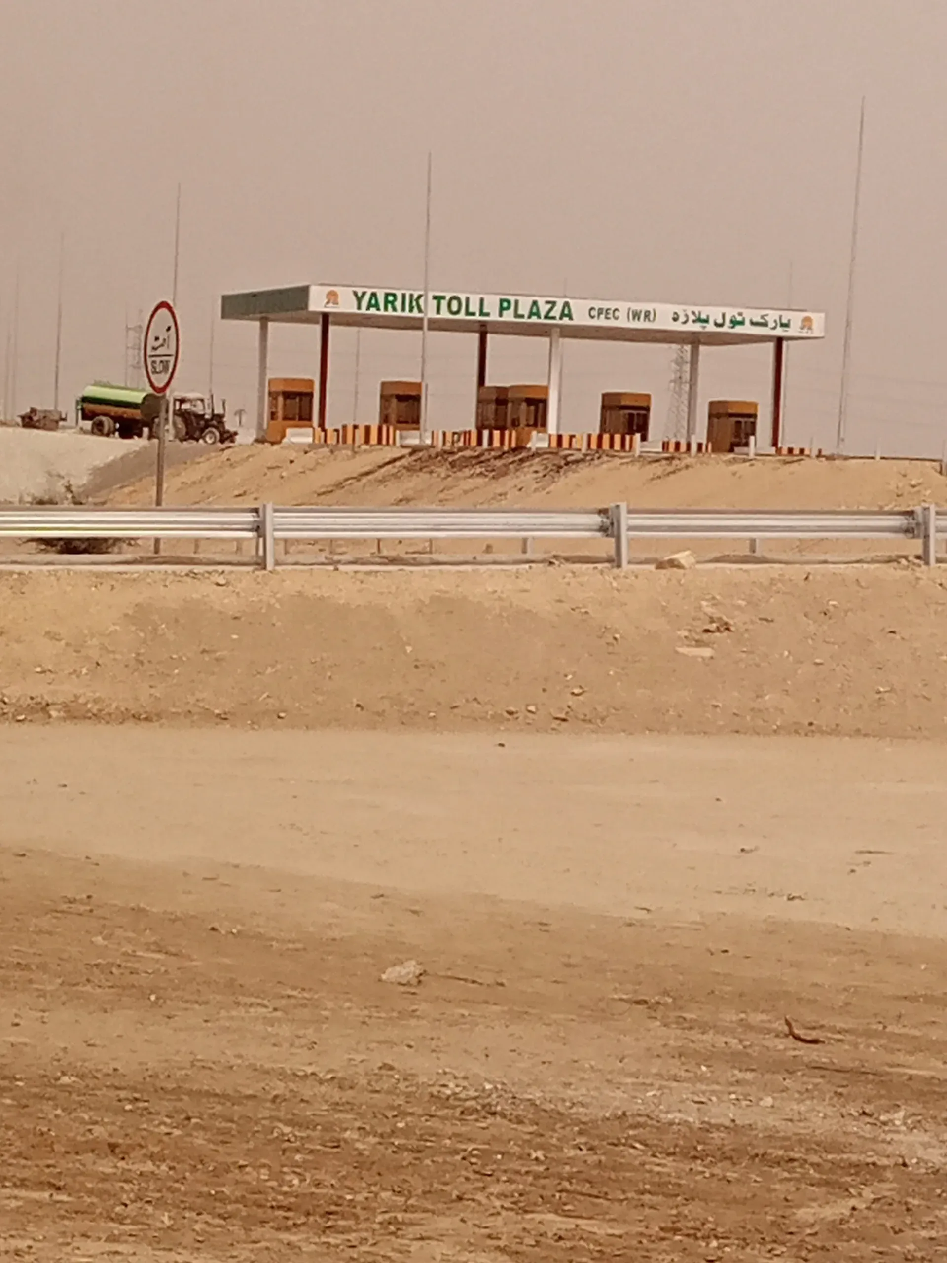
Photo: Dera Ismail Khan, with thanks · CC BY-SA 4.0 · via Wikimedia Commons · temporary stand-in photo

M-14 Hakla-Dera Ismail Khan Motorway
The M-14 is an open four-lane motorway of about 293 km from Hakla on the M-1 to Yarik near Dera Ismail Khan, inaugurated 5 January 2022. Rehabilitation work between Hakla and Kundal continued in September 2026.
The journey
Last verified: 16 November 2026.
Overview
The M-14 is a four-lane motorway from the Hakla interchange on the M-1, near Fateh Jang, to Yarik, just north of Dera Ismail Khan. It opened on 5 January 2022. APP and other reports of the inauguration give 293 km and 11 interchanges; Wikipedia gives 285 km. We use 293 km, which fits the last interchange at about km 291 to 292. It passes Pindi Gheb, Jand, Tarap and Mianwali and crosses the Indus River near Mianwali. Our inventory note said it was under construction in parts, but sources show it is open, so this page follows the sources. The right of way was bought wide enough to allow widening to six lanes.
Interchanges and distances from Hakla
Wikipedia gives these (km from Hakla): Fateh Jang 23, Pindi Gheb 62, Jand 73, Tarap 112, Daud Khel 154, Kot Bailian 166, Isakhel 209, Kundal 219, then Abdul Khel and Yarik at the end, where it continues as the N-55. Its table has Abdul Khel at 292 and Yarik at 291, so the last two figures conflict.
Status in 2026
A Motorway Police spokesperson said in late September 2026 that rehabilitation work between Hakla and Kundal was still under way. The M-14 reopened with the M-1 at 6:00 am on 27 September 2026 after closures. Expect lane closures and ask NHMP before you set out.
Rules, tolls and M-Tag
Motorway Police (NHMP) patrol the road; for emergencies call 130. Reports in June 2026 say NHMP restored the motorway limits to 120 km/h for cars and light vehicles and 110 km/h for buses and heavy vehicles, after a temporary cut in March 2026. Limits can change and some stretches carry their own, so follow the signs. Keep left, overtake on the right, and do not stop on the carriageway.
Tolls are charged at interchanges and the NHA publishes the rates; news reports say rates were revised in 2026. Current fees will be added soon, so check the NHA toll chart before you go. Wikipedia gives no toll or speed information for the M-14. News reports mention revised M-14 tolls in July 2026; confirm with the NHA.
Fuel and services
Wikipedia does not list service areas. Fill up at Hakla or Fateh Jang before the long run south.
Weather
Summers are hot. Fog is possible in winter.
What to see near the exits
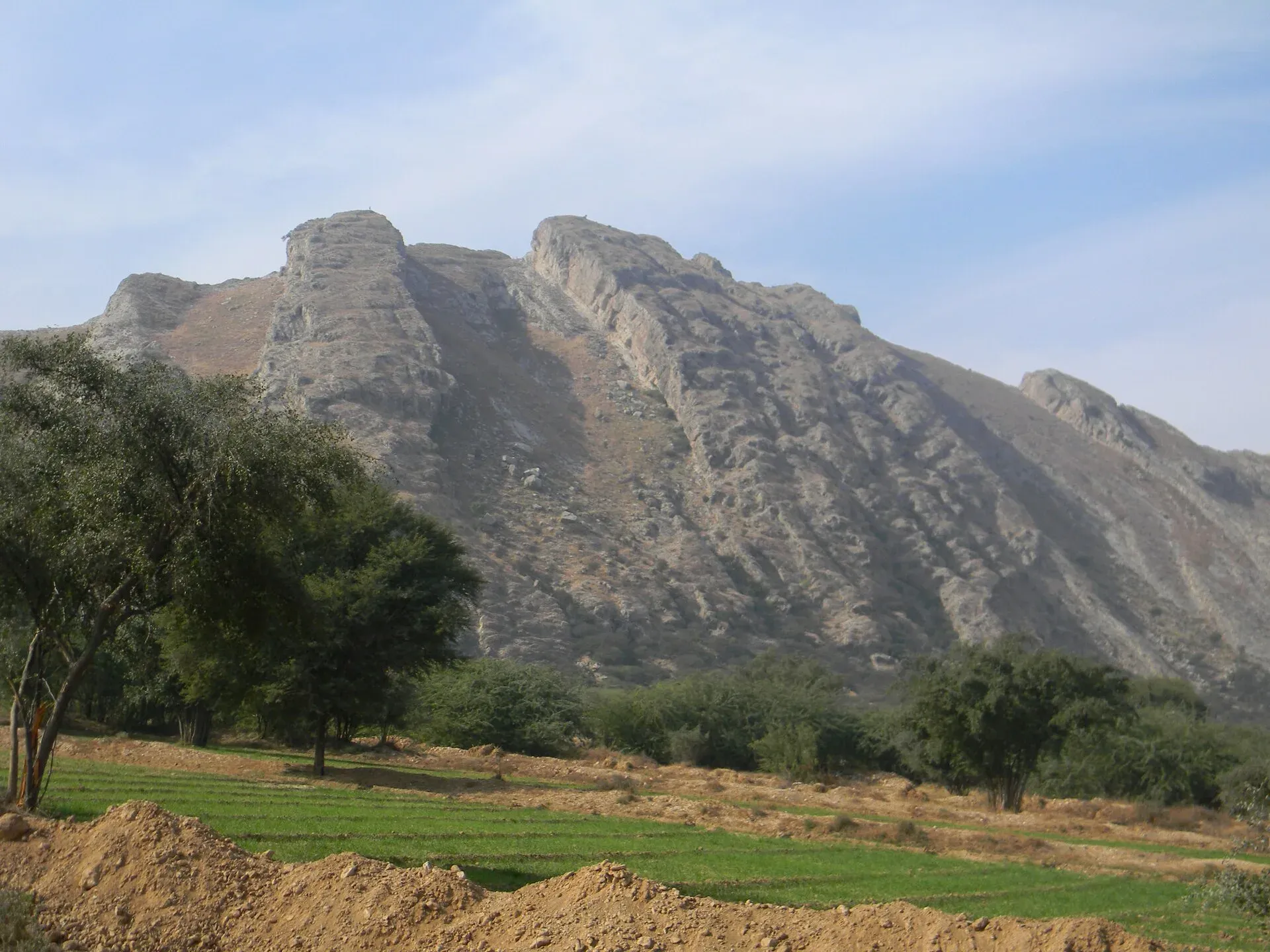
Photo: Khalid Mahmood, with thanks · CC BY-SA 3.0 · via Wikimedia Commons · temporary stand-in photo

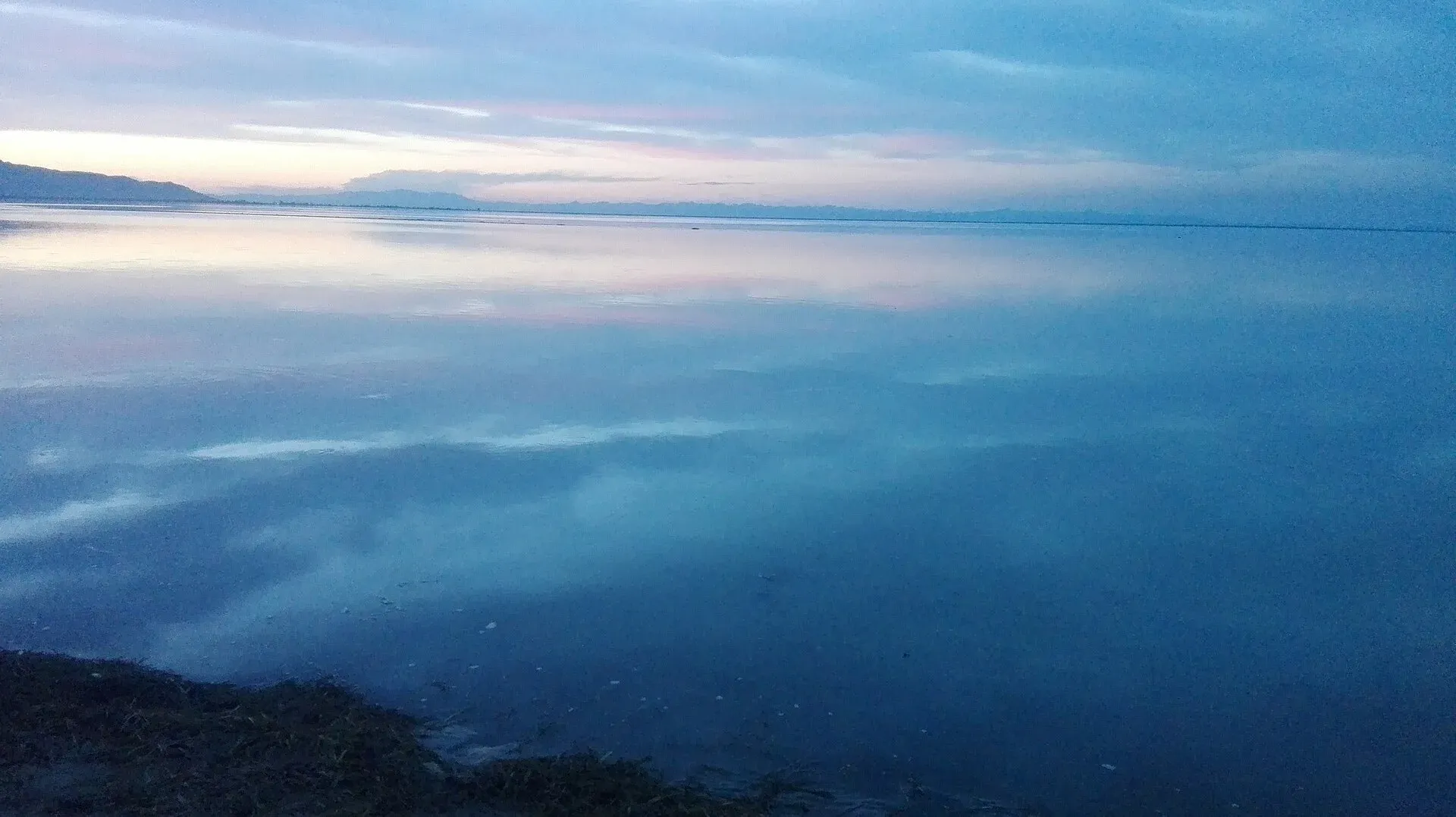
Photo: Muhammad Zain Abbas, with thanks · CC BY-SA 4.0 · via Wikimedia Commons · temporary stand-in photo

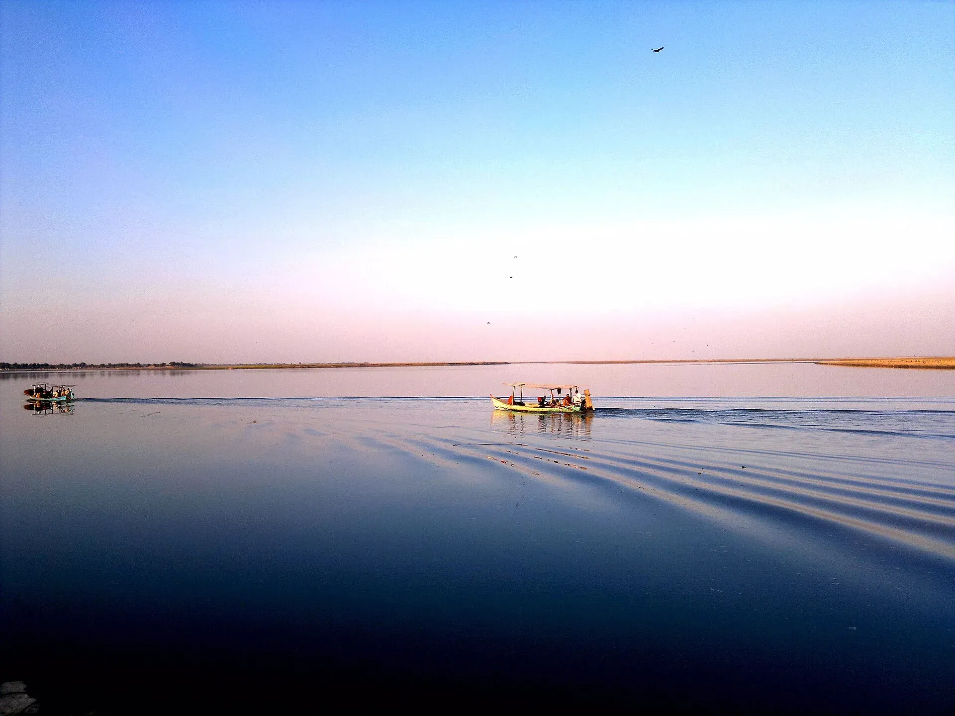
Photo: Dera Ismail Khan, with thanks · CC BY-SA 3.0 · via Wikimedia Commons · temporary stand-in photo

Not much is developed for visitors, and the road is mostly a fast link. These are the places the exits lead towards.
- Talagang and the Salt Range (towards Jand and Tarap): Talagang is the district capital on the Potohar plateau, north of the Salt Range, in peanut country. It is a transit stop between Islamabad, Chakwal and Mianwali and lies near Kallar Kahar Lake.
- Mianwali (from the Daud Khel exit): the district capital lies east of the Indus at about 210 m. Wikipedia says it was founded in the 16th century by the Sufi saint Shaikh Mian Ali and became district headquarters in 1901. The Thal Canal can be seen from the main bridge, and Namal Lake is about a 20-minute drive north-east.
- Chashma Lake (near the Isakhel exit): the Chashma Barrage reservoir on the Indus is a wildlife sanctuary (since 1974) and a Ramsar site (since 1996), with large winter flocks of ducks and coots and passing cranes.
- Dera Ismail Khan (beyond Yarik): an Indus city in southern Khyber Pakhtunkhwa near the 5,000-year-old Rehman Dheri mound. The FCDO advice below applies.
Wikipedia gives Mianwali's main language as Saraiki (86.9 per cent in the 2023 census figures for the municipal committee), which is useful to know on the road south.
Safety
Ask the district administration or local police about current conditions before you go. For foreign visitors: the UK FCDO (updated 27 October 2026) advises against all travel to Dera Ismail Khan, Bannu, Lakki Marwat and other KP districts. It notes emergency measures and Governor's Rule in Khyber Pakhtunkhwa since 11 October 2026. It does not name Mianwali. Read the full page before you plan travel to the southern end. Call 130 for the Motorway Police.
Highlights
- About 285 km, opened 5 January 2022
- Km distances from Hakla
- Crosses the Indus near Mianwali
- Rehabilitation work in 2026
Stops
- Hakla (M-1)Start
- Fateh JangInterchange
- Pindi GhebInterchange
- JandInterchange
- TarapInterchange
- Daud KhelMianwali and Kalabagh roads
- Kot BailianInterchange
- IsakhelInterchange
- KundalLakki Marwat-Chashma road
- YarikEnd; continues as N-55 (293 km is the total length per APP)
km: distance from the start along the route.
Numbers follow the stops in order. The map shows the 4 stops that have a trek.pk page, not the road itself.
Road conditions
Four lanes. Rehabilitation work between Hakla and Kundal was continuing in September 2026.
Where to stay, eat and fuel up
Places to stay
- National Club Hotel & RestaurantCall National Club Hotel & RestaurantMap of National Club Hotel & Restaurant in Google Maps
- Shelton Rezidor Hotel Dera Ismail KhanCall Shelton Rezidor Hotel Dera Ismail KhanMap of Shelton Rezidor Hotel Dera Ismail Khan in Google Maps
- Al Mairaj HotelCall Al Mairaj HotelMap of Al Mairaj Hotel in Google Maps
- Yarik sobat gharMap of Yarik sobat ghar in Google Maps
- FC MessCall FC MessMap of FC Mess in Google Maps
- Superior Group Of College Mianwali Boys HostelCall Superior Group Of College Mianwali Boys HostelMap of Superior Group Of College Mianwali Boys Hostel in Google Maps
Places to eat
- Pace RestaurantCall Pace RestaurantMap of Pace Restaurant in Google Maps
- Lasani Pizza TimeCall Lasani Pizza TimeMap of Lasani Pizza Time in Google Maps
- Lasani BroastCall Lasani BroastMap of Lasani Broast in Google Maps
- Qadeemi Sohan Halwa قدیمی سوہن حلوہCall Qadeemi Sohan Halwa قدیمی سوہن حلوہMap of Qadeemi Sohan Halwa قدیمی سوہن حلوہ in Google Maps
- One Pizza & GrillCall One Pizza & GrillMap of One Pizza & Grill in Google Maps
- Midway HotelCall Midway HotelMap of Midway Hotel in Google Maps
Essential services fuel stations, mechanics, ATMs, banks, pharmacies and hospitals and clinics
Fuel
- Total Petrol PumpCall Total Petrol PumpMap of Total Petrol Pump in Google Maps
- Chinar CNG StationMap of Chinar CNG Station in Google Maps
- Attock Petrol PumpMap of Attock Petrol Pump in Google Maps
- Attock Petrol PumpMap of Attock Petrol Pump in Google Maps
- Hassan filling station (PSO)Call Hassan filling station (PSO)Map of Hassan filling station (PSO) in Google Maps
- NAVEED & BROTHERS PETROLEUM- Total Petrol StationCall NAVEED & BROTHERS PETROLEUM- Total Petrol StationMap of NAVEED & BROTHERS PETROLEUM- Total Petrol Station in Google Maps
Mechanics and tyre shops
- Nasrullah Khan & Co. MianwaliCall Nasrullah Khan & Co. MianwaliMap of Nasrullah Khan & Co. Mianwali in Google Maps
- Mianwali Tyre CentreCall Mianwali Tyre CentreMap of Mianwali Tyre Centre in Google Maps
- Muslim Tyre and Tyre Care BranchCall Muslim Tyre and Tyre Care BranchMap of Muslim Tyre and Tyre Care Branch in Google Maps
- Al Basit tyre shopMap of Al Basit tyre shop in Google Maps
- Hamza & Co. Tire Shop MianwaliCall Hamza & Co. Tire Shop MianwaliMap of Hamza & Co. Tire Shop Mianwali in Google Maps
- Bannu Sarhad Radiator WorksCall Bannu Sarhad Radiator WorksMap of Bannu Sarhad Radiator Works in Google Maps
ATMs
- Allied Bank Ltd. (ABL)Map of Allied Bank Ltd. (ABL) in Google Maps
- Bank of Khyber Circular RoadCall Bank of Khyber Circular RoadMap of Bank of Khyber Circular Road in Google Maps
- NBPMap of NBP in Google Maps
- MCBMap of MCB in Google Maps
- National Bank of Pakistan (NBP)Call National Bank of Pakistan (NBP)Map of National Bank of Pakistan (NBP) in Google Maps
- Bank AL-Habib LtdCall Bank AL-Habib LtdMap of Bank AL-Habib Ltd in Google Maps
Banks and money exchange
- Meezan Bank - Dera Ismail Khan BranchCall Meezan Bank - Dera Ismail Khan BranchMap of Meezan Bank - Dera Ismail Khan Branch in Google Maps
- Bank Alfalah LtdMap of Bank Alfalah Ltd in Google Maps
- MCB Bank LTD. Circular Road Branch. Dera Ismail KhanCall MCB Bank LTD. Circular Road Branch. Dera Ismail KhanMap of MCB Bank LTD. Circular Road Branch. Dera Ismail Khan in Google Maps
- Bank of KhyberMap of Bank of Khyber in Google Maps
- UBL BankMap of UBL Bank in Google Maps
- Allied Bank Ltd.Call Allied Bank Ltd.Map of Allied Bank Ltd. in Google Maps
Pharmacies
- Rashid PharmacyCall Rashid PharmacyMap of Rashid Pharmacy in Google Maps
- Zafar Medicine CompanyCall Zafar Medicine CompanyMap of Zafar Medicine Company in Google Maps
Hospitals and clinics
- Dr Nasim Saba Mahsood ClinicCall Dr Nasim Saba Mahsood ClinicMap of Dr Nasim Saba Mahsood Clinic in Google Maps
- Dr Nadia Shah Clinic and Maternity HospitalCall Dr Nadia Shah Clinic and Maternity HospitalMap of Dr Nadia Shah Clinic and Maternity Hospital in Google Maps
- Dr Nusrat Ullah Eye Specialist (Al Mustafa Laser Eye Clinic)Map of Dr Nusrat Ullah Eye Specialist (Al Mustafa Laser Eye Clinic) in Google Maps
- Khalida Nusrat Maternity HomeCall Khalida Nusrat Maternity HomeMap of Khalida Nusrat Maternity Home in Google Maps
- Major Sheikh Arshad HospitalCall Major Sheikh Arshad HospitalMap of Major Sheikh Arshad Hospital in Google Maps
- Doctor Shoaib Khan (Eye Specialist)Call Doctor Shoaib Khan (Eye Specialist)Map of Doctor Shoaib Khan (Eye Specialist) in Google Maps
Listings come from Google Maps data and are unverified: phone numbers, opening months and prices may have changed. Report a problem · Own one of these? Claim it
More safety notes
See FCDO advice. Call 130.
Tips
- Check NHMP for closures
- Fill up before you start
- Read the FCDO advice for Dera Ismail Khan
Photos we still need: the motorway near Mianwali or the Indus bridge. Send us yours
Sources and last checked
Last checked Confidence medium10 sources4 still to check
- Last checked
- Method
- Desk research from published sources
- Confidence
- medium
- Checked by
- trek.pk research team
Researched from published sources; not yet checked on the ground by our team. Spot something out of date? Report a mistake.
Sources
- M-14 motorway (Pakistan) · Wikipedia · checked
- National Highway Authority (official site; toll chart page could not be opened from our connection) · Government of Pakistan · checked
- National Highways and Motorway Police (helpline 130) · Government of Pakistan · checked
- Pakistan restores motorway speed limits to 120 km/h · DrivePK · checked
- Motorway Police begin fines for new speed limits on M2 · Dunya News · checked
- M-1 Motorway reopens to all traffic after five-day closure · ARY News · checked
- Pakistan travel advice (updated 27 October 2026) · UK FCDO · checked
- Hakla-D.I. Khan Motorway inaugurated (5 Jan 2022; 293 km, 11 interchanges) · Associated Press of Pakistan · checked
- Hakla-DI Khan motorway inaugurated (6 Jan 2022; 293 km) · Zameen News · checked
- Mianwali (location, history, Thal Canal, Namal Lake) · Wikipedia · checked
Still to be checked on the ground (4)
- Toll and service area details (July 2026 toll rates are reported only by news, not from an NHA page we could open, so none is given)
- Status of the Hakla to Kundal rehabilitation work (only the September 2026 Motorway Police statement; no later report)
- Which of the last two interchange km figures is right (Abdul Khel 292 vs Yarik 291 in Wikipedia; no other source found)
- Which interchange serves Talagang, Kallar Kahar and the Salt Range (no source found)
Nearby and related

Dera Ismail Khan
A historic Indus river city in southern Khyber Pakhtunkhwa where Saraiki and Pashtun cultures meet, near the 5,000-year-old Rehman Dheri mound. Check security advice before any visit.

Mianwali
District capital east of the Indus in north-west Punjab. A farm and air-force town with the Chashma and Jinnah barrages nearby.

Chashma Lake Wildlife Sanctuary
The Chashma Barrage reservoir on the Indus near Mianwali, Punjab: a wildlife sanctuary since 1974 and Ramsar site no. 816 since 1996, with large winter flocks of ducks and coots and passing cranes.

Talagang
District capital on the Potohar plateau, north of the Salt Range. Peanut country and a transit stop between Islamabad, Chakwal and Mianwali, near Kallar Kahar Lake.

Lakki Marwat
The headquarters of Lakki Marwat District in the sandy south of Khyber Pakhtunkhwa, about 208 km from Peshawar. A regional market town, with no established visitor sights.