

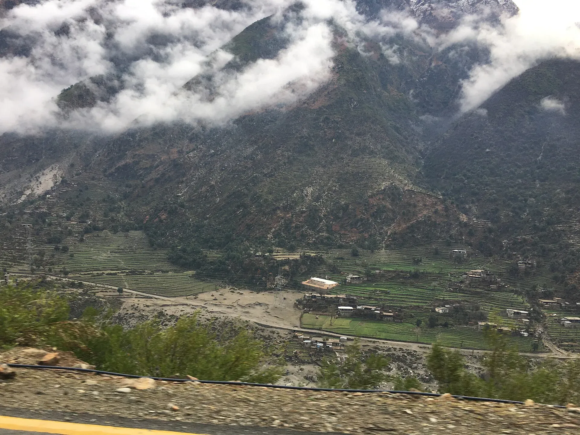
Photo: Bilal Munir, with thanks · CC BY-SA 4.0 · via Wikimedia Commons · temporary stand-in photo

N-90 Khwazakhela-Besham
The 64 km N-90 links Khwazakhela in Swat with Besham on the Karakoram Highway over the hills of Shangla, joining the Swat valley to the KKH. The UK advises against all travel to Swat and against all but essential travel to Shangla.
Overview
The N-90 is a short national highway of 64 km between Khwazakhela, in Swat District, and Besham, in Shangla District, both in Khyber Pakhtunkhwa. Wikipedia describes it as connecting Malakand Division with the Karakoram Highway at Besham. Measured by road routing, the distance from Khwazakhela to Besham is about 69 km.
The road matters mostly as a link. It joins the Swat valley road (N-95) at Khwazakhela to the KKH (N-35) at Besham, so travellers can go from Swat to Gilgit-Baltistan, or the reverse, without going back down to the plains.
Route
From Khwazakhela the road climbs out of the Swat valley, crosses the hills of Shangla, and descends to the Indus at Besham. Our routing puts the Shangla Pass about 19 km from Khwazakhela and Besham about 46 km beyond it, which agrees with the total of about 66 to 69 km.
- Khwazakhela (Swat). A town at 1,151 m close to the Swat river, and according to Wikipedia the second-largest commercial centre in Swat after Mingora, serving shoppers from Kalam, Kohistan and Shangla. It is known for the shrines of local saints such as Mian Baba and Derai Baba. The Lwar-e-Jamat Mosque is described as a 12th-century site, said to have been built during a visit by Mahmud of Ghazni. The 2023 census gave the town 57,113 people.
- Shangla Pass and Shangla Top. The Shangla Pass connects Swat and Shangla districts at about 34°52'N 72°35'E. Wikipedia does not give its height or name the highway. Shangla Top, the high point of the road over Shangla, is given as about 7,000 feet (roughly 2,100 m) by Pakistan Traveler; a search listing gave 2,125 m, which we did not open. These are approximate, and we have not confirmed that the pass is on exactly this alignment. Pakistan Traveler also lists hiking, camping and birdwatching in the area and says snow falls in winter.
- Alpuri. The district headquarters of Shangla. The News (26 January 2026) names Alpuri-Mingora and Alpuri-Bisham as separate highways, so Alpuri is on a link road and not necessarily on the N-90 itself.
- Besham (Shangla). The southern end, on the Karakoram Highway beside the Indus.
The country the road crosses
Shangla District was split from Swat in 1995. Wikipedia describes small valleys between hillocks, ringed by high forested mountains, with an average height of 2,000 to 3,000 m. The forests include pindrow fir, Morinda spruce, blue pine (kail), chir pine and deodar. Pashto is spoken by about 95 per cent of people and the Yusufzai are the main tribe. Wikipedia says relics from the Greek period are found at Pirsar, Chakesar and Daut, and that Alexander the Great is believed to have camped at Pirsar for a few days. Buddhist sculpture also turns up in the district. The 2015 Hindu Kush earthquake killed more than 18 people in Shangla.
Road condition
There is no known recent official report on the surface. Expect a mountain road with bends, drops and heavy truck use at times, and possible rockfall in rain. Snow does close it: The News (26 January 2026) reported the Bisham-Swat road and other links closed for more than 48 hours, snow up to nearly four feet at Shangla Top, a ban on vehicles without snow chains, and an NHA tractor too weak to clear it. Check locally in winter.
What to see near it
- Alpuri, the main town of Shangla.
- Besham, a stop on the KKH with fuel and rooms.
- Swat valley beyond Khwazakhela, with Mingora and Kalam.
- The Indus at Besham and the KKH, which continues north to Dasu and Chilas.
Landslide and seasonal hazards
Steep slopes, heavy rain in monsoon (July and August) and snow in winter make rockfall and slides likely. The KKH at Besham is part of the stretch where landslides block traffic often (see the N-35 page). There is no known dated N-90 incident, so no specific date is given here.
Fuel and services
Fuel and food are limited between Khwazakhela and Besham. Fill up at Khwazakhela or Besham. Besham has rooms and shops; mobile signal is variable in the hills. Allow about two hours for the drive, longer in rain or behind trucks, and start early so you reach Besham or Khwazakhela by daylight. Vans and pickups run the route, but timetables are informal, so ask locally.
Tolls and checkposts
Tolls, if any, are not confirmed; current rates will be added soon. Expect police checkposts at both ends. Carry passport and visa copies.
Safety and travel advice by section
For foreign visitors: the UK FCDO page (updated 27 October 2026, checked 16 November 2026) advises against all travel to Swat, which includes Khwazakhela, and against all but essential travel to Shangla. It also advises against all travel on the KKH between Mansehra and Chilas, including Besham City, which sits at the southern end of this road. In effect, the whole N-90 lies inside areas the UK government advises against. KP emergency measures and Governor's Rule since 11 October 2026 also apply. Check the live text and local advice. Do not drive at night.
Highlights
- Links Swat with the Karakoram Highway at Besham
- Crosses Shangla hills
- Only 64 km
- Used by local and onward traffic
Stops
- KhwazakhelaNorthern end, Swat; N-95 junction
- Shangla Pass (Shangla Top)About 19 km (OSRM estimate); height uncertain
- BeshamKKH junction; fuel, food and rooms
km: distance from the start along the route.
Numbers follow the stops in order. The map shows the 2 stops that have a trek.pk page, not the road itself.
Where to stay, eat and fuel up
Places to stay
- Swat shangrila Hotel & RestaurantCall Swat shangrila Hotel & RestaurantMap of Swat shangrila Hotel & Restaurant in Google Maps
- Machaar AbshaarCall Machaar AbshaarMap of Machaar Abshaar in Google Maps
Places to eat
- Kashmir Sweets and BakerMap of Kashmir Sweets and Baker in Google Maps
- Dine Up RestaurantCall Dine Up RestaurantMap of Dine Up Restaurant in Google Maps
- Sarhad CafeCall Sarhad CafeMap of Sarhad Cafe in Google Maps
- Anwar HotelCall Anwar HotelMap of Anwar Hotel in Google Maps
- Al Furqan HotelCall Al Furqan HotelMap of Al Furqan Hotel in Google Maps
- Night Day Hotel and RestaurantCall Night Day Hotel and RestaurantMap of Night Day Hotel and Restaurant in Google Maps
Essential services fuel stations, ATMs, banks, pharmacies and hospitals and clinics
Fuel
- Attock ⛽ zong tower 8232Map of Attock ⛽ zong tower 8232 in Google Maps
- Attock Filling StationCall Attock Filling StationMap of Attock Filling Station in Google Maps
- Teeta But Filling StationCall Teeta But Filling StationMap of Teeta But Filling Station in Google Maps
- PSO Filling Station Shangla TopMap of PSO Filling Station Shangla Top in Google Maps
- Quality 1 Arab Emarat PetroleumCall Quality 1 Arab Emarat PetroleumMap of Quality 1 Arab Emarat Petroleum in Google Maps
- Arab Emirate PetroleumCall Arab Emirate PetroleumMap of Arab Emirate Petroleum in Google Maps
ATMs
- QistonaCall QistonaMap of Qistona in Google Maps
- HBL BankCall HBL BankMap of HBL Bank in Google Maps
- Allied Bank ATMMap of Allied Bank ATM in Google Maps
- HBL ATMMap of HBL ATM in Google Maps
- MCB ATM ServiceMap of MCB ATM Service in Google Maps
Banks and money exchange
- United Bank Ltd (UBL)Call United Bank Ltd (UBL)Map of United Bank Ltd (UBL) in Google Maps
- MCB Bank LtdCall MCB Bank LtdMap of MCB Bank Ltd in Google Maps
- Bank Al Habib MattaCall Bank Al Habib MattaMap of Bank Al Habib Matta in Google Maps
- Khyber Bank Matta BranchMap of Khyber Bank Matta Branch in Google Maps
- Faisal Bank MattaMap of Faisal Bank Matta in Google Maps
- United Bank LimitedCall United Bank LimitedMap of United Bank Limited in Google Maps
Pharmacies
- Al Amin Enterprise Khwazakhela SwatCall Al Amin Enterprise Khwazakhela SwatMap of Al Amin Enterprise Khwazakhela Swat in Google Maps
- Ali Pharmacy Wholesale & DistributorsCall Ali Pharmacy Wholesale & DistributorsMap of Ali Pharmacy Wholesale & Distributors in Google Maps
- Sky pharmacyCall Sky pharmacyMap of Sky pharmacy in Google Maps
- Royal Arbaz Pharamcy and surgical storeCall Royal Arbaz Pharamcy and surgical storeMap of Royal Arbaz Pharamcy and surgical store in Google Maps
- New Kohistan Medical StoreCall New Kohistan Medical StoreMap of New Kohistan Medical Store in Google Maps
- Azan pharmacy khwaza khela swat kpk PakistanCall Azan pharmacy khwaza khela swat kpk PakistanMap of Azan pharmacy khwaza khela swat kpk Pakistan in Google Maps
Hospitals and clinics
- Skin Solutions & LASER centre (Dr Allauddin)Call Skin Solutions & LASER centre (Dr Allauddin)Map of Skin Solutions & LASER centre (Dr Allauddin) in Google Maps
- Salman Teaching HospitalsCall Salman Teaching HospitalsMap of Salman Teaching Hospitals in Google Maps
- Sher Zada Medical CenterCall Sher Zada Medical CenterMap of Sher Zada Medical Center in Google Maps
- Ahmad HospitalCall Ahmad HospitalMap of Ahmad Hospital in Google Maps
- Civil Besham HospitalMap of Civil Besham Hospital in Google Maps
- Khyber Medical ComplexCall Khyber Medical ComplexMap of Khyber Medical Complex in Google Maps
Listings come from Google Maps data and are unverified: phone numbers, opening months and prices may have changed. Report a problem · Own one of these? Claim it
More safety notes
- Khwazakhela (Swat): UK FCDO advises against all travel.
- Shangla: all but essential travel advised against.
- Besham City / KKH: all travel advised against (checked 16 November 2026).
Tips
- Read the live FCDO text before any plan.
- Fill up before the hills.
- Do not drive after dark.
- Check weather and rockfall after rain.
Photos we still need: Khwazakhela and the descent from Shangla to Besham. Send us yours
Sources and last checked
Last checked Confidence low9 sources4 still to check
- Last checked
- Method
- Desk research from published sources
- Confidence
- low
- Checked by
- trek.pk research team
Researched from published sources; not yet checked on the ground by our team. Spot something out of date? Report a mistake.
Sources
- National highways of Pakistan · Wikipedia · checked
- N-90 National Highway · Wikipedia · checked
- Shangla Pass · Wikipedia · checked
- Pakistan travel advice: warnings and insurance (updated 27 October 2026) · UK Foreign, Commonwealth & Development Office · checked
- OSRM routing (road distances measured from the start of each highway) · OpenStreetMap / Project OSRM · checked
- Road blockades, power disruption compound misery in Shangla (26 January 2026) · The News · checked
- Shangla Top · Pakistan Traveler · checked
- Khwazakhela · Wikipedia · checked
- Shangla District · Wikipedia · checked
Still to be checked on the ground (4)
- Exact alignment over Shangla and pass altitude (about 7,000 ft per Pakistan Traveler; 2,125 m in an unopened listing; no official figure)
- Road surface (no recent dated report beyond the January 2026 snow closures)
- Fuel stations (no source found)
- Whether Alpuri lies on the N-90 itself (sources treat Alpuri as a separate link road)
Nearby and related

Besham
A busy Indus-side town and junction on the Karakoram Highway at about 613 m, long used as the first overnight stop from Islamabad towards Gilgit and Hunza.

Alpuri
The small hill town that is the headquarters of Shangla District, at about 1,587 m on the road between Swat and the Indus. A working administrative town, not a tourist stop.

Swat Valley
A long green river valley in northern Khyber Pakhtunkhwa, with Gandhara Buddhist sites, orchards, hill towns and the road up to Kalam. Check the current security advice before you plan a trip.

Saidu Sharif
The administrative town of Swat, joined to the bazaar city of Mingora, with the ancient Butkara stupa, the Swat Museum of Gandhara art, a Sufi shrine and the road into the Swat valley.
Shangla Pass
A road pass connecting Swat and Shangla districts in Khyber Pakhtunkhwa, on the road between Khwazakhela and Besham. The UK advises against all travel to Swat and all but essential travel to Shangla.

Swat and Kalam
A 4-5 day road trip from Islamabad up the Swat valley by the M-16 and N-95 to Mingora, Madyan, Bahrain and Kalam, with Mahodand Lake and Ushu forest in summer.