

Photo: Muhammad Akram Attari, with thanks · CC BY-SA 4.0 · via Wikimedia Commons · temporary stand-in photo

Swat and Kalam
A 4-5 day road trip from Islamabad up the Swat valley by the M-16 and N-95 to Mingora, Madyan, Bahrain and Kalam, with Mahodand Lake and Ushu forest in summer.
Customise this route Change the dates, stops and how you travel in the Road Trip Planner.
Overview
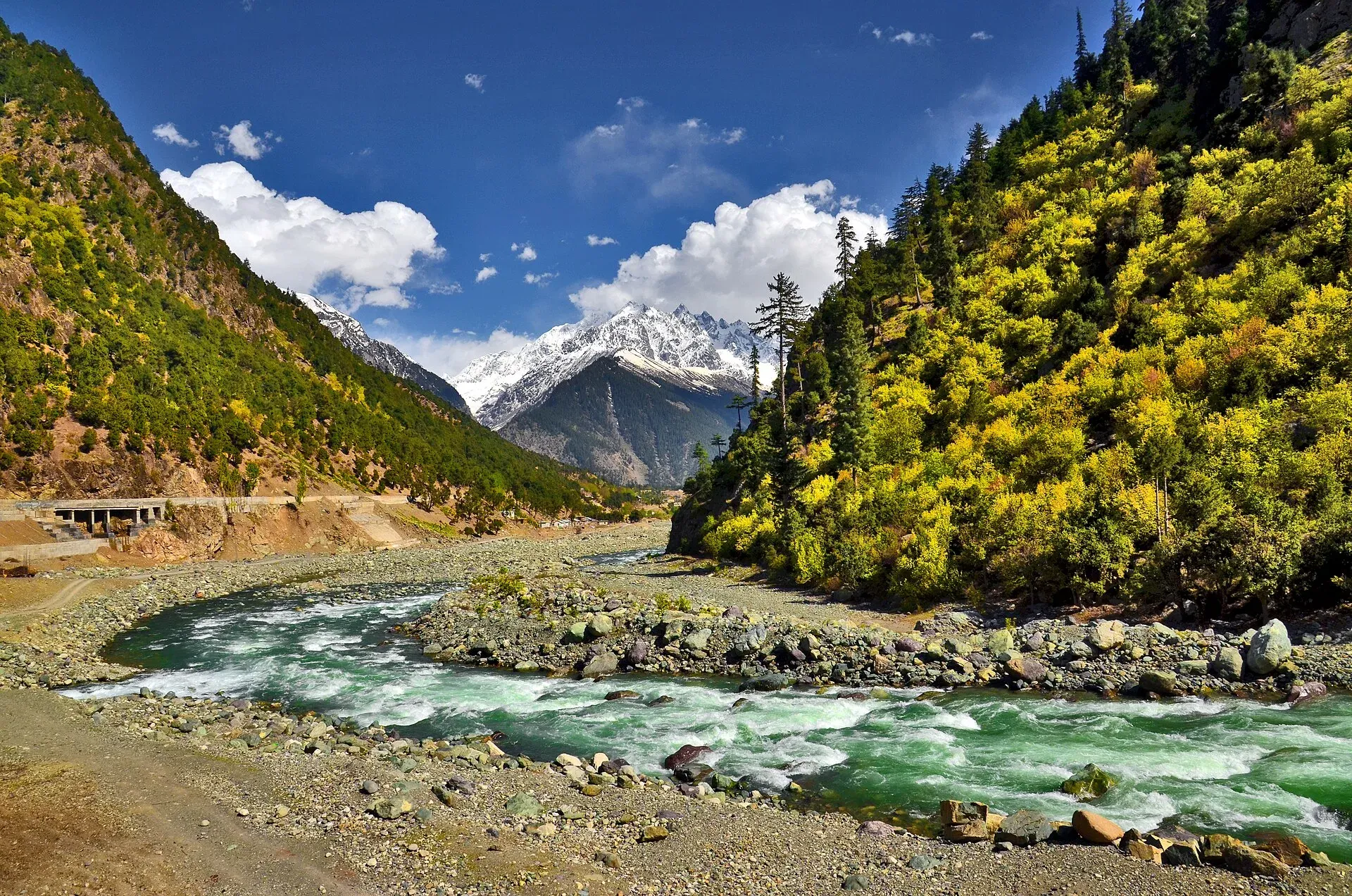
Swat is a green, long valley in Khyber Pakhtunkhwa, with the Swat River running through it. Fast roads take you to Mingora and then the valley narrows past Madyan and Bahrain to Kalam, where pine forests, waterfalls and Mahodand Lake lie beyond. The valley has a long Buddhist history and many old monuments around Mingora and Saidu Sharif.
Who it suits
Families, couples and first-time northern visitors. The M-16 and N-95 are easy; the final track to Mahodand is rough and needs a 4x4.
When to go
April to October. Spring and autumn are mild and clear. July and August bring crowds, rain and flash-flood risk on the river. The upper valley can have snow from November to March.
The route in short
Take the M-1 motorway towards Peshawar, then the Swat Motorway (M-16) to Chakdara, where the N-95 continues through Mingora, Madyan, Bahrain and Kalam. Wikipedia lists M-16 Phase 1 (Nowshera to Chakdara) as open since 3 June 2019 and Phase 2 (Chakdara to Fatehpur, about 80 km) as under construction, with no completion date; there is no known 2026 report of progress, so do not expect it to reach beyond Chakdara this year. Beyond Chakdara the N-95 runs close to the river and is often busy.
Stops in order
Distances are from Islamabad by OSRM (estimates) and match the stops list.
- Chakdara (km 193). The junction where the N-95 starts. Chakdara Fort is nearby.
- Mingora and Saidu Sharif (km 233). Swat's biggest city and its administrative neighbour.
- Malam Jabba. A forested hill resort at about 2,800 m above Mingora, with a chairlift. Wikipedia and our own page give no road-condition details, so check locally.
- Madyan (km 285). A town of Torwali people at 1,320 m, about 55 km from Mingora, and a popular stop in the valley.
- Bahrain (km 293). About 60 km north of Mingora at 1,432 m, where the Daral and Swat rivers meet. The name means "two rivers".
- Kalam (km 328). About 2,000 m, where the Ushu and Gabral rivers form the Swat River.
- Mahodand Lake (km 362). Above Kalam, by 4x4 in summer.
Swat was administered as one district from 1969 to 2025. Wikipedia says it was split in October 2025 into Upper Swat and a smaller Swat district, so older books and maps may use different names.
Buddhist Swat around Mingora
Swat was a centre of Gandhara Buddhist culture. Wikipedia says the Butkara Stupa near Mingora may date from the 2nd century BCE. It was enlarged five times, each new layer built over the last. An Italian mission began excavating it in 1956. The Swat Museum, between Mingora and Saidu Sharif, shows Gandharan sculpture. It was damaged in 2005 and 2008, and a new seismic-resistant building opened in 2014. Other sites on the Wikipedia list include the Nemogram Stupa (Kushan period, with statues now in the museum), the 27 m Shingardar Stupa beside the road into Swat, and the Jehanabad Buddha, which Italian restorers repaired after its face was blown up. At Barikot, the ancient city of Bazira that Alexander's army stormed in 327 BCE has been excavated by an Italian-Pakistani team since 1984. Udegram, in lower Swat, was the capital of the Hindu Shahi dynasty from the 8th century, and its mosque dates to 1048-49.
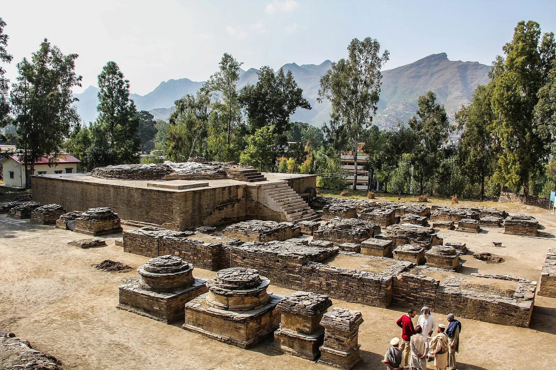
Photo: Fazal.Khaliq, with thanks · CC BY-SA 4.0 · via Wikimedia Commons · temporary stand-in photo

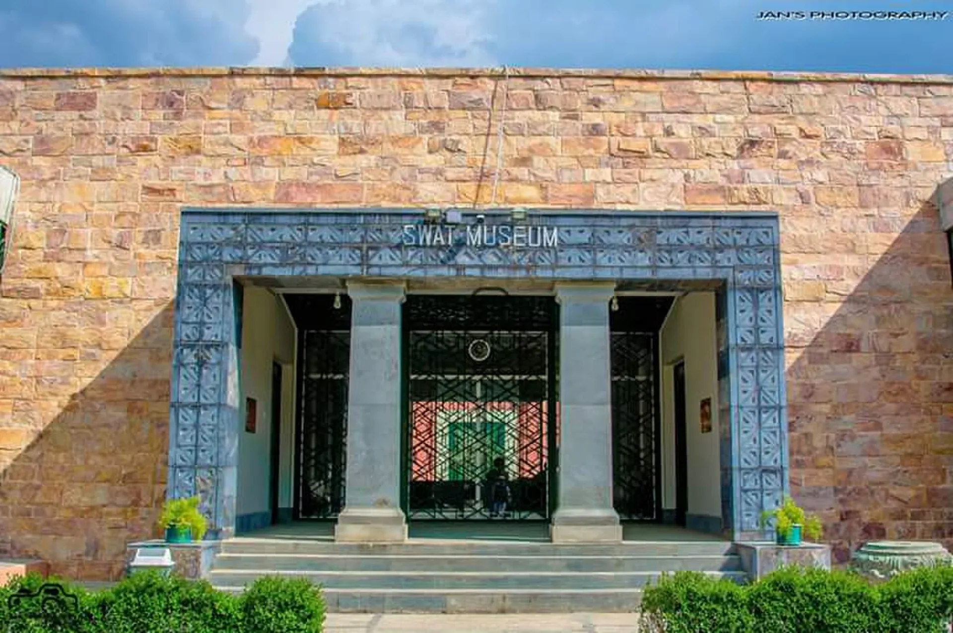
Photo: Adilswati, with thanks · CC BY-SA 4.0 · via Wikimedia Commons · temporary stand-in photo

Mingora itself is a large working bazaar town. Our Mingora bazaar page describes an everyday market for cloth, crafts and local produce.
Madyan and Bahrain
Madyan has grown in recent years into a popular stop for visitors from across Pakistan, with riverside tea stops and restaurants known for trout. Bahrain, the tehsil (sub-district) headquarters, is a base for trails to Daral Lake and Saidgai Lake and is known for its handicrafts, according to Wikipedia. It had 76,728 people at the 2023 census. The Bahrain bazaar is one of the places where the Express Tribune reported damage to the Kalam road in June 2026 (see road conditions). Check the state of the road before you plan a long day beyond Madyan.
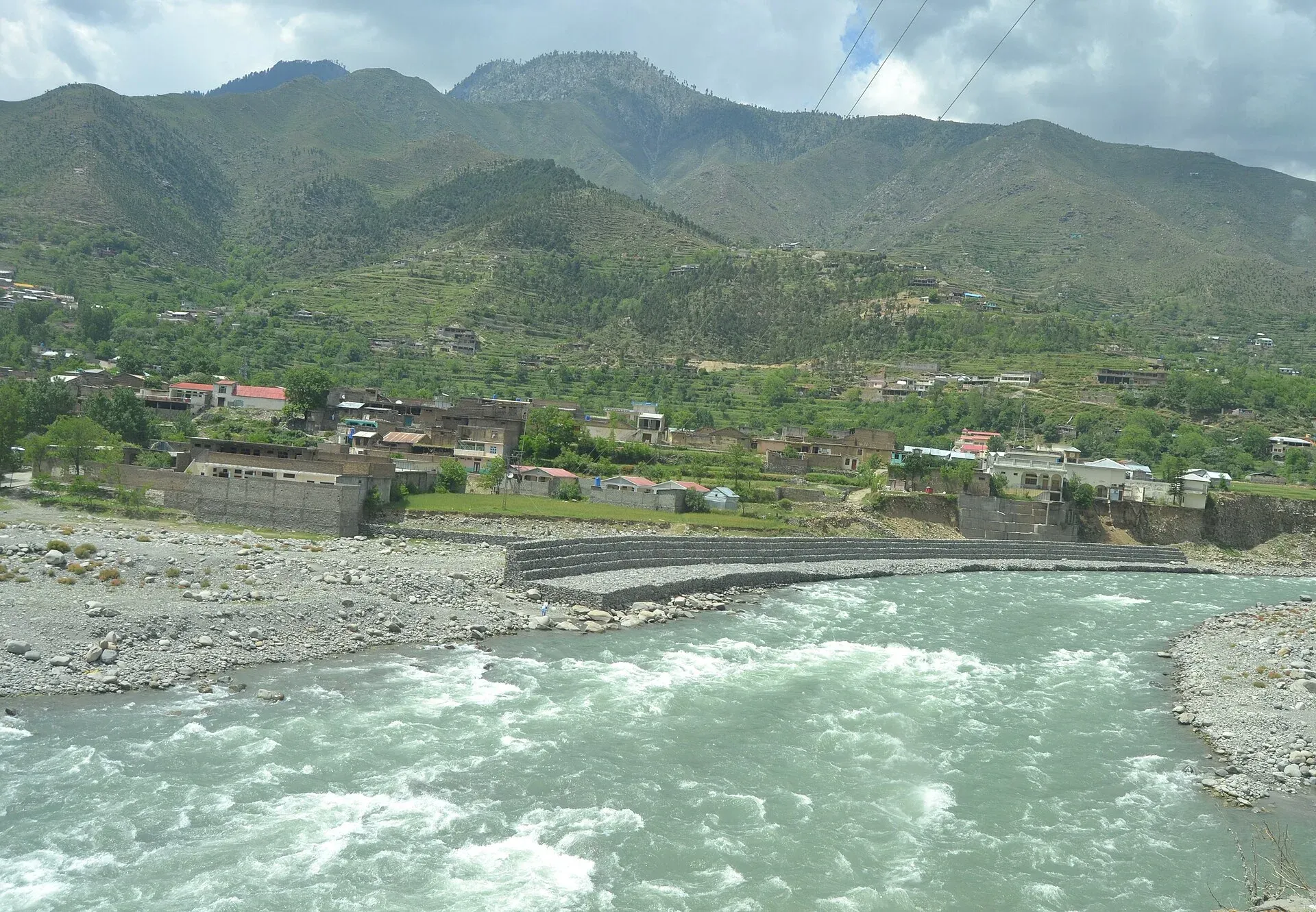
Photo: Xain, with thanks · CC BY-SA 3.0 · via Wikimedia Commons · temporary stand-in photo

Kalam and the upper valley
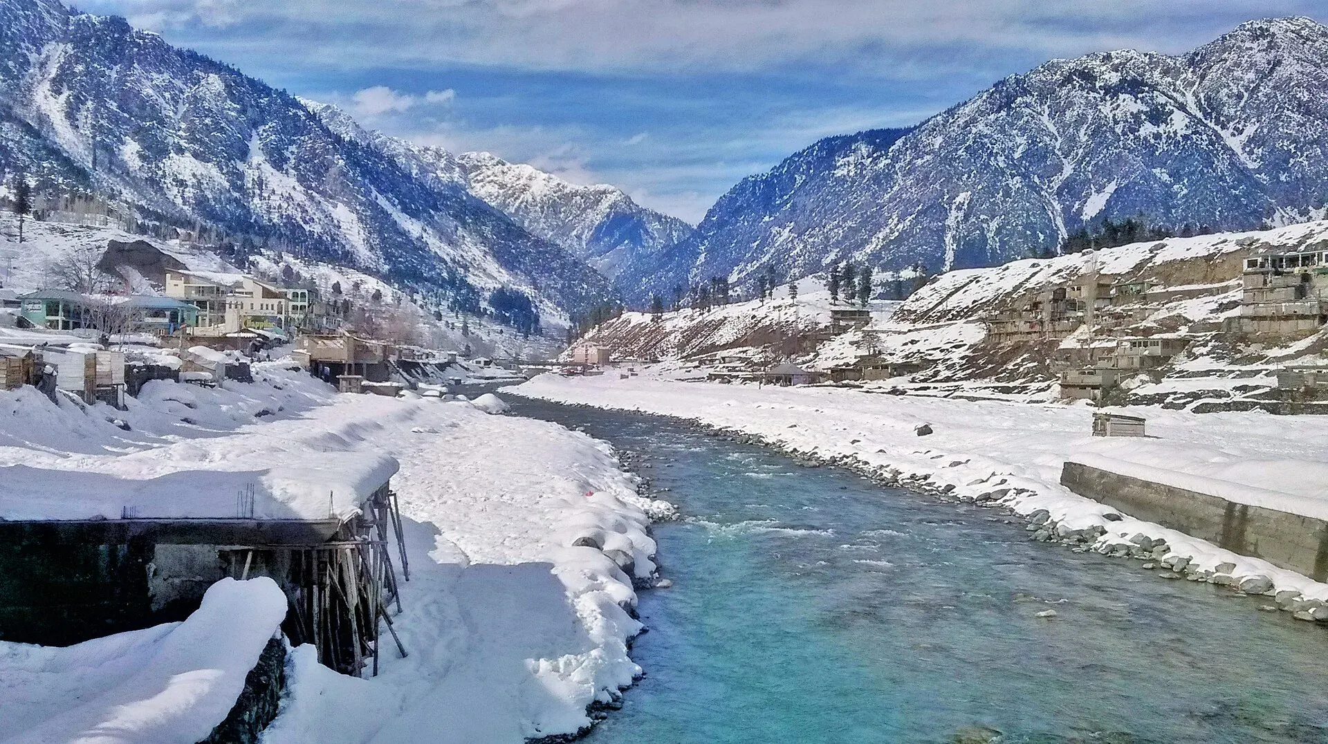
Photo: M. Hamza Shahab, with thanks · CC BY-SA 4.0 · via Wikimedia Commons · temporary stand-in photo

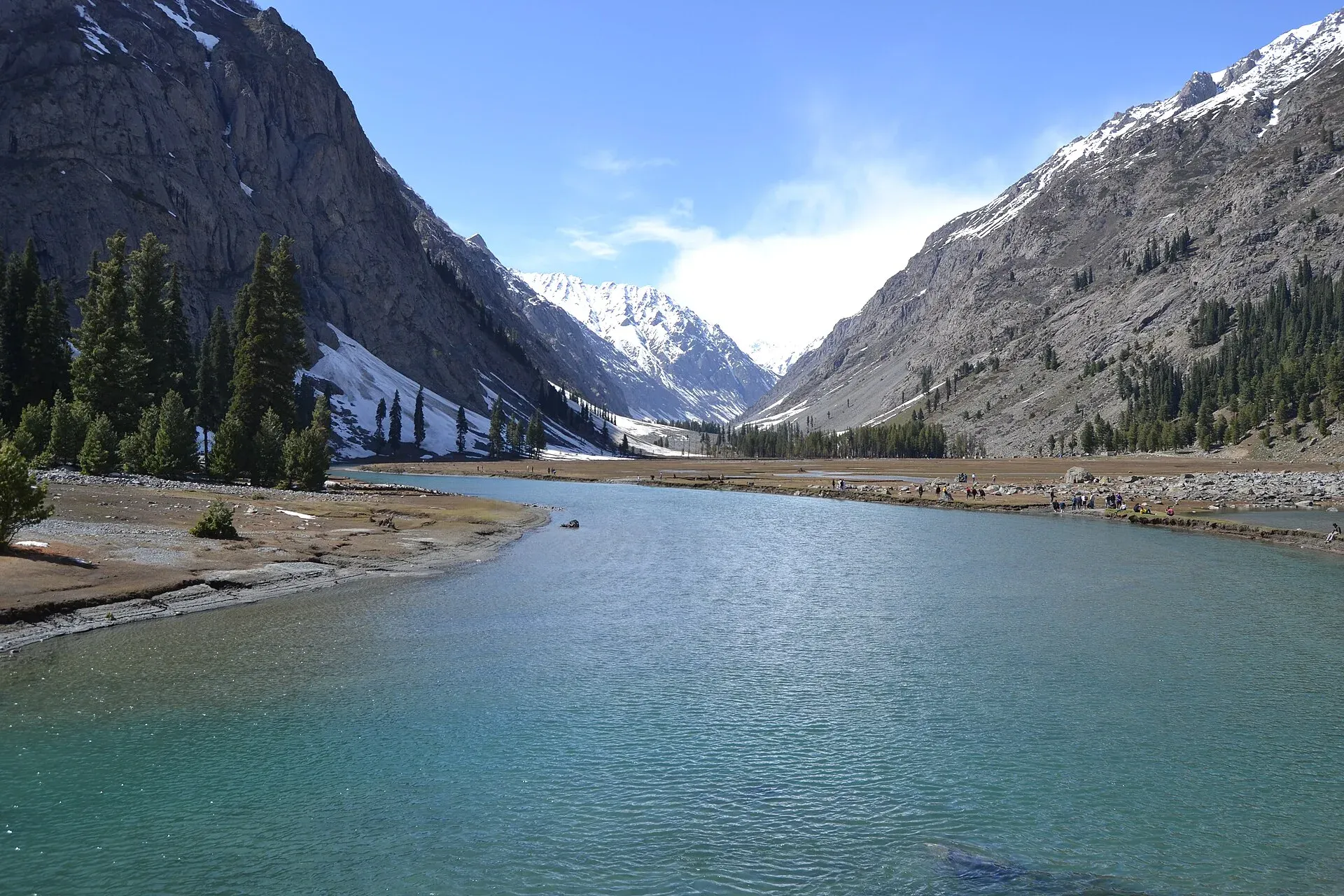
Photo: Xain, with thanks · CC BY-SA 3.0 · via Wikimedia Commons · temporary stand-in photo

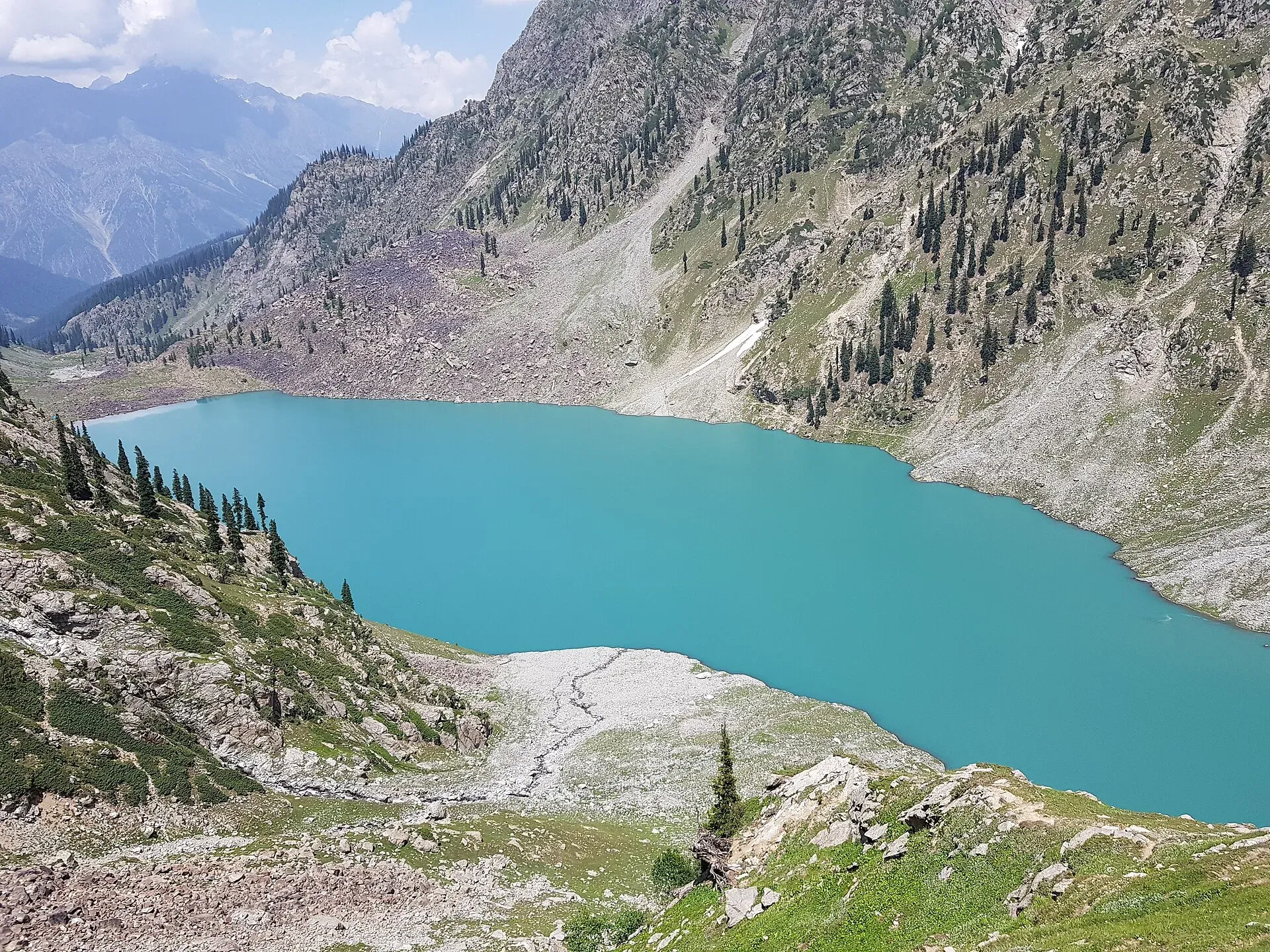
Photo: Kmbilall, with thanks · CC BY-SA 4.0 · via Wikimedia Commons · temporary stand-in photo

Kalam is the last large town, with 23,170 people at the 2017 census, mostly Gawri-speaking. Wikipedia's climate figures give an average of 13.4 C, with July the hottest month (24.1 C) and January the coldest (1.5 C), and about 639 mm of rain a year. April is the wettest month. That matches the season in this page: April to October is the open season, and snow is likely from November to March. From Kalam, the Ushu valley leads to Ushu forest and Mahodand Lake, about 40 km from Kalam by Wikipedia (our OSRM figure is 34 km). The Utror valley, to the north-west, has Kundol Lake. Matiltan, on the Ushu road, has views towards Falak Sar (5,918 m). Mahodand and Kundol are the lakes most visited because access is relatively easy.
Distances
Distances and times in this plan are from OSRM / OpenStreetMap, measured on 16 November 2026. They are driving time only, without stops, and OSRM is optimistic on mountain roads, unpaved tracks and in traffic, so real journeys are usually clearly longer; treat the times as a minimum. Islamabad to Kalam is about 328 km (4 h 01 by OSRM); Mahodand Lake is a further 34 km on a rough track.
Treks and side trips
The Kachakani An trek begins near Mahodand Lake. See also the places Ushu forest, Utror and Gabral.
Culture
Swat is mainly Pashtun, and Pashto is spoken. Be careful about dress and photography in bazaars and villages. Public safety is better than in the past, but check news locally. The N-95 Kalam Road was damaged by the 2022 floods and, on 13 June 2026, the Express Tribune reported about 4,887 m still critically damaged at seven places between Madyan and Kalam, including Bahrain bazaar, with permanent repairs unfinished and the KP chief minister asking the NHA to finish them. Expect slow, rough stretches.
Highlights
- Swat Motorway and the upper valley
- Mingora and Saidu Sharif
- Madyan and Bahrain bazaars
- Kalam forests and Ushu
- Mahodand Lake
Stops
- ChakdaraJunction where the Swat road begins
- MingoraMain city; museum and bazaar
- MadyanBazaar and riverside hotels
- BahrainStart of the final climb
- KalamUpper valley base
- Mahodand Lake4x4 only
km: distance from the start along the route.
Numbers follow the stops in order. The map shows the stops, not the road itself.
Day by day
Day 1 · Islamabad to Mingora
Use the motorways to Chakdara (193 km) and then the N-95 to Mingora. Visit Swat Museum or the old bazaar in the afternoon.
Day 2 · Mingora to Kalam
Follow the river via Madyan and Bahrain. Roadworks near Bahrain can add an hour, and June 2026 reports describe damaged sections, so real times are longer than OSRM.
Day 3 · Kalam: Ushu or Mahodand
Take a local 4x4 for Mahodand Lake (34 km from Kalam, rough track, far slower than OSRM suggests), or go to Ushu forest (20 km). Return to Kalam. The distance shown is both trips as round trips; do one or the other and it is about half.
Day 4 · Kalam to Madyan
Return down the valley and stop for Matiltan or Madyan.
Day 5 · Return to Islamabad
Leave early on a weekday to avoid traffic.
Road conditions
- M-1 and M-16: modern motorway sections. M-16 serves the lower part of the Swat route; beyond Chakdara the N-95 is a regular two-lane road.
- N-95 to Madyan and Bahrain: busy and in some stretches slow.
- Bahrain to Kalam: June 2026 reports from The Express Tribune and Dawn describe damaged road sections, landslides at times and urgent repair needs, so expect delays.
- Kalam to Mahodand and Ushu: rough tracks that need a 4x4.
Distances and times in this plan are from OSRM / OpenStreetMap, measured on 16 November 2026. They are driving time only, without stops, and OSRM is optimistic on mountain roads, unpaved tracks and in traffic, so real journeys are usually clearly longer; treat the times as a minimum.
Fuel and services
Fuel at Chakdara, Mingora, Madyan, Bahrain and Kalam. ATMs at Mingora, Madyan and Kalam. Hotels at all price ranges at Kalam and Madyan in summer; many close in winter. Mobile signal is good until Kalam.
Where to stay, eat and fuel up
Places to stay
- Serena HotelCall Serena HotelMap of Serena Hotel in Google Maps
- Islamabad Marriott HotelCall Islamabad Marriott HotelMap of Islamabad Marriott Hotel in Google Maps
- Mabali IslandCall Mabali IslandMap of Mabali Island in Google Maps
- Ramada by Wyndham IslamabadCall Ramada by Wyndham IslamabadMap of Ramada by Wyndham Islamabad in Google Maps
- Avari Xpress Residences Islamabad HotelCall Avari Xpress Residences Islamabad HotelMap of Avari Xpress Residences Islamabad Hotel in Google Maps
- Swat Hilton HotelCall Swat Hilton HotelMap of Swat Hilton Hotel in Google Maps
Places to eat
- The Monal IslamabadCall The Monal IslamabadMap of The Monal Islamabad in Google Maps
- Tehzeeb Bakers Blue AreaCall Tehzeeb Bakers Blue AreaMap of Tehzeeb Bakers Blue Area in Google Maps
- TKR 3Call TKR 3Map of TKR 3 in Google Maps
- Savour FoodsCall Savour FoodsMap of Savour Foods in Google Maps
- Cheezious Commercial MarketCall Cheezious Commercial MarketMap of Cheezious Commercial Market in Google Maps
- Savour FoodsCall Savour FoodsMap of Savour Foods in Google Maps
Essential services fuel stations, mechanics, pharmacies and hospitals and clinics
Fuel
- Attock Petrol PumpMap of Attock Petrol Pump in Google Maps
- PSO Petrol PumpMap of PSO Petrol Pump in Google Maps
- PSO Petrol Pump (Zoom Filling)Call PSO Petrol Pump (Zoom Filling)Map of PSO Petrol Pump (Zoom Filling) in Google Maps
- Attock Petrol PumpCall Attock Petrol PumpMap of Attock Petrol Pump in Google Maps
- Byco Petrol Pump (Range Road)Map of Byco Petrol Pump (Range Road) in Google Maps
- PSO Petrol PumpCall PSO Petrol PumpMap of PSO Petrol Pump in Google Maps
Mechanics and tyre shops
- Mohammed Bilal tyre centreMap of Mohammed Bilal tyre centre in Google Maps
- Toyota GT MotorsCall Toyota GT MotorsMap of Toyota GT Motors in Google Maps
- JAPAN TYRES Blue AreaCall JAPAN TYRES Blue AreaMap of JAPAN TYRES Blue Area in Google Maps
- Polygon CastCall Polygon CastMap of Polygon Cast in Google Maps
- Hybrid SpecialistCall Hybrid SpecialistMap of Hybrid Specialist in Google Maps
- Honda CapitalCall Honda CapitalMap of Honda Capital in Google Maps
Pharmacies
- Imtiaz Mega - Ramzan Mall - islamabadCall Imtiaz Mega - Ramzan Mall - islamabadMap of Imtiaz Mega - Ramzan Mall - islamabad in Google Maps
- D.WATSON CHEMIST BLUE AREACall D.WATSON CHEMIST BLUE AREAMap of D.WATSON CHEMIST BLUE AREA in Google Maps
- D.WATSON CHEMIST F-11 MARKAZCall D.WATSON CHEMIST F-11 MARKAZMap of D.WATSON CHEMIST F-11 MARKAZ in Google Maps
- Shaheen Chemist I-8 MarkazCall Shaheen Chemist I-8 MarkazMap of Shaheen Chemist I-8 Markaz in Google Maps
- Shaheen ChemistCall Shaheen ChemistMap of Shaheen Chemist in Google Maps
- D. Watson Chemist F-10 MarkazCall D. Watson Chemist F-10 MarkazMap of D. Watson Chemist F-10 Markaz in Google Maps
Hospitals and clinics
- Shifa International Hospitals LimitedCall Shifa International Hospitals LimitedMap of Shifa International Hospitals Limited in Google Maps
- Amanat Eye Hospital RawalpindiCall Amanat Eye Hospital RawalpindiMap of Amanat Eye Hospital Rawalpindi in Google Maps
- Maryam Memorial Hospital (MMH)Call Maryam Memorial Hospital (MMH)Map of Maryam Memorial Hospital (MMH) in Google Maps
- Combined Military Hospital Rawalpindi (CMH)Call Combined Military Hospital Rawalpindi (CMH)Map of Combined Military Hospital Rawalpindi (CMH) in Google Maps
- Advanced International Hospital IslamabadCall Advanced International Hospital IslamabadMap of Advanced International Hospital Islamabad in Google Maps
- Brain Surgery HospitalCall Brain Surgery HospitalMap of Brain Surgery Hospital in Google Maps
Listings come from Google Maps data and are unverified: phone numbers, opening months and prices may have changed. Report a problem · Own one of these? Claim it
Safety
- Floods: the Swat River has killed visitors who were caught in sudden flash floods. KP issued a monsoon advisory in July 2025. Do not camp on riverbanks or sandbars, and leave if upstream rain begins.
- Landslides: frequent on the Kalam road in the rainy season.
- Ask the district administration or local police about current conditions before you go. Security: For foreign visitors: the UK FCDO advises against all travel to Swat (advice updated 27 October 2026, checked 16 November 2026). Check your own government's advice and your insurance, and ask the district administration or police about local notices before you go.
- Winter: snow and ice on the upper road from late autumn.
The UK FCDO advises against all travel to Swat (advice updated 27 October 2026, checked 16 November 2026). Read the live advice before you plan.
Tips
- Avoid riverbank camping during the monsoon; flash floods happen without warning.
- Start the Kalam drive early; the N-95 is crowded at weekends.
- Use a 4x4 with a local driver for Mahodand.
- Check KP PDMA and district updates before travel.
- Do not swim in the Swat River.
Photos we still need: the N-95 between Madyan and Kalam, and Bahrain bazaar. Send us yours
Sources and last checked
Last checked Confidence medium13 sources6 still to check
- Last checked
- Method
- Desk research from published sources
- Confidence
- medium
- Checked by
- trek.pk research team
Researched from published sources; not yet checked on the ground by our team. Spot something out of date? Report a mistake.
Sources
- Pakistan Tourism Guide 2021 · Trade Development Authority of Pakistan (TDAP) · checked
- M-16 motorway (Pakistan) · Wikipedia · checked
- Rehabilitation of Kalam Road demanded (June 2026) · The Express Tribune · checked
- Mahodand road cleared of debris · Dawn · checked
- Advisory issued for tourists during monsoon after Swat tragedy · ARY News · checked
- NDMA issues landslide alerts for KP, Balochistan, GB, AJK (January 2026) · Radio Pakistan · checked
- OSRM driving route service: distances and times measured 16 November 2026 (drive times are without stops) · OSRM / OpenStreetMap contributors · checked
- Swat District · Wikipedia · checked
- Swat Valley · Wikipedia · checked
- Kalam Valley · Wikipedia · checked
- Madyan, Pakistan · Wikipedia · checked
- Bahrain, Pakistan · Wikipedia · checked
- Butkara Stupa · Wikipedia · checked
Still to be checked on the ground (6)
- Whether the damaged N-95 stretches (about 4,887 m, Madyan to Kalam, per June 2026) have been repaired since
- Whether the Kalam to Mahodand track is passable now (only a June 2026 landslide clearance found; condition changes with weather)
- Whether M-16 Phase 2 has progressed (no 2026 report found; Wikipedia says under construction)
- OSRM times are minimums; real times on the Bahrain to Kalam road and the Mahodand track are longer
- Food and craft specifics for Swat (trout, shawls, woodwork) beyond what the sources read state
- Which of the Buddhist sites (Butkara, Jehanabad, Udegram) are open to visitors and when
Nearby and related

Kachakani An

Swat Valley
A long green river valley in northern Khyber Pakhtunkhwa, with Gandhara Buddhist sites, orchards, hill towns and the road up to Kalam. Check the current security advice before you plan a trip.

Mingora Bazaar
The main market of Mingora, the biggest city in Swat. A busy everyday bazaar for cloth, crafts and local produce. UK advice is against all travel to Swat.

Saidu Sharif
The administrative town of Swat, joined to the bazaar city of Mingora, with the ancient Butkara stupa, the Swat Museum of Gandhara art, a Sufi shrine and the road into the Swat valley.

Swat Museum (Saidu Sharif)
The Swat Museum between Mingora and Saidu Sharif shows Gandharan Buddhist sculpture and local crafts. It was damaged in 2005 and 2008, and a new seismic-resistant building opened in 2014.

Malam Jabba
A forested hill station at about 2,800 m above Swat, with summer views, a hotel and a chairlift. Swat is covered by UK advice against all travel (checked 16 November 2026). The ski side has its own page.

Madyan Bazaar
The small riverside bazaar of Madyan in upper Swat, known for trout restaurants beside the Swat River. For foreign visitors: the UK FCDO advises against all travel to Swat; check before any plan.

Kalam
The last large town in the upper Swat Valley, at about 2,000 m where the Ushu and Gabral rivers meet. Kalam is the base for Ushu, Utror, Mahodand Lake and Kundol Lake.

Kalam, Utror and Gabral
The head of the Swat valley: Kalam town where the Ushu and Gabral rivers meet, with Ushu forest, Utror and Kundol Lake, Gabral, and jeep tracks to Mahodand Lake.

Mahodand Lake
A cold trout lake at about 2,865 m in the Usho valley above Kalam, reached by a rough 4x4 track of around 40 km. Open in summer only.
Ushu Forest (Kalam)
A deodar and spruce forest in the Ushu valley above Kalam in upper Swat, about 2,300 m. A popular jeep trip and one of the forests most affected by illegal logging in Swat.

Matiltan Waterfall
A roadside waterfall in the Matiltan area of the Usho valley above Kalam, Swat, on the way to Mahodand Lake. Few reliable sources exist. For foreign visitors: the UK FCDO advises against all travel to Swat.

Utror Camping (Swat)
Summer tent camping in the Utror valley above Kalam in upper Swat, near the meadows and the track to Kundol Lake. UK advice is against all travel to Swat.
Swat River
A perennial river of northern Khyber Pakhtunkhwa formed at Kalam by the Ushu and Gabral streams. It runs through the Swat Valley to the Kabul River near Charsadda. Travel advice currently warns against Swat.

M-16 Swat Motorway
The M-16 Swat Motorway is planned to run about 160 km from the M-1 to Fatehpur. Phase I to Chakdara is open; Phase II (about 80 km) was reported started in March 2026. For foreign visitors: the UK FCDO advises against all travel to Swat.
N-95 Chakdara-Kalam
The 135 km N-95 runs up the Swat valley from Chakdara via Mingora, Khwazakhela and Madyan to Kalam. Flood damage from 2022 is still unrepaired in places, and the UK advises against all travel to Swat.

Kumrat Valley
A 4-day road trip from Islamabad to Kumrat in Upper Dir: deodar forest, the Panjkora river and waterfalls, via Chakdara, Dir and Thal, with a final jeep leg.

Chitral and Kalash
A 6-7 day road trip from Islamabad to Chitral through Dir and the Lowari Tunnel, with the Kalash valleys of Bumburet, Rumbur and Birir, Chitral Fort and Tirich Mir views.