

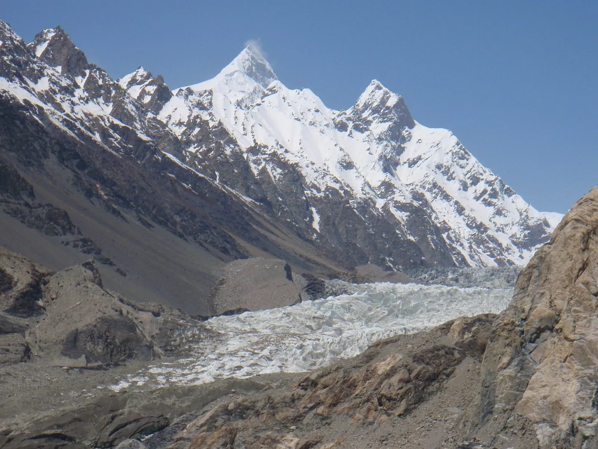
Photo: Raki_Man, with thanks · CC BY 3.0 · via Wikimedia Commons · temporary stand-in photo

Avdegar
- Duration
- 2 days
- Distance
- 13.4 km
- Grade
- Strenuous
- Max altitude
- 3,930 m
- Season
- May – Oct
A short but very steep trek from Passu to a high yak pasture with a bird's-eye view of the Passu, Ghulkin and Batura glaciers. Best done as a night out, with a guide or porter.
Overview
Avdegar is the winter yak pasture of Passu village. It sits at about 3,930 m on the east side of the Hunza River, high above the Karakoram Highway (KKH). The reward is the view west: the Ghulkin, Passu and Batura glaciers lie below you, with Shispare and the Batura peaks above them. The name comes from the tall rock finger on the ridge above the pasture. In Wakhi, videk means "the way" and gar means "stone".
The walk is short on the map, but it climbs about 1,340 m in 6.7 km. Most of the work is in the last 1,300 m above the river flats. Many people do it as a night out. Very fit, acclimatised walkers can do it as an 8 to 10 hour day, but that is a hard day.
Passu as a base
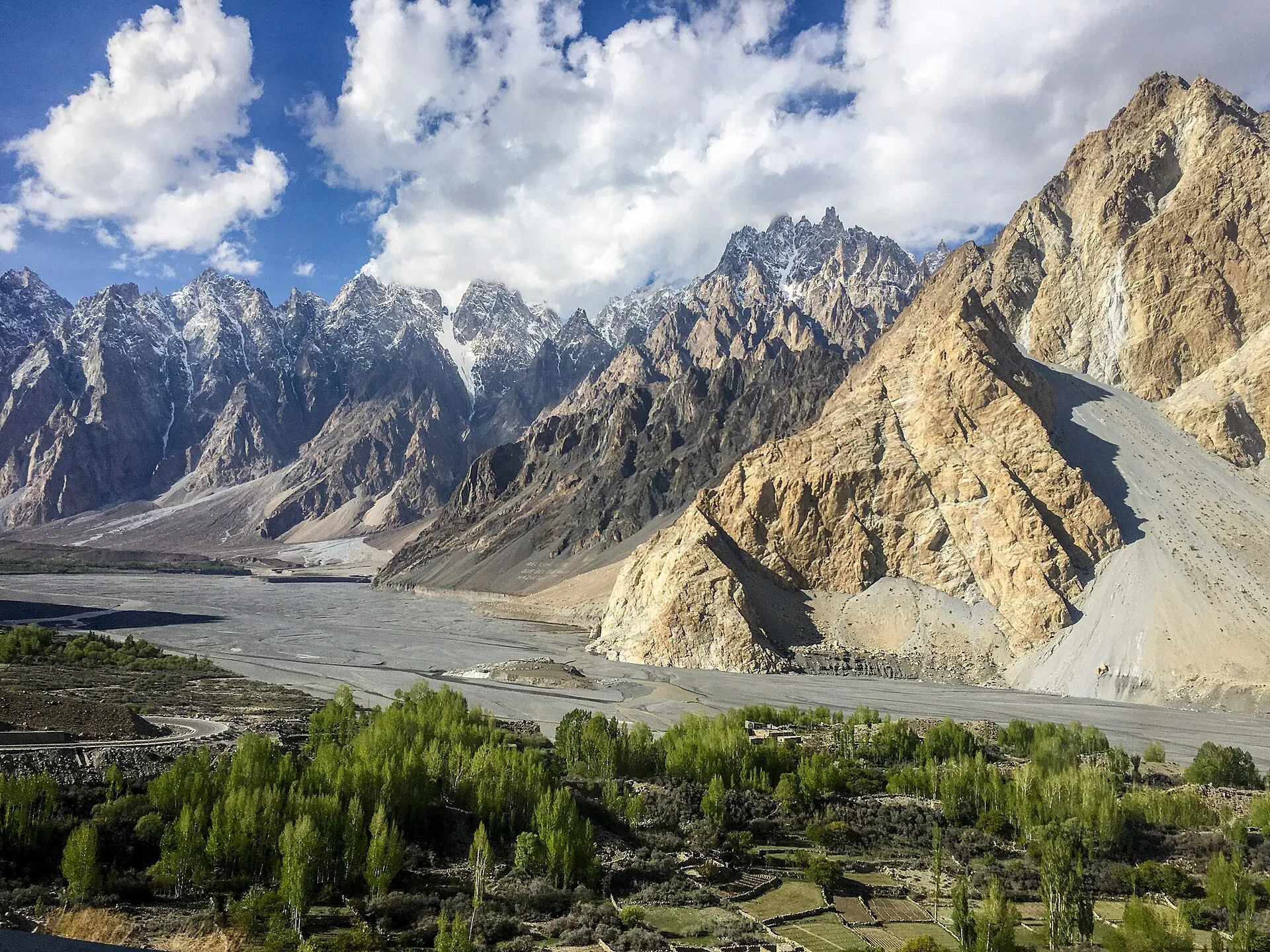
Photo: Mehrunisa Reimoo, with thanks · CC BY-SA 4.0 · via Wikimedia Commons · temporary stand-in photo

Passu sits at a large bend of the Hunza River on the Karakoram Highway, below the jagged Tupopdan, also called the Passu Cones or Passu Cathedral. Wikivoyage describes a small village with guesthouses (most with a restaurant), a fairly well-stocked general store and buses along the highway. It lists no ATM, so bring cash. The cable-and-plank suspension footbridge over the Hunza River, known as the Hussaini bridge, is reached by a path from the first hairpin south of the village and is the same crossing this trek uses. Other short walks from Passu include the viewpoint at Borit Lake, from where a trail climbs beside the Passu Glacier, and the Yunz valley between the Passu and Batura glaciers, marked by cairns. Local guides can be found through Passu guesthouses.
Who it suits
This trek suits fit walkers who are already at height. Passu is at 2,400 m and you should spend a day or two in Upper Hunza first. You need a head for heights, because the Hunza River is crossed on a long, narrow suspension footbridge. The trail has no signs above Kharamabad. A porter or guide from Passu makes the route and the water much easier to find.
It is not a good choice if you are afraid of heights or if the wind is strong. The footbridge sways badly in wind.
When to go
The usual season is May to October. In April, May, September and October the river is low and you can cross the flood plain on the low-water path. From June to August the river is high and you use the higher path along the hillside. Spring and afternoons are often windy, which matters for the bridge. Water above Kharamabad is scarce. In autumn the stream near the pasture can dry up, so carry enough from below.
Terrain underfoot
The route changes character three times. First comes a rocky gully path and the plank suspension bridge. Then a flat stretch across fields and an old irrigation canal at Kharamabad. Then the climb itself: a dry, rocky slope with loose gravel, followed by scattered junipers and a final steep section to the more level pasture. There are no glacier crossings, and the main water is the stream bed at the base of the slope. At the top the ground is open pasture with level places for tents.
The route
From Passu, walk south along the KKH for about 10 minutes, past the Shisper View Hotel, to the first hairpin bend. The trail leaves the road a little beyond the turn-off to Yashbandan village. It crosses a small valley and then dips through rocky gullies towards the Hunza River. Allow 20 to 30 minutes to reach the footbridge, depending on the water level.
The bridge has more than 400 steps on narrow boards. Allow about 10 minutes and go slowly. On the far side, a trail splits. Take the left fork north-east to Kharamabad (2,610 m), a farming area where Passu families grow fodder and graze sheep and goats in winter. It is about 2 km and one hour on the flat.
From the last houses, cross open ground towards an old canal that runs to the base of the Avdegar slope. Follow it to the stream bed at about 2,670 m. Do not use the old trail that starts at the top of the stream bed. A rockfall in 1997 turned it into a steep rock chute. The correct trail starts several hundred metres lower, opposite the end of the canal.
The climb is relentless. It goes up a dry, rocky slope for about an hour (300 to 400 m of height), then through scattered juniper trees at about 3,360 m. Another 1.5 hours of steep walking brings you to the more level pasture of Avdegar (3,930 m), marked by two cairns. There is a small three-sided stone shelter just south of the pasture, and level places for tents.
An optional side trip goes to the notch on the ridge above, up to about 4,100 m. It adds two stages (one up, one down) and is steep and loose in places.
Return by the same route the next day. The descent is hard on the knees. Poles help.
Culture and people
Passu is a Wakhi village. Wakhi families keep livestock and move them between pastures through the year. Avdegar is the winter yak pasture, so you will not see herders here in summer in the way you do on the Batura Glacier trek. Be polite with any shepherds you meet, ask before you photograph people, and do not camp inside a herders' hut or pen. The Hunza River footbridge is a village lifeline as well as a tourist sight. Pass it only one group at a time.
Practical information
Passu has guesthouses and a few small shops, so you can leave extra luggage behind. Bring all your food and a stove for the night out. Carry at least 3 litres of water per person above Kharamabad, unless you have checked the stream. A tent and sleeping bag rated for freezing nights are needed even in summer. Hiring a porter from Passu is sensible and supports the village.
The official sources do not list a permit for this trek. Gilgit-Baltistan rules for foreign trekkers change, so ask your hotel or the Gilgit-Baltistan Tourism Department before you set out.
Highlights
- Bird's-eye view of the Ghulkin, Passu and Batura glaciers
- Shispare and the Batura peaks opposite you
- Crossing the Hunza River on a long suspension footbridge
- A short trek that is easy to reach from the KKH
- Optional ridge scramble to about 4,100 m
Day by day
- StartPassu
- Day 1Avdegar pasture
- Day 2Passu (guesthouse)
| Day | Route | Hours | Distance | Ascent / descent | Camp and altitude |
|---|---|---|---|---|---|
| Day 1 | Passu to Avdegar | 5–7 h | 6.7 km | +1,340 m | Avdegar pasture, 3,930 m |
Day 1 notesWalk south on the KKH to the first hairpin, then follow the trail down to the Hunza River footbridge. Cross it, turn left to Kharamabad (2,610 m) and follow the old canal to the stream bed at about 2,670 m. Take the village trail, not the rock chute, and climb steeply for about an hour to the first junipers (3,360 m). Another 1.5 hours of steep walking reaches the two cairns at Avdegar. Camp near the stone shelter. | |||||
| Day 2 | Avdegar to Passu | 5–7 h | 6.7 km | −1,340 m | Passu (guesthouse), 2,400 m |
Day 2 notesReturn the same way. Take care on the steep upper slope, where loose gravel is common. Cross the footbridge early if it is windy. If you still have energy on day 1, you can climb the ridge above the pasture (about 170 m of extra height) for a wider view. | |||||
Getting there
Passu is on the Karakoram Highway (KKH) about halfway between Karimabad (Hunza) and Sost. Coaches and vans between Gilgit and Sost stop here. Since 2015 the KKH has bypassed Attabad Lake through tunnels, so the road from Gilgit to Passu is open all year, apart from landslides and winter snow. Allow a long half-day from Gilgit. The trailhead is a short walk south of Passu village along the KKH, near the first hairpin bend.
Permits and rules
- Permit needed
- Usually not, Open zone
- Fee
- Current fees will be added soon
- Last checked
- 16 November 2026
The old trek.pk page and the 2002 guidebook list no permit. Gilgit-Baltistan rules for foreign trekkers have changed since then, and fees for trekking and mountaineering were raised in 2024, contested, and reduced again in May 2025 (The News, 25 May 2025). Ask the Gilgit-Baltistan Tourism Department or a licensed operator before you go.
How trekking permits, NOCs and registration work: Visa and permits.
Season
Best: May – Oct
Water and camps
Water is available all year in the stream bed at the base of the slope (about 2,670 m), though you may have to walk a little upstream to find it. Above that, water is scarce. The stream south of the pasture is hard to reach and can be dry in autumn, so carry enough for the night and the morning. Camp on the level ground near the cairns and the three-sided stone shelter. Leave no litter and do not use the shelter if herders have claimed it.
Gear and safety
The route climbs 1,340 m quickly, so acclimatise first and turn back if you get a headache or feel sick. The Hunza River footbridge is long and narrow, and wind can make it dangerous. Do not cross if you are afraid of heights, if it is windy or if you have a heavy pack. Do not use the old trail wiped out by rockfall in 1997. Carry a warm layer, a tent and a stove. There is no mobile signal on the upper slope in most places. Rescue would have to come from Passu or Gulmit on foot.
Variations
Add the ridge top (about 4,100 m) for a wider view. The same footbridge also gives access to Zarabad and the Two Bridges day walk. Linking treks: batura-glacier and patundas start from Passu too.
Tips
- Spend at least a day in Gojal before you start. The climb gains 1,340 m quickly.
- Cross the footbridge early. Wind is common in the afternoon and in spring, and the bridge can become impassable.
- Use the village trail that starts several hundred metres below the old stream-bed route. Do not go up the rock chute.
- Carry water from below. The stream at the pasture can be dry in autumn.
- Hire a Passu porter or guide to find the correct trail and to share the load.
Photos we still need: the Hunza River footbridge, the Kharamabad canal, the climb and the Avdegar pasture (current photos are of glaciers and peaks seen from the area). Send us yours
Health and emergency
Mobile signal is patchy on most treks, so tell someone your plan before you go. Emergency numbers
Sources and last checked
Last checked Confidence medium6 sources6 still to check
- Last checked
- Method
- Desk research from published sources
- Confidence
- medium
- Checked by
- trek.pk research team
Researched from published sources; not yet checked on the ground by our team. Spot something out of date? Report a mistake.
Sources
- Trekking in the Karakoram and Hindukush (Avdegar trek) · Lonely Planet, c. 2002 (facts only) · checked
- Batura Glacier · Wikipedia · checked
- PM inaugurates Pak-China Friendship Tunnels over Attabad Lake · Dawn · checked
- GB winter adventure tourism hit by soaring permit fee, visa delays · Dawn · checked
- Passu (Hussaini bridge, Borit Lake, Yunz valley, village facilities) · Wikivoyage · checked
- GB slashes mountaineering, trekking fees to promote tourism (25 May 2025) · The News · checked
Still to be checked on the ground (6)
- Current condition and safety of the Hunza River footbridge near Passu (Wikivoyage lists a suspension footbridge over the river, undated; no source gives its present condition), and whether the old high-water and low-water paths still exist
- Times, distances and heights come from a c. 2002 guidebook; the glacier trail and Kharamabad route may have changed
- Whether any permit or registration is needed for foreigners (Dawn, 1 Feb 2026, reports a sharp rise in foreigner permit fees in Gilgit-Baltistan and disputes over it; Dawn, 29 Mar 2026, says foreigners need no permit in open zones but does not list this walk; no official page names it)
- Reliability of water at Avdegar and at the base of the slope
- Exact position of the village trail to Avdegar (the old route was cut by rockfall in 1997)
- Whether Passu has an ATM now (Wikivoyage lists none)
Nearby and related

Batura Glacier

Patundas

Passu Glacier and Borith Lake Walk

Shispare
Shispare (7,611 m) is the high peak in the Batura Muztagh seen above Passu and the Passu Glacier. It was first climbed in 1974 by a Polish-German expedition.
Tupopdan (Passu Cones)
Tupopdan (6,106 m) is the highest summit of the Passu Cones, the jagged peaks above Passu village. It is also called Passu Cathedral. It is seen from the Karakoram Highway and on the Avdegar and Patundas walks.