

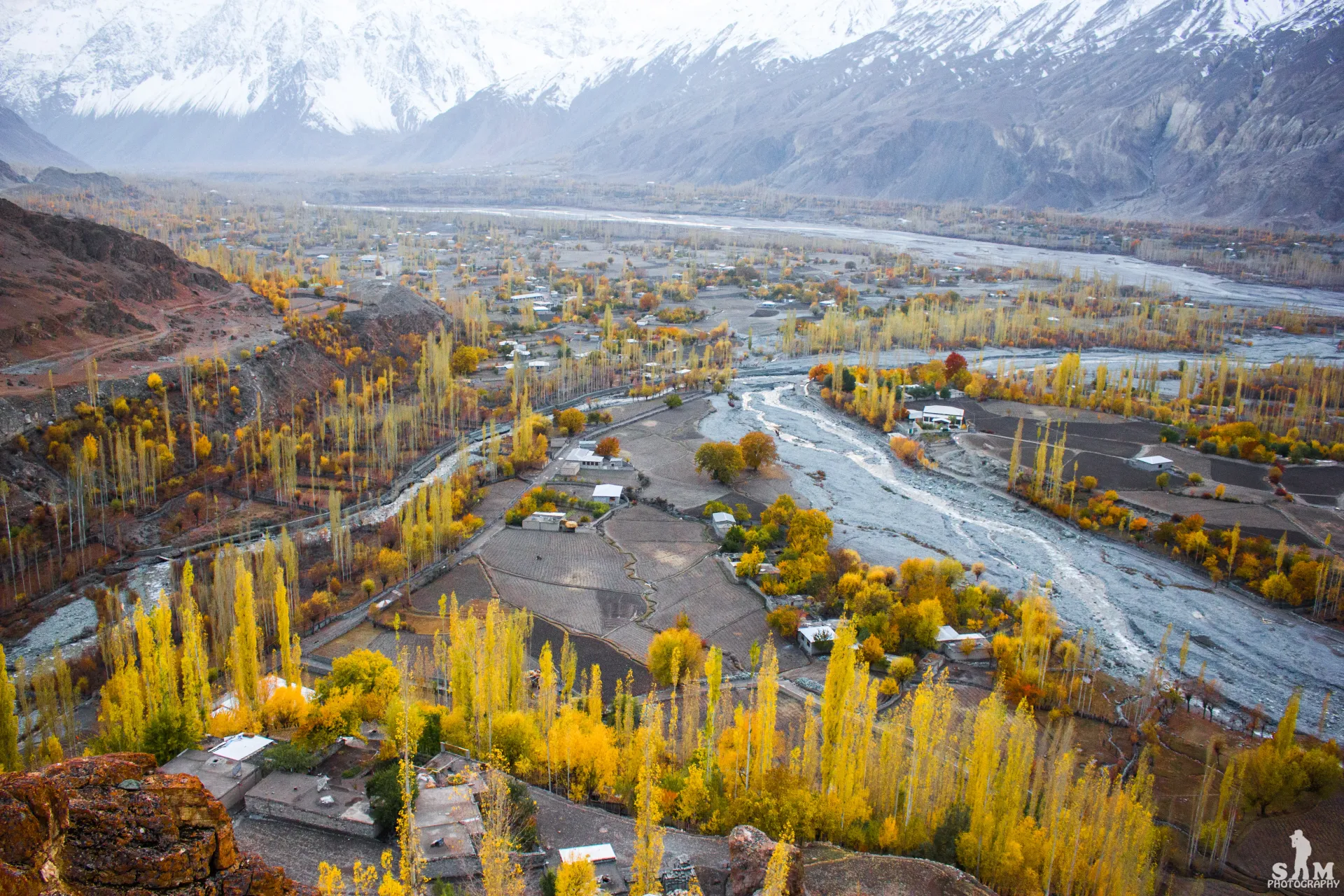
Photo: Samikhan86, with thanks · CC BY-SA 4.0 · via Wikimedia Commons · temporary stand-in photo

Asumbar Haghost
- Duration
- 4 days
- Distance
- 44.7 km
- Grade
- Moderate
- Max altitude
- 4,560 m
- Season
- Jul – Sep
A four-day, non-glaciated Hindu Raj crossing from Asumbar (Ishkoman) to Dal Sandhi (Yasin) over a gentle grassy pass of about 4,500 m. One of the easiest high passes in the region.
Overview
Asumbar Haghost is a grassy, non-glaciated pass at about 4,560 m. It links Asumbar village in the Ishkoman valley with Dal Sandhi in the Yasin valley, both in Ghizer district. You cross it in four days.
Many people call it one of the easiest passes in the Karakoram and Hindu Kush. There is no ice, no scrambling and no river crossing that matters. The trail is clear, and the climb comes in steady steps. You also walk through country where people speak Shina, Khowar, Wakhi and Burushaski, which makes it one of the most mixed language zones on any Pakistani trek.
Wikipedia calls it the most used tourist route between the Yasin and Ishkoman valleys. Yasin itself lies about 148 km from Gilgit in a straight line, and its other passes include the Darkot (4,570 m) and the Thoi (4,499 m).
The pass has other names. Darkot villagers and some maps call it Ishkoman Haghost or Iskhoman Pass. The Punji Pass nearby is sometimes given the same name, so check which one a guide means.
Who it suits
Fit walkers who are new to high passes will manage it. The longest day is Day 4 (about 18 km, all downhill). Camps rise to about 4,000 m, so you need to take the altitude seriously even though the walking is gentle. Most people combine it with another crossing: the Pakora Pass often comes before it, and the Punji Pass or Thui An often follows.
When to go
The usual season is mid-July to mid-September. Snow lies on the pass until about the end of June. Operators describe July and August as best for flowers and grazing, when herders are in the high huts. The lower Asumbar valley is hot and dry in summer.
The route
Day 1: Asumbar to Lower Charinj. From Asumbar (2,910 m) you follow the stream's southern bank, crossing four footbridges in all. Springs along the way give the only clear water until camp. You pass the dark rock mound of Shah Dheri, then open meadows at Golomir and Tokun Kuch. Camp in the pine woods of Lower Charinj (3,180 m).
Day 2: Lower Charinj to Upper Borta Bort. You pass Upper Charinj and leave the trees behind. At Wakhikandeh a few Wakhi families live all year. A side valley here leads south to the Asumbar An (about 4,800 m, a harder pass). Climb on to the boulder-strewn pasture of Borta Bort and camp in flower meadows at about 3,990 m, with views to Rakaposhi.
Day 3: Upper Borta Bort to Mayur. Cross the Jinali grassland, then climb grass for about an hour to the flat, flowery pass (4,560 m). Rakaposhi and Diran lie to the east and the Hindu Kush ranges to the west. Descend by a willow-lined stream to the herders' huts at Ji Shawaran, then to a pond and on to Mayur (3,630 m), where springs are plentiful.
Day 4: Mayur to Dal Sandhi. The path follows the river's banks past Gamas and Haghost An, a large irrigated terrace. It then descends to Dal Sandhi (2,700 m), where you can camp in a village orchard.
Terrain underfoot
Day 1 follows the Asumbar stream along its southern bank on a clear trail, crossing four footbridges, with chir pine woods at Lower Charinj. On day 2 you climb through juniper and birch to the tree line, then up a rocky hillside into the boulder-strewn Borta Bort pasture, crossing a silty stream. Day 3 is grass all the way: the Jinali grassland, then about an hour of grass slope to a flat, flowery crest. The west side drops beside a willow-lined stream, over a low rise past a pond to Mayur. Day 4 follows the river past the irrigated terraces of Gamas and Haghost An, then a steep drop to willows and a broad valley down to Dal Sandhi.
Culture and people
Gujar herders live in conical huts in the lower valley in summer. Wakhi families at Wakhikandeh and Borta Bort wear tall pillbox hats. Burusho farmers from Sandhi cultivate land at Gamas and Haghost An. Be careful of herding dogs near huts, especially on Day 2.
Preparing for the trek
The walking is gentle but the altitude is real: the camps are at 3,180 m, 3,990 m and 3,630 m, and the pass is about 4,500 m. Spend a few days above 3,000 m first if you can. Carry water on day 1, because the lower valley is dry and hot, and a stove, because there is little fuel wood above the trees. Plan for cold nights near 4,000 m even in summer. Four stages suit people and donkeys better than three.
Practical information
You do not need a guide, as the route is obvious, though one helps you find the right trails at the start. Porters here use donkeys (about 50 kg per animal). Hire in Asumbar or Pakora if you will also cross the Punji Pass, so that porters can walk home from the Iskhoman side. Four stages are right; three is too much for people and donkeys. The AMS Baltit (NJ 43-14) and Mastuj (NJ 43-13) maps cover it, though they label few settlements east of the pass.
Pass heights differ by source. The older guidebook gives 4,560 m; tour operators list roughly 4,400 to 4,500 m. Treat the pass as about 4,500 m and trust your altimeter.
Highlights
- Grassy pass with views of Rakaposhi and Diran
- Four languages along one trail
- Pine woods, springs and flower meadows
- Easy option for a first high pass
- Links to Punji Pass and Thui An
Day by day
| Day | Camp | Altitude |
|---|---|---|
| 1 | Lower Charinj | 3,180 m |
| 2 | Upper Borta Bort | 3,990 m |
| 3 | Mayur | 3,630 m |
| 4 | Dal Sandhi | 2,700 m |
| Day | Route | Hours | Distance | Ascent / descent | Camp and altitude |
|---|---|---|---|---|---|
| Day 1 | Asumbar to Lower Charinj | 4–6 h | 8.4 km | +270 m | Lower Charinj, 3,180 m |
Day 1 notesClimb gently along the Asumbar stream from the village (2,910 m). You cross four footbridges and pass the dark mound of Shah Dheri. Springs near the third bridge give the only clear water of the day. Tokun Kuch is a pleasant spot for a break. Camp in the chir pine woods of Charinj, where grassy terraces and clear streams make an easy camp. Gujar huts here are usually empty in midsummer. | |||||
| Day 2 | Lower Charinj to Upper Borta Bort | 3.75–4 h | 8 km | +810 m | Upper Borta Bort, 3,990 m |
Day 2 notesGo past Upper Charinj and through juniper and birch to the tree line. Wakhikandeh has three Wakhi households living there all year. A side valley leads south to the harder Asumbar An. Continue up a rocky hillside into the Borta Bort pasture. Cross a grassy knoll (dogs near the huts) and a silty stream. Camp in meadows below big boulders, with views east to Rakaposhi. | |||||
| Day 3 | Upper Borta Bort to Mayur over Asumbar Haghost | 5.5 h | 10.6 km | +570 m / −930 m | Mayur, 3,630 m |
Day 3 notesCross the Jinali grassland and follow the north fork to the foot of the pass hill. Climb grass for about an hour to the flat, flowery crest at about 4,560 m. Descend by a clear stream to the huts at Ji Shawaran, then cross a low rise to a green pond (a possible camp). Mayur is 45 minutes farther, among junipers and springs. Mayur also lies on the Darmodar Haghost route. | |||||
| Day 4 | Mayur to Dal Sandhi | 5.5–6 h | 17.7 km | −930 m | Dal Sandhi, 2,700 m |
Day 4 notesThe main trail follows the Asumbar river past Gamas, a large irrigated area, then crosses to the right bank. Haghost An, a high terrace, comes after about 30 minutes. At its west end, drop steeply to willows and follow a good trail down a broad valley. Dal Sandhi is about 2.5 hours beyond. You can camp in a village orchard. This is a long day on tired legs, but it is all downhill. | |||||
Getting there
To Asumbar: Jeeps run from Gilgit's Punial Road to Asumbar. You can also take the NATCO bus from Gilgit to Chatorkhand (about 5.5 hours, 11 am in the old guidebook) and then walk or find a jeep. If you do the Pakora Pass first, walk about 3.4 km (one hour) along the road from Pakora to Asumbar.
From Dal Sandhi: Jeeps and special hires run to Gilgit, but not often. Otherwise walk 4 km south to Taus and take the daily NATCO bus to Gilgit. To go on to Darkot, walk 7 km north to Barkulti and look for a jeep there. Check bus times in Gilgit, as the guidebook times are about 20 years old.
Permits and rules
- Permit needed
- Usually not, Open zone
- Fee
- Current fees will be added soon
- Last checked
- 16 November 2026
This route is in Gilgit-Baltistan's open zone. Foreign visitors do not need a trekking permit for open-zone treks, according to operators and GB tourism sources (checked 16 November 2026). Trekking and mountaineering fee rules in GB were disputed in 2025: the Chief Court suspended a fee rise on 28 February 2025 and permits were held up while the case continued (Dawn, 29 April 2025). In May 2025 the GB Tourism Department notified a reduced fee schedule (The News, 25 May 2025); no official 2026 schedule was found. Ask the Gilgit-Baltistan Tourism Department or a registered operator for today's rules before you book.
How trekking permits, NOCs and registration work: Visa and permits.
Season
Best: Jul – Sep
Water and camps
Water is good almost everywhere, but the lower valley is dry and hot, so carry water on Day 1. Springs along the trail give the only clear water before Charinj. Silty glacier streams carry most of the flow higher up, so camp near clear spring-fed side streams.
Camps are open and grassy: Lower Charinj (pines, many terraces), Upper Borta Bort (3,990 m, flower meadows, cold), Mayur (3,630 m, junipers) and Dal Sandhi (village orchard). The pond below the pass is an alternative if you start late. Porters often prefer the huts near Borta Bort to the higher camp. Carry a stove, as there is little fuel wood above the trees.
Gear and safety
Plan for cold nights near 4,000 m even in summer. Your biggest risk is altitude: sleep high only if you have already spent a few days above 3,000 m. Snow patches lie near the pass on the western side, and the pass can hold snow into early July. There are no glaciers to cross. Rescue is hard in the upper valleys: carry a first-aid kit and a satellite messenger, and tell your hotel in Gilgit your plan. Keep clear of herding dogs. The map shows few place names east of the pass, so a guide can save you time.
Variations
Asumbar Haghost is often combined with other treks. The Pakora Pass trek usually comes first. You can then follow with the Punji Pass trek (from Darkot) or Thui An (from Nialthi), depending on whether you return to Gilgit or head for Chitral. The Darmodar Haghost (4,495 m) also meets this route at Mayur; see Other treks in Ghizar.
Tips
- Carry water on Day 1; the lower valley is hot and dry.
- Camp at Upper Borta Bort for the best views, but expect cold nights at about 4,000 m.
- Watch for dogs near the herders' huts.
- Use four stages; three days is too hard on porters and donkeys.
- Pay donkey drivers by the animal and bargain if you carry under 50 kg.
Photos we still need: Asumbar Haghost crest and the Borta Bort meadows. Send us yours
Health and emergency
Mobile signal is patchy on most treks, so tell someone your plan before you go. Emergency numbers
Sources and last checked
Last checked Confidence medium7 sources5 still to check
- Last checked
- Method
- Desk research from published sources
- Confidence
- medium
- Checked by
- trek.pk research team
Researched from published sources; not yet checked on the ground by our team. Spot something out of date? Report a mistake.
Sources
- Asumbar Haghost (legacy trek.pk page from Lonely Planet text) · trek.pk / Lonely Planet · checked
- Asumbar and Punji Pass trek · Hunza Guides Pakistan · checked
- Search results: Asumber Pass height 4,400-4,500 m; season mid-July to mid-September · Tour operator and blog pages · checked
- Yasin Valley · Wikipedia · checked
- GB tourism stakeholders trade blame as permit fees remain undecided · Dawn · checked
- GB winter adventure tourism hit by soaring permit fee, visa delays (1 February 2026) · Dawn · checked
- GB slashes mountaineering, trekking fees to promote tourism (25 May 2025) · The News · checked
Still to be checked on the ground (5)
- Pass height: guidebook 4,560 m, operators about 4,400-4,500 m (a Hunza operator's itinerary gives 4,400 m); no survey or official figure found
- Current jeep and bus times and fares from Gilgit
- Current permit and fee rules for open-zone treks in Gilgit-Baltistan (Dawn, 1 February 2026, reports permit fees and visa delays still disputed, but does not state the open-zone rule)
- Day distances come from a 2002 guidebook; none re-measured (a Hunza operator gives Day 4 as 17.7 km and 7 to 8 hours, close to the 18 km on this page)
- Whether the Asumbar-Pakora road and footbridges have changed
Nearby and related

Punji Pass

Thui An

Other treks in Ghizar
Asumbar Haghost
A gentle, grassy, non-glaciated pass of about 4,500 to 4,560 m between Asumbar in Ishkoman and Dal Sandhi in Yasin. One of the easiest high passes in the region.
Punji Pass
A Hindu Raj pass of about 4,680 m between Darkot in Yasin and Ghotulti in Ishkoman, with a small glacier. Four-day trek; also called Iskhoman Haghost.
Shahchoi An
A pass of about 4,500 m, a variation start for the Darmodar Haghost route from Maiun to Dal Sandhi in Yasin, Ghizer. Very little information is available.
Darmodar Haghost
A pass of 4,495 m between Jundoli on the Gilgit River and Mayur in Yasin, crossed on day two of a four-day moderate trek in Ghizer.

Pakora Pass
A glaciated but non-technical pass of 4,710 m linking Upper Naltar with Pakora in Ishkoman, Ghizer. Five days; moderate, and a good first Karakoram pass.