

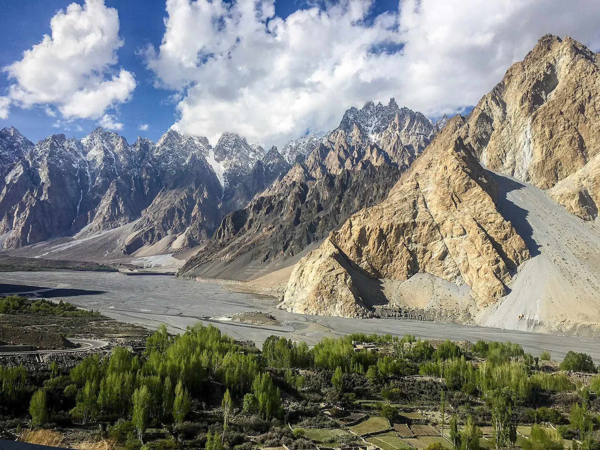
Photo: Mehrunisa Reimoo, with thanks · CC BY-SA 4.0 · via Wikimedia Commons · temporary stand-in photo
Lupgar Sar Base Camp
- Duration
- 3 days
- Distance
- 29 km
- Grade
- Strenuous
- Max altitude
- 4,900 m
- Season
- Jun – Sep
A steep, three-day out-and-back from the Shimshal road to the high pastures of Lupgar and the base camp of Lupgar Sar (about 7,200 m). Short on distance, hard on legs and nerves, with exposed ledges.
Overview
Lupgar means "big rock". The name belongs to a high, sunny ridge of pasture above the Lupgar Glacier, in the Shimshal valley south of Passu. The glacier flows from Lupgar Sar, a 7,000 m peak with a triple summit. Its meltwater joins the Shimshal River at Dut. The pastures are among the oldest used by Shimshal people. This is the quickest way to reach Shimshal's alpine world, and it begins only a short drive from the Karakoram Highway (KKH).
The trek is rarely done. The trail is faint in places, with two rock ribs that need hands, and several exposed ledges above steep erosion gullies. Most walkers find the first day the hardest part, with a 1,250 m climb in about 9 km.
The mountain
Lupghar Sar is a 7,200 m peak in the Hispar Muztagh, part of the Momhil Sar cluster, and ranks 108th in the world. It has three summits. The first ascent of Lupghar Sar West was made in 1979 by Hans and Sepp Gloggner. In July 2018 the Austrian alpinist Hansjörg Auer climbed the West Face solo, in alpine style, and the climb later won a Piolet d'Or. The trek does not go onto the mountain. It stops at the pastures and the ridge crest, where the three summits are in view.
Who it suits
This trek suits fit, experienced walkers who are comfortable with exposure and steep, loose ground. It is not for anyone who dislikes heights. You will sleep high. The suggested plan climbs from about 3,850 m to a base camp at 4,900 m in a single day, so allow extra time at Bospuraghil to acclimatise, or camp at Suraghil instead and go up to base camp as a day trip.
A Shimshal guide or porter is a sensible choice. The trail is easy to lose, and the herders know the route and the water.
When to go
The usual season is June to September. Herding families from Shimshal move to Bospuraghil on 1 June and stay until about 1 August. After that they move higher, to Suraghil, and stay until early October. Higher camps are snow-covered in early June. Afternoon storms are common in July and August. Water is plentiful on the lower slopes but very scarce at the ridge top.
Getting to Dut
The Shimshal road leaves the KKH next to the Passu Cones. It is 56 km long to Shimshal village, and the community built it between 1985 and 2003. One travel guide describes a gorge section cut into the cliff above the river, a wooden bridge over the Shimshal River that flexes under vehicles, an exposed cliff stretch that it calls the most dangerous part, a high plateau, a small hydroelectric station and a sandy final stretch into the valley. A police checkpoint at the valley entrance asks for passport and visa details from foreign visitors. Shared jeeps run from Aliabad bazaar around midday and call at places up to Passu, and the same guide says the journey to Shimshal village takes 5 to 7 hours. Dut lies before the village, so the trip to the trailhead is shorter than that, but no recent time was found.
The route
The road to Dut leaves the KKH at Passu and follows the Shimshal valley. Dut (2,600 m) is a small flat area where the Lupgar and Momhil rivers meet. The trail begins before the road bridge over the Momhil River, on the true right (south-east) bank of the Lupgar River.
The first day climbs steadily on a thin trail. It passes above a large erosion scar, crosses a low-angle rock slab and a rib, and traverses a broad black scree slope. A second rib needs hands and has real exposure. Beyond it, you reach gentler slopes of artemisia and then Targeen, an open area with tamarisk and a few stone shelters (about 3,300 m). Another 15 minutes brings you to Yazmis, near the black snout of the Lupgar Glacier, where clear water comes from the scree.
From the snout, follow the east side of the glacier on moraine. After 30 to 45 minutes you reach a cairn. Turn east and climb a steep gully for 15 minutes onto smooth slopes covered with artemisia and a few junipers. Lupgar Sar's three summits fill the view to the south, with Dut Sar to the east. Walk south, parallel to the glacier, to the herders' huts at Bospuraghil (3,856 m), which means "golden eagle pasture". This is the usual first camp.
On day 2 the herders' trail continues to Suraghil ("cold pasture"), the highest settlement, in 1.5 to 2 hours. Base camp is another one to 1.5 hours above, at about 4,900 m on the grassy ridge crest. The views of Lupgar Sar, Mulungutti Sar and Destaghil Sar are very wide. If you feel the height, sleep at Suraghil and go up for the day.
The return follows the same route. The descent of 2,320 m from base camp to Dut takes 6 to 7 hours and is as hard as the climb, because of the loose slopes and exposed sections.
Culture and people
Shimshal is a Wakhi village at the end of the valley, at about 3,100 m. Its people are Ismaili Muslims, and the valley is known as a valley of mountaineers because so many villagers have worked as climbers and porters. Many families move livestock to the high summer pastures. About six Shimshal families live at Lupgar in summer. Their huts and pens are private, so camp away from them and ask before you take photographs. Livestock are central to life here. Respect the herders' pastures, and do not leave rubbish. Buy milk or yogurt only if it is offered.
Practical information
There is no public transport past Dut. Hire a jeep in Passu or in Shimshal, and ask about the state of the road before you go. The Shimshal road runs along a gorge and is often blocked by rockfall, so allow some spare time. Water is clear at Dut, in a small pool in the sand on the Lupgar river bank, and at Yazmis.
Bring all your food. There are no shops. The route is within or next to the Khunjerab National Park area, so check whether park or waste-management fees apply. The old trek.pk page lists the area as open with no permit. Rules for foreign trekkers in Gilgit-Baltistan have been changed since the guidebook was written, so confirm with your operator or the Gilgit-Baltistan Tourism Department.
Highlights
- Close views of Lupgar Sar's triple summit
- High pastures that are among the oldest used by Shimshal families
- Wide views of Mulungutti Sar, Destaghil Sar and Qarun Koh
- A true mountain trek reached in a short drive from the KKH
- Golden eagles and ibex are seen on the slopes
Day by day
| Day | Camp | Altitude |
|---|---|---|
| 1 | Bospuraghil | 3,856 m |
| 2 | Base camp, on the ridge crest | 4,900 m |
| 3 | Dut | 2,600 m |
| Day | Route | Hours | Distance | Ascent / descent | Camp and altitude |
|---|---|---|---|---|---|
| Day 1 | Dut to Bospuraghil | 4–5 h | 9 km | +1,250 m | Bospuraghil, 3,856 m |
Day 1 notesClimb on a thin trail above the Lupgar River, past an erosion scar and two rock ribs. The second rib is steep and exposed. Pass Targeen and Yazmis near the glacier snout, follow the moraine to a cairn, then turn east and climb a steep gully onto grassy slopes. Walk south to the herders' huts at Bospuraghil. | |||||
| Day 2 | Bospuraghil to Lupgar Sar Base Camp | 2.5–3 h | 5.5 km | +1,044 m | Base camp, on the ridge crest, 4,900 m |
Day 2 notesFollow the herders' trail to Suraghil in 1.5 to 2 hours, then another 1 to 1.5 hours to base camp on the ridge crest. The view takes in Lupgar Sar, Mulungutti Sar and Destaghil Sar. If you feel altitude, sleep at Suraghil and walk up as a day trip, then come back down. | |||||
| Day 3 | Base camp to Dut | 6–7 h | 14.5 km | −2,320 m | Dut, 2,600 m |
Day 3 notesRetrace your steps. The long descent is hard on knees and the exposed ledges need care, especially if the trail is wet. Collect water at Yazmis and at Dut. | |||||
Getting there
From Passu on the KKH, take the Shimshal road to Dut, about one hour by jeep (this time is from the guidebook and may differ). Dut (2,600 m) is a small flat area between the Lupgar and Momhil rivers. The road goes on another 1 km to a flat area, and the trailhead is visible just before the bridge over the Momhil River. Passu is a long half-day from Gilgit on the KKH. Since 2015 the KKH has bypassed Attabad Lake through tunnels, so the road is open, apart from landslides and winter snow. Dawn reported on 13 November 2026 that the Shimshal road was closed to all traffic after a landslide at Wain Bain; check with the district administration or police (helpline 15) before you travel.
Permits and rules
- Permit needed
- Usually not, Open zone
- Fee
- Current fees will be added soon
- Last checked
- 16 November 2026
The old trek.pk page lists no permit. Foreign-trekker rules and fees in Gilgit-Baltistan changed in 2024 and were later contested, and no official current list was found. The Shimshal valley lies near the Khunjerab National Park. Check with the Gilgit-Baltistan Tourism Department or a licensed operator before you go.
How trekking permits, NOCs and registration work: Visa and permits.
Season
Best: Jun – Sep
Water and camps
Clear water is at Dut (a pool in the sand along the Lupgar River), at Yazmis (pools from the scree) and at the herders' camps. The ridge above Suraghil is dry, so carry water. Camp near Bospuraghil or Suraghil, away from the huts and pens. At base camp, snow or ice patches may be the only water source. Treat all water.
Gear and safety
This is steep terrain with loose rock, two rock ribs (class 1 and 2) and exposed ledges above erosion gullies. Do not use the route in rain, wind or snow. Climb high and sleep low where you can, and descend if you get a persistent headache. Carry a warm layer and a tent that handles wind. There is no mobile coverage. The nearest help is in Shimshal or at Passu, and rescue needs a long jeep drive and a long carry.
Variations
Other treks in the area include mai-dur-pass, which begins in Shimshal village, and boibar, whose Qarun Pass side trip looks down on the Lupgar meadows.
Tips
- Spend a night at Bospuraghil or Suraghil before going to base camp at 4,900 m.
- Take a Shimshal guide. The trail is faint and exposed in places.
- Do not use the exposed sections in rain or strong wind.
- Fill up with clear water at Dut and at Yazmis. The ridge is dry.
- Ask about the state of the Shimshal road before you book a jeep.
Photos we still need: the Lupgar trail (rock ribs, Yazmis, Bospuraghil huts) and the ridge-crest base camp (no open-licence photo found). Send us yours
Health and emergency
Mobile signal is patchy on most treks, so tell someone your plan before you go. Emergency numbers
Sources and last checked
Last checked Confidence low7 sources7 still to check
- Last checked
- Method
- Desk research from published sources
- Confidence
- low
- Checked by
- trek.pk research team
Researched from published sources; not yet checked on the ground by our team. Spot something out of date? Report a mistake.
Sources
- Trekking in the Karakoram and Hindukush (Lupgar Sar Base Camp trek) · Lonely Planet, c. 2002 (facts only) · checked
- Khunjerab National Park · Wikipedia · checked
- GB winter adventure tourism hit by soaring permit fee, visa delays · Dawn · checked
- Lupghar Sar · Wikipedia · checked
- Rain, snowfall disrupt life across GB · Dawn · checked
- Lupghar Sar Base Camp Trek · Apricot Tours · checked
- Shimshal Valley Travel Guide · Into the Wild Unknown · checked
Still to be checked on the ground (7)
- Current state of the trail, especially the two rock ribs and the exposed erosion gullies
- Distances, times and heights are repeated by one operator page but look copied from the c. 2002 guidebook; no independent trip report found
- Acclimatisation plan for the 4,900 m night, and whether herders still use Suraghil in the same months
- Jeep transport Passu to Dut and its cost (the Shimshal road was closed on 13 Nov 2026; reopening not confirmed; no official fares)
- Whether park fees or a permit apply for foreigners on this route (operator pages quote fees; no official source)
- Travel time Passu to Dut: 1 hour in the c. 2002 guide; the whole road to Shimshal village is described as 5 to 7 hours by shared jeep in one travel guide
- Where the police checkpoint stands and what it checks (one travel guide says passport and visa)


