

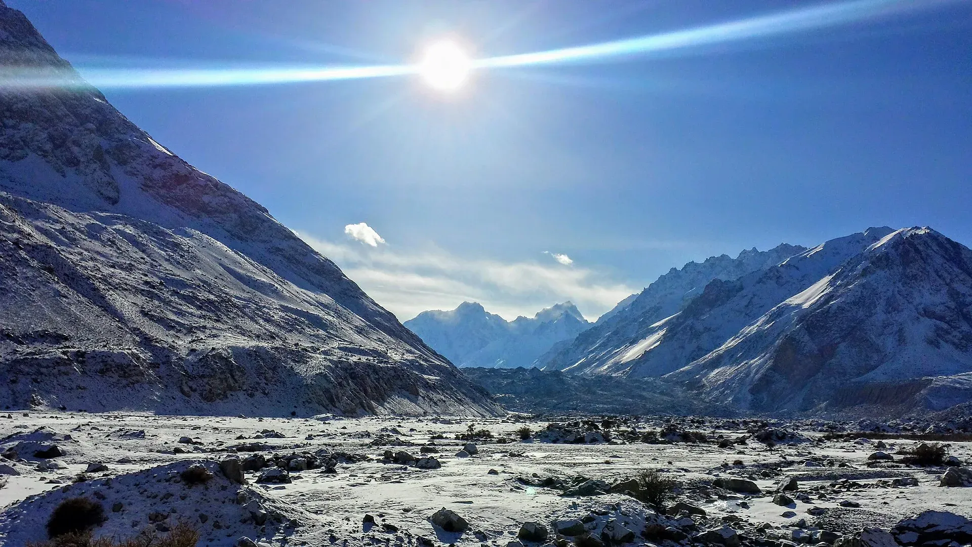
Photo: Azeez Saddiquee, with thanks · CC BY-SA 4.0 · via Wikimedia Commons · temporary stand-in photo

Chilinji An and Qalander Uween
- Duration
- 6–8 days
- Distance
- 57 km
- Grade
- Technical
- Max altitude
- 5,220 m
- Season
- Jun – Sep
A hard six-day glacier crossing between Chapursan and the Karambar valley, near the Afghan border. Two passes share the name, at 5,160 m and 5,220 m. Roped travel, guide and permit are required.
Overview
Chilinji An links the Chapursan valley with the Karambar valley, near Pakistan's northern border with Afghanistan's Wakhan Corridor. It is a hard, glaciated crossing. The east side of the pass is ice and snow. The west side is a long, steep drop on loose scree.
The name covers two passes. The true Chilinji An (5,160 m) is the one early explorers used, including Aurel Stein, Tilman and Thesiger. Just north of it is Qalander Uween (5,220 m), the name Chapursan people use for the other crossing. Many trekkers going west to east take Qalander Uween and think it is the Chilinji An. Check with your guide which one you are crossing.
Who it suits
This is a mountaineer's trek, not a walking holiday. You travel roped on a crevassed glacier, you camp above 4,600 m, and you finish with a 1,500 m scree descent. You need experience on snow and ice, a rope, an ice axe and crampons, and a guide who knows the route. Do not attempt it without a few days at altitude first. The old guidebook advises that only acclimatised trekkers cross east to west.
When to go
Mid-June to September. Snow and ice make the pass unsafe outside this window. Late in the season water becomes scarce on the glacier approach. Baba Ghundi's annual pilgrimage falls in late September and early October, and the shrine area is busy then.
The route
From Baba Ghundi Ziarat (3,660 m) you follow the Chapursan river past the old juniper grove at Yarz Yarz, then climb the cliffs above the Kuz Glacier to Biatar (4,020 m). Biatar has good springs and grass. The next day you cross the lateral moraine and the Biatar Glacier to the ablation valley, and camp at Chilinji An Base Camp (4,620 m). Rockfall is a danger here.
Pass day is long. You walk the moraine, rope up on the snow-covered glacier, and zigzag between crevasses to the cairn at 5,160 m. You then drop on scree to a small camp at 4,560 m, and continue down very steep, loose scree, about 1,000 m in an hour, into birch and willow forest. Jungle Camp (3,600 m) sits beside a clear stream in this sheltered valley.
From Jungle Camp the route reaches the Gujar settlement of Chilinji beside the Karambar River, then follows the Karambar valley down through Maturamdan to Bort, where the road starts.
Going the other way over Qalander Uween takes the Karambar valley up from Bort for three days, then climbs from Jungle Camp to a high camp at 4,710 m. The pass is a scree slope of about 50 degrees, followed by a roped descent of the snowfield and a steep drop beside a large icefall into the Biatar valley.
Chapursan villages on the way in
Chapursan is a high valley, above 3,000 m, with about eight scattered villages in Gojal. Wikipedia lists Yarzerech, Raminj, Kirmin, Khill, Rashet, Sheresubz, Ispenj, Shetmerg and Zood Khun, and then the pastures and settlements of Yashkuk, Kukchaizem, Korkot, Kimkut and Baba Ghundi. Wakhi is the main language. Raminj, which people also reach by the Werthum Pass trek, is a Burusho village. Zood Khun is where many vehicles stop.
Terrain in order
Chapursan river trail and juniper at Yarz Yarz, a fan of boulders and a red cliff, a stream crossing near the Kuz Glacier, grassy ground at Biatar, moraine and a glacier crossing, a snow-covered glacier with crevasses, very steep loose scree, then forest and a river valley. Ropes, crampons and an ice axe matter on day 4. Poles help on the scree.
Preparation
Spend a night or two at Baba Ghundi first. Camp heights climb from 3,800 m to 4,620 m in three days, and the pass is above 5,100 m. Have your guide confirm which pass you will cross and the state of the snow in your season.
Culture and people
Chapursan is a Wakhi valley. Baba Ghundi Ziarat is the most important shrine in Hunza. The saint is said to have come from Ghund, in today's Tajikistan. His tomb, built in 1924 by Mir Ghazan Khan, stands on a wide meadow where Wakhi and Kyrgyz herders from the Wakhan trade livestock for flour, tea and salt. People come on Thursdays to pray on Friday, and the main pilgrimage is in late September to early October. Local legend explains the boulder-covered lower valley as a flood sent by the saint to punish the villagers. Be respectful at shrines. Spend one or two nights at Baba Ghundi before you start, which helps with acclimatisation too.
Practical information
Take your passport, because Chapursan lies beyond the Afiyatabad check post. Carry several photocopies of your permit for the army post at Baba Ghundi and the police posts. The Swiss 1:250,000 Karakoram map is the only map, and it is inaccurate here. The Chilinji An is shown at the wrong coordinates, and Biatar is on the wrong bank. Qalander Uween is not shown at all. Use a local guide who knows the route; hire Chapursan porters going east to west.
At the Karambar end, the road reaches Bort, but high water in summer can block it at Bilhanz, about four hours' walk away. Allow time for this.
Highlights
- Cross a glaciated pass between Chapursan and Karambar
- Camp at Biatar, Chilinji An Base Camp and the birch forest of Jungle Camp
- Visit Baba Ghundi Ziarat, Hunza's most important shrine
- Follow the Karambar valley down to Bort
Day by day
| Day | Camp | Altitude |
|---|---|---|
| 1 | Yarz Yarz | 3,800 m |
| 2 | Biatar | 4,020 m |
| 3 | Chilinji An Base Camp | 4,620 m |
| 4 | Jungle Camp | 3,600 m |
| 5 | Maturamdan | not given |
| 6 | Bort | not given |
| Day | Route | Hours | Distance | Ascent / descent | Camp and altitude |
|---|---|---|---|---|---|
| Day 1 | Baba Ghundi Ziarat to Yarz Yarz | 2 h | 5.4 km | +140 m | Yarz Yarz, 3,800 m |
Day 1 notesCross the footbridge at Baba Ghundi (3,660 m) and follow a good trail along the Chapursan river. After about an hour you reach the Sekr Zherav stream. A further hour takes you to Yarz Yarz, a juniper stand that has been cut for firewood. There are small huts and room for a few tents beside a clear stream. This is a short day on purpose, to help you acclimatise. | |||||
| Day 2 | Yarz Yarz to Biatar | 3 h | 7 km | +220 m | Biatar, 4,020 m |
Day 2 notesWalk across the alluvial fan to the red cliff of Besk Rui and climb the trail above it. You reach the livestock pens at Jamal Ilga (3,810 m). A stream may block the path where a bridge has washed away. Cross the lateral moraine of the Kuz Glacier to avoid the deep fast water, then follow the stream to Biatar (4,020 m), which has big clear springs and grassy camps among boulders. | |||||
| Day 3 | Biatar to Chilinji An Base Camp | 3½–4 h | 4.6 km | +600 m | Chilinji An Base Camp, 4,620 m |
Day 3 notesClimb the rocky pasture above Biatar and follow a faint path onto the moraine of the Biatar Glacier. Cross the glacier and its stream, then climb the narrowing ablation valley, where yaks graze, to the base camp. There are four tent platforms and five rock circles. Water comes from a snowbank and gets scarce late in the season. Watch for rockfall. | |||||
| Day 4 | Base Camp over Chilinji An to Jungle Camp | 5–6 h | 7 km | +540 m / −1,560 m | Jungle Camp, 3,600 m |
Day 4 notesThe big day. Follow the moraine and rope up where the slope steepens to about 30 degrees, zigzagging between crevasses to the cairn on Chilinji An (5,160 m). Then take the scree west and north to a small ridge and down to a camp spot at 4,560 m. The final 1,000 m of scree is steep and loose, with rockfall danger. Reach the willow and birch of Jungle Camp (3,600 m) beside a clear stream. | |||||
| Day 5 | Jungle Camp to Maturamdan | not given | not given | not given | Maturamdan |
Day 5 notesFollow the stream through the forested valley. After one to two hours you reach the Gujar settlement of Chilinji on the Karambar River (3,450 m). Head down the Karambar valley to camp at Maturamdan. The two days from Jungle Camp to Bort cover about 33 km and 870 m of descent. The guidebook does not split the distance. | |||||
| Day 6 | Maturamdan to Bort | not given | not given | not given | Bort |
Day 6 notesContinue down the Karambar valley to Bort, where the road begins. Porters sometimes count an extra stage at Yazben. In summer, high water can block the road at Bilhanz. If so, walk the road, fording side streams as needed, and arrange a jeep from Bilhanz or Imit to Gilgit. | |||||
Getting there
Fly or drive to Gilgit and on to Hunza. Afiyatabad (Gojal) is the last major check post before Chapursan. From there the 70 km road to Baba Ghundi Ziarat takes about four hours. Jeeps, vans and pick-ups usually leave Afiyatabad in the afternoon after the Gilgit bus arrives. Many stop at Zood Khun, so you may need a special hire for the last hour.
At the finish, jeeps run from Bort and Imit to Gilgit. If the road is blocked at Bilhanz, you may have to walk, which takes about four hours between Bort and Bilhanz.
Permits and rules
- Permit needed
- Yes, Restricted zone
- Fee
- Current fees will be added soon
- Last checked
- 16 November 2026
Rules and fees for foreign trekkers in Gilgit-Baltistan have changed since. Dawn reported in February 2026 that permit fees had risen sharply and that foreigners need permits from the GB tourism department for restricted zones. We have not confirmed the current fee. Book through a licensed Pakistani operator and ask them for the permit and fee in writing. Checked 16 November 2026. Current fees will be added soon.
How trekking permits, NOCs and registration work: Visa and permits.
Season
Best: Jun – Sep
Water and camps
Water is plentiful at Baba Ghundi, Yarz Yarz and Biatar. On the glacier approach and at Chilinji An Base Camp it comes from snowmelt and gets scarce late in the season. Camps are at Yarz Yarz (3,800 m, few tent spots), Biatar (4,020 m, large and grassy), Chilinji An Base Camp (4,620 m, four platforms), a rocky site at 4,560 m west of the pass, and Jungle Camp (3,600 m, forest, clear stream). Carry a tent or tarp for porters.
Gear and safety
Altitude: you sleep above 4,000 m from day 2 and cross 5,160 m or higher. Allow time at Baba Ghundi and go up slowly. Glacier travel: the east side of the pass is crevassed. Rope up, probe for hidden crevasses and bring crampons, an ice axe and a rope. West-to-east crossings need a trekking pole and care not to knock rock onto the people below. Rockfall is serious at Chilinji An Base Camp and on the western scree. The Kuz Glacier stream can be deep and fast. Border: Chapursan runs along Afghanistan's Wakhan Corridor, so stay on the route, carry your permit and never take photographs of military posts. Rescue is slow. There is no road near the pass, so carry a satellite messenger and make sure your insurance covers helicopter evacuation.
Variations
The Chilinji An often leads into the Karambar An and Darkot An trek. Cross the Karambar River at Chilinji and head up the Karambar valley on day 5. The Qalander Uween is often combined with the Broghil and Karambar An trek. For the Qalander Uween crossing from Bort, you take three days up the Karambar to Jungle Camp, then go over the pass via a high camp at 4,710 m to Biatar and Baba Ghundi. For acclimatisation, the four-day Pamiri trek from Yishkuk is covered in our roundup of other treks in Gojal.
Tips
- Spend one or two nights at Baba Ghundi Ziarat to acclimatise before you start.
- Bring a rope, ice axe, crampons and know how to rope up for crevasse travel.
- Carry several photocopies of your permit and your passport for the army and police posts.
- Cross east to west if you are less experienced. West to east means a 50-degree scree climb.
- Pack extra days. High water can block the road near Bort.
Photos we still need: Baba Ghundi Ziarat, Biatar, the glacier approach, Jungle Camp and the Karambar valley. Send us yours
Health and emergency
Mobile signal is patchy on most treks, so tell someone your plan before you go. Emergency numbers
Sources and last checked
Last checked Confidence medium9 sources8 still to check
- Last checked
- Method
- Desk research from published sources
- Confidence
- medium
- Checked by
- trek.pk research team
Researched from published sources; not yet checked on the ground by our team. Spot something out of date? Report a mistake.
Sources
- Trekking in the Karakoram and Hindukush (Lonely Planet, ~2002), Gojal chapters; old trek.pk text · Lonely Planet / trek.pk archive · checked
- Chilinji Pass trek · Hunza Guides Pakistan · checked
- Chilinji Pass Trek Reopens After Years · Global Roof Times (Aug 2025) · checked
- GB winter adventure tourism hit by soaring permit fee, visa delays · Dawn (1 Feb 2026) · checked
- List of Restricted/Prohibited/Border Areas in Pakistan · Apricot Tours (operator, undated) · checked
- Chillinji An/Qalandar Uween - Trek Summary · Snow Lake 2010 expedition group (Google Groups) · checked
- List of Restricted/Prohibited/Border Areas in Pakistan (14 Jan 2026; operator page, supporting only) · Apricot Tours · checked
- Chipursan (villages, Baba Ghundi, passes) · Wikipedia · checked
- Ishkoman Valley (Karambar side: location, height, languages) · Wikipedia · checked
Still to be checked on the ground (8)
- Current permit fee, issuing office and whether a licensed guide is mandatory on this route (no official GB source found; Dawn, 1 Feb 2026, reports fee increases and disputes; an operator list dated 14 Jan 2026 treats Chilinji as a restricted trek needing a permit, supporting only)
- Which pass is crossed: a trek summary (Snow Lake 2010 group, undated) gives Chillinji An as the main route, 5,160 m, crossed east to west, and Qalandar Uween as a parallel alternative normally crossed west to east, height not given; an August 2025 blog quotes Chilinji An as about 5,335 m. Heights and naming remain unsettled
- Coordinates: guidebook gives 36°47.7' N, 74°03.9' E for Chilinji An; check on a GPS
- Number of days after Jungle Camp: the same summary gives 2 days from Jungle Camp to Bort over Chillinji An, matching this page; operators schedule more days (6 to 8 in total)
- Whether the road beyond Afiyatabad and to Bort is open and where the jeep road currently ends
- All times and distances are from the ~2002 guidebook and have not been re-walked
- Height of Chilinji Pass: Wikipedia lists 5,411 m (uncited), the guidebook 5,160 m, a 2025 blog about 5,335 m
- Wikipedia says the saint of Baba Ghundi is not buried at the shrine; the page text says "tomb": check local wording
Nearby and related

Shimshal Pamir

Other treks in Gojal

Asumbar Haghost
Chilinji An
A glaciated pass of about 5,160 m between the Chapursan and Karambar valleys, near the Afghan border. Roped travel, guide and permit needed.
Qalander Uween
A glaciated pass of about 5,220 m just north of Chilinji An, used between Chapursan and Karambar. Roped travel, guide and permit needed.