

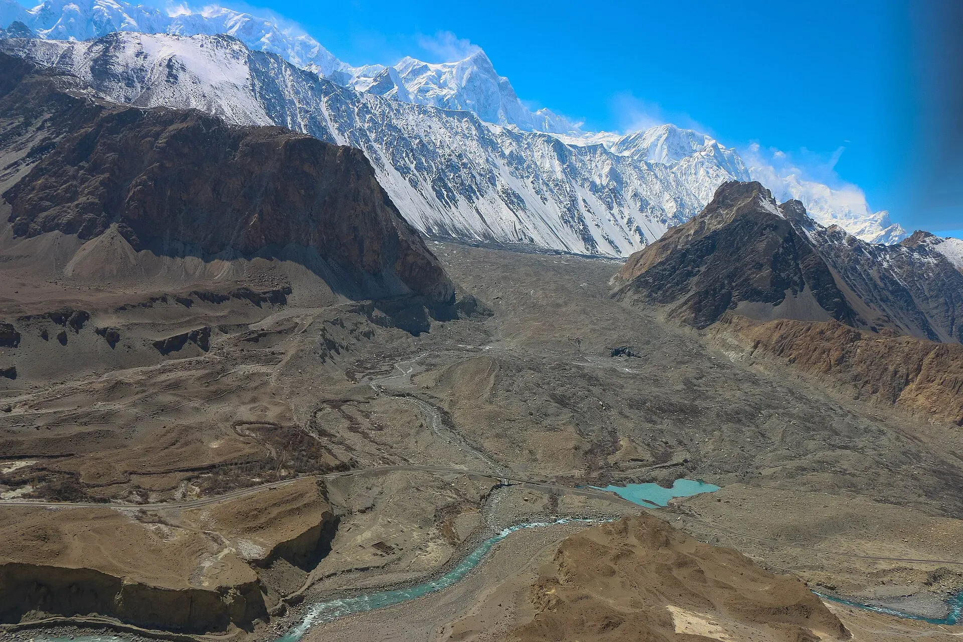
Photo: Akbar Khan Niazi, with thanks · CC BY-SA 3.0 · via Wikimedia Commons · temporary stand-in photo

Other treks in Gojal
Short notes on the other walks and treks in Gojal: day walks from Passu and Gulmit, Shimshal base camps and passes, and routes in Chapursan and Misgar.
This page collects several shorter treks in Gojal. Each heading below is a separate route with its own season, grade and permit rules, so read the notes for the one you plan to walk.
15 routes: Shatubar Glacier · Borit Sar · Two Bridges · Yunz · Momhil Sar Base Camp · Yazghil Sar Base Camp · Kanjut Sar Base Camp · Qapachpund and Chilinj Passes · Ghidims Pass · Lukpe La · Khurdopin Pass · Shikarzherav · Pamiri · Chapursan to Misgar · Wodwashk Pass
A short guide to the other treks and day walks in Gojal, from Gulmit and Passu to Shimshal, Chapursan and Misgar. Details come from the ~2002 guidebook unless noted, so check the current situation with an operator.
Shatubar Glacier
A moderate two to three day loop from Gulmit. Walk to Kamaris village (2,800 m) and up to the summer pastures of Rajabhil, cross the ridge saddle and descend to Bulkishkuk and Shatubar below the glacier. A short side trip from Kamaris leads to the ruins of Andra Fort, about 200 years old.
Borit Sar
Borit Sar (4,105 m) is the rocky ridge between the Ghulkin and Passu glaciers, and the best day trek along the Karakoram Highway for mountain views. It is a stiff 7 to 10 hours round trip from Passu with about 1,700 m of climbing, so start at first light and carry all your water. You see more than ten 7,000 m peaks, including Rakaposhi, Diran and Malubiting, from May to October. Close to the start, the Passu Cones (Tupopdan, 6,106 m, also called Passu Cathedral) rise north of the village and are reported to be the most photographed peak in the region. Passu Sar (7,478 m) and Shispare Sar are also in view from the valley.
Two Bridges
An easy 5 to 6 hour day walk from Passu that crosses the Hunza River twice on suspension bridges (narrow footbridges hung on cables; hold the rail and cross one at a time), via Zarabad and Hussaini. It gives good views of the Ghulkin, Passu and Batura glaciers. The Batura Glacier is 56 km long, the seventh longest outside the polar regions, and reaches close to the highway. Hussaini sits above Borith Lake, a saline lake at about 2,600 m. You can return along the KKH or spend a night at Borit Lake. The road is flat and open to the sun, so go early in summer.
Yunz
A popular 15.8 km loop through the Yunz valley between the Passu and Batura glaciers, with about 480 m of climbing, April to October. Go via Passu Lake, which formed around 1989. The valley is dry and exposed, so carry water. The route runs along glacier moraine and over loose ground, and paths are not always clear. The guidebook says people get lost here every year, so hire a guide or walk with others.
Momhil Sar Base Camp
A moderate four-day trek from the Momhil bridge beyond Dut to the base camps of Momhil Sar, Trivor, Destaghil Sar and Mulungutti Sar. The base camp is at 4,300 m, with a camp at Yazmis, Chikareen and Ambareen on the way. Momhil Sar is listed on Wikipedia at 7,414 m (the guidebook gives 7,343 m), a few kilometres north-west of Trivor in the Hispar Muztagh. Its first ascent was on 29 June 1964 by an Austrian team led by Hanns Schell. This is a trek for people who want to look at big mountains from below, not to climb them.
Yazghil Sar Base Camp
A moderate three-day trip from Shimshal village to the summer pastures and herders' huts above the Yazghil Glacier (the guidebook gives 4,500 m for the huts and 3,600 m for the base camp, so check), with views of Yukshin Gardan and Kunyang Chhish. You need a local guide to cross the glacier. Shimshalis count six stages round trip.
Kanjut Sar Base Camp
A moderate five or six day trek from Shimshal to the base camp (4,600 m) of Kanjut Sar (7,760 m), with views of Jutmo Sar and Yukshin Gardan. Kanjut Sar I (7,760 m) is the 28th highest mountain in the world and stands between the Shimshal and Hispar valleys. Its first ascent was in 1959 by Camillo Pellissier of an Italian expedition led by Guido Monzino. Its lower neighbour, Kanjut Sar II (6,831 m), was first climbed in 1985 by a Swiss team. It crosses the Yazghil Glacier's end, then the Yukshin Gardan Glacier, with a cable crossing of an outwash stream. Eight stages round trip.
Qapachpund and Chilinj Passes
Two technical, extreme routes from Shimshal to Shuwerth in the Shimshal Pamir, via the Virzherav Glacier. Qapachpund Pass (about 5,270 m) takes six days one way. Chilinj Pass (about 5,600 m, a different pass from Chilinji An) takes eight days. High camps are needed on both sides.
Ghidims Pass
Ghidims Pass (5,486 m) links the Ghidims valley in Ghuzherav to Sher Ilaq, Shimshal's winter pastures, and was first crossed by the guidebook authors in June 2000. It is a very demanding, technical trek of at least nine days round trip from Mandi Kshlakh, with roped glacier travel on both sides.
Lukpe La
A technical and extreme route across Lukpe La (5,650 m) from Shuwerth in the Shimshal Pamir to Lukpe Lawo and the Biafo Glacier. It runs up the crevassed 36 km Braldu Glacier. Tilman first crossed it in 1937. Roped travel and possibly fixed ropes are needed.
Khurdopin Pass
Khurdopin Pass (5,790 m) is an extreme alpine Grade III mountaineering route from Shimshal to Lukpe Lawo, first crossed in 1986. It crosses the 37 km Khurdopin Glacier, an icefall and a 50-degree ice wall, with avalanche danger. Only for experienced mountaineers. Wikipedia's Shimshal article adds that the Khurdopin Glacier surged in 2016 and 2017 and formed a large lake in the valley, so check the river and glacier state with Shimshal villagers before planning any route near it.
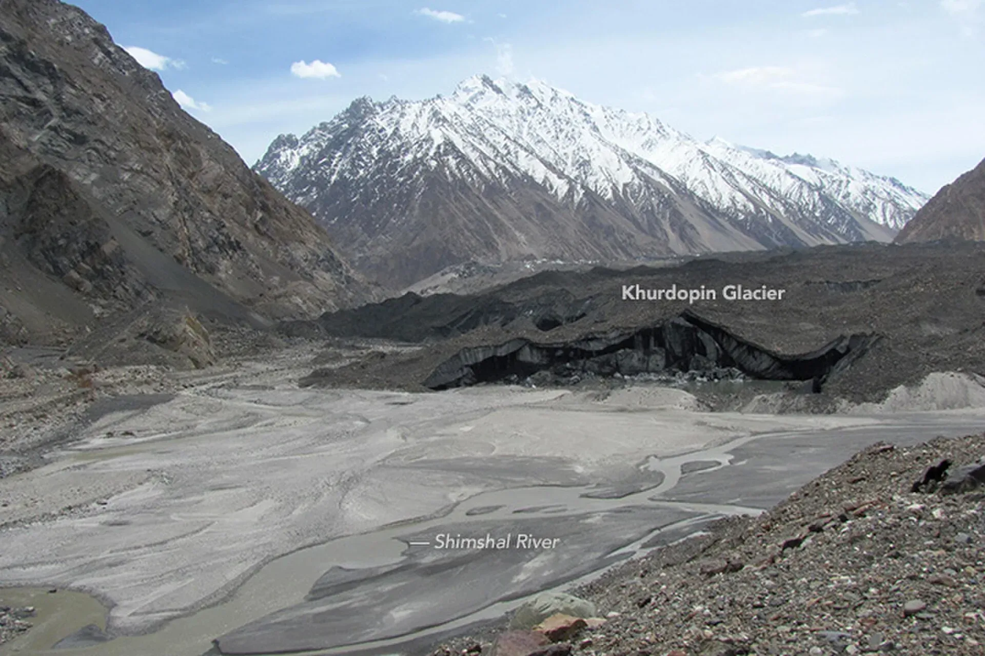
Photo: Waheed Anwar and NASA Earth Observatory, with thanks · Public domain (CC0) · via Wikimedia Commons · temporary stand-in photo

Shikarzherav
A very demanding six-day near-loop east of Sost, through an isolated valley below the North Qarun Koh Glacier where over 300 blue sheep are reported. It crosses two ridges (one at 5,774 m) and ends near Kilik Ilga on the KKH. Hire a local guide.
Pamiri
A moderate four-day walk from Yishkuk in Chapursan, along the Yishkuk Glacier, to Pamiri, the summer pasture of Zood Khun herders. It is good for acclimatisation before Lupgar Pir Pass or Chilinji An, and passes Kuk Chesham and the small lake of Dush Zhui.
Chapursan to Misgar
Two passes link Chapursan with Misgar's Dilisang Valley. Kermin Pass is an easy five-hour day walk. A harder unnamed pass links Zood Khun with Wergisht Khun, and needs a local guide.
Wodwashk Pass
An obscure, demanding glaciated pass between the Hapuchan valley and Wodwashk Bar in Misgar, with 30 to 60 minutes of glacier travel. It is reportedly easier from the Dilisang side. Bring an ice axe and rope. Misgar's nambardar knew the route when the guidebook was written, and no stages are set.
Highlights
- Borit Sar, the best day walk along the Karakoram Highway
- Easy day treks at Passu: Two Bridges and Yunz
- Base camps under Kanjut Sar and the Yazghil Glacier from Shimshal
- Remote passes in Misgar, Chapursan and the Ghuzherav
Getting there
Passu and Gulmit lie on the Karakoram Highway in Gojal. Sost is the last town before the Khunjerab Pass. Afiyatabad is the gateway to Chapursan. Shimshal is reached by a rough jeep road from Passu.
Permits and rules
- Fee
- Current fees will be added soon
- Last checked
- 16 November 2026
Rules differ between the routes on this page; this is a general note for Gojal.
Most day walks around Passu and Gulmit are open. Treks to Shimshal, Chapursan, Misgar and the high passes may need a permit from the Gilgit-Baltistan tourism department. Dawn reported in February 2026 that foreigners need permits for restricted zones. Ask a licensed operator before you go.
How trekking permits, NOCs and registration work: Visa and permits.
Season
Best: Jun – Sep · general guide; each route differs
Water and camps
Varies by route. Yunz is dry, so carry water from Passu. Glacier streams are silty by afternoon.
Gear and safety
Several routes here need glacier travel, ropes and mountaineering skills (Qapachpund, Chilinj, Ghidims, Lukpe La, Khurdopin, Wodwashk). Go with experienced people and a local guide. Rescue is slow and phone signal is poor beyond the villages.
Variations
See the separate pages for Shimshal Village, Shimshal Pamir, Qachqar-e-Dur and Shpodeen Pass, Boisum and Chafchingol Passes, Chilinji An and Qalander Uween, and Werthum Pass.
Tips
- Most treks listed here are open-zone day walks near the KKH. Check restrictions for Shimshal, Chapursan and Misgar.
- Hire a local guide for glacier crossings and unmarked passes.
- Do not rely on the Swiss 1:250,000 map for names and trail positions. It has errors.
- Carry water on dry routes such as Yunz.
- Agree porter stages before you start.
Photos we still need: Shatubar, Momhil Sar base camp, Yazghil and Kanjut Sar base camps, Chapursan-Misgar passes. Send us yours
Health and emergency
Mobile signal is patchy on most treks, so tell someone your plan before you go. Emergency numbers
Sources and last checked
Last checked Confidence low8 sources7 still to check
- Last checked
- Method
- Desk research from published sources
- Confidence
- low
- Checked by
- trek.pk research team
Researched from published sources; not yet checked on the ground by our team. Spot something out of date? Report a mistake.
Sources
- Trekking in the Karakoram and Hindukush (Lonely Planet, ~2002), Gojal chapters; old trek.pk text · Lonely Planet / trek.pk archive · checked
- Shimshal · Wikipedia · checked
- GB winter adventure tourism hit by soaring permit fee, visa delays · Dawn (1 Feb 2026) · checked
- List of Restricted/Prohibited/Border Areas in Pakistan · Apricot Tours (operator, undated) · checked
- List of Restricted/Prohibited/Border Areas in Pakistan (14 Jan 2026; operator page, supporting only) · Apricot Tours · checked
- Momhil Sar · Wikipedia · checked
- Kanjut Sar · Wikipedia · checked
- Passu · Wikipedia · checked
Still to be checked on the ground (7)
- All distances, durations, altitudes and stages are from the ~2002 guidebook and have not been rechecked
- Which routes are now in restricted zones or need a permit: an operator list dated 14 Jan 2026 treats Shimshal, Chapursan and Lupgar Pass routes as restricted treks needing a permit (supporting only); no official list found
- Trail status, bridges and glacier conditions on every route
- Names and contacts of local guides mentioned in the guidebook may be out of date
- Khurdopin glacier: Wikipedia's Shimshal article (citing a 2018 study) says it surged in 2016-17 and formed a lake in 2017; the current state of the river routes is not confirmed
- Momhil Sar height: Wikipedia 7,414 m, guidebook 7,343 m (page now gives Wikipedia's figure only in the route note)
- The Passu Cones photo used on 11 other pages was replaced with a different Tupopdan photo
Nearby and related

Shimshal Village

Shimshal Pamir

Chilinji An and Qalander Uween

Werthum Pass

Khurdopin Pass
An extreme glacier pass of about 5,790 m from Shimshal to Lukpe Lawo, first crossed in 1986. For experienced mountaineers only.
Lukpe La
A technical glacier pass of about 5,650 m from Shuwerth in the Shimshal Pamir to Lukpe Lawo and the Biafo Glacier, first crossed by Tilman in 1937.
Chilinj Pass
A technical pass of about 5,600 m from Shimshal to Shuwerth in the Shimshal Pamir. Not the same as Chilinji An.
Qapachpund Pass
A technical pass of about 5,270 m from Shimshal to Shuwerth in the Shimshal Pamir, six days one way.
Ghidims Pass
A very demanding pass of 5,486 m between the Ghidims valley in Ghuzherav and Sher Ilaq, Shimshal's winter pastures. First crossed by the guidebook authors in June 2000.
Chilinji An
A glaciated pass of about 5,160 m between the Chapursan and Karambar valleys, near the Afghan border. Roped travel, guide and permit needed.
Lupgar Pir Pass
A non-glaciated pass of 5,190 m linking Yishkuk in Chapursan with Raminj in the Lupgar valley. Six very demanding days.
Hapuchan Pass
A pass on the Chinese border at the head of the Hapuchan valley in Misgar. Border area: restricted, not a trek for visitors.
Kermin Pass
An easy five-hour day-walk pass between the Chapursan valley and Misgar's Dilisang valley in Gojal. Height not known.
Wodwashk Pass
An obscure glaciated pass between the Hapuchan valley and Wodwashk Bar in Misgar, with 30 to 60 minutes of glacier travel. Height unknown. Border area, ask locally.

Khunjerab Pass
The 4,693 m pass on the Karakoram Highway where Pakistan meets China. It is the road crossing between Sost in Gojal and Tashkurgan in Xinjiang, now agreed to run all year.
Tupopdan (Passu Cones)
Tupopdan (6,106 m) is the highest summit of the Passu Cones, the jagged peaks above Passu village. It is also called Passu Cathedral. It is seen from the Karakoram Highway and on the Avdegar and Patundas walks.
Yukshin Gardan Sar
Yukshin Gardan Sar is a Hispar Muztagh peak above the Shimshal valley, given as 7,530 m, 7,469 m or 7,641 m. It was first climbed in 1984. Shimshal-area treks see it.