

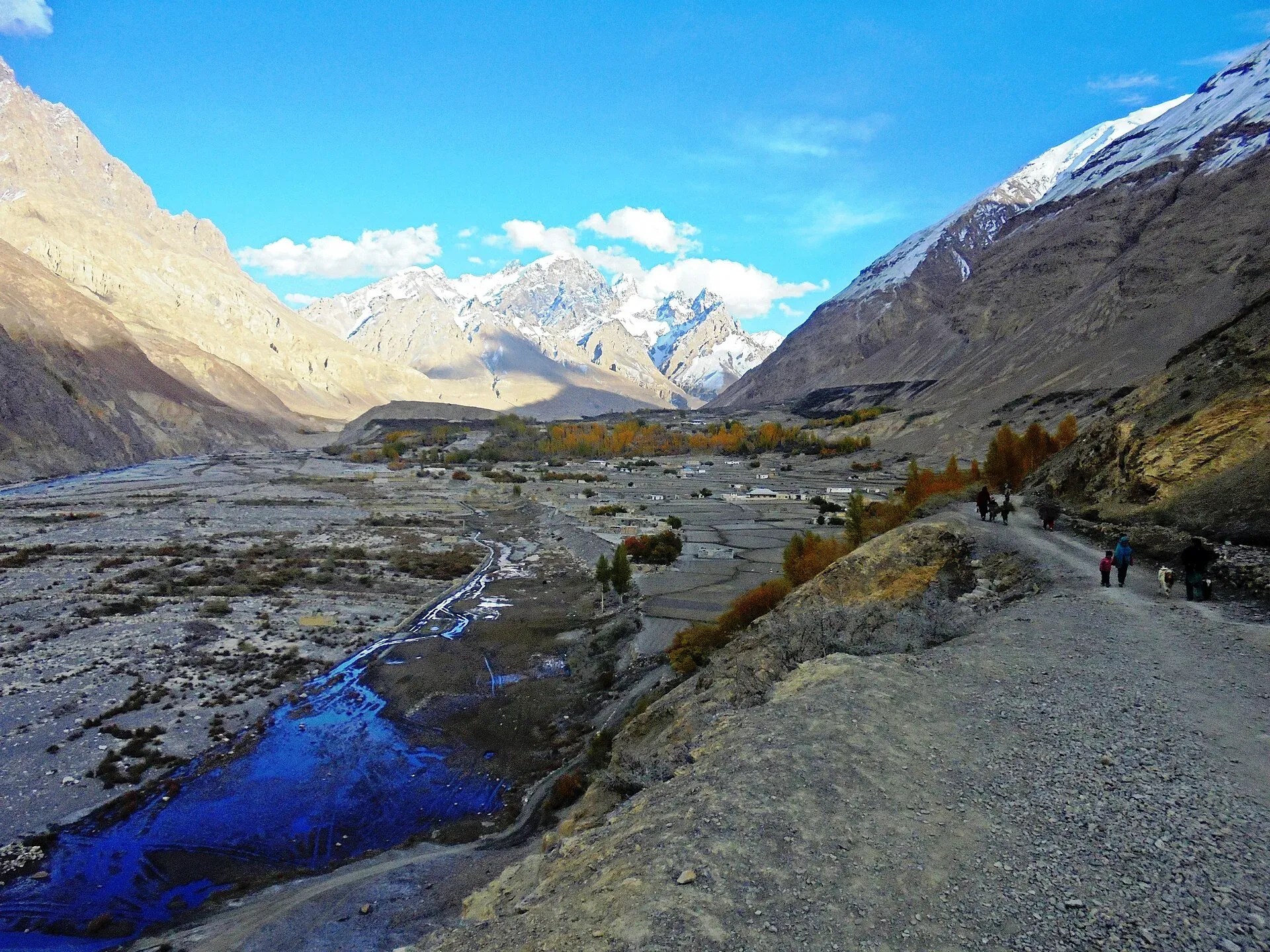
Photo: Spiture, with thanks · CC BY-SA 4.0 · via Wikimedia Commons · temporary stand-in photo

Shimshal Pamir
- Duration
- 5 days
- Distance
- 83.2 km
- Grade
- Moderate
- Max altitude
- 4,735 m
- Season
- Jun – Sep
A five-day trek from Shimshal village to the high yak pastures of the Shimshal Pamir and Shimshal Pass (4,735 m), with lakes and herder camps. Graded moderate, but the first day is exposed.
Overview
The Shimshal Pamir is a wide alpine grassland above 4,500 m, where about a thousand yaks and thousands of sheep and goats graze each summer. It lies on the watershed between South and Central Asia, with two big lakes near Shimshal Pass (4,735 m). The trek is a five-day round trip from Shimshal village. It is graded moderate, though that is for Shimshal, where nothing is easy: the first day is a long walk on exposed trail.
Shimshal village and access
Shimshal is a Wakhi village in Gojal, Hunza, at about 3,113 m, and is described as the highest settlement in its district. It had no motor road until October 2003, when the jeep road from the Karakoram Highway at Passu was completed. Before then people walked from Passu in about three days, according to one operator. The road is 53 to 56 km long, follows a narrow gorge and takes about 3 hours by jeep from Passu. Shimshal people also run their own conservation body, the Shimshal Nature Trust, which manages land in the wider area.
Who it suits
Strong walkers who are comfortable with exposure and altitude. You do not need a rope. You do need a local guide, as the trail along the Pamir-e-Tang gorge has narrow, steep sections, and the alternative pass route is one of the hardest non-glacier days in the Karakoram.
When to go
June to September. Women and children from Shimshal move to the pastures in late May, to the Shuwerth settlement in June, back to Shuizherav in early September and home in early October. From June to early September the pastures are at their busiest.
Terrain underfoot
Day 1 is a rough, narrow path along the Shimshal river gorge, with galleries (built-out ledges) above the water and a steep spur up to Gar-e-Sar. Beyond the Pamir-e-Tang footbridge the trail climbs a steep juniper staircase and then traverses easy hillside to the yak pastures. The pastures are short grass with streams and herds, and the last stretch to the lakes crosses flower fields. The alternative uween trail adds scree slopes and two high passes in one day.
The route
There are two ways between Shimshal and Purien-e-Ben. The "tang" (gorge) trail follows the Pamir-e-Tang River. It was widened and bridged in 1997 and is now the usual way. The "uween" (pass) trail crosses Shachmirk Pass (4,560 m) and Uween-e-Sar (4,650 m) in a single huge day. Most people take the tang trail one way, and some return by the uween trail.
On day 1 you walk about 15 km to Wuch Furzeen (3,365 m). On day 2 you cross the Pamir-e-Tang footbridge, climb the juniper staircase above Purien-e-Ben, and follow a long easy traverse to the summer settlement of Shuizherav (4,350 m). On day 3 you walk through pastures, among yaks and sheep, to Abdullah Khan Maidan, then to the lakes and Shimshal Pass (4,735 m). Camps near the lakes are the best. A short side trip leads to the main summer settlement, Shuwerth, where the women make milk products and welcome visitors.
Days 4 and 5 return the same way, camping at Wuch Furzeen. The Pamir-e-Tang trail was a hard path for centuries. Villagers still improve it, and hope that one day yaks will be able to use it instead of the pass trail.
On the way, look for the Chat Pirt massif south of the Pamir-e-Tang, whose grassy lower slopes hold blue sheep, and for the Hispar Muztagh peaks (Kunyang Chhish, Yukshin Gardan) from Gar-e-Sar, and Mungalig Sar to the east of Purien-e-Sar.
Culture and people
The Shimshal yak race and festival is held at the pass in late July or early August, according to Wikipedia (the article is flagged for unreliable sourcing, so check locally). Herders move yaks, goats and sheep to seasonal pastures several days' walk from the village. The Pamir is one of several summer pastures that Shimshal uses.
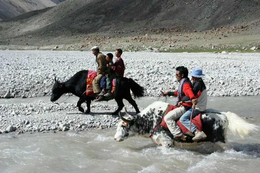
Photo: Pm.pfeiffer, with thanks · Public domain (CC0) · via Wikimedia Commons · temporary stand-in photo

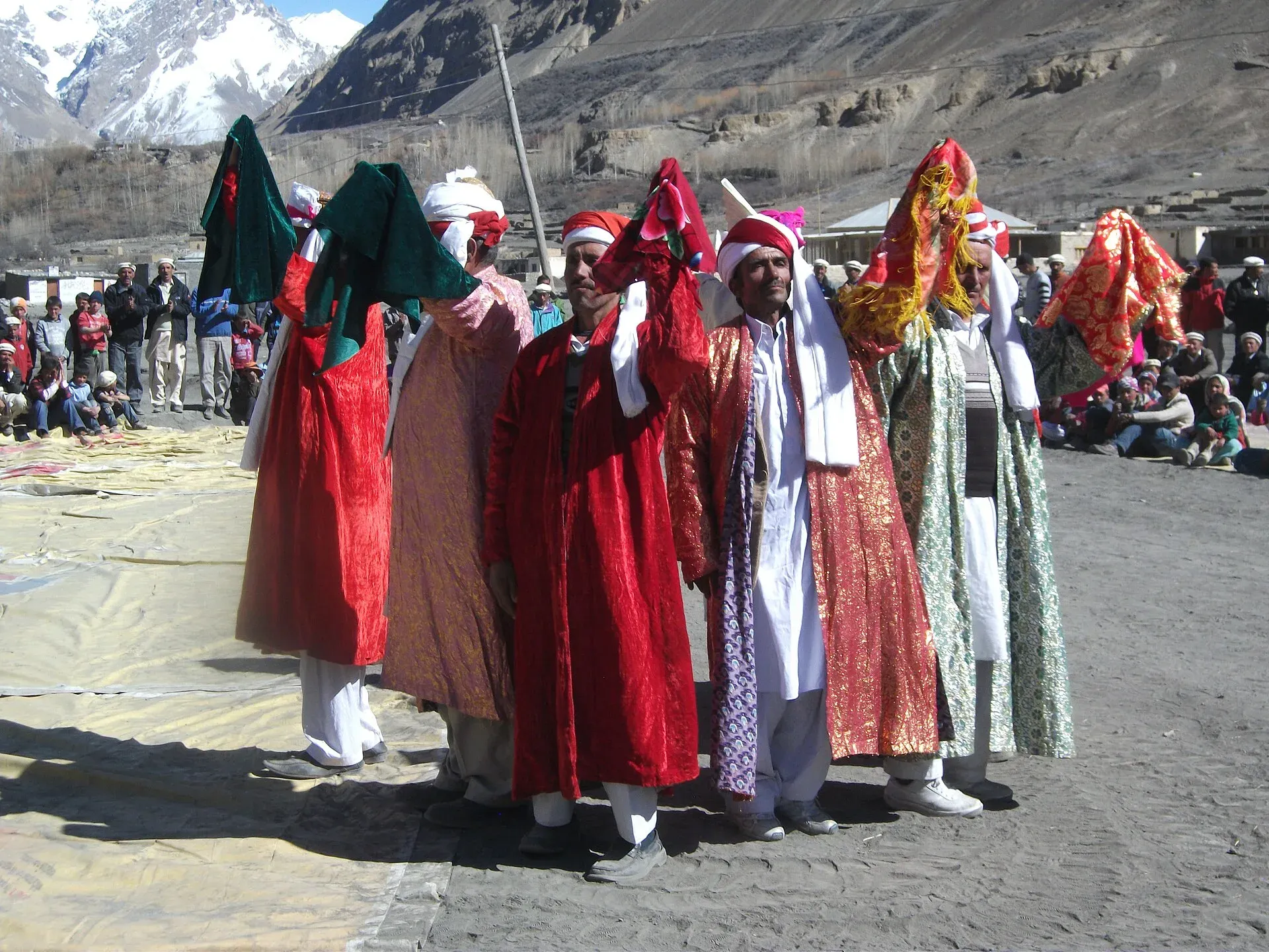
Photo: Spiture, with thanks · CC BY-SA 4.0 · via Wikimedia Commons · temporary stand-in photo

Shimshal people are Wakhi and have a deep link to the Pamir. The women's pastures have a custom: visitors should not enter in a sad mood, and the best way in is singing. Ask before you photograph people or enter a hut. Most trekkers spend at least a day at Shuwerth, watching the women milk the animals and make cheese (qurut).
Practical information
One operator lists a Shimshal Nature Trust fee of US$20 per person within its package price, and says porters carry up to 20 kg. These are operator figures, not an official tariff.
Access to Shimshal is by jeep road from Passu (see Getting there). Most of the Shimshal Pamir lies inside Khunjerab National Park. Local assistance is necessary for the exposed trail along the Pamir-e-Tang, the scree slopes on the uween trail and the difficult sections into and out of Purien-e-Ben. Porters may ask for more per stage on the uween trail. The Swiss 1:250,000 Karakoram map does not label the passes or any place names along either route, and shows Shuwerth as Shuwari. Some Shimshalis now count six stages each way on the tang trail instead of five. Agree the stage count before you start.
Highlights
- High pastures with about 1,000 yaks and thousands of sheep and goats
- Lakes on the watershed of South and Central Asia at Shimshal Pass (4,735 m)
- Summer village life at Shuwerth and Shuizherav
- Choice of the gorge trail or the harder Shachmirk and Uween-e-Sar pass route
Day by day
| Day | Camp | Altitude |
|---|---|---|
| 1 | Wuch Furzeen | 3,365 m |
| 2 | Shuizherav | 4,350 m |
| 3 | Shimshal Pass lakes | 4,700 m |
| 4 | Wuch Furzeen | 3,365 m |
| 5 | Shimshal village | 3,000 m |
| Day | Route | Hours | Distance | Ascent / descent | Camp and altitude |
|---|---|---|---|---|---|
| Day 1 | Shimshal village to Wuch Furzeen | 7–9 h | 15.1 km | +685 m / −320 m | Wuch Furzeen, 3,365 m |
Day 1 notesCross Michael Bridge and follow the river to the Pamir-e-Tang junction. Ford or bridge the Pamir-e-Tang and climb a steep spur to the viewpoint at Gar-e-Sar (3,502 m). Take the right fork. The exposed galleries beyond Shanj are the hardest part. Past Furzeen has the first reliable water. Wuch Furzeen has a hut and spring. | |||||
| Day 2 | Wuch Furzeen to Shuizherav | 6–8 h | 18.5 km | +985 m | Shuizherav, 4,350 m |
Day 2 notesCross the footbridge over the Pamir-e-Tang and climb to Purien-e-Ben (3,596 m). Go up the juniper staircase to Purien-e-Sar (3,916 m). The rest of the day is easier, a long traverse past Arbab Purien, a good lunch spot with a spring, to a wooden footbridge and on to Shuizherav, a large summer settlement with many huts. | |||||
| Day 3 | Shuizherav to Shimshal Pass | 3 h | 8 km | +385 m | Shimshal Pass lakes, 4,700 m |
Day 3 notesCross the bridge and climb an easy side stream to Abdullah Khan Maidan (4,600 m). Walk for two hours through flower fields and herds to the two lakes on the watershed and to Shimshal Pass (4,735 m). The best camps are just below the pass in view of the lakes. A side trip of about an hour reaches Shuwerth, the main summer settlement. | |||||
| Day 4 | Shimshal Pass to Wuch Furzeen | 8–10 h | 26.5 km | not given | Wuch Furzeen, 3,365 m |
Day 4 notesRetrace your route along the Shuizherav and Pamir-e-Tang rivers. This is a long day, mostly downhill. Camp at the same birch grove as on the way up. | |||||
| Day 5 | Wuch Furzeen to Shimshal village | 6–8 h | 15.1 km | not given | Shimshal village, 3,000 m |
Day 5 notesReturn along the tang trail over the exposed galleries and Gar-e-Sar to Shimshal. Watch for rockfall and keep to the trail. Jeep to Passu can be arranged for the next day. | |||||
Getting there
From the Karakoram Highway near Passu, a rough jeep road runs about 56 km up the Shimshal River gorge to Shimshal village. It opened in 2003 and takes about three hours by jeep. It is unsealed, narrow and exposed, with rockfall and washouts, so allow for delays. Arrange the jeep in Passu or Gulmit, or through your operator.
The trek starts and finishes at the village. When you leave, send word ahead to have a jeep meet you.
Permits and rules
- Permit needed
- Yes, Restricted zone
- Fee
- Current fees will be added soon
- Last checked
- 16 November 2026
The old guidebook lists this trek as open with no permit. Current advice is less clear. Dawn reported in February 2026 that foreign trekkers in restricted zones need permits from the Gilgit-Baltistan tourism department, and that permit fees rose sharply in 2025. Some operators list Shimshal-area treks as restricted. Check with a licensed Pakistani operator or the GB tourism department before you book. Checked 16 November 2026. Shimshal Pass is near the Chinese border, so expect checks. Current fees will be added soon.
How trekking permits, NOCs and registration work: Visa and permits.
Season
Best: Jun – Sep
Water and camps
Water is scarce on day 1: fill bottles at the spring before Michael Bridge. Past Furzeen has the first reliable stream, and Wuch Furzeen has a small spring, or silty water from the river. Purien-e-Ben has silty water. Arbab Purien has a clear spring. Shuizherav and the lakes have plenty. Camps: Wuch Furzeen (3,365 m), Shuizherav (4,350 m, grassy, below the huts) and the lakes below Shimshal Pass (4,700 m).
Gear and safety
The exposed trail on days 1 and 5 is the main hazard. Several sections have narrow galleries above the river. Do not hurry, and avoid it in rain or high wind. Rockfall and afternoon wind are common. Altitude is moderate: you sleep at 4,350 m and 4,700 m, so go up slowly. Take warm clothes, because snow can fall at the pass even in summer. There is no phone signal. The only medical help is in Shimshal village, which had an Aga Khan Health Services dispenser at the time of the guidebook. Bring a full first-aid kit.
Variations
Alternative Route A returns via the uween trail: Shimshal Pass to Purien-e-Ben (16.7 km), then a day over Shachmirk Pass (4,560 m) and Uween-e-Sar (4,650 m) to Zardgarben, and on to Shimshal. This is one of the toughest non-glacier days in the Karakoram. Alternative Route B returns through Arbab Purien, Pamir Mai Dur and Shpodeen Pass. See the Qachqar-e-Dur and Shpodeen Pass page. You can also continue west from Shpodeen on the Boisum and Chafchingol Passes trek. Mungalig Sar (5,931 m) can be climbed from the lakes by properly equipped parties.
Tips
- Take the gorge (tang) trail in and the pass (uween) trail out only if you are very strong. It is a 3,000 m day.
- Fill bottles at the spring before Michael Bridge, as there is no water for hours after it.
- Enter the pastures singing and in good humour, as the local custom asks.
- Spend a day in Shimshal village to acclimatise before you start.
- Agree the number of stages with your porters before you leave.
Photos we still need: the Pamir-e-Tang gorge trail, Shuizherav and the lakes at Shimshal Pass. Send us yours
Health and emergency
Mobile signal is patchy on most treks, so tell someone your plan before you go. Emergency numbers
Sources and last checked
Last checked Confidence medium7 sources7 still to check
- Last checked
- Method
- Desk research from published sources
- Confidence
- medium
- Checked by
- trek.pk research team
Researched from published sources; not yet checked on the ground by our team. Spot something out of date? Report a mistake.
Sources
- Trekking in the Karakoram and Hindukush (Lonely Planet, ~2002), Gojal chapters; old trek.pk text · Lonely Planet / trek.pk archive · checked
- Shimshal · Wikipedia · checked
- Hunza Shimshal Pass trek (road details) · Lokalee · checked
- GB winter adventure tourism hit by soaring permit fee, visa delays · Dawn (1 Feb 2026) · checked
- List of Restricted/Prohibited/Border Areas in Pakistan · Apricot Tours (operator, undated) · checked
- Khunjerab National Park · Wikipedia · checked
- Hunza Shimshal Pass trek (access, Shimshal Nature Trust fee in package) · Lokalee · checked
Still to be checked on the ground (7)
- Current permit rules and fees for Shimshal Pass and the Pamir (guidebook says open, no permit; some operators call the pass trek a restricted-zone trek needing a permit via an agency, and say the Pamir is open to Shuwerth only; no official notice found)
- Whether foreign trekkers may go all the way to Shimshal Pass and Shuwerth
- Distances, times and camps are from the ~2002 guidebook
- Whether yaks or porters can now use the tang trail
- Stage counts demanded by porters (disputed)
- Shimshal Nature Trust fee and whether it applies to day visitors and trekkers (one operator lists US$20 in a package)
- Passu to Shimshal road length: 53 km (operator) or 56 km (Wikipedia)
Nearby and related

Qachqar-e-Dur and Shpodeen Pass

Boisum and Chafchingol Passes

Shimshal Village
Shimshal Pass
A high pass of about 4,735 m above Shimshal, on the watershed between the Indus and Tarim basins near the Chinese border. Reached on a five-day trek; yak race festival in summer.
Shpodeen Pass
A snow-covered pass of about 5,346 m in the South Ghuzherav mountains above Shimshal, crossed without glacier travel on a seven-day loop.
Shachmirk Pass
A pass of 4,560 m on the Shimshal Pamir uween trail, crossed in one very long day together with Uween-e-Sar (4,650 m). Strong parties only. Restricted-zone area near the Chinese border.
Shimshal Pamir
The high summer pastures above Shimshal village at about 4,350 to 4,700 m, grazed by yaks, sheep and goats, with two lakes and Shimshal Pass (4,735 m) at the upper edge. Reached on foot only.
Yukshin Gardan Sar
Yukshin Gardan Sar is a Hispar Muztagh peak above the Shimshal valley, given as 7,530 m, 7,469 m or 7,641 m. It was first climbed in 1984. Shimshal-area treks see it.