

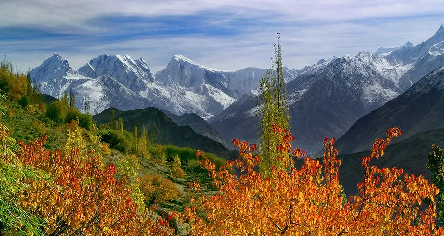
Photo: Nabokhan, with thanks · CC BY-SA 4.0 · via Wikimedia Commons · temporary stand-in photo

Chogo Lungma Glacier
- Duration
- 5–8 days
- Distance
- 72.6 km
- Grade
- Strenuous
- Max altitude
- 3,779 m
- Season
- Jun – Sep
A five-day return trek from Doko up the Basha valley and along the 44 km Chogo Lungma Glacier to Gareencho, with Malubiting and Spantik in view. Quiet, open-zone and strenuous.
Overview
Chogo Lungma means "big valley" in Balti. The 44 km glacier, called the Chogo Lungma, lies at the head of the Basha valley, which runs west from the Braldu road north of Skardu. Godfrey Vigne, who reached the Karakoram in 1835, called its snout the grandest sight of his travels. The route starts at Doko and goes through the terraced villages of the Basha valley to Arandu, then along the flower-filled ablation valleys on the north side of the glacier. The scenery is alpine, with granite slabs above Gon and Arandu, Malubiting and Spantik in view, and very few other trekkers.
Who it suits
A strenuous trek of about five days that suits walkers who are comfortable with long days and rough trails. Day 1 is easy road walking, but the upper glacier sections can be hard to follow. Going beyond Gareencho to Bolocho and Spantik Base Camp means glacier travel in roped teams, which needs a guide. Chogo Lungma is a good first step if you want a Karakoram experience without the crowds of the Baltoro.
When to go
Mid-June to September. The Doko–Arandu road is passable for jeeps only in spring and autumn, when the Basha River is low; in summer you walk. Afternoon flows in side streams are heavy, so cross early. One operator's Arandu departure in 2024 ran from 20 June to 6 July.
The route
From Doko (2,530 m) a wide track follows the Basha River, passing villages and fords. Granite cliffs line the west side. At Bisil, across the river, a wooden basket on a cable carries people over. A technical route, the Sokha La, leads east from Bisil to the upper Biafo Glacier. Continue past Gon to Arandu (2,770 m), the last village. Arandu villagers are the best porters here because they use the glacier pastures. Choose the fittest porters who know the route.
The glacier surged in 2000 and threatened Arandu, so the trail near its snout may have changed. On day 2 you climb the terminal moraine and cross the glacier to the ablation valley on its north side. Churzing is on the way. Chogo Brangsa, at about 3,320 m (derived from the old guide's figures), has camp sites and streams. On day 3 you pass the flowery ablation valley and the Shing Kuru juniper camps, with views of Malubiting. Kurumal and Wung follow, and Gareencho (3,779 m) is a broad, grassy camp with clear views of Malubiting, the Polan La and Spantik. It is a good rest or acclimatisation stop.
Day 4 and 5 take you back to Doko, camping at Arandu.
Beyond Gareencho, Bolocho is a harder camp, and the side trip to Spantik Base Camp (4,300–4,360 m) takes two days there and back from Bolocho. It crosses the glacier in roped teams and takes 7–9 hours each way. Skari Byanga is a sandy camp along the way.
The mountains around the glacier
The glacier starts on the slopes of Malubiting (7,458 m), which Wikipedia places in the Rakaposhi-Haramosh range about 50 km east of Gilgit. Spantik (7,027 m, also called Golden Peak) lies east of Diran and north-east of Malubiting. Fanny Bullock Workman and William Hunter Workman climbed the glacier in 1906 and got within about 300 m of the top of Spantik. A German team made the first ascent in 1955 by way of the Chogo Lungma and the south-east ridge. Climbers also reach Spantik from the Hoper (Hopar) valley in Nagar, which is a separate approach.
Wilhelm Kick published a short account of the glacier in The Geographical Journal in 1956. Wikipedia calls it the first of the big Karakoram glaciers to be discovered, in 1835.
Terrain and conditions underfoot
The route changes character every day. Day 1 is a wide track beside the Basha River with a few fords and granite slabs near Gon. From Arandu the way leaves the cultivated valley for the terminal moraine of the glacier, a heap of rubble that takes about 30 minutes to climb. Beyond that, the trail follows herders' paths across the glacier and along the ablation valley (the trough between the glacier and the valley wall), where grass, streams and juniper make easier walking than the ice. Above Gareencho the ground is broken ice and loose scree, and the roped glacier travel needed for Spantik Base Camp begins. Side streams are low in the morning and heavy by afternoon.
Culture and people
The Basha valley villages are Balti and use terraced fields beneath Mango Brak. Arandu people herd livestock on the glacier pastures. They are known as strong porters, and the old guide notes that porters here welcome trekkers and do not ask for the clothing allowance or rest days that porters elsewhere expect. Arandu's Balti people and the Shina-speaking people of Haramosh reportedly do not cross each other's passes together, so hire a Shina speaker for the Haramosh La.
Practical information
Zone and permits. The old guide lists this trek as open zone, with no permit. CKNP's page says the core zone includes Baltoro, Biafo, Hispar and Hushe areas, but it does not mention the Chogo Lungma; check with your operator whether a CKNP fee applies.
Getting there. From Skardu, Haiderabad is about three hours up the Shigar valley. From there jeeps turn west to Doko, 35 km, the last shop with basic supplies. Landslides sometimes block the road beyond Tissar.
Maps. The Swiss 1:250,000 Karakoram sheet 1 covers the trek but mislabels several camps; Churzing is shown as Churtsinks and Chogo Brangsa as Chohob Langsa.
Highlights
- The 44 km Chogo Lungma Glacier, praised by Vigne in 1835
- Terraced Balti villages and granite walls in the Basha valley
- Flower-filled ablation valleys with views of Malubiting and Spantik
- Few other trekkers; a good alternative to the Baltoro
Day by day
| Day | Camp | Altitude |
|---|---|---|
| 1 | Arandu | 2,770 m |
| 2 | Chogo Brangsa | 3,320 m |
| 3 | Gareencho | 3,779 m |
| 4 | Arandu | 2,770 m |
| 5 | Doko | 2,530 m |
| Day | Route | Hours | Distance | Ascent / descent | Camp and altitude |
|---|---|---|---|---|---|
| Day 1 | Doko to Arandu | 5–6 h | 14.5 km | +240 m | Arandu, 2,770 m |
Day 1 notesA wide road-width track runs beside the Basha River. Ford a big side stream 20 minutes out. Pass Gon and its fractured granite slabs, and reach Arandu, with a small camp site to the west of the village. Ask villagers where the springs are; the canal water is silty from the glacier. | |||||
| Day 2 | Arandu to Chogo Brangsa | 4–5 h | 11.1 km | +552 m | Chogo Brangsa, 3,320 m |
Day 2 notesFollow the true right bank towards the glacier snout, then climb the terminal moraine in 30 minutes. A herders' trail crosses the glacier to the ablation valley on its north side. Pass Churzing, cross clear streams and reach the camp at Chogo Brangsa. The altitude is derived, not measured. | |||||
| Day 3 | Chogo Brangsa to Gareencho | 4–6 h | 10.7 km | +457 m | Gareencho, 3,779 m |
Day 3 notesContinue up the flower-filled ablation valley to the juniper camps of Shing Kuru. Malubiting comes into view. Cross a gap where a torrent from the Khilburi Gang descends, then reach Kurumal and Wung. Gareencho is a broad, grassy camp beside a stream with clear views of Malubiting, the Polan La and Spantik. | |||||
| Day 4 | Gareencho to Arandu | 8–9 h | 21.8 km | −1,009 m | Arandu, 2,770 m |
Day 4 notesReturn down the glacier's north side and across the glacier. This is a long day. If you want to visit Spantik Base Camp, add camp at Bolocho and allow two days from there (7–9 hours on the glacier in roped teams). | |||||
| Day 5 | Arandu to Doko | 4–5 h | 14.5 km | −240 m | Doko, 2,530 m |
Day 5 notesWalk out on the Basha valley road, where your jeep can meet you. | |||||
Getting there
From Skardu go north up the Shigar valley to Haiderabad (about 3 hours), then by jeep west up the Basha valley to Doko (35 km). Beyond Doko the road to Arandu is passable only in spring and autumn when the river is low, so most people walk. Landslides can block the road beyond Tissar.
Permits and rules
- Permit needed
- Usually not, Open zone
- Fee
- Current fees will be added soon
- Last checked
- 16 November 2026
Zone: open. The old guide lists the trek as open-zone with no permit. The CKNP page names Baltoro, Biafo, Hispar and Hushe as core-zone areas and does not mention the Chogo Lungma. A licensed guide or operator is still advised, and any CKNP fee or rule should be confirmed with your operator or the Gilgit-Baltistan Tourism Department.
How trekking permits, NOCs and registration work: Visa and permits.
Season
Best: Jun – Sep
Water and camps
Streams are plentiful but silty in the afternoon. Clear water is found at the first stream beyond the moraine, at Shing Kuru and at Gareencho. Arandu's canal water is silty. Juniper is used for fuel by herders; carry a stove. Bolocho and Skari Byanga are rougher camps on the glacier margin.
Gear and safety
The Chogo Lungma surged in 2000, so check the trail at the snout. Side streams swell by afternoon. Beyond Gareencho the terrain is broken ice and loose scree, so go with a guide. Spantik Base Camp needs roped glacier travel. Altitude is moderate (up to about 3,800 m) on the main route, rising above 4,300 m at Spantik. Rescue is slow in this valley.
Variations
- Spantik Base Camp (side trip, about 2 days from Bolocho, roped glacier travel).
- Haramosh La (4,800 m, extreme technical, 9 days from Doko to Sassi; see Other treks in Baltistan).
- Sokha La and Nushik La are technical passes from the Basha side; not for trekkers.
- Add Laila Base Camp or Malubiting Base Camp as camps beyond Gareencho.
Tips
- Pick your porters in Arandu; they know the glacier best.
- Cross side streams in the morning, before the afternoon melt.
- Go with a guide beyond Gareencho; glacier travel is roped.
- Check the road beyond Tissar before you leave Skardu.
Photos we still need: the Chogo Lungma Glacier snout and moraine, the ablation valley, and Gareencho camp. Send us yours
Health and emergency
Mobile signal is patchy on most treks, so tell someone your plan before you go. Emergency numbers
Sources and last checked
Last checked Confidence low9 sources10 still to check
- Last checked
- Method
- Desk research from published sources
- Confidence
- low
- Checked by
- trek.pk research team
Researched from published sources; not yet checked on the ground by our team. Spot something out of date? Report a mistake.
Sources
- Chogo Lungma Glacier (old trek.pk page, text from Lonely Planet Trekking in the Karakoram and Hindukush, c. 2002; used for facts only) · trek.pk / Lonely Planet · checked
- Chogo Lungma Glacier · Wikipedia · checked
- Spantik Base Camp Trek (operator page) · Apricot Tours · checked
- Visiting CKNP: permits, season, logistics (unofficial-looking summary; figures approximate) · cknp.org · checked
- Procedure for Applying for Permission 2024-25 · Pakistan Travel Blog · checked
- List of Restricted/Prohibited/Border Areas in Pakistan (14 Jan 2026; operator page, supporting only) · Apricot Tours · checked
- Spantik · Wikipedia · checked
- Malubiting · Wikipedia · checked
- The Golden Pillar (Himalayan Journal, vol. 44) · Himalayan Club · checked
Still to be checked on the ground (10)
- Whether the Chogo Lungma trek is open zone and whether any CKNP fee applies: the CKNP site (article 6 May 2026, with signs of poor maintenance, so not treated as official) does not mention Chogo Lungma; its trek list (Oct 2021) does not include it; an operator list of restricted treks (14 Jan 2026) does not include it either. No fee added
- Chogo Brangsa altitude (about 3,320 m is derived from the old guide's figures, not a source)
- Position of the trail near the glacier snout, which has changed since the 2000 surge
- Road condition and jeep access from Haiderabad to Doko and beyond
- Spantik base camp altitude: 4,360 m (operator) vs 4,300 m (old Swiss map)
- Daily distances and times (c. 2002 guide)
- Photo: no on-trail photo found with a compatible licence; the Shigar valley photo shows the valley the trek starts in
- Operator figures differ from the old guide: one operator lists Arandu at 2,720 m (guide: 2,770 m) and Chogo Brangsa at 3,400 m (guide-derived: about 3,320 m)
- Whether the Doko to Arandu stretch can be driven in the current season (the operator lists Arandu as the jeep roadhead from Skardu)
- Photo: the hero shows the Basha valley near Bisil, not the glacier itself; the Spantik photo was taken from Haiderabad in Nagar, outside the trek
Nearby and related

Other treks in Baltistan

Hispar La (Biafo–Hispar traverse)

Asumbar Haghost
Haramosh La
A glaciated, technical pass of about 4,800 m between the Chogo Lungma and Haramosh glaciers, ringed by Laila, Mani and Haramosh. For experienced mountaineers only.
Nushik La
A technical pass from the Basha side, linked on our trek pages to the Chogo Lungma and Hispar glaciers. Not for trekkers.
Polan La
A pass seen from Gareencho camp on the Chogo Lungma trek, with views of Malubiting and Spantik. Few details are known.
Sokha La
A technical pass leading east from Bisil on the Chogo Lungma glacier to the upper Biafo Glacier. Not for trekkers.