

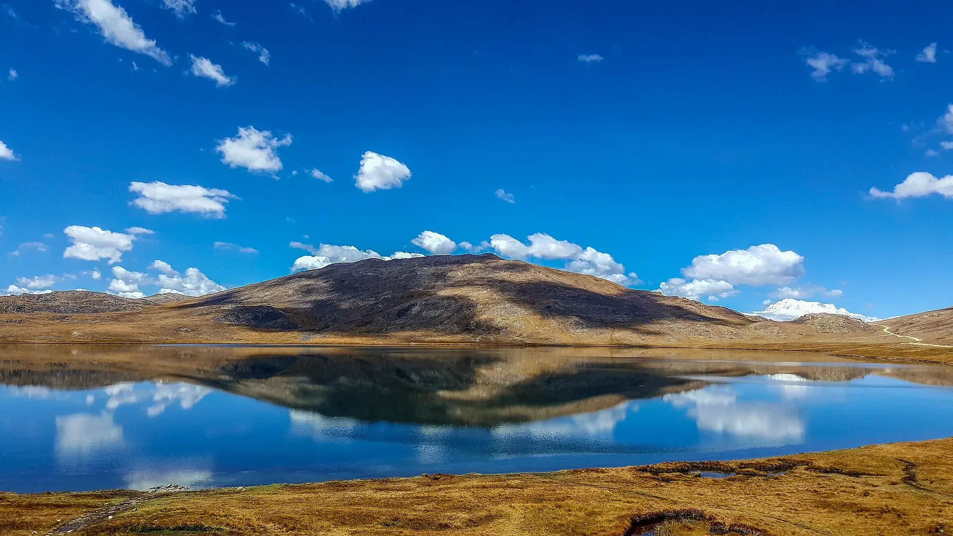
Photo: Jehan Sher, with thanks · CC BY-SA 4.0 · via Wikimedia Commons · temporary stand-in photo

Other treks in Baltistan
A roundup of shorter and quieter treks in Baltistan: Ganto La, Stak La, Haramosh La, the Deosai Traverse, Alampi La, Katichu La, Sosbun, Skoro La, Panmah Glacier, Hushe walks and more, with key facts for each.
This page collects several shorter treks in Baltistan. Each heading below is a separate route with its own season, grade and permit rules, so read the notes for the one you plan to walk.
17 routes: Ganto La · Stak La · Haramosh La · Deosai Traverse · Alampi La and Banak La · Dari La · Naqpo Namsul La · Skoyo · Trango Pir Pass and Harpo La · Katichu La · Sosbun · Skoro La · Panmah Glacier · Khaplu walks · Honbrok · Aling Glacier and K6 Base Camp · Kondus and Saltoro valleys
Overview
Baltistan has many shorter and quieter treks besides the famous Baltoro, Gondogoro and Hispar routes. This page summarises them. Facts come from the c. 2002 guidebook and have not all been re-checked, so treat distances, heights and village services as a starting point and ask a licensed operator or the Gilgit-Baltistan Tourism Department for current rules. Most routes below are in open zones; the exceptions are the Panmah Glacier (restricted) and the Kondus and Saltoro valleys (closed or special-permit only; Wikipedia says the Kondus valley reopened to foreigners with a special permit in 2002). Heights are as given in the old guide, and several have no second source.
Ganto La
A moderate trek over a pass of about 4,606 m linking the Basha and Tormik valleys, usually open from late June to early September. It starts from Hemasil in the Basha valley, next to the Chu Tron hot spring, which is about 39 degrees C and has hardly any sulphur smell. You climb about 1,000 m to Matunturu meadow, cross the pass past a permanent snowfield, and camp at Pakora meadow. It is two to three days to Harimal in the Tormik valley, from where Dassu or Bagicha on the Gilgit–Skardu road is a day away.
Stak La
A demanding technical loop of four to five days over a pass of about 4,500 m that links the Stak Nala and the upper Tormik valley. From Dassu, walk up the Tormik valley to Harimal, Dunsa and the herders' huts, then cross a small glacier to the pass. The west side is corniced, so you need a rope and ice axe. The descent looks across to Haramosh and its Khotia Lungma glacier, and the trail leads down to Stak village. It can be combined with the Ganto La.
Haramosh La
An extreme, technical nine-day trek over a glaciated pass of about 4,800 m between the Chogo Lungma and Haramosh glaciers. Laila (6,986 m), Mani and Haramosh (7,409 m) enclose the pass. It starts at Doko, follows the Chogo Lungma route to Bolocho, then goes via Laila Base Camp (4,100 m) and Sharing to the pass. Parties may have to fix up to 500 m of rope on the west side. You descend to Kutwal Lake (3,260 m) and Dassu. It is best late July to early September and suits only experienced mountaineers with a guide. The old guide also notes that Arandu porters reportedly do not cross because of old conflict with Shina-speaking Haramosh, so hire a Shina-speaking guide. Haramosh itself (7,409 m) was first climbed in 1958 by three Austrians, who reached the summit by this pass, the Haramosh La, and the east ridge.
Deosai Traverse
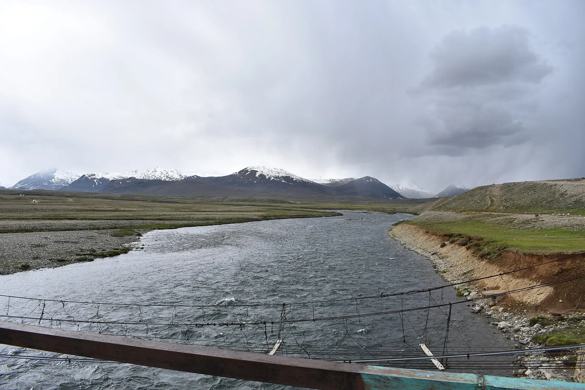
Photo: Syedmuradali22, with thanks · CC BY-SA 4.0 · via Wikimedia Commons · temporary stand-in photo

A walk of about 165 km on the jeep road from Skardu to Astor across the Deosai Plains, easy in four or five days. Deosai is a high plateau with an average height of about 4,114 m. Its name joins the Shina words deo (giant) and sai (shadow), and the Balti name Ghbiarsa means "summer's place". The plains are a national park, set up in 1993 to protect the Himalayan brown bear, whose count rose from 19 in 1993 to 78 in 2022. Himalayan marmots live on the plateau. You pass Satpara Lake and Sheosar Lake and cross the Sheosar Pass (4,266 m) into the Chilam valley and down to the Astor valley. Nanga Parbat is visible from hilltops. A two-day side trip from Zail gives a closer view of Nanga Parbat. You can shorten the walk with a jeep hire from Skardu to Satpara or a bus from Chilam. The Bara Pani is the largest of the rivers that cross the park, and Sheosar Lake lies in its western part. Deosai can be entered from Skardu, Astore, Chilam in the Astore valley, Mehdiabad and the Burji La. Wikipedia says the park is accessible only in summer. Check the park's current entry rules before you go.
Alampi La and Banak La
A demanding six-day trek across either the Alampi La (5,030 m) or the Banak La (4,963 m) from the Shigarthang valley to Astor, best from mid-June to September. It starts near Kachura Lake, 30 km west of Skardu. At Thlashing Spang the valley splits: the south-west branch goes to the Alampi La, which has a steep, rocky descent, and the west branch goes to the Banak La, which has a glacier and a steep descent to Chumik. Alampi La was probably first crossed by Vigne in 1834–35.
Dari La
A demanding three-day trek over the Dari La (4,724 m) from Shigarthang village to the Deosai Plains. The first day camps at Dokhsun pasture, then you cross the pass to Usar Mar, and on day 3 walk to the road at Ali Malik Mar. You can continue north over the Burji La to make a five-day trek (see the Burji La trek).
Naqpo Namsul La
A demanding five-day near-loop over a glaciated pass of about 5,000 m near the head of the Basho valley, whose name means "grape". It starts at Sultanabad (Turmik on maps), reached by jeep from Skardu, goes south-west up the valley, crosses the pass into the upper Shigarthang valley and descends to Kachura on the Gilgit–Skardu road. You can add the Banak La from the upper Shigarthang valley.
Skoyo
Skoyo village is about 60 km west of Skardu. The village runs a snow leopard conservation project that depends on trekking income. An easy three-day loop visits pastures beneath Takht-i-Sulaiman (5,632 m). The Shigarthang, Basho and Skoyo valleys all have wildlife programmes where you have a good chance of seeing animals.
Trango Pir Pass and Harpo La
A very demanding four-day trek over either of two difficult glaciated passes, best from mid-July to September. It starts at Shoat village on the Indus, 2½ hours' drive from Skardu, and goes up the Tukchun Lungma to Chutabar, where the valley splits. The Trango Pir Pass has conflicting heights of 4,800–5,600 m. The Harpo La is 5,115 m with serious avalanche danger. Both routes lead to Thengi in the Parishing Gah and on to Astor. Markhor are common on both routes.
Katichu La
A moderate three-day trek over the Katichu La (4,588 m) from Mehdiabad (formerly Parkutta) on the Indus east of Skardu to the Deosai Plains. It is usually snow-free from July to late September and is easily combined with the Burji La, a pass of about 5,000 m between Skardu and the Deosai park. Wikipedia lists the Burji La's views as K2, Nanga Parbat, Masherbrum, Chogolisa and Laila Peak among others. The old guide says K2 is reportedly visible from the Katichu La. Public transport to the start leaves Skardu in the afternoon.
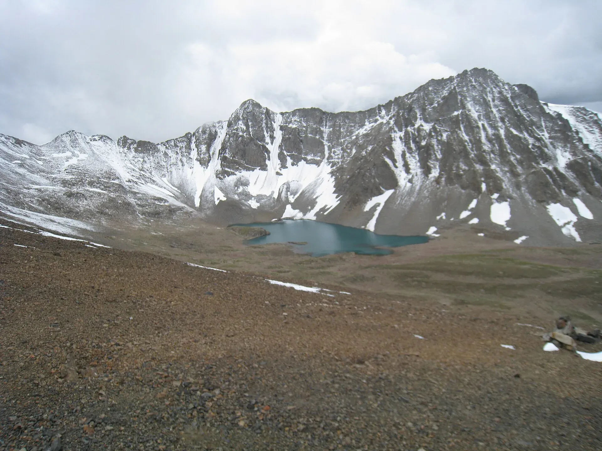
Photo: Ijaz024, with thanks · CC BY-SA 4.0 · via Wikimedia Commons · temporary stand-in photo

Sosbun
A moderate five-day trek into the rarely visited Sosbun valley, good for wildlife watching and for climbers looking at unnamed walls. Ride from Skardu up the Braldu valley to Chakpo, trek up the Hoh Lungma to Nangmah, cross the Sosbun Glacier to Jusma, then go on to Sosbun Base Camp beneath Sosbun Brak (6,413 m). Return in two days to Chakpo.
Skoro La
A demanding three-day trek over the Skoro La (5,073 m), a little-used pass first crossed by Falconer in 1838, between Askole in the Braldu valley and Namika near Shigar. It was used more before the road reached Askole, and is useful if the Braldu road is blocked. From Askole you climb to Thal Brok, go up the glacier to the pass, descend 450 m steeply on snow and rock, and follow a stream down to Namika, 6.5 km north of Shigar.
Panmah Glacier
The 42 km Panmah Glacier is fed by the Choktoi and Nobande Sobande glaciers and has the Latok spires at its head. The area is in a restricted zone and needs a permit, a licensed guide and CKNP fees. The treks are scenic and extreme technical routes that start from Thungol, follow the Dumordo River and then the glacier. Passes include the Sim La (5,833 m) and the Skam La (5,407 m). Conditions change from year to year, and guides and porters do not yet know these routes well.
Khaplu walks
Khaplu stands on the Shyok River at about 2,600 m, 103 km east of Skardu, and is a base for treks into the Hushe valley. From Khaplu's bazaar a 45-minute walk passes the polo ground to the palace of the Raja of Khaplu, with its four-storey wooden balcony. Wikipedia calls it the last and best Tibetan-style palace in Pakistan. A further steep 20 minutes leads to Chakchun village and views across the Shyok River to Masherbrum. Wikipedia lists a 14th-century mosque at Chaqchan, said to have been founded by Ameer Kabeer Syed Ali Hamadani. Longer walks go to Ghanche Tso (two stages up the Ghanche River) and Daholi Tso, a lake reached in two stages from Hanjore.
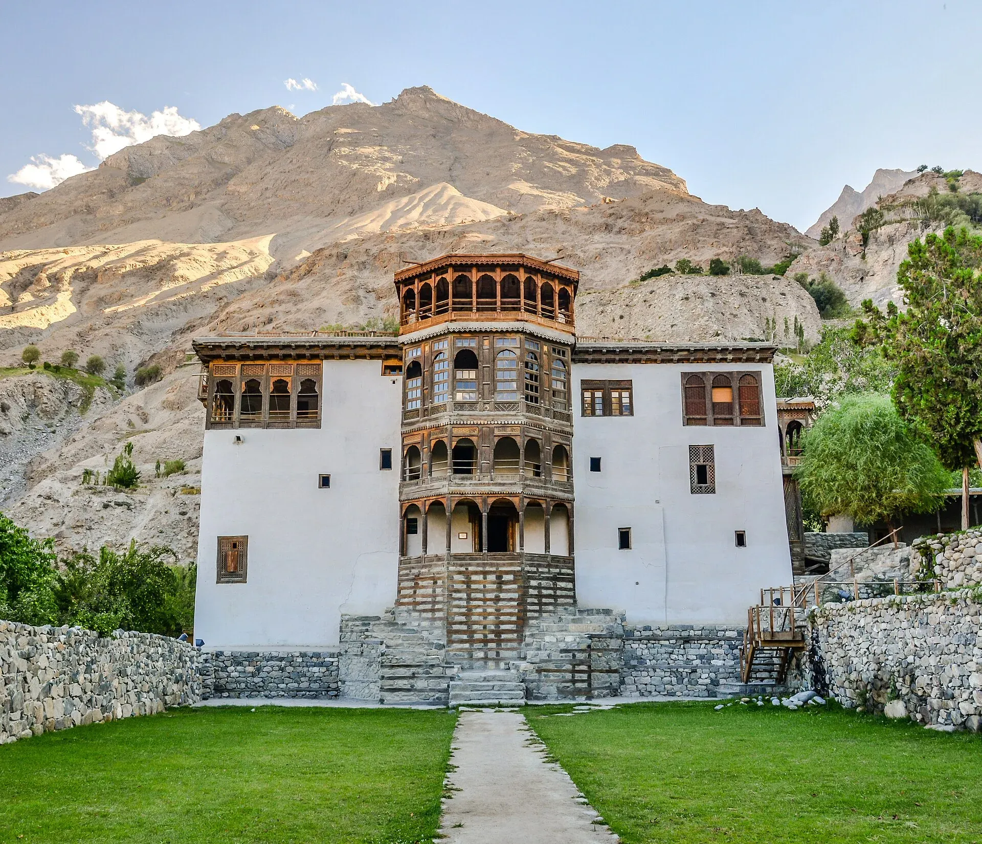
Photo: Muhammad Ashar, with thanks · CC BY-SA 3.0 · via Wikimedia Commons · temporary stand-in photo

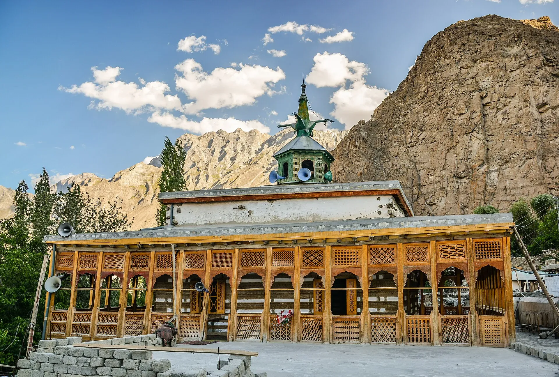
Photo: Muhammad Ashar, with thanks · CC BY-SA 3.0 · via Wikimedia Commons · temporary stand-in photo

Honbrok
A day hike from Hushe to the Honbrok summer pastures. It takes about four hours to climb steeply and 1½–2 hours to return. Cross the Hushe River on the lower footbridge, follow the Honbrok stream's north bank and reach pastures with reliable spring water. June to October is best.
Aling Glacier and K6 Base Camp
The Aling Glacier, the westernmost in the Hushe valley, is large with several upper branches. The trail from Hushe goes via Dumsum to Shatonchen and base camp; Hushe villagers count 14 stages one way, but few go beyond the seventh. K6 (7,281 m) is approached from Kande village through Mingyulu to Nangmah pastures, a moderate trek of three stages each way. The steep granite walls of the Nangmah valley make it a popular rock-climbing area.
Kondus and Saltoro valleys
These eastern Baltistan valleys have been a closed zone since the Siachen dispute began in 1984. Wikipedia says Kondus was closed to foreigners for 18 years and reopened in 2002 with a special permit. The valley lies at about 2,900 m, about 50 km from Khaplu, and its main village is Khor Kondus. The old guide notes that a US group received a trekking permit for the Kondus valley in 2000, and Wikipedia adds that the group made the first ascent of the Tahir Tower that year. Anyone interested would need to ask the Tourism Division through a licensed trekking company, and the answer may well be no. The valleys have fine granite towers above Karmading and Tsino. Current access has not been verified, so check with the authorities and do not go without clearance.
Practical information
For all of these treks, hire local porters and guides where the old guide recommends them. Facilities are basic. Villages along the Gilgit–Skardu road, such as Bagicha, Dassu, Stak and Sassi, are trailheads served by daily transport. In restricted or closed zones, you need a permit and a licensed guide. In all areas, ask your operator about any Central Karakoram National Park fees and the current rules before you go.
Highlights
- Easy and moderate passes linking the Basha, Tormik, Shigarthang and Deosai areas
- Hot springs at Chu Tron on the Ganto La route
- Technical passes for experienced parties: Haramosh La, Stak La, Harpo La
- Day walks from Khaplu and Hushe with views of Masherbrum
Getting there
Most trailheads are on the Gilgit–Skardu road (Bagicha, Dassu, Stak, Sassi) or reached by jeep from Skardu (Shigarthang, Basho, Skoyo, Doko). Khaplu and Hushe are reached by road from Skardu. See the individual route notes and arrange transport through your operator.
Permits and rules
- Fee
- Current fees will be added soon
- Last checked
- 16 November 2026
Rules differ between the routes on this page; this is a general note for Baltistan.
Most routes in this roundup are in open zones, where the old guide says no permit is needed. The Panmah Glacier is a restricted zone (permit and licensed guide). The Kondus and Saltoro valleys have been closed since 1984, although Wikipedia says the Kondus valley reopened to foreigners with a special permit in 2002. Rules and fees change; check with a licensed operator or the Gilgit-Baltistan Tourism Department before you go.
How trekking permits, NOCs and registration work: Visa and permits.
Season
Best: Jul – Sep · general guide; each route differs
Water and camps
Water and camps vary by route; see the notes under each trek. Expect basic or no facilities.
Gear and safety
The technical passes (Haramosh La, Stak La, Harpo La, Naqpo Namsul La, Skam La) need rope, crampons, ice axe, helmet and an experienced guide. Moderate routes have river crossings and steep, rocky passes that hold snow early in the season. Rescue is slow in these valleys.
Variations
See the Burji La, Thalle La, Chogo Lungma Glacier, Masherbrum Base Camp and Hispar La treks for full guides.
Tips
- Bring most supplies; villages on these routes have only basic shops.
- Check each pass's snow conditions and height with local guides.
- Hire a Shina-speaking guide for the Haramosh La.
- Confirm permit and CKNP requirements with an operator before you go.
- Closed zones (Kondus, Saltoro) need government permission.
Photos we still need: Ganto La, Stak La, Alampi La, Skoyo, Skoro La, Sosbun and the Panmah Glacier (no open-licence photos found). Send us yours
Health and emergency
Mobile signal is patchy on most treks, so tell someone your plan before you go. Emergency numbers
Sources and last checked
Last checked Confidence low11 sources9 still to check
- Last checked
- Method
- Desk research from published sources
- Confidence
- low
- Checked by
- trek.pk research team
Researched from published sources; not yet checked on the ground by our team. Spot something out of date? Report a mistake.
Sources
- Other Treks in Baltistan (old trek.pk page, text from Lonely Planet Trekking in the Karakoram and Hindukush, c. 2002; used for facts only) · trek.pk / Lonely Planet · checked
- Burji La · Wikipedia · checked
- Visiting CKNP: permits, season, logistics (unofficial-looking summary; figures approximate) · cknp.org · checked
- Procedure for Applying for Permission 2024-25 · Pakistan Travel Blog · checked
- Gilgit-Baltistan tourism bounces back despite Middle East war · Dawn · checked
- Kondus Valley · Wikipedia · checked
- Deosai National Park · Wikipedia · checked
- Pakistan trekking visa 2026 · Skardu Trekkers (operator, 11 Jul 2026) · checked
- Khaplu · Wikipedia · checked
- Haramosh · Wikipedia · checked
- Shigar Valley · Wikipedia · checked
Still to be checked on the ground (9)
- Pass heights and stage counts come from the c. 2002 guidebook; the only second source found for Ganto La is a copy of the same text
- Zone status of each route (general rule confirmed by Dawn, Mar 2026; Panmah, Haramosh La and others not listed in any source found)
- Deosai National Park entry rules and fees for the Deosai Traverse (no official source)
- Road and bridge changes since 2002 (for example at Skoyo and Dambudas)
- Whether the Saltoro valley is still closed and whether Kondus still needs a special permit (Wikipedia says reopened with a permit in 2002)
- Transport details: bus and jeep services have changed
- Photos cover only some routes (Deosai, Khaplu, Hushe, Haramosh, Kondus)
- Burji La height: about 5,000 m (Wikipedia); this page gives no figure for it
- Whether the Kondus valley is open to foreigners now; Wikipedia gives the 2002 reopening but no later source was checked
Nearby and related

Burji La

Thalle La

Chogo Lungma Glacier

Masherbrum Base Camp

Hispar La (Biafo–Hispar traverse)

Baltoro Glacier and K2 Base Camp
Sim La
A very high glaciated pass of about 5,833 m on the Panmah Glacier trek routes in Baltistan. Restricted zone, extreme and technical.
Skam La
A glaciated pass of about 5,407 m on the Panmah Glacier routes in Baltistan. Restricted zone, extreme and technical.
Trango Pir Pass
A glaciated pass between Shoat on the Indus and Astor. Sources conflict on its height, from 4,800 to 5,600 m.
Harpo La
A glaciated pass of 5,115 m between Shoat on the Indus and Astor, with serious avalanche danger.
Skoro La
A little-used pass of 5,073 m between Askole in the Braldu valley and Namika near Shigar, first crossed by Falconer in 1838.
Alampi La
A demanding pass of 5,030 m from the Shigarthang valley to Astor, with a steep rocky descent. Probably first crossed by Vigne in 1834-35.
Banak La
A demanding pass of 4,963 m from the Shigarthang valley to Astor, with a glacier and a steep descent to Chumik.
Naqpo Namsul La
A glaciated pass of about 5,000 m near the head of the Basho valley, on a five-day near-loop from Sultanabad to Kachura.
Dari La
A demanding trekking pass of about 4,724 m between Shigarthang and the Deosai Plains, crossed in three days. Little information published.
Katichu La
A moderate trekking pass of about 4,588 m between Mehdiabad on the Indus and the Deosai Plains, usually snow-free from July to late September.
Sheosar Pass
A jeep-road pass of about 4,266 m on the Deosai Plains between Sheosar Lake and the Chilam valley, on the Skardu to Astore traverse.
Burji La
A snow-covered pass of about 4,816 m between Skardu and the Deosai Plains, with distant views of K2 and the Baltoro peaks. A moderate three-day trek.
Ganto La
A moderate pass of about 4,606 m linking the Basha and Tormik valleys in Roundu, from Hemasil and the Chu Tron hot spring to Harimal.
Haramosh La
A glaciated, technical pass of about 4,800 m between the Chogo Lungma and Haramosh glaciers, ringed by Laila, Mani and Haramosh. For experienced mountaineers only.
Stak La
A technical glacier pass of about 4,500 m linking the Stak Nala and the upper Tormik valley in Roundu. Needs rope and ice axe on a corniced west side.
Thalle La
A non-glaciated pass of 4,572 m linking the Thalle valley near Khaplu with the Bauma valley and Shigar. One of Baltistan's easiest passes. Also written Thalay La.
K6 (Baltistan Peak)
K6, also called Baltistan Peak, is a 7,282 m peak in the Masherbrum Mountains above the Charakusa and Hushe valleys. It was first climbed in 1970 by an Austrian expedition. It is seen on the K7 Base Camp trek.