

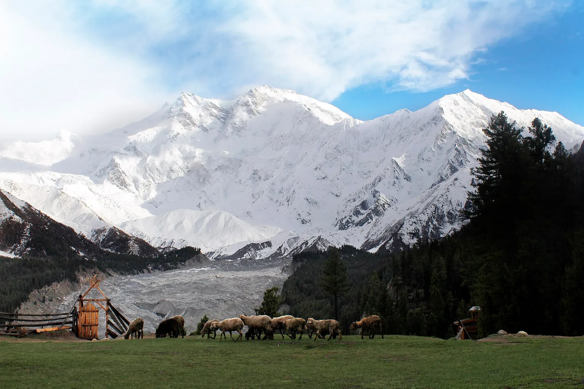
Photo: Zaki Khan89, with thanks · CC BY-SA 4.0 · via Wikimedia Commons · temporary stand-in photo

Fairy Meadows and Nanga Parbat Base Camp
- Duration
- 3–5 days
- Distance
- 21 km
- Grade
- Easy
- Max altitude
- 3,967 m
- Season
- May – Oct
A short, popular trek from the Karakoram Highway to green meadows below the north face of Nanga Parbat (8,126 m), with an easy extension to the Raikot-side base camp.
Overview
Fairy Meadows is a grassy terrace at about 3,300 m, above the Raikot Glacier in Diamer district. Pine and birch forest runs along its edge. Straight ahead is the north (Raikot) face of Nanga Parbat, the ninth-highest mountain in the world at 8,126 m. Below the meadows, the Raikot stream drops through a deep gorge to the Indus.
The trek itself is short. You drive a rough 15 km jeep track from Raikot Bridge on the Karakoram Highway (KKH) to Tato, then walk about 5.5 km up to the meadows. Most people stop there. If you have more time, you can walk on to Beyal (about 3,500 m) and, from there, to Nanga Parbat Base Camp (about 3,970 m).
It is one of the easiest ways in Pakistan to get this close to an 8,000 m peak. It is also busy in summer, so book a bed or tent in advance in July and August.
Name and setting
Locals call the meadows Joot. German climbers named them Märchenwiese, "fairy tale meadows", and the English name follows from that. The meadows were declared a national park in 1995 and have been part of Nanga Parbat National Park since 2021. Local people have run camping sites here since 1992.
Who it suits
- First-time trekkers and families with older children who are used to walking uphill.
- Anyone who wants big mountain views without carrying a heavy pack or crossing glaciers.
- Fit walkers who want a longer day to the base camp. This day is 8 km return from Beyal and has some rubble-covered glacier to cross, so it is not a stroll.
You need no climbing skills. The main risks are the road, altitude above 3,000 m, and weather.
When to go
The usual season is late May to mid-October. Wikipedia gives April to the end of September for visitors. In May and June the meadows are green and flowers come out. July and August are warmest and busiest, and also bring the highest risk of rain-triggered landslides on the jeep track. September and early October are clearer and cooler. In winter the meadows are under snow and the track is not used by normal visitors.
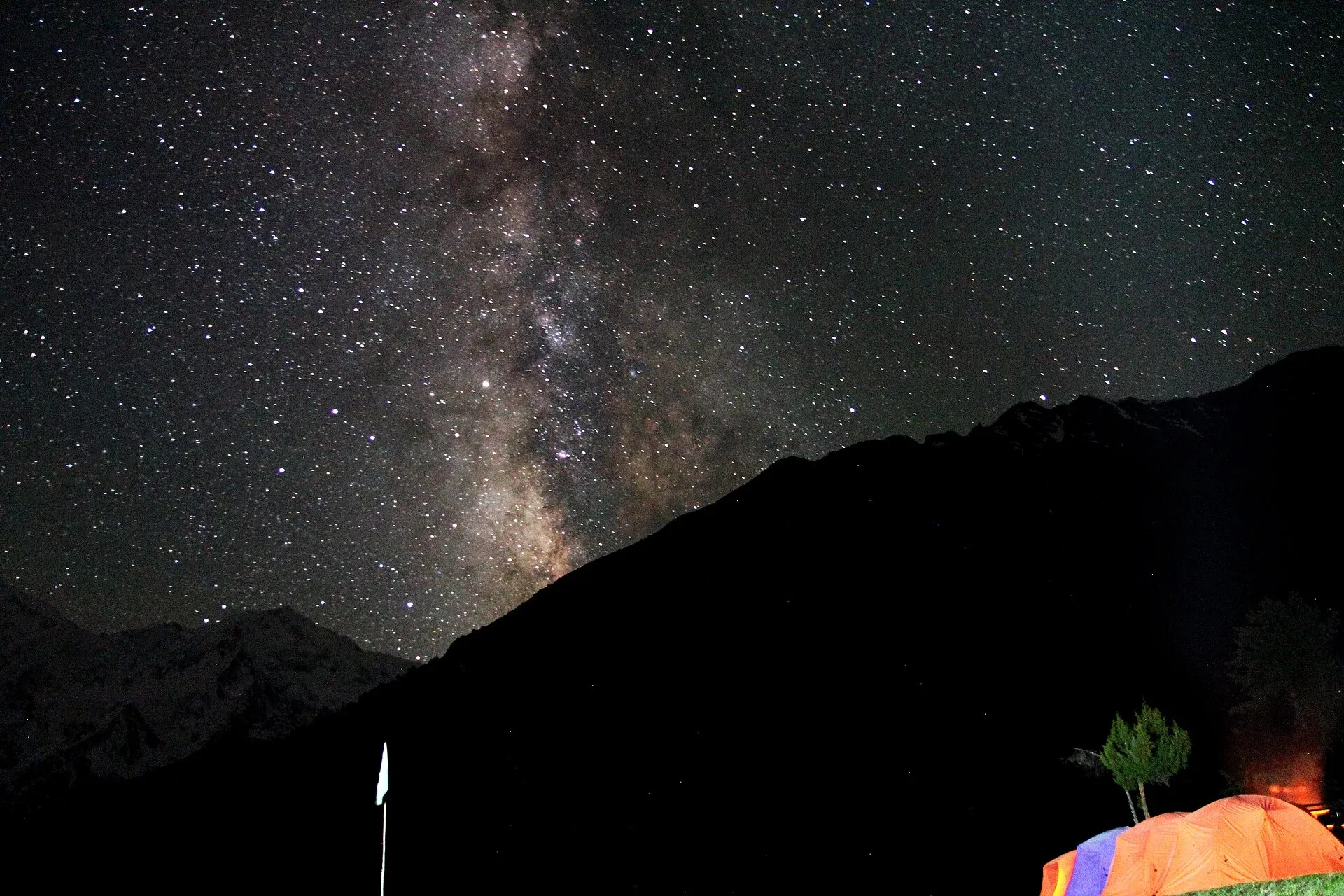
Photo: M.Ahmad Hussnain, with thanks · CC BY-SA 4.0 · via Wikimedia Commons · temporary stand-in photo

The route
Tato to Fairy Meadows (about 5.5 km, 2 to 2.5 hours). The path climbs steadily through junipers and pines on what used to be the main mule track. Halfway there is a shady stream. After that the slope eases and you reach the meadows, with the glacier and the peak ahead.
Fairy Meadows to Beyal (about 5 km, 1.5 hours). The trail follows the edge of the terrace above the end of the Raikot Glacier, then runs through pine and fir along a birch-lined stream. Beyal is a quieter meadow with a spring and good views back down towards the Indus Valley and Rakaposhi. Water can run short late in the season.
Beyal to Nanga Parbat Base Camp (about 8 km return, 6 to 7 hours). From Beyal an easy path leads to a rocky viewpoint (about 3,670 m) on the glacier's side moraine. From there you cross the rubble of the Ganalo Glacier on a cairned route to base camp (about 3,970 m), roughly 3 to 4 hours from Beyal. Fit walkers can do this as a long day from Beyal. A rest day or an overnight at base camp is better for acclimatisation.
You then retrace your steps to Tato (about 10.5 km from Beyal) and take a jeep back to Raikot Bridge. Walking down to the highway is possible but hot and dusty.
Which peak is which
The great white wall seen from the meadows is the north side of Nanga Parbat, which Wikipedia calls the Rakhiot flank. The Rakhiot flank rises about 7,000 m from the Indus valley to the summit in only 25 km. The peak that looks like the summit is the North Peak (7,816 m). The true summit (8,126 m) is behind the North Peak's massif and the Silver Saddle, and is hard to pick out from the meadows.
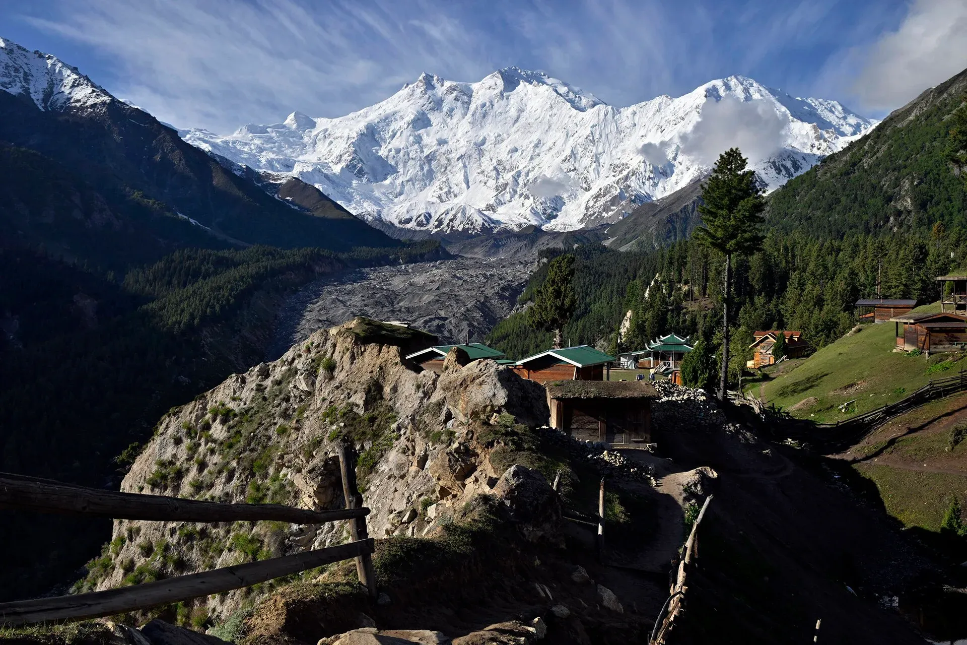
Photo: Moskenes, with thanks · CC BY-SA 4.0 · via Wikimedia Commons · temporary stand-in photo

The north flank is the route of the first ascent. Hermann Buhl reached the summit on 3 July 1953 by the Rakhiot flank and the east ridge, and climbed the last section alone and without oxygen. In 1895 Albert Mummery and two Gurkha companions died while reconnoitring the Rakhiot face. Wikipedia places Rakhiot Base Camp at 4,100 m. This page gives about 3,970 m for the base camp reached on foot from Beyal, so treat the figures as approximate.
Forest and wildlife
The forest around the meadows is mainly blue pine (Pinus wallichiana), Himalayan spruce (Picea smithiana) and silver fir (Abies pindrow). Birch and willow grow higher up, juniper on the southern slopes and artemisia at lower levels. Wikipedia says a few brown bears remain and are declining, and that some musk deer, an endangered species, live in the forest.
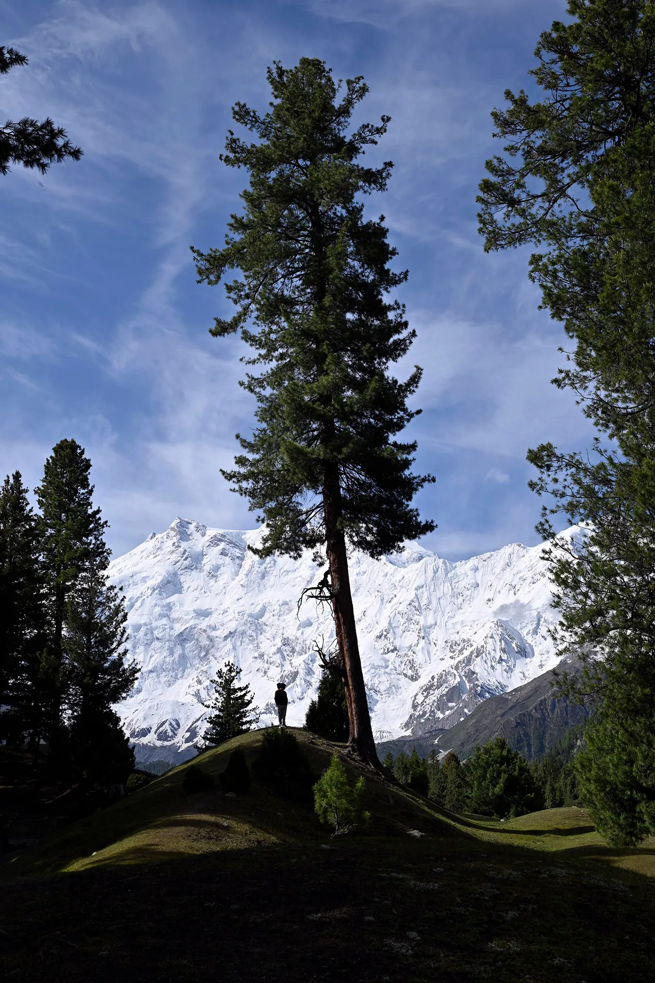
Photo: Moskenes, with thanks · CC BY-SA 4.0 · via Wikimedia Commons · temporary stand-in photo

Culture and people
The land around the meadows is summer pasture. Families from the valley below bring livestock up in the warm months, and you will see herders' huts, dogs and mules on the paths. In May and June, locals gather morel mushrooms in the forest. Keep your distance from herding dogs and shut gates behind you.
Local jeep drivers from Raikot run the road, and porters and mule owners work as a group. Prices are fixed by these groups rather than negotiated one by one. Treat guides and porters fairly, and agree the rate for each stage before you start.
Practical information
- Getting to the road: Raikot Bridge is on the KKH, about 55 km east of Chilas, and about 78 km (around 1.5 hours) south-west of Gilgit. One travel guide says about 80 km and two hours by road from Gilgit. Buses and vans between Gilgit and Rawalpindi or Chilas can drop you there, and a bus station at the bridge serves Chilas.
- Jeep to Tato: Only local jeeps run the track. It is a gravel road about 15 km long. The WHO named it the second most dangerous road in the world in 2013, according to Wikipedia, and one blog reports that it was widened after accidents. Horses can be hired for the climb from Tato to the meadows. Jeeps are hired per vehicle for the round trip (not per person), so a group can share the cost; current fares will be added soon. There is no known official tariff. Ask for the price before you set off.
- Road safety: The track is narrow and cut into a steep slope. Drivers are experienced, but accidents do happen. At the end of May 2026 a jeep carrying tourists fell into a ravine near Fairy Meadows; Dawn reported seven people missing. Sit in the vehicle calmly, do not rush the driver, and avoid the track in heavy rain. Flood and landslide damage blocked it in July and August 2025.
- Stay: Tent camps, huts and small guesthouses are at Fairy Meadows and Beyal. Fees change each year, so confirm the price on arrival. Take warm clothes even in summer: nights are cold.
- Security: In June 2013, gunmen attacked the Diamir side base camp of Nanga Parbat, on the other side of the mountain, and killed ten foreign climbers and a Pakistani guide. Fairy Meadows is on the Raikot side and has been visited by large numbers of domestic tourists since. Ask your operator or the Diamir police for current advice before you travel.
- Permits: Fairy Meadows lies in Nanga Parbat National Park and Pakistan's open trekking zone. Foreigners should check current trekking permit rules with a licensed operator, because Gilgit-Baltistan's permit fees and processing have been disputed since 2024 (see the permits section). Pakistani citizens do not need a trekking permit.
Highlights
- Close-up view of Nanga Parbat's north (Raikot) face
- Forest and meadow camping at about 3,300 m
- Easy day walks to Beyal and a rocky viewpoint
- Optional day or overnight to Nanga Parbat Base Camp
- Side climb to Susuru Bush (about 4,000 m) for wide views
Day by day
| Day | Camp | Altitude |
|---|---|---|
| 1 | Fairy Meadows | 3,306 m |
| 2 | Beyal | 3,500 m |
| 3 | Tato | 2,666 m |
| Day | Route | Hours | Distance | Ascent / descent | Camp and altitude |
|---|---|---|---|---|---|
| Day 1 | Tato to Fairy Meadows | 2–2.5 h | 5.5 km | +640 m | Fairy Meadows, 3,306 m |
Day 1 notesJeep from Raikot Bridge to Tato, then walk up a clear path through chir pine, juniper and wild rose. A stream about halfway gives shade. The slope eases before the meadows. Camps and huts sit on the terrace facing Nanga Parbat. Wander through the herders' settlements in the afternoon, but watch for dogs. An optional half-day walk leads to Susuru Bush (about 4,000 m) for views over the glacier. | |||||
| Day 2 | Fairy Meadows to Beyal | 1.5 h | 5 km | +194 m | Beyal, 3,500 m |
Day 2 notesA gentle walk along the terrace above the Raikot Glacier's end, through fir and birch. Keep left at a vague fork near the start. Beyal is quieter than Fairy Meadows and has fenced campsites and a spring. Spend the afternoon resting or walking to the viewpoint boulder (about 3,670 m) for a close view of the icefalls. | |||||
| Day 3 | Beyal to Tato (or day trip to base camp) | 2–2.5 h | 10.5 km | −834 m | Tato, 2,666 m |
Day 3 notesWalk back to Fairy Meadows in about an hour, then down to Tato in 1 to 1.5 hours. If you have an extra day, go from Beyal to Nanga Parbat Base Camp (about 3,970 m) and back: 8 km, 6-7 hours, with a cairned crossing of the Ganalo Glacier. Strong walkers can continue 2 hours to Camp 1 (about 4,470 m) over the Great Moraine in July and August, when it is usually snow-free. | |||||
Getting there
From Gilgit, take a bus or van on the KKH to Raikot Bridge (about 78 km, 1.5 hours). From Chilas it is about 55 km (1 hour). Gilgit-Rawalpindi buses will drop you at the bridge if you ask.
From Raikot Bridge a local jeep takes you up the narrow track (about 15 km) to Tato, the road end. Only jeeps from the Raikot drivers' group are normally allowed on this track. Outside vehicles may be turned back or charged extra. Walking the track takes about four hours and climbs roughly 1,300 m; start early because it is hot and dry.
From Tato, walk about 2 to 4 hours to Fairy Meadows (guides say 2 to 3; Wikipedia says 3 to 4 for the 5 km).
Permits and rules
- Permit needed
- Usually not, Open zone
- Fee
- Current fees will be added soon
- Last checked
- 16 November 2026
Fairy Meadows is in Pakistan's open trekking zone and inside Nanga Parbat National Park. Our older sources say no trekking permit was needed. Since 2024, Gilgit-Baltistan has changed its permit fees for foreign trekkers and climbers, and a Chief Court case held up permits in 2025 (ExplorersWeb, 27 March 2025), and the Tourism Department notified a reduced fee schedule in May 2025 (The News, 25 May 2025). Dawn reported in February 2026 that foreign winter permits had not been issued since 2023. Foreign visitors should ask a licensed Pakistani operator which permits and fees apply to their dates. Pakistani citizens: check at the Gilgit-Baltistan Tourism office in Chilas or Gilgit.
How trekking permits, NOCs and registration work: Visa and permits.
Season
Best: May – Oct
Water and camps
Streams run at Fairy Meadows and along the path. Treat or filter all water. Beyal has a spring, but the stream there can run dry late in the season when snowmelt stops.
Fairy Meadows has fenced campsites and simple huts with toilets, a kitchen and dining area. Beyal has fenced campsites, one with a year-round spring. Rates and facilities change each year, so confirm on arrival. Carry out all rubbish.
Gear and safety
- Altitude: The meadows are at about 3,300 m and the base camp at about 3,970 m. Sleep a night at Fairy Meadows or Beyal before going to base camp, and descend if you get a worsening headache, nausea or breathlessness.
- Road: The jeep track is the riskiest part of the trip. Do not drive it at night or in rain, and tell your driver to slow down.
- Glacier crossing: The Ganalo Glacier crossing is rubble, not ice, but stones move. Keep to the cairns and go in daylight.
- Weather and landslides: Afternoon storms are common in summer. After heavy rain the track and trail can close.
- Help: There is no road rescue above Tato. Pay for a guide or tell someone at your camp where you are going. The nearest hospital is in Chilas.
- Gear: Walking boots, a warm layer, a rain shell, sun protection, and a sleeping bag if you camp.
Ask the district administration or local police about current conditions before you go. For foreign visitors: the UK FCDO advises against all travel on the Karakoram Highway between Mansehra and Chilas (advice updated 27 October 2026, checked 16 November 2026), but does not advise against Gilgit-Baltistan generally. Read the live advice before you plan.
Variations
- Rupal Valley (
rupal): the south side of Nanga Parbat, reached from Astore. - Mazeno La (
mazeno-la): a technical high-level route from the Rupal side that can finish at Fairy Meadows via two further passes. - Bezar Gali and Muthat Pass: little-used passes that start near Fairy Meadows (see
other-treks-in-diamir). - Buldar Peak (5,602 m) and South Jalipur Peak (5,206 m): climbs from the Raikot valley. South Jalipur is non-technical but needs a high camp; Buldar needs basic mountaineering skills.
Tips
- Book beds and tents ahead in July and August.
- Agree the jeep price at Raikot Bridge before leaving and keep the driver's number.
- Do not take the jeep track in heavy rain or after a flood warning.
- Spend a night before going higher than Beyal to adjust to altitude.
- Take warm layers and a rain shell; nights at 3,300 m are cold even in July.
- Keep your distance from herders' dogs and carry your rubbish out.
Stay and eat in Chilas
Chilas is the nearest town to the trek: somewhere to sleep and stock up before and after.
Places to stay
- Shangrila Chilas HotelCall Shangrila Chilas HotelMap of Shangrila Chilas Hotel in Google Maps
- Indus lodges ChilasCall Indus lodges ChilasMap of Indus lodges Chilas in Google Maps
- Grace Continental Hotel & RestaurantCall Grace Continental Hotel & RestaurantMap of Grace Continental Hotel & Restaurant in Google Maps
- Tarangfa LodgesCall Tarangfa LodgesMap of Tarangfa Lodges in Google Maps
- Panorama Hotel & Restaurant ChilasCall Panorama Hotel & Restaurant ChilasMap of Panorama Hotel & Restaurant Chilas in Google Maps
- Hotel Royal City ChilasCall Hotel Royal City ChilasMap of Hotel Royal City Chilas in Google Maps
Places to eat
- Babusar Gateway RestaurantCall Babusar Gateway RestaurantMap of Babusar Gateway Restaurant in Google Maps
Essential services fuel stations, ATMs, banks and hospitals and clinics
Fuel
- PSO (Meera Jan) at Gini (Chilas)Call PSO (Meera Jan) at Gini (Chilas)Map of PSO (Meera Jan) at Gini (Chilas) in Google Maps
- Total Parco Filling Station ChilasMap of Total Parco Filling Station Chilas in Google Maps
- PSO Petroleum ChilasMap of PSO Petroleum Chilas in Google Maps
- Khair-ul-Bashar Filling - Total Petrol StationCall Khair-ul-Bashar Filling - Total Petrol StationMap of Khair-ul-Bashar Filling - Total Petrol Station in Google Maps
ATMs
Banks and money exchange
- Faysal Bank ChilasMap of Faysal Bank Chilas in Google Maps
- Meezan Bank - Chillas BranchCall Meezan Bank - Chillas BranchMap of Meezan Bank - Chillas Branch in Google Maps
Hospitals and clinics
- Regional Headquarters Hospital ChilasMap of Regional Headquarters Hospital Chilas in Google Maps
- Marham health care centre (MHCC)Call Marham health care centre (MHCC)Map of Marham health care centre (MHCC) in Google Maps
Listings come from Google Maps data and are unverified: phone numbers, opening months and prices may have changed. Report a problem · Own one of these? Claim it
Health and emergency
Mobile signal is patchy on most treks, so tell someone your plan before you go. Emergency numbers
Sources and last checked
Last checked Confidence medium15 sources8 still to check
- Last checked
- Method
- Desk research from published sources
- Confidence
- medium
- Checked by
- trek.pk research team
Researched from published sources; not yet checked on the ground by our team. Spot something out of date? Report a mistake.
Sources
- Trekking in the Karakoram and Hindukush (Lonely Planet, c. 2002) and the old trek.pk pages · Lonely Planet / trek.pk legacy · checked
- Fairy Meadows · Wikipedia · checked
- Nanga Parbat · Wikipedia · checked
- Fairy Meadows · Gilgit-Baltistan Tourism Department · checked
- How to reach Fairy Meadows? A guide (July 2025) · Pakistan Tour n Travel · checked
- 5 Days Trip to Fairy Meadows (jeep fares quoted) · TripMaker.pk · checked
- Seven missing after tourist jeep falls into ravine en route to Fairy Meadows (2 June 2026) · Dawn · checked
- 2013 Nanga Parbat massacre · Wikipedia · checked
- Trekkers and climbers stranded amid Pakistan permit dispute (27 March 2025) · ExplorersWeb · checked
- GB winter adventure tourism hit by soaring permit fee, visa delays (1 February 2026) · Dawn · checked
- Pakistan travel advice: warnings and insurance · UK Foreign, Commonwealth & Development Office · checked
- Fairy Meadows jeep cost 2026 · Pakistan Travellers (blog) · checked
- Fairy Meadows jeep track: fares, rules and safety · Explore Pakistan (blog) · checked
- All we know so far: Fairy Meadows jeep tragedy in Diamer · Fuchsia Magazine · checked
- GB slashes mountaineering, trekking fees to promote tourism (25 May 2025) · The News · checked
Still to be checked on the ground (8)
- Jeep fare Raikot Bridge to Tato (blogs say PKR 8,000 to 20,000 per jeep, union-set; no official fare)
- Camping and hut rates at Fairy Meadows and Beyal, and any entry or national park fee
- Current state of the Tato road (blocked by floods in Jul 2025; accident end of May 2026; no current report)
- Beyal and Nanga Parbat base camp walking times and distances (c. 2002 survey; only Tato to Fairy Meadows re-checked, 2 to 4 h)
- Current foreign trekking permit fees and rules for Gilgit-Baltistan
- Base camp height: about 3,970 m on this page against 4,100 m for Rakhiot Base Camp in a Wikipedia photo caption
- Gilgit to Raikot Bridge: 78 km and 1.5 hours here, about 80 km and two hours in a travel guide
- Whether horses are still hired at Tato, and the rates
Nearby and related

Rupal Valley and Nanga Parbat Rupal Face
Mazeno La

Other treks in Diamir
Muthat Pass
A very demanding pass of about 4,965 m between the Raikot valley and Astore, the last stage of a full Nanga Parbat circuit. Little information; local guide essential.
Khusto Pass
A trekking pass of about 4,837 m on the Mazeno variation between Jalipur high camp and Beyal near Fairy Meadows. Very little published.
Karu Sagar Pass
A trekking pass of about 4,400 m between Kutagali and Shaichi on the Mazeno variation to Fairy Meadows. Very little published.
Mazeno La
A glaciated pass of about 5,399 m on the Mazeno Ridge of Nanga Parbat, linking the Rupal Valley in Astore with the Diamir side. Technical; experts only.