

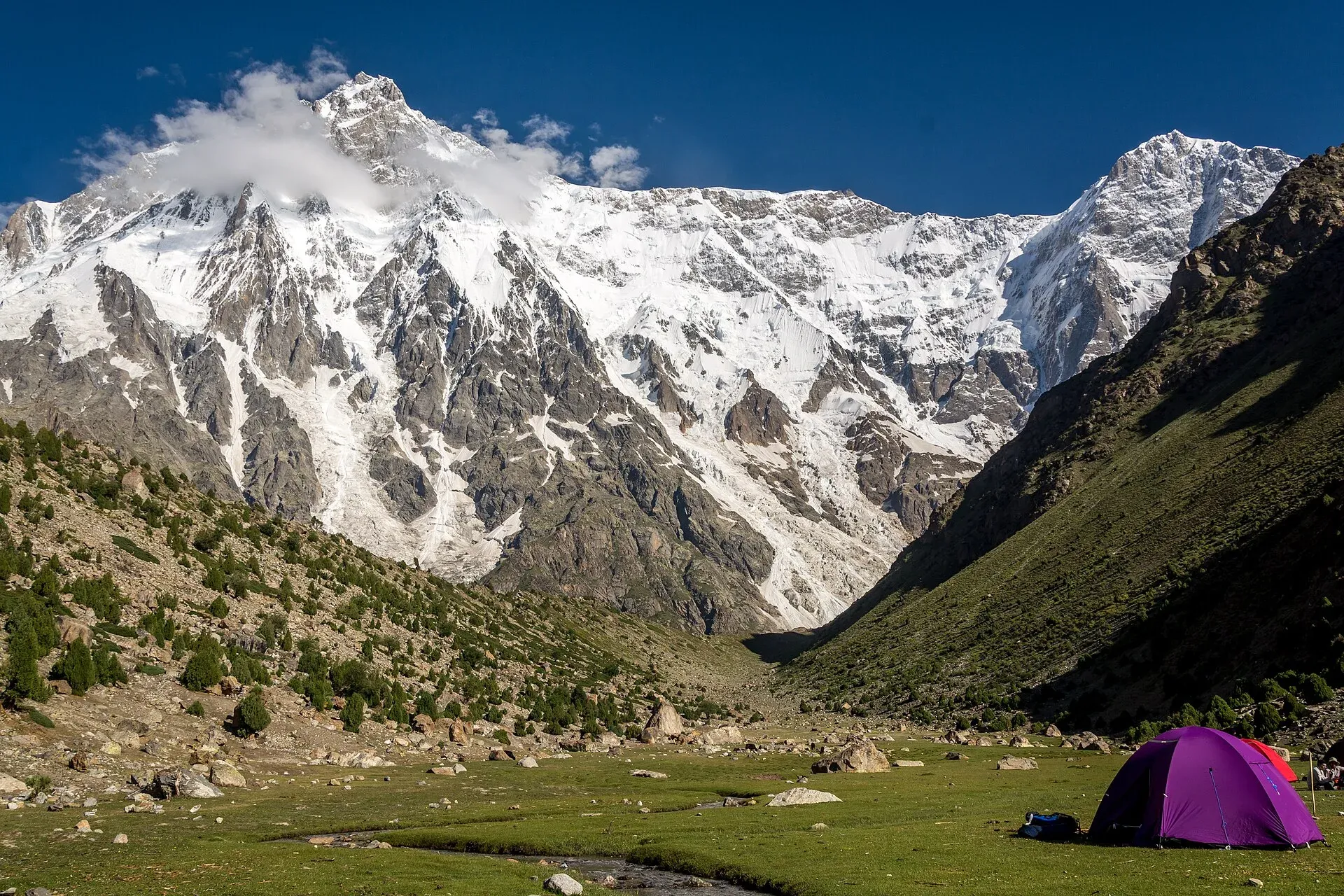
Photo: Muhammad Ashar, with thanks · CC BY-SA 3.0 · via Wikimedia Commons · temporary stand-in photo
Rupal Valley and Nanga Parbat Rupal Face
- Duration
- 5–6 days
- Distance
- 37 km
- Grade
- Easy
- Max altitude
- 3,655 m
- Season
- Jun – Oct
A five-day trek up the Rupal Valley from Tarashing to the south face of Nanga Parbat, one of the tallest mountain walls on Earth. Easy trails, two short glacier crossings.
Overview
The Rupal Valley runs along the south side of Nanga Parbat in Astore district. At its head, the Rupal Face climbs about 4,600 m from the valley floor to the summit at 8,126 m. It is often described as one of the biggest mountain walls on Earth.
The standard trek starts at Tarashing (about 2,900 m) and follows the valley floor past Rupal village and the German base camp at Herrligkoffer (3,550 m). It crosses the Bazhin Glacier to the Latobah meadows and goes on to Shaigiri (3,655 m), a summer settlement directly below the face. You retrace your route to return.
It is about 37 km in total, with no steep climbs. The rewards come from the close, unobstructed views.
The mountain and its history
Nanga Parbat means "naked mountain", a name that refers to the often snow-free south face. Its Shina name, Diamer or Deo Mir, is usually translated as "mountain of God". The Rupal Face is the south side, rising about 4,600 m above its base. Wikipedia says it is often called the highest mountain face in the world. Günther and Reinhold Messner made the first ascent of the face in 1970 and came down the Diamir side, the first traverse of the mountain. Hermann Buhl's first ascent in 1953 was on the opposite, north side. A Polish team climbed the south-east pillar (the Polish Spur) on the right of the face in 1985. Near the base of the face lies Latbo, a glacial lake above a seasonal shepherds' settlement of the same name, close to the Latobah meadows on this route.
Who it suits
- Walkers with some hiking fitness who want a first high-altitude trek.
- People who want Nanga Parbat views without the jeep ride to Fairy Meadows.
- Photographers: the face is best in the early morning light.
You do not need climbing gear. You do need to be comfortable crossing short glacier sections on a clear path, and you should be ready for cold nights above 3,500 m.
When to go
June to October is the usual season. June and July have more snow on the glacier crossings and more mosquitoes in the lower valley. August is warmest but also the time of most afternoon cloud. September and early October give crisp air and stable weather, but nights get very cold. The road to Astore can be blocked by landslides after heavy rain at any time in summer.
The route
Tarashing to Herrligkoffer Base Camp (about 10 km, 5 hours). From the village, cross the Tarashing glacier by its side moraine and walk up the broad valley through Rupal village's terraced fields. The trail follows the north side of the valley to the meadow at Herrligkoffer, named for Karl Herrligkoffer, who organised the German expedition of 1953 that made the first ascent of the mountain (by the north side, not the Rupal Face) and later plotted a route on the Rupal Face. There is a spring.
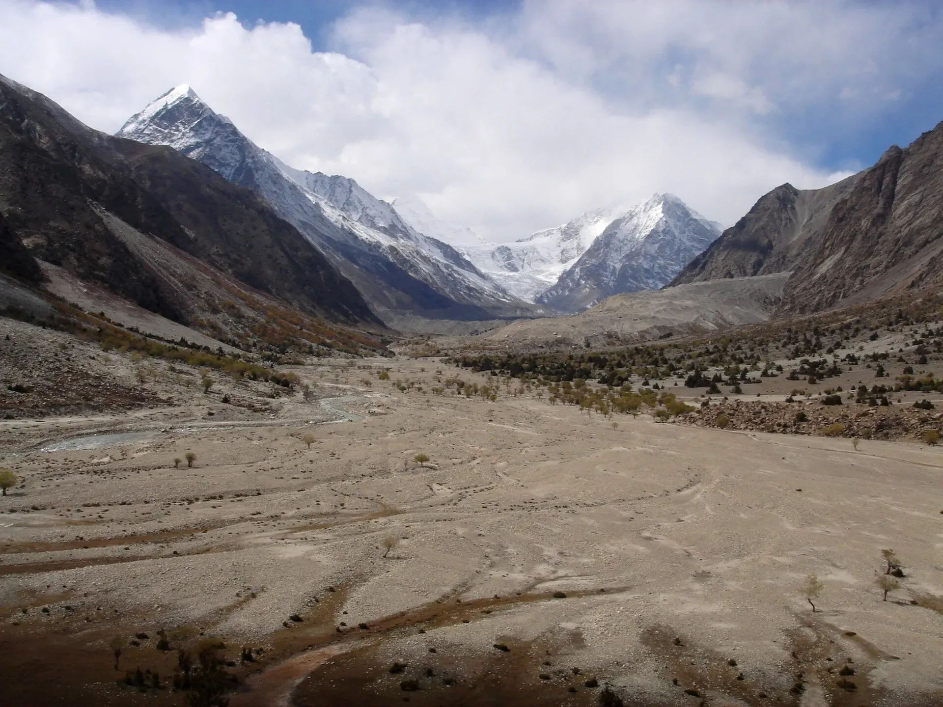
Photo: Daniel Martin, with thanks · CC BY 3.0 · via Wikimedia Commons · temporary stand-in photo
Herrligkoffer to Latobah (about 3 km, 2 hours). Cross the Bazhin Glacier on a marked path, then reach the broad level meadows of Latobah (also called Tupp). Herders use these in summer.
Latobah to Shaigiri (about 5.5 km, 4 hours). The trail stays on the north side of the valley, past a moraine lake, several alluvial fans and the end of the Shaigiri Glacier. Shaigiri is marked by a large white boulder, and the face rises straight ahead.
Return (about 18.5 km, 2 days). Retrace your steps, camping at Herrligkoffer on the first night. The itinerary below adds a rest day at Shaigiri for altitude and photography; skip it for a four-day trek.
An optional side trip goes along the moraine above the Bazhin Glacier, for a view of the icefall that falls from the summit.
Terrain underfoot
The trek is mostly walking on valley paths, grass and meadows, with three kinds of rough ground. Moraine and glacier-edge ground at the Tarashing glacier and the Bazhin Glacier is covered in loose stones, and the paths across them are marked. Between Latobah and Shaigiri the path crosses alluvial fans of gravel and boulders and runs past a moraine lake. The rest is easy grassy valley floor and village fields. There are no steep climbs, but the daily walks are long at altitude, so pace matters more than strength.
Preparation
Start slowly: sleep a night at Herrligkoffer before going higher, drink plenty of water and use the optional rest day at Shaigiri. Carry a warm sleeping bag, a rain shell, sun protection and a stove, since wood is scarce. Allow a spare day in the schedule in case of road slides on the way out. Early morning gives the clearest views of the face, with afternoon cloud more likely in August.
Culture and people
Rupal villages sit at the head of the Astore Valley, and people speak Shina. Families farm barley and potatoes on terraces and keep sheep, goats and cattle on higher pastures in summer. Tarashing and Chorit villages share the work of portering by agreement, so if you hire porters, you usually hire an equal number from each. Ask your guide how this works before you start.
Mules and donkeys carry gear on this trek. Porters ask for a flat rate per stage that includes their food. Large groups are often expected to buy a goat at Shaigiri.
Practical information
- Getting there: Astore is reached from Jaglot on the KKH (about 60 km south of Gilgit). A rough road runs about 40 km up the Astore valley, taking three to four hours. Jeeps run from Gilgit's Jaglot stand to Astore, then on to Tarashing (about 30 km, around two hours). A hired jeep saves time.
- Stay: Tarashing has a few guesthouses and campsites. Confirm prices and availability in advance in July and August.
- Guide: A licensed guide who knows the Rupal porters and villagers is a good idea. Foreign visitors normally book through a licensed operator.
- Permits: The area is open to trekking. Rules and fees for foreigners have been unsettled since 2024. Check with your operator. Checked 2026-11-16.
- Security: The Rupal side has had far fewer problems than the Diamir side of the mountain, where the 2013 attack took place. Still, check the current situation before you travel.
Highlights
- Face-on view of Nanga Parbat's 4,600 m Rupal Face
- Easy trail through Rupal village and alpine meadows
- Camp at Herrligkoffer Base Camp, named for the 1953 expedition leader
- Two short glacier crossings, no technical climbing
- Shaigiri, the summer camp directly below the face
Day by day
| Day | Camp | Altitude |
|---|---|---|
| 1 | Herrligkoffer Base Camp | 3,550 m |
| 2 | Shaigiri | 3,655 m |
| 3 | Shaigiri | 3,655 m |
| 4 | Herrligkoffer Base Camp | 3,550 m |
| 5 | Tarashing | 2,911 m |
| Day | Route | Hours | Distance | Ascent / descent | Camp and altitude |
|---|---|---|---|---|---|
| Day 1 | Tarashing to Herrligkoffer Base Camp | 5 h | 10 km | +639 m | Herrligkoffer Base Camp, 3,550 m |
Day 1 notesCross the Tarashing glacier by the moraine near the village's north edge, then follow the gentle valley through Rupal village. The path climbs gradually through fields to the meadow at the Bazhin Glacier's east side. A large spring flows near a big boulder used as a kitchen site. If you have energy, walk a few hours up the moraine for a view of the icefall from the summit. The ground is mostly valley path and field edge, apart from the short stony moraine crossing near Tarashing. | |||||
| Day 2 | Herrligkoffer to Shaigiri via Latobah | 6 h | 8.5 km | +105 m / −20 m | Shaigiri, 3,655 m |
Day 2 notesCross the Bazhin Glacier on a marked path in about 1.5 hours to reach the level meadows of Latobah (3,530 m). Continue on the north side of the valley past a moraine lake and several alluvial fans. Shaigiri, a summer settlement marked by a white boulder, sits directly under the Rupal Face. This is a long day for some groups; camp at Latobah if you want a shorter walk. Between Latobah and Shaigiri the path crosses gravel fans and passes a moraine lake. | |||||
| Day 3 | Rest day at Shaigiri | free | not given | not given | Shaigiri, 3,655 m |
Day 3 notesUse the day to adjust to altitude and take photographs. Short walks along the valley give new angles on the face. Early morning is the clearest time. This day is optional but helpful for acclimatisation. | |||||
| Day 4 | Shaigiri to Herrligkoffer Base Camp | 5–6 h | 8.5 km | −125 m | Herrligkoffer Base Camp, 3,550 m |
Day 4 notesRetrace the route past the moraine lake and across the Bazhin Glacier. Camp at Herrligkoffer. | |||||
| Day 5 | Herrligkoffer to Tarashing | 3–4 h | 10 km | −639 m | Tarashing, 2,911 m |
Day 5 notesWalk down the valley past Rupal village and cross the Tarashing glacier to the road end. Jeep transport to Astore is normally arranged for the afternoon. | |||||
Getting there
From Gilgit, take a jeep or van from the Jaglot stand to Astore (about 3 to 4 hours). The Astore road leaves the KKH at Jaglot, about 60 km south of Gilgit. Then take a jeep from Astore to Tarashing, about 30 km and around two hours. A direct hire from Gilgit to Tarashing avoids the change at Astore.
From Chilas, Astore is about 129 km. Road conditions vary with landslides, so ask your driver.
Permits and rules
- Permit needed
- Usually not, Open zone
- Fee
- Current fees will be added soon
- Last checked
- 16 November 2026
Older sources list the Rupal Valley as an open zone needing no permit. Since 2024, Gilgit-Baltistan has changed fees for foreign trekkers and mountaineers, and a Chief Court case held up permits in 2025 (ExplorersWeb, 27 March 2025; Dawn, 1 February 2026). The Tourism Department then notified a reduced fee schedule in May 2025 (The News, 25 May 2025). Foreign visitors should confirm requirements with a licensed operator. Pakistani citizens: ask at the Gilgit-Baltistan Tourism office in Gilgit or the Astore district office.
How trekking permits, NOCs and registration work: Visa and permits.
Season
Best: Jun – Oct
Water and camps
Streams and springs are frequent. Herrligkoffer has a large spring. Glacier-fed streams are silty, so let the water settle or use a filter. Camps are on open meadows with no facilities, so carry a toilet kit and carry out all rubbish. Wood is scarce; cook on a stove.
Gear and safety
- Altitude: The highest camp is Shaigiri at about 3,655 m. Altitude sickness is rare on this trek, but stay hydrated and sleep one night at Herrligkoffer before going higher.
- Glacier crossings: The Tarashing and Bazhin crossings are short and non-technical, but covered in loose stones. Keep to the marked path.
- Cold and weather: Nights are near freezing even in July. Pack a warm bag and a rain shell.
- Landslides: Road and side-valley slides after rain can delay the return. Allow a spare day.
- Help: There is no medical care up the valley. Astore has basic facilities, and Gilgit has the nearest main hospital.
Variations
- Mazeno La (
mazeno-la): the same first three days, then a technical glacier pass over the Mazeno Ridge to the Diamir side. - Fairy Meadows (
fairy-meadows-nanga-parbat-base-camp): the north side of the same mountain, reached from the KKH. - Rama Lake (
other-treks-in-diamir): an easy two-day trip from Astore village.
Tips
- Start early; afternoon cloud often covers the summit.
- Spend an extra night at Latobah or Shaigiri to adjust to altitude.
- Agree porter numbers and rates with your guide before you leave Tarashing.
- Bring warm sleeping gear; nights above 3,500 m are cold even in July.
- Treat all water, because herders and animals use the streams.
Stay and eat in Astore
Astore is the nearest town to the trek: somewhere to sleep and stock up before and after.
Places to stay
- Astore Inn Hotel & RestaurantCall Astore Inn Hotel & RestaurantMap of Astore Inn Hotel & Restaurant in Google Maps
- PTDC Motel RamaCall PTDC Motel RamaMap of PTDC Motel Rama in Google Maps
- Rama lake view hotel and restaurantCall Rama lake view hotel and restaurantMap of Rama lake view hotel and restaurant in Google Maps
- City Inn Hotel & RestaurantCall City Inn Hotel & RestaurantMap of City Inn Hotel & Restaurant in Google Maps
- Mulberry Inn astore (bulen)Call Mulberry Inn astore (bulen)Map of Mulberry Inn astore (bulen) in Google Maps
- Rama Midway Guest House AstoreCall Rama Midway Guest House AstoreMap of Rama Midway Guest House Astore in Google Maps
Essential services fuel stations, pharmacies and hospitals and clinics
Fuel
- NEW KARAKURAM PET SERVICEMap of NEW KARAKURAM PET SERVICE in Google Maps
- Admore - Rama Filling StationMap of Admore - Rama Filling Station in Google Maps
Pharmacies
- Khyber PharmacyCall Khyber PharmacyMap of Khyber Pharmacy in Google Maps
Hospitals and clinics
- DHQ Hospital AstoreMap of DHQ Hospital Astore in Google Maps
Listings come from Google Maps data and are unverified: phone numbers, opening months and prices may have changed. Report a problem · Own one of these? Claim it
Photos we still need: Tarashing start, Herrligkoffer Base Camp meadow, Bazhin Glacier crossing and Shaigiri. Send us yours
Health and emergency
Mobile signal is patchy on most treks, so tell someone your plan before you go. Emergency numbers
Sources and last checked
Last checked Confidence medium12 sources6 still to check
- Last checked
- Method
- Desk research from published sources
- Confidence
- medium
- Checked by
- trek.pk research team
Researched from published sources; not yet checked on the ground by our team. Spot something out of date? Report a mistake.
Sources
- Trekking in the Karakoram and Hindukush (Lonely Planet, c. 2002) and the old trek.pk pages · Lonely Planet / trek.pk legacy · checked
- Rupal Valley · Wikipedia · checked
- Nanga Parbat · Wikipedia · checked
- Fairy Meadows and Rupal Valley trek · Hunza Guides Pakistan · checked
- Trek to Rupal Face and Herrligkoffer Base Camp (operator itinerary) · Hunza Guides Pakistan · checked
- Trekkers and climbers stranded amid Pakistan permit dispute (27 March 2025) · ExplorersWeb · checked
- GB winter adventure tourism hit by soaring permit fee, visa delays (1 February 2026) · Dawn · checked
- 2013 Nanga Parbat massacre · Wikipedia · checked
- Gilgit-Baltistan tourism bounces back (permit rules: open zones no permit, restricted zones permit before arrival; 29 March 2026) · Dawn · checked
- Around Nanga Parbat trek (Tarashing jeep track 3-4 h) · Apricot Tours · checked
- Nanga Parbat (Rupal Face, 1953 and 1970 ascents, names) · Wikipedia · checked
- GB slashes mountaineering, trekking fees to promote tourism (25 May 2025) · The News · checked
Still to be checked on the ground (6)
- Current state and price of the Astore to Tarashing jeep road (Apricot Tours: off-road jeep track, about 3 to 4 hours to Tarashing at 2,900 m; no price)
- Tarashing guesthouse and camping prices (older sources name hotels; not rechecked)
- Day times and distances (from c. 2002 survey; not re-measured)
- Rupal Face height: sources give 4,572 m and about 4,600 m
- Whether porter rotation between Tarashing and Chorit still applies
- Current foreign trekking permit fees and rules for Gilgit-Baltistan (Dawn, 29 Mar 2026: open-zone areas need no permit for foreigners; restricted zones need a permit from the tourism department beforehand; no fee amounts)


