

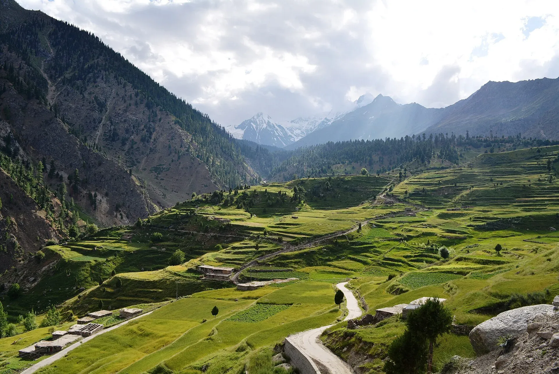
Photo: Obaid Hassan Qureshi, with thanks · CC BY-SA 4.0 · via Wikimedia Commons · temporary stand-in photo

Other treks in Diamir
Short notes on six treks and walks around Astore, Raikot and the Kaghan Valley: Rama Lake, Muthat Pass, Bezar Gali, Lake Saiful Muluk, Babusar Pass and Eastern Kaghan.
This page collects several shorter treks in Diamir. Each heading below is a separate route with its own season, grade and permit rules, so read the notes for the one you plan to walk.
7 routes: Rama Lake · Muthat Pass · Bezar Gali · Lake Saiful Muluk · Kaghan Valley · Babusar Pass · Eastern Kaghan
Rama Lake
Rama Lake (3,482 m) sits above Rama meadow, about 6 km west of Astore village (2,345 m), beside the Sachen Glacier. The Astore valley is about 120 km long with a floor at about 2,600 m, and was an independent line of rulers until the Sikh Empire took it in 1842. It became a district in 2004. A two- or three-day trip takes you through flowers, pine, fir and juniper forest, with views of the Chongra peaks. A jeep road climbs about 1,200 m from Astore to Rama, so a hire jeep makes the trip easier. Jeeps run from Gilgit to Astore all day. Plan a night in Astore before and after, and carry warm clothes, because the lake is above 3,400 m.
Muthat Pass
Muthat Pass (4,965 m) links the Raikot valley with Astore. It is the final stage of a full Nanga Parbat circuit, after crossing Mazeno La. From Fairy Meadows, descend towards Tato, cross the footbridge over the Raikot stream and climb over a ridge. You then cross the Buldar river to Muthat village (3,000 m) and follow the Buldar Glacier to about 4,000 m. A harder ablation-valley route leads to the pass. The descent is steep to the Lotang Glacier, and the ridge between the Lotang and Sachen glaciers is hard to find. Goat traders have reportedly used this very demanding route. Take an experienced local guide.
Bezar Gali
Bezar Gali (4,062 m) is a little-used pass between the Raikot and Jalipur valleys. It makes a moderate three-day trek from Fairy Meadows to Gunar on the KKH, about 30 km from Chilas. You cross the pass, camp at Bezar in the Jalipur valley, and finish by Khusto the next day.
Lake Saiful Muluk
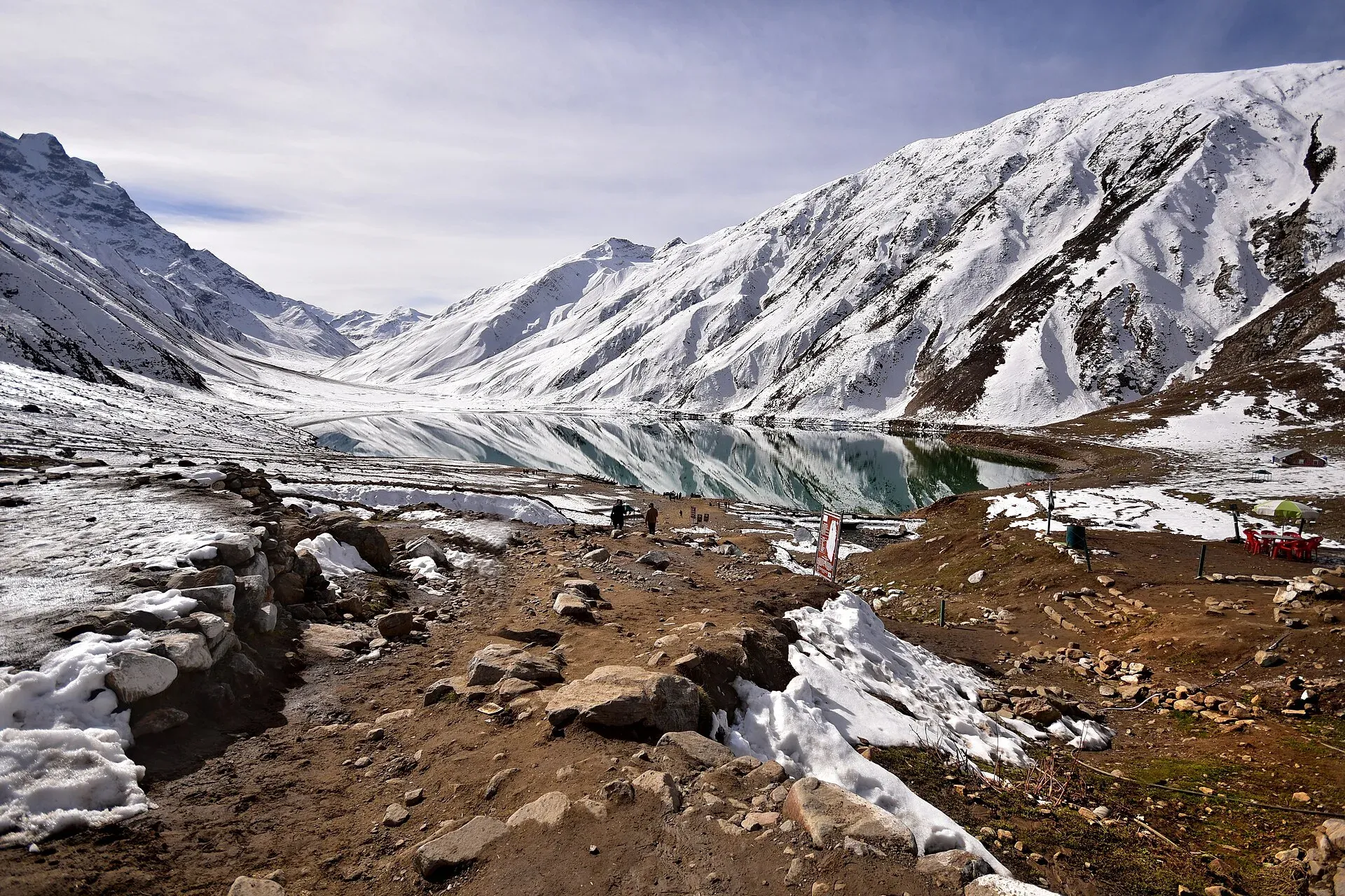
Photo: Kamranki, with thanks · CC BY-SA 4.0 · via Wikimedia Commons · temporary stand-in photo

At about 3,200 m, Lake Saiful Muluk is the most popular day trip from Naran in the Kaghan Valley, with Malika Parbat (5,290 m) behind it. The usual season is mid-June to September. A road about 10 km long climbs through forest to the lake, a journey of around three hours by jeep. You can walk around the lake in an hour to reach meadows below the Saiful Muluk Glacier. Rubbish has been a problem, so carry yours out. In August 2026 the Mansehra district administration lifted a week-long monsoon ban on visits, allowing them from 9:30am to 4pm, and said police may close the road if weather worsens (Dawn, 7 August 2026). A tiring ridge crossing at about 4,191 m leads into the upper Manur Valley.
Kaghan Valley
Kaghan is in Mansehra district of Khyber Pakhtunkhwa, about 155 km long, rising from about 650 m to Babusar Pass. The Kunhar river starts at Lulusar Lake and joins the Jhelum near Balakot. Lakes include Saiful Muluk, Ansoo, Lulusar and Dudipatsar. Malika Parbat (5,290 m) is the highest peak. Naran is the base. It is about a day's drive from Islamabad. Gujar herders bring flocks up in spring. It lies outside Diamir, but it is included here because the old trek.pk page grouped these walks together and because they are easy to combine with a trip to Chilas over Babusar Pass. The valley is busiest from June to September, when the high road and lakes are open. Wikipedia reports more than 300,000 visitors over the Eid al-Adha holidays in June 2024, so expect crowds on holidays. Glaciers block the roads in winter and the valley is closed to visitors then.
Babusar Pass
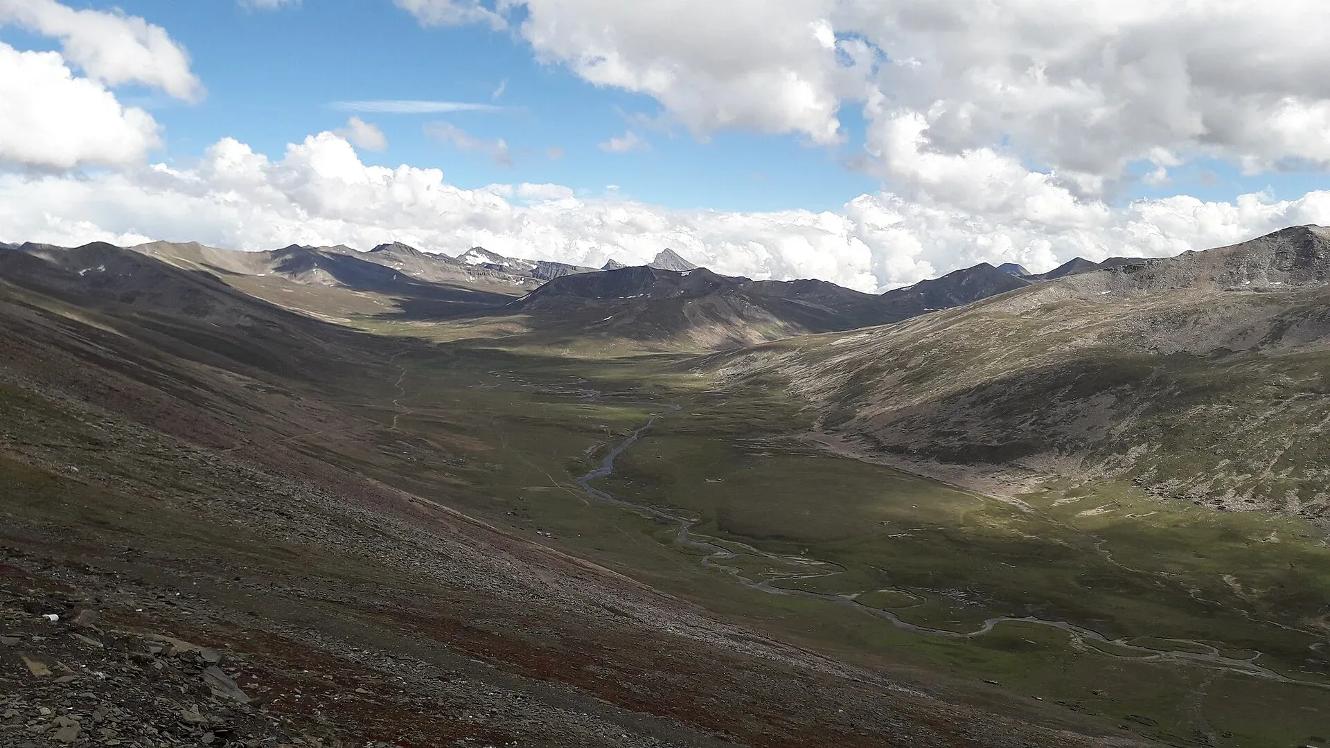
Photo: King Eliot, with thanks · CC BY-SA 4.0 · via Wikimedia Commons · temporary stand-in photo

Babusar Pass (about 4,175 m; Wikipedia gives 4,173 m) marks the border between Khyber Pakhtunkhwa and Gilgit-Baltistan at the head of the Kaghan Valley. A road crosses it to Chilas on the Indus. Some trekkers walk the Naran to Chilas road (about 130 km, four to six days) between mid-June and September. The road is usually closed by snow from about November to late May or June, and reopened in late May in 2025. You can take any vehicle for the last 39 km from Babusar village to Chilas. Check road status with the Kaghan Development Authority or the National Highway Authority. The road is the N-15. Wikipedia calls it one of the most dangerous in Pakistan, with accidents most often from brake failure on the steep bends, so walkers should keep well to the side.
Eastern Kaghan
A five-day trek links Burawai with Lulusar Lake, crossing four easy passes and coming close to Azad Jammu and Kashmir. It passes Jora, Ratti Gali (4,115 m), the Nuri valley, Saral Gal (4,191 m) and Saral Lake, then Jor-di-Gali (4,450 m) and Dudibach Lake (3,962 m), finishing in the Purbi valley at Besal. A guide from Naran is essential. Check with the district administration about permission before you go, as the route is near the boundary with Azad Jammu and Kashmir.
Highlights
- Rama Lake below the Chongra peaks near Astore
- Muthat Pass link between Raikot and Astore
- Bezar Gali, a quiet three-day pass from Fairy Meadows
- Lake Saiful Muluk and Malika Parbat in Kaghan
- Walking the road over Babusar Pass
Getting there
- Rama Lake: Jeeps run from Gilgit to Astore all day. A jeep road runs on to Rama.
- Muthat Pass and Bezar Gali: start at Fairy Meadows (see
fairy-meadows-nanga-parbat-base-camp). - Kaghan: Naran is about a day's drive from Islamabad via Mansehra. Roads over Babusar close in winter.
Permits and rules
- Fee
- Current fees will be added soon
- Last checked
- 16 November 2026
Rules differ between the routes on this page; this is a general note for Diamir.
Older sources list these routes as open zone. Foreign visitors should confirm current rules with a licensed operator, since Gilgit-Baltistan has changed trekking permit rules since 2024. For Eastern Kaghan near Azad Jammu and Kashmir, ask the district administration.
How trekking permits, NOCs and registration work: Visa and permits.
Season
Best: Jun – Sep · general guide; each route differs
Water and camps
See each trek above. Streams are common. Treat all water.
Gear and safety
Muthat Pass and Eastern Kaghan need a local guide. Weather changes fast above 4,000 m. Check road and pass status before starting.
Variations
Muthat Pass completes a Nanga Parbat circuit after mazeno-la. Bezar Gali and Muthat Pass both start at Fairy Meadows.
Tips
- Check road status for Babusar and Naran before travelling.
- Use a local guide for Muthat Pass and Eastern Kaghan.
- Carry out all rubbish at Saiful Muluk.
- Confirm permission for border-area routes with the district office.
Photos we still need: Rama Lake itself, Muthat Pass, Bezar Gali and Eastern Kaghan (the Rama photo shows the valley). Send us yours
Health and emergency
Mobile signal is patchy on most treks, so tell someone your plan before you go. Emergency numbers
Sources and last checked
Last checked Confidence low11 sources7 still to check
- Last checked
- Method
- Desk research from published sources
- Confidence
- low
- Checked by
- trek.pk research team
Researched from published sources; not yet checked on the ground by our team. Spot something out of date? Report a mistake.
Sources
- Trekking in the Karakoram and Hindukush (Lonely Planet, c. 2002) and the old trek.pk pages · Lonely Planet / trek.pk legacy · checked
- Babusar road reopens to traffic after seven months · Dawn · checked
- Naran gets ready to welcome tourists (April 2026) · Express Tribune · checked
- Nanga Parbat · Wikipedia · checked
- Trekkers and climbers stranded amid Pakistan permit dispute (27 March 2025) · ExplorersWeb · checked
- GB winter adventure tourism hit by soaring permit fee, visa delays (1 February 2026) · Dawn · checked
- Mansehra admin lifts ban on Saiful Muluk travel (7 August 2026) · Dawn · checked
- Astore Valley, Rama, Deosai (CKNP) · CKNP · checked
- Kaghan Valley (length, lakes, seasons, visitors) · Wikipedia · checked
- Babusar Pass (height, N-15, hazards) · Wikipedia · checked
- Astore Valley (length, elevation, history) · Wikipedia · checked
Still to be checked on the ground (7)
- All distances and times are from a c. 2002 survey; not rechecked on the ground
- Whether Muthat Pass is still passable and the glacier route has changed
- Permission rules for Eastern Kaghan near Azad Jammu and Kashmir
- Current Babusar road works and 2026-27 winter closure dates
- Rama jeep road condition (CKNP page, undated, calls it rough but passable in summer; jeep-only past Tarishing)
- Saiful Muluk fees (KP entry fees from July 2025 are reported only by blogs; no official source opened)
- Saiful Muluk Wikipedia page could not be opened; its figures come from the old guide and Dawn only
Nearby and related

Fairy Meadows and Nanga Parbat Base Camp

Rupal Valley and Nanga Parbat Rupal Face
Mazeno La
Saral Lake Trek (Neelum)

Ratti Gali Lake Trek from Dowarian

Chitta Katha Lake Trek (Shounter Valley)
Muthat Pass
A very demanding pass of about 4,965 m between the Raikot valley and Astore, the last stage of a full Nanga Parbat circuit. Little information; local guide essential.

Babusar Pass
A 4,173 m summer road pass on the N-15 linking the Kaghan valley with Chilas on the Karakoram Highway. Open only in summer and known for steep, sharp bends.
Mazeno La
A glaciated pass of about 5,399 m on the Mazeno Ridge of Nanga Parbat, linking the Rupal Valley in Astore with the Diamir side. Technical; experts only.