

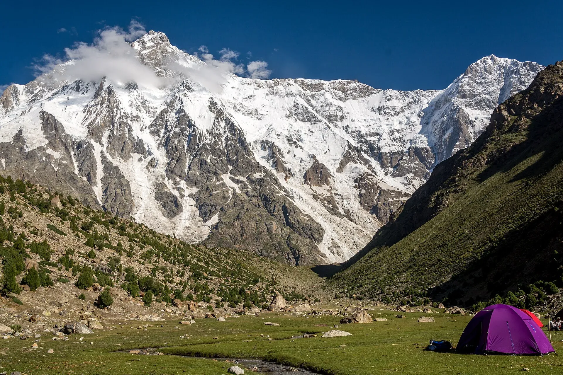
Photo: Muhammad Ashar, with thanks · CC BY-SA 3.0 · via Wikimedia Commons · temporary stand-in photo

Mazeno La
- Duration
- 8–14 days
- Distance
- 74.5 km
- Grade
- Technical
- Max altitude
- 5,399 m
- Season
- Jun – Sep
A technical, glaciated pass at about 5,400 m that crosses the Mazeno Ridge of Nanga Parbat from the Rupal Valley to Diamir. Experts only; plan with a licensed operator.
Overview
Mazeno La (about 5,399 m) is a high glacier pass on the Mazeno Ridge, the long south-western spur of Nanga Parbat (8,126 m). Wikipedia describes it as the longest ridge on any eight-thousander, about 13 km from Mazeno Pass to Mazeno Col, with eight subsidiary peaks above 6,800 m. The highest, Mazeno Peak, is 7,120 m. The pass links the Rupal Valley in Astore with the Diamir Valley in Diamer district, so this trek is a crossing from one side of the massif to the other.
The standard route takes 8 days and about 75 km, from Tarashing to Bunar on the KKH. A longer variation leaves from Zangot over two more passes and finishes at Fairy Meadows, adding six days. It is not a casual trek. It needs rope work, glacier travel, and often fixed ropes on the northern descent.
History of the ridge
The Mazeno Ridge has a short and hard climbing history. A French team in 1979 was stopped by bad weather after the first Mazeno peak. Doug Scott made three attempts between 1992 and 1995. Doug Chabot and Steve Swenson completed the ridge to Mazeno Col in 2004, and in 2012 Sandy Allan and Rick Allen followed it all the way to the summit of Nanga Parbat in 18 days, work that won the 2013 Piolet d'Or. In 2017 two climbers attempting a second ascent of the ridge disappeared. Trekkers cross only the Mazeno pass at the south-western end of the ridge.
Who it suits
This is for fit trekkers with good basic mountaineering skills: crampons, ice axe, roped glacier travel and abseiling. People with this experience still often fail to cross, because snow conditions can make the pass unsafe. Experienced guides in the old sources said most parties did not make it across. A strong, licensed operator with Shina-speaking guides who know the route is needed.
If you want a Nanga Parbat trek without technical sections, choose Fairy Meadows or Rupal instead.
When to go
Mid-June to mid-September is the usual window. Early in the season there is more snow, which makes the north-side descent easier but may need up to 300 m of fixed rope. In August and early September more rock is exposed, which can cut the fixed rope needed to as little as 10 m but increases rockfall. A press report on a 2025 circuit trek said the operator would move its 2026 start to early June for better snow on the pass. Conditions vary from year to year, so ask your operator.
The route
Days 1 and 2, Tarashing to Shaigiri (about 18.5 km). The same as the Rupal trek: Herrligkoffer Base Camp, across the Bazhin Glacier, then Shaigiri (3,655 m).
Day 3, to Mazeno Base Camp (about 6.5 km, 3 to 5 hours). Follow the north edge of the Toshain (Rupal) Glacier, crossing streams, to a camp at about 4,050 m below the snout of the Mazeno Glacier.
Day 4, to Mazeno High Camp (about 5.5 km, 4 to 6 hours). Turn north and climb steeply to about 4,700 m, on the east side of the glacier.
Day 5, over the pass (about 12 km, 6 to 8 hours). Climb along the glacier's north-east side, cross it higher up, and reach the pass in about three hours. The north side is very steep, with rockfall and about 300 m of technical ground down to the Upper Loibah Glacier. Continue to Upper Loibah Meadow (4,200 m).
Day 6, to Zangot (about 10 km, 5 to 6 hours). Descend 1,400 m through Loibah Meadow to Zangot (2,800 m).
Day 7, to Halaley Bridge (about 10 km, 3 to 4 hours). Walk down the Diamir valley to its meeting with the Bunar valley (about 1,800 m). This is the area that British climbers Mummery, Hastings and Collie explored in 1895.
Day 8, to Bunar (about 12 km, 3 to 4 hours). Follow the Bunar valley down to the KKH at about 1,200 m.
Variation to Fairy Meadows. From Zangot you can go by Kutagali, the Karu Sagar Pass (4,400 m), Shaichi, Gutum Sagar, Jalipur high camp and the Khusto Pass (4,837 m) to Beyal and Fairy Meadows, for six more days.
Terrain underfoot
The first two days are the Rupal valley route: jeep road to Tarashing, then Tarashing glacier, Rupal village, a gentle climb to the meadow beside the Bazhin Glacier, and the white-boulder camp at Shaigiri. From Shaigiri the route follows the north edge of the Toshain (Rupal) Glacier, with stream crossings, to Mazeno Base Camp. The next day climbs steeply to the high camp on the east side of the glacier. On the pass day the route climbs the glacier's north-east side, crosses it higher up and reaches the pass in about three hours. One operator lists its crossing day as 8 to 10 hours, the longest of its itinerary, and says ropes are fixed on the steep descent. The north side is the harder side. Below the Upper Loibah Glacier the ground eases into meadows, and the last two days follow valleys down to the Karakoram Highway.
Culture and people
You cross three districts' grazing lands. Porters come from Tarashing, Bunar and other villages, and each group has its own territory. The first group usually goes only to the top of the pass, where Bunar porters take over. Your operator must arrange this in advance, usually through the shopkeeper in Bunar. Each porter group is paid the return journey as well, which makes this an expensive trek.
Practical information
- Pass height: about 5,399 m in the old guide and operator pages, 5,358 m in Wikipedia. Treat it as about 5,400 m.
- Operator: Hire a licensed Pakistani operator with high-pass experience. Do not attempt this independently. Apricot Tours and other operators run it as part of a longer Nanga Parbat circuit, and one operator reported crossing the pass in early August 2025.
- Equipment: Rope, harness, crampons, ice axe, helmet, and fixed rope sized to conditions. Your operator should supply the group gear.
- Permits: Older sources list this as open zone with no permit. In practice, foreign trekkers use a licensed operator, and Gilgit-Baltistan's permit fees have been disputed since 2024. A Chief Court case held up permits in 2025, and Dawn reported in February 2026 that no foreign winter permits had been issued since 2023. Ask your operator for the current position. Checked 2026-11-16.
- Security: The Diamir side of Nanga Parbat was the scene of the June 2013 attack on climbers at the Diamir base camp. Both the descent and the route to Bunar are in that area, so ask your operator for current security advice and any escort requirements.
- Finish: From Bunar, vehicles go to Chilas or Gilgit. A pre-arranged jeep from Halaley to Bunar shortens the trek by a day.
Highlights
- Glaciated pass of about 5,400 m beneath unclimbed 7,000 m peaks
- Crossing from the Rupal side to the Diamir side of Nanga Parbat
- Steep, technical north-side descent needing rope
- Option to continue to Fairy Meadows by two more passes
- Remote glacier camps and wide views of Nanga Parbat's southern flanks
Day by day
| Day | Camp | Altitude |
|---|---|---|
| 1 | Herrligkoffer Base Camp | 3,550 m |
| 2 | Shaigiri | 3,655 m |
| 3 | Mazeno Base Camp | 4,050 m |
| 4 | Mazeno High Camp | 4,700 m |
| 5 | Upper Loibah Meadow | 4,200 m |
| 6 | Zangot | 2,800 m |
| 7 | Halaley Bridge | 1,800 m |
| 8 | Bunar (KKH) | 1,200 m |
| Day | Route | Hours | Distance | Ascent / descent | Camp and altitude |
|---|---|---|---|---|---|
| Day 1 | Tarashing to Herrligkoffer Base Camp | 5 h | 10 km | +639 m | Herrligkoffer Base Camp, 3,550 m |
Day 1 notesAs on the Rupal trek: cross the Tarashing glacier, walk through Rupal village and climb gently to the meadow beside the Bazhin Glacier. A spring runs at the camp. | |||||
| Day 2 | Herrligkoffer to Shaigiri | 6 h | 8.5 km | +105 m / −20 m | Shaigiri, 3,655 m |
Day 2 notesCross the Bazhin Glacier to Latobah, then follow the north side of the valley to Shaigiri, the white-boulder camp below the Rupal Face. The route is covered in the Rupal trek. | |||||
| Day 3 | Shaigiri to Mazeno Base Camp | 3–5 h | 6.5 km | +395 m | Mazeno Base Camp, 4,050 m |
Day 3 notesFollow the north edge of the Toshain (Rupal) Glacier, crossing several streams. Camp below the snout of the Mazeno Glacier at about 4,050 m. | |||||
| Day 4 | Mazeno Base Camp to Mazeno High Camp | 4–6 h | 5.5 km | +650 m | Mazeno High Camp, 4,700 m |
Day 4 notesThe route turns north and climbs steeply to a high camp on the glacier's east edge. Rest, drink plenty, and check the weather. Your guide decides whether conditions allow the pass. | |||||
| Day 5 | Mazeno High Camp over Mazeno La to Upper Loibah Meadow | 6–8 h | 12 km | +699 m / −1,199 m | Upper Loibah Meadow, 4,200 m |
Day 5 notesClimb along the glacier's north-east side, cross it higher up and reach the pass (5,399 m) in about three hours. The north side is very steep, with rockfall and 300 m of technical ground. Fixed rope is often needed, from about 10 m late in the season to as much as 300 m earlier. Continue down the Upper Loibah Glacier to the meadow. | |||||
| Day 6 | Upper Loibah Meadow to Zangot | 5–6 h | 10 km | −1,400 m | Zangot, 2,800 m |
Day 6 notesA long descent through Loibah Meadow to Zangot, a settlement in the Diamir valley. This is the point where the Fairy Meadows variation continues. | |||||
| Day 7 | Zangot to Halaley Bridge | 3–4 h | 10 km | −1,000 m | Halaley Bridge, 1,800 m |
Day 7 notesWalk north-west down the Diamir valley to its meeting with the Bunar valley. A pre-arranged jeep from here to Bunar saves a day. | |||||
| Day 8 | Halaley Bridge to Bunar | 3–4 h | 12 km | −600 m | Bunar (KKH), 1,200 m |
Day 8 notesFollow the Bunar valley down to the KKH at about 1,200 m. Vehicles run from here to Chilas and Gilgit. | |||||
Getting there
To the start, travel to Tarashing as for the Rupal trek: Gilgit to Astore by jeep from Jaglot, then jeep to Tarashing (about 30 km).
From the finish at Bunar on the KKH, jeeps and vans run to Chilas and on to Gilgit. A pre-arranged vehicle from Halaley Bridge to Bunar saves a day.
Permits and rules
- Permit needed
- Usually not, Open zone
- Fee
- Current fees will be added soon
- Last checked
- 16 November 2026
Older sources list the route as open with no permit. In practice, foreigners go through a licensed operator, and Gilgit-Baltistan has changed trekking and mountaineering fees since 2024. A Chief Court case halted permits in 2025 (ExplorersWeb, 27 March 2025), and the Tourism Department notified a reduced fee schedule in May 2025 (The News, 25 May 2025). Dawn reported in February 2026 that foreign winter permits had not been issued since 2023. Confirm the current rules with your operator. Pakistani citizens: ask the Gilgit-Baltistan Tourism office.
How trekking permits, NOCs and registration work: Visa and permits.
Season
Best: Jun – Sep
Water and camps
Water is plentiful on the lower sections but glacier streams carry silt. At high camp, you will melt snow or collect from streams, so carry a stove and fuel. Plan for cold, windy camps above 4,000 m. On the Diamir side, local porters may ask for camping fees at Diamir Gah; agree this in advance with your operator.
Gear and safety
- Technical gear: Harness, ropes for roped teams and fixed lines, ice axe, crampons and a helmet. Be able to use them.
- Rockfall and steep descent: The north side of the pass has rockfall and about 300 m of steep technical ground.
- Altitude: The high camp is about 4,700 m and the pass is about 5,400 m. Allow time to acclimatise with the Rupal days.
- Weather and snow: Conditions change each year. Your guide should make the decision at the pass, and you should accept a turn-back.
- Rescue: There is no quick rescue. Carry a satellite communicator and insurance that covers helicopter evacuation at altitude.
- Security: Ask your operator about the current situation on the Diamir side.
Variations
- Fairy Meadows finish: Zangot to Kutagali, Karu Sagar Pass (4,400 m), Shaichi, Gutum Sagar, Jalipur high camp, Khusto Pass (4,837 m), Beyal and Fairy Meadows; six extra days. See
fairy-meadows-nanga-parbat-base-camp. - Full circuit: Continue from Fairy Meadows over Muthat Pass (see
other-treks-in-diamir) to Astore for a full Nanga Parbat circuit. - Easier option:
rupalfollows the same first two days without technical ground.
Tips
- Go only with a licensed operator and a guide who has crossed before.
- Plan a spare day for weather or snow conditions on the pass.
- Arrange the porter change at the pass well in advance.
- Decide fixed rope length with your guide after seeing recent snow reports.
- Carry extra food and fuel; delays are common.
- Check current permit and security advice before booking.
Stay and eat in Astore
Astore is the nearest town to the trek: somewhere to sleep and stock up before and after.
Places to stay
- Astore Inn Hotel & RestaurantCall Astore Inn Hotel & RestaurantMap of Astore Inn Hotel & Restaurant in Google Maps
- PTDC Motel RamaCall PTDC Motel RamaMap of PTDC Motel Rama in Google Maps
- Rama lake view hotel and restaurantCall Rama lake view hotel and restaurantMap of Rama lake view hotel and restaurant in Google Maps
- City Inn Hotel & RestaurantCall City Inn Hotel & RestaurantMap of City Inn Hotel & Restaurant in Google Maps
- Mulberry Inn astore (bulen)Call Mulberry Inn astore (bulen)Map of Mulberry Inn astore (bulen) in Google Maps
- Rama Midway Guest House AstoreCall Rama Midway Guest House AstoreMap of Rama Midway Guest House Astore in Google Maps
Essential services fuel stations, pharmacies and hospitals and clinics
Fuel
- NEW KARAKURAM PET SERVICEMap of NEW KARAKURAM PET SERVICE in Google Maps
- Admore - Rama Filling StationMap of Admore - Rama Filling Station in Google Maps
Pharmacies
- Khyber PharmacyCall Khyber PharmacyMap of Khyber Pharmacy in Google Maps
Hospitals and clinics
- DHQ Hospital AstoreMap of DHQ Hospital Astore in Google Maps
Listings come from Google Maps data and are unverified: phone numbers, opening months and prices may have changed. Report a problem · Own one of these? Claim it
Photos we still need: Mazeno La and the north-side descent to Upper Loibah Meadow; Diamir valley near Zangot and Halaley Bridge. Send us yours
Health and emergency
Mobile signal is patchy on most treks, so tell someone your plan before you go. Emergency numbers
Sources and last checked
Last checked Confidence medium10 sources6 still to check
- Last checked
- Method
- Desk research from published sources
- Confidence
- medium
- Checked by
- trek.pk research team
Researched from published sources; not yet checked on the ground by our team. Spot something out of date? Report a mistake.
Sources
- Trekking in the Karakoram and Hindukush (Lonely Planet, c. 2002) and the old trek.pk pages · Lonely Planet / trek.pk legacy · checked
- Nanga Parbat · Wikipedia · checked
- Rupal Valley · Wikipedia · checked
- Around Nanga Parbat trek · Apricot Tours · checked
- Our trekking group on the Mazeno La high pass at 5,400 m (4 Aug 2025) · TravMedia press release · checked
- Trekkers and climbers stranded amid Pakistan permit dispute (27 March 2025) · ExplorersWeb · checked
- GB winter adventure tourism hit by soaring permit fee, visa delays (1 February 2026) · Dawn · checked
- 2013 Nanga Parbat massacre · Wikipedia · checked
- Mazeno Ridge · Wikipedia · checked
- GB slashes mountaineering, trekking fees to promote tourism (25 May 2025) · The News · checked
Still to be checked on the ground (6)
- Day times, distances and fixed rope needs (from c. 2002 survey; Apricot Tours gives 8 to 10 hours for its pass-crossing day and says fixed ropes are used on the steep sections; conditions change with snow and glacier retreat)
- Current permit and fee status for foreign trekkers (Gilgit-Baltistan Tourism): Dawn (1 Feb 2026) reports a sharp rise in permit fees but gives no amounts; no official notice found
- Security arrangements and escorts for the Diamir side (Apricot Tours does not mention an escort)
- Which operators currently run the pass and how many parties succeed
- Porter arrangements and prices for Tarashing, Bunar and Gunar (Apricot Tours says porters are local villagers with a 12.5 kg personal bag limit; no rates)
- Pass height: 5,399 m (old guide, operator) against 5,358 m (Wikipedia); ridge length 10 km (old guide) against about 13 km (Wikipedia)
Nearby and related

Rupal Valley and Nanga Parbat Rupal Face

Fairy Meadows and Nanga Parbat Base Camp

Other treks in Diamir
Mazeno La
A glaciated pass of about 5,399 m on the Mazeno Ridge of Nanga Parbat, linking the Rupal Valley in Astore with the Diamir side. Technical; experts only.
Khusto Pass
A trekking pass of about 4,837 m on the Mazeno variation between Jalipur high camp and Beyal near Fairy Meadows. Very little published.
Karu Sagar Pass
A trekking pass of about 4,400 m between Kutagali and Shaichi on the Mazeno variation to Fairy Meadows. Very little published.
Muthat Pass
A very demanding pass of about 4,965 m between the Raikot valley and Astore, the last stage of a full Nanga Parbat circuit. Little information; local guide essential.
Herrligkoffer Base Camp (Rupal Face)
The grassy base camp on the south side of Nanga Parbat, about 3,550 m, reached on a day's walk from Tarashing under the 4,600 m Rupal Face.