

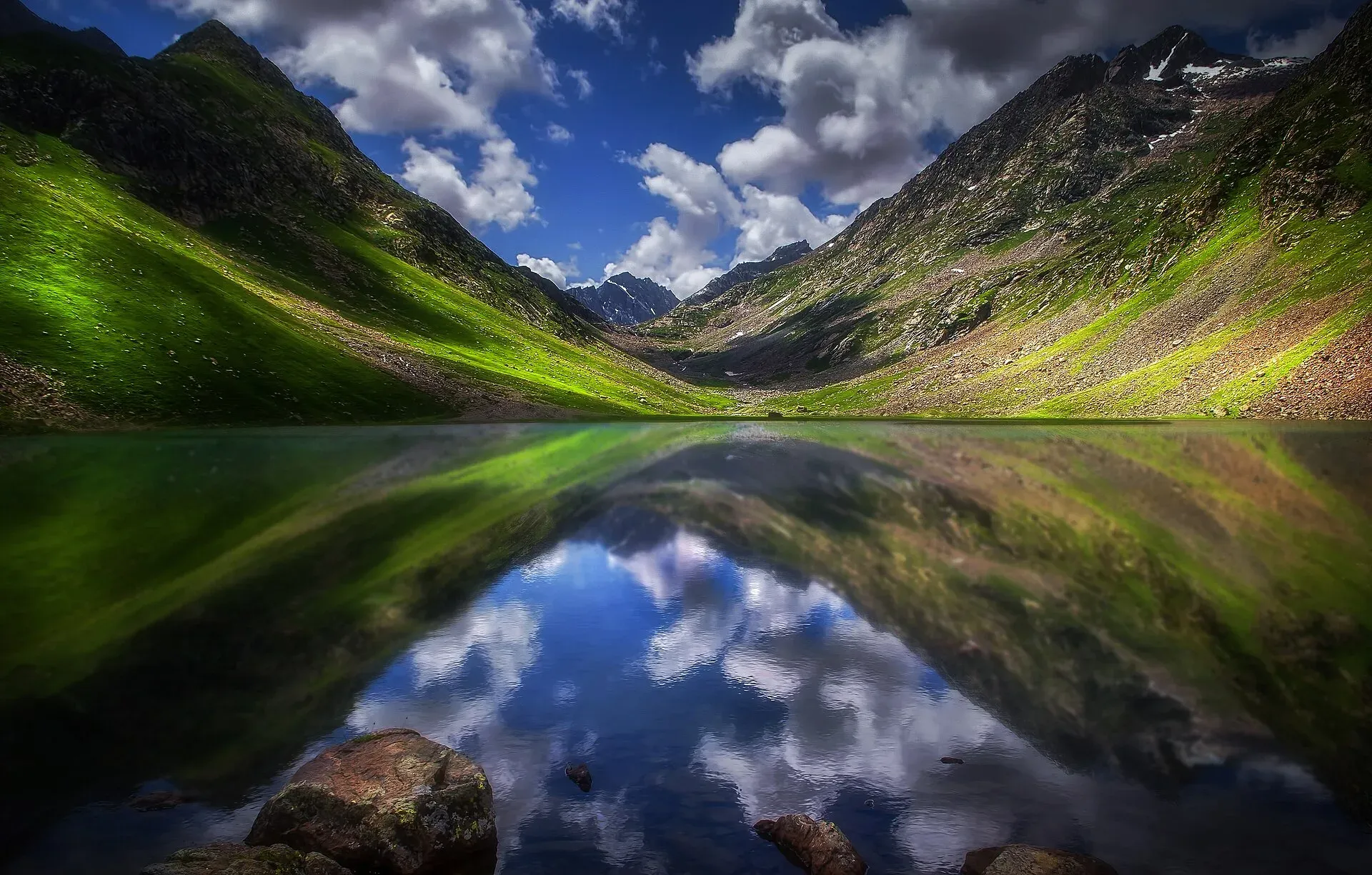
Photo: Tariq siddiq kohistani, with thanks · CC BY-SA 4.0 · via Wikimedia Commons · temporary stand-in photo

Izmis Lake Trail
- Duration
- 1–2 days
- Distance
- 13 km
- Grade
- Moderate
- Max altitude
- 3,505 m
- Season
- Jul – Sep
A day hike or short overnight from Utror in Swat to Izmis Lake, a high lake above the treeline at about 3,500 m. Wikipedia gives 3 to 6 hours on foot from the end of the jeep road.
Overview
Izmis Lake is a glacial lake above the treeline, south-west of Utror in the Swat region. Dawn reported in June 2019 that it lies at about 11,500 ft (about 3,505 m) and about 13 km above Utror bazaar. The walk climbs from Utror forest through the Chinaitshing meadows and Kalam Banda (a high pasture) to the lake and its base camp. It can be done in a day, but the time on foot is long enough that many walkers camp.
Name and setting
The name Izmis is said to mean "caves" in Kohistani, and Wikipedia says the lake is surrounded by several natural caves. The lake sits in the alpine zone, higher than the forest, and Dawn describes it as a mirror-like glacial lake with snow-capped peaks around it. Other lakes in the area include Mahodand and Kundol in the Kalam valley, Daral and Saidgai in the Swat valley, and Katora in Kumrat.
Who it suits
Hikers of reasonable fitness. The climb is moderate, and the walk is long enough to need a full day or a night out. First-time walkers should go with a local guide, and everyone should use one in fog or poor visibility.
When to go
July to September, when snow has gone and the jeep road is open. Rain and floods can damage roads and bridges, so check conditions in Utror.
Getting to the trailhead
Utror lies up the valley from Kalam. From Kalam it is about 16.5 km by road (OSRM estimates 25 minutes of driving; allow about 1.5 hours when the road is damaged). From Utror a short link road, passable by jeep, runs part of the way towards the lake. Wikipedia says it ends in the valley of Loypanrghalay. Nature Adventure Club says the start of the trek can be reached by jeep from Utror on this short road, but gives no distance or road condition.
The route
Dawn's photo captions and introduction describe the walk in this order. The trek starts in Utror forest, where the path climbs through trees past streams and waterfalls. It then crosses the Chinaitshing meadows, where trekkers pitch tents and sheep graze. Next comes Kalam Banda, a grassy pasture with goats. Above it the trees stop and the path reaches the lake and the Izmis base camp, with snow-capped peaks beyond.
The time on foot depends on where the jeep leaves you. Nature Adventure Club gives 3 to 4 hours from Utror bazaar. Wikipedia gives 3 to 6 hours from the end of the jeep road. The 13 km figure is the distance above Utror bazaar in Dawn's report, so it may not be the walking distance. Allow a full day for the round trip, or camp at the meadows and walk up in the morning.
Heights and figures that differ
The lake height is quoted as 11,500 ft (about 3,505 m) by Dawn and in the summary table of Nature Adventure Club, but the text of the same club page says 11,230 ft (about 3,423 m). This page uses 3,505 m. Treat any height as approximate until it is measured on the ground.
Culture and people
Utror and nearby Gabral are Gujar and Kohistani communities with mountain farms. Hire local guides and jeeps, buy supplies in Utror and respect local customs.
Practical information
- Take food, water and warm layers. The lake is above the treeline and the air is cold even in summer.
- Streams cross the lower path, but treat any water before drinking.
- Dawn asked visitors to keep the area clean and not leave litter. Carry rubbish down.
- Flood damage has altered some Swat approaches, so ask locally.
Highlights
- High lake above the treeline
- Meadows of the Utror valley
- Jeep access to the start
- Can be done as a day hike
Day by day
- StartUtror (jeep road to the trailhead)
- Day 1Izmis Lake
| Day | Route | Hours | Distance | Ascent / descent | Camp and altitude |
|---|---|---|---|---|---|
| Day 1 | Utror to Izmis Lake | 3–6 h (one way) | 13 km | not given | Izmis Lake, 3,505 m |
Day 1 notesTake a jeep from Utror to the end of the road, then walk up through Utror forest, across the Chinaitshing meadows and through the Kalam Banda pasture. Above the last trees the path reaches the lake and base camp. Stay for a rest and return the same way, or camp at the meadows. | |||||
Getting there
Fly or drive to Swat (Saidu Sharif, Mingora) and continue up the valley through Kalam to Utror, about 1.5 hours beyond Kalam depending on roads. A short jeep ride from Utror reaches the start of the walk.
Permits and rules
- Permit needed
- Usually not, Open zone
- Fee
- Current fees will be added soon
- Last checked
- 16 November 2026
No confirmed fee or permit was found. KP Tourism launched an online NOC system for foreign tourists in July 2025 that names Swat among the areas covered (Daily Times, 14 July 2025). Foreign visitors should check current rules with a registered tour operator, KP Tourism or the tourism police. Current fees will be added soon.
How trekking permits, NOCs and registration work: Visa and permits.
Season
Best: Jul – Sep
Water and camps
Streams run in the valley; treat water. Camping near the lake is possible for groups with tents and local advice.
Gear and safety
Weather
Afternoon storms and cold fog are common.
Rivers and roads
Floods can break roads and bridges. Check before travelling.
Getting lost
Use a local guide in poor visibility.
Ask the district administration or local police about current conditions before you go. For foreign visitors: the UK FCDO advises against all travel to Swat (advice updated 27 October 2026, checked 16 November 2026). Read the live advice before you plan.
Variations
Other lakes of the Kalam and Utror cluster include Kundol Lake, Spin Khwar and Daral Lake.
Tips
- Hire a jeep at Utror
- Start at dawn
- Bring warm clothing
- Check road conditions after rain
Health and emergency
Mobile signal is patchy on most treks, so tell someone your plan before you go. Emergency numbers
Sources and last checked
Last checked Confidence medium7 sources6 still to check
- Last checked
- Method
- Desk research from published sources
- Confidence
- medium
- Checked by
- trek.pk research team
Researched from published sources; not yet checked on the ground by our team. Spot something out of date? Report a mistake.
Sources
- Izmis Lake · Wikipedia · checked
- Beautiful lakes in Swat · Nature Adventure Club · checked
- Pakistan Tourism Guide 2021 · TDAP · checked
- Pakistan treks and mountain ranges (trek.pk research report) · trek.pk research · checked
- OSRM driving route service: road distances and times measured 16 November 2026 (driving only, optimistic on mountain roads) · OSRM / OpenStreetMap contributors · checked
- In pictures: Mirror-like Izmis glacial lake draws tourists to Utror valley (20 June 2019) · Dawn · checked
- KP launches online NOC system for foreign tourists · Daily Times · checked
Still to be checked on the ground (6)
- Time one way (3 to 4 hours per Nature Adventure Club; 3 to 6 hours per Wikipedia)
- Where the jeep road ends (Loypanrghalay on Wikipedia; Dawn 2019 describes a start from Utror forest) and whether the 13 km is walking distance
- Fees and any rules for Pakistani visitors (foreign NOC system confirmed; no fee source)
- Road state Kalam to Utror after floods
- Order and distances of Chinaitshing meadows and Kalam Banda (taken from Dawn photo captions; no map or GPS track found)
- Lake height: 3,505 m (Dawn; Nature Adventure Club table) against 11,230 ft (about 3,423 m) in the text of Nature Adventure Club
Nearby and related

Bashigram Lake Trail

Kundol Lake Hike from Utror

Ansoo Lake Trail

Izmis Lake
A high glacial lake above the tree line, south-west of Utror in Swat. A jeep track ends at Loypanrghalay and the lake is a 3 to 6 hour walk beyond.

Kalam, Utror and Gabral
The head of the Swat valley: Kalam town where the Ushu and Gabral rivers meet, with Ushu forest, Utror and Kundol Lake, Gabral, and jeep tracks to Mahodand Lake.