

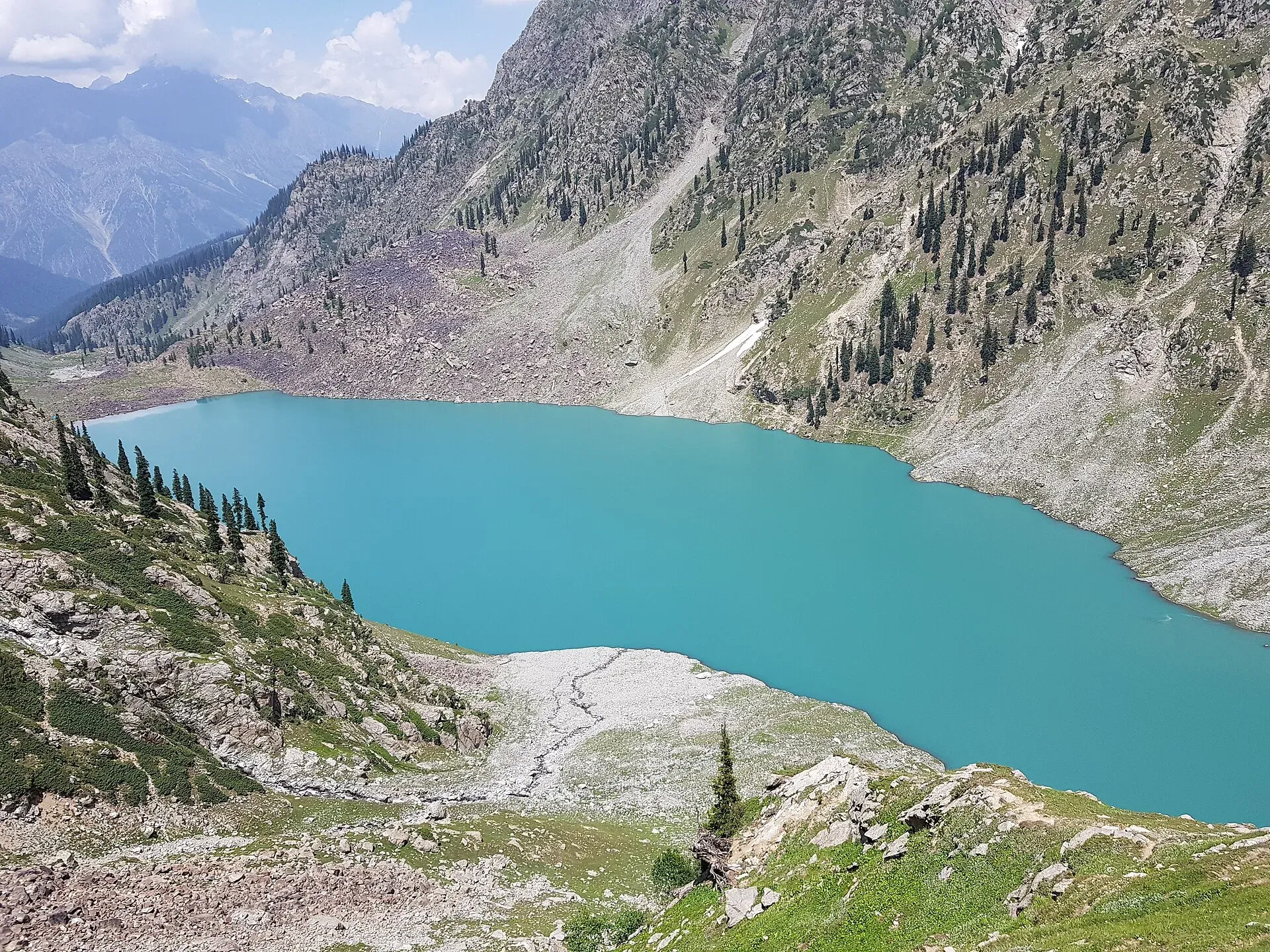
Photo: Kmbilall, with thanks · CC BY-SA 4.0 · via Wikimedia Commons · temporary stand-in photo

Kundol Lake Hike from Utror
- Duration
- 1–2 days
- Grade
- Moderate
- Max altitude
- 3,033 m
- Season
- Jul – Sep
A hike from Ladu, where the link road above Utror ends, to Kundol Lake at about 3,030 m in Swat. Sources give from 1.5 hours to 6 hours on foot, depending on the route and the source.
Overview
Kundol Lake (also Kandol or Kundal) is a glacial lake in the north of the Utror valley in Upper Swat. Wikipedia gives its height as 3,033 m (9,950 ft), its length as 1.5 km and its width as about 1 km. Glaciers and springs feed it, and the outflow forms the Utror stream (Utror Khwar), a major tributary of the Swat River. Wikipedia puts it 19 km from Kalam. Dawn (24 November 2016) says about 2 km north of Utror valley.
Getting to Ladu
From Kalam an unpaved road runs to Utror, and a link road continues to Ladu. Wikipedia says a four-wheel vehicle is needed. Nature Adventure Club says private jeeps run from Kalam to Utror in about an hour and gives 1.5 hours by jeep to Lado Village. Wikivoyage says Ladu can also be reached by walking from Utror, which takes almost two hours. Ladu is a small farming valley where residents grow potatoes and turnips in summer, and Wikivoyage says a small hut serves tea and food.
The route
The trail from Ladu follows the large stream that flows down from the lake. Wikipedia mentions forest and waterfalls on the way, and Dawn describes thick forest, rushing streams and small waterfalls, with an emerald-green outflow stream.
Sources disagree on the time on foot:
- Dawn (2016): about 1.5 hours from Ladu, on an alternative route used since the 2010 floods damaged the original trek. A trekker quoted in the article said the original trek was easier and shorter.
- Nature Adventure Club: 3 to 4 hours from Lado Village.
- Wikivoyage: four hours from Ladu.
- Wikipedia: almost four to six hours from Ladu.
Allow a half-day each way if you are not used to altitude, and ask in Ladu for the current path. Locals will guide and carry luggage for a fee, according to Wikivoyage.
When to go
Wikipedia says the lake is accessible only in summer, because roads are closed by heavy snow in winter. July to September is the safest window. Dawn reported trekkers still going in late November 2016, with the lake forecast at -4 C. That is not a planning guide, because Wikipedia says the roads close in heavy snow.
At the lake
The shore is used as a summer campsite. Wikipedia names Spinkhor Waterfall, Loypanghalay Lake, the Desan meadows, Katora Lake, Jahaz Banda and Gabeen Lake as other places in the area, without route details. Spin Khwar Lake lies to the north and can be reached from Kundol by a steep track, see Spin Khwar Lake Trek.
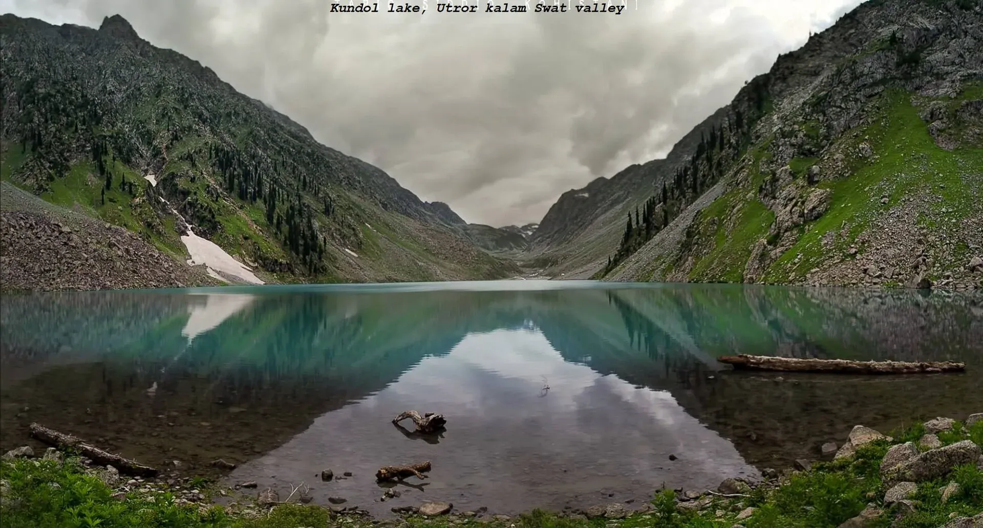
Photo: Adilswati, with thanks · CC BY-SA 4.0 · via Wikimedia Commons · temporary stand-in photo

Practical information
- Carry a tent, food and water treatment. There are no facilities at the lake.
- Ask local people at Utror or Ladu before camping.
- Take rubbish down with you.
- Check road conditions in Utror after rain, as floods have damaged roads and the trail in the past.
Highlights
- Glacial lake at about 3,030 m in the Utror valley
- Forest, streams and small waterfalls beside the trail
- Summer camping on the lake shore
- Starting point for Spin Khwar Lake
Day by day
- StartLadu (end of the jeep road above Utror)
- Day 1Kundol Lake
| Day | Route | Hours | Distance | Ascent / descent | Camp and altitude |
|---|---|---|---|---|---|
| Day 1 | Ladu to Kundol Lake and return | 1.5–6 h one way (sources differ) | not given | not given | Kundol Lake, 3,033 m |
Day 1 notesTake a jeep from Kalam through Utror to Ladu, where the link road ends. Walk up beside the stream through forest and past small waterfalls to the lake. Return by the same route, or camp on the shore. | |||||
Getting there
Drive from Mingora to Kalam, then take the rough road to Utror and the link road to Ladu, about one to 1.5 hours by jeep from Kalam. Use a 4x4. There is no public transport past Kalam.
Permits and rules
- Permit needed
- Usually not, Open zone
- Fee
- Current fees will be added soon
- Last checked
- 17 November 2026
No confirmed fee or permit was found. Foreign visitors should check current rules with a registered tour operator, KP Tourism or the tourism police. Current fees will be added soon.
How trekking permits, NOCs and registration work: Visa and permits.
Season
Best: Jul – Sep
Water and camps
Streams run beside the trail and the lake outflow is the Utror stream. Treat water before drinking. Camping is on the lake shore in summer. There are no facilities, so bring a tent and food.
Gear and safety
Weather
Cold nights and sudden fog are possible even in summer.
Path
The 2010 floods damaged the original trek, and the current route has been described as bumpy. Ask locally before you go.
Roads
Floods can cut the link road. Check in Utror.
Ask the district administration or local police about current conditions before you go. For foreign visitors: the UK FCDO advises against all travel to Swat (advice updated 27 October 2026, checked 17 November 2026). Read the live advice before you plan.
Variations
Izmis Lake lies in the same valley system. Spin Khwar Lake can be reached from Kundol, and Mahodand Lake is in the neighbouring Usho valley.
Tips
- Use a 4x4 from Kalam to Ladu
- Ask a local in Ladu for the current path
- Start early and allow for a long day
- Take a local guide in fog or on a first visit
Photos we still need: the trail beside the stream, and Ladu. Send us yours
Health and emergency
Mobile signal is patchy on most treks, so tell someone your plan before you go. Emergency numbers
Sources and last checked
Last checked Confidence medium5 sources6 still to check
- Last checked
- Method
- Desk research from published sources
- Confidence
- medium
- Checked by
- trek.pk research team
Researched from published sources; not yet checked on the ground by our team. Spot something out of date? Report a mistake.
Sources
- Kundol Lake · Wikipedia · checked
- Cold weather? No problem: Trekkers continue heading to Kandol Lake in Swat (24 November 2016) · Dawn · checked
- Swat Valley (Utror, Kundol Lake, Ladu) · Wikivoyage · checked
- Beautiful lakes in Swat · Nature Adventure Club · checked
- Pakistan travel advice · UK FCDO · checked
Still to be checked on the ground (6)
- Time on foot from Ladu: 1.5 hours (Dawn 2016, alternative route), 3 to 4 hours (Nature Adventure Club), about 4 hours (Wikivoyage), 4 to 6 hours (Wikipedia)
- Distance of the walk (no source)
- Lake height: 3,033 m (Wikipedia), 2,900 m (Wikivoyage), 9,950 ft (Dawn), 2,743 m in a table on Nature Adventure Club
- Road state from Kalam to Utror and Ladu after floods
- Which path is current since the 2010 floods
- Fees and camping rules
Nearby and related

Izmis Lake Trail

Ansoo Lake Trail

Bashigram Lake Trail

Kundol Lake
A glacial lake at about 3,030 m above Utror in Swat, reached by a 4x4 track to Ladu and then a hike of around four to six hours.
Utror Camping (Swat)
Summer tent camping in the Utror valley above Kalam in upper Swat, near the meadows and the track to Kundol Lake. UK advice is against all travel to Swat.

Kalam, Utror and Gabral
The head of the Swat valley: Kalam town where the Ushu and Gabral rivers meet, with Ushu forest, Utror and Kundol Lake, Gabral, and jeep tracks to Mahodand Lake.

Kalam
The last large town in the upper Swat Valley, at about 2,000 m where the Ushu and Gabral rivers meet. Kalam is the base for Ushu, Utror, Mahodand Lake and Kundol Lake.

Mahodand Lake
A cold trout lake at about 2,865 m in the Usho valley above Kalam, reached by a rough 4x4 track of around 40 km. Open in summer only.
Izmis Lake
A high glacial lake above the tree line, south-west of Utror in Swat. A jeep track ends at Loypanrghalay and the lake is a 3 to 6 hour walk beyond.
Spin Khwar Lake
A lake north of Kundol Lake and east of the Utror valley in Swat Kohistan, reached from the Ladu valley or from Kundol. Steep, basic, and for experienced trekkers.

Swat Valley
A long green river valley in northern Khyber Pakhtunkhwa, with Gandhara Buddhist sites, orchards, hill towns and the road up to Kalam. Check the current security advice before you plan a trip.