

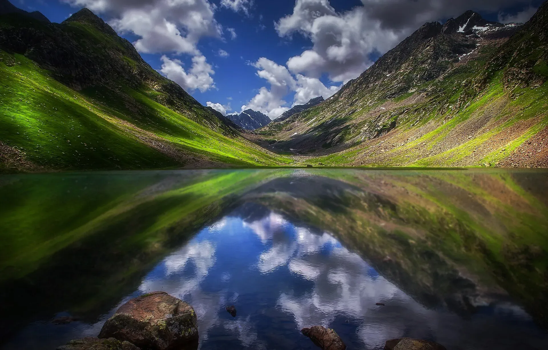
Photo: Tariq siddiq kohistani, with thanks · CC BY-SA 4.0 · via Wikimedia Commons · temporary stand-in photo

Izmis Lake
A high glacial lake above the tree line, south-west of Utror in Swat. A jeep track ends at Loypanrghalay and the lake is a 3 to 6 hour walk beyond.
Overview
Izmis Lake lies above the tree line south-west of the Utror valley in Swat. The name is said to mean "caves" in Kohistani, and several small caves are found around the shore. Dawn (20 June 2019) describes glacial water in the alpine zone, clear enough to reflect the peaks above it, and puts the lake at about 11,500 feet (about 3,500 m). That is a single newspaper figure rather than a survey height; Wikipedia gives no altitude.
The lake is a trek destination, not a roadside stop. A day hike can reach it from the end of the jeep track, but it is a long day.
Plan your visit
- Nearest town
- Utror
- Getting there
Reach Kalam from Mingora, then continue by 4x4 to Utror (see Swat and Kalam). From Utror a small link road runs towards Loypanrghalay. More
Best months
Jul – Sep
- Izmis Lake
- Related places nearby: Utror Camping (Swat), Kundol Lake, Kalam, Kalam, Utror and Gabral, Swat Valley
The walk
Dawn describes the route in order: Utror forest, the Chinaitshing meadows, Kalam Banda, the Izmis base camp, and then the lake. The same newspaper (18 June 2019) says the first part is by jeep along a stony track beside the river, then through thick pine forest. Water springs beside the way are said by visitors to have medicinal effects.
- Utror forest. Dense forest near the start, with streams and small waterfalls.
- Chinaitshing. A long pasture ringed by snow peaks, about 10,500 feet (roughly 3,200 m) up and about two hours from Utror Bazaar by Dawn's account. Lambs graze here, and trekkers pitch tents.
- Kalam Banda. A second meadow, with grass and grazing goats. Banda is a local word for a summer pasture.
- Izmis base camp. The staging point for the last climb to the lake.
Wikipedia describes a link road from Utror that ends in a valley called Loypanrghalay. From there the walk is about three to six hours, depending on fitness and the snow on the route. Dawn gives no walking time, so treat all times as rough and confirm them with a local guide.
Terrain underfoot
The route changes from forest track to meadow grass, then to open alpine ground above the tree line. Several small streams cross the path in summer. Dawn does not mention moraine or snow, but early in the season snow can lie on the upper route and hide the trail. Wear boots with grip, not trainers, and carry a layer for wind at the lake.
What to see and do
- Caves and shoreline. Look around the lake edge; keep clear of unstable rock.
- Other lakes. Kundol Lake is in the same valley system. See also the Utror camping page for the valley base, and the Izmis Lake trail for a walking guide.
When to visit
Mid-summer only, roughly July to September, once snow has cleared. Outside summer the road and trail are snowed in.
Where to stay and eat
Base yourself at Utror or Kalam for guesthouses, camps and simple meals. There are no facilities at the lake. If you camp, ask the local community first and carry out all rubbish; Dawn's article also asked visitors not to leave plastic bags.
Good to know
- Guide: The trail is not well marked. A local guide from Utror is strongly advised.
- Altitude and weather: Above the tree line, weather changes fast. Carry waterproofs, warm layers and food.
- Vehicle: A 4x4 is needed on the link road.
- Fees: Any jeep, guide or camping charges are set locally. Current fees will be added soon.
- Safety: Do not swim; the lake is glacial-cold.
Travel advice
Ask the district administration or local police about current conditions before you go. For foreign visitors: the UK FCDO advises against all travel to Swat (advice updated 27 October 2026, checked 16 November 2026). Read the live advice before you plan.
Highlights
- Glacial lake above the tree line
- Surrounded by natural caves (name means caves)
- Jeep track to Loypanrghalay, then a 3 to 6 hour walk
- Reached from the Utror valley
Getting there
Reach Kalam from Mingora, then continue by 4x4 to Utror (see Swat and Kalam). From Utror a small link road runs towards Loypanrghalay. Park or leave the jeep there and walk to the lake, about three to six hours depending on pace.
Tips
- Hire a local guide at Utror
- Start at first light to be back before afternoon weather
- Carry waterproofs and warm clothes
- Do not rely on the altitude figure until surveyed
Photos we still need: Chinaitshing meadow and the trail above the tree line. Send us yours
Sources and last checked
Last checked Confidence low4 sources5 still to check
- Last checked
- Method
- Desk research from published sources
- Confidence
- low
- Checked by
- trek.pk research team
Researched from published sources; not yet checked on the ground by our team. Spot something out of date? Report a mistake.
Sources
- Izmis Lake · Wikipedia · checked
- In pictures: Mirror-like Izmis glacial lake draws tourists to Utror valley · Dawn · checked
- Natural beauty of Utror meadows stuns tourists (18 June 2019) · Dawn · checked
- Kundol Lake (Wikipedia) · Wikipedia · checked
Still to be checked on the ground (5)
- Altitude: Dawn 2019 says about 11,500 ft (about 3,500 m); single newspaper figure, no survey height
- Exact trail length and time (Wikipedia: 3 to 6 hours from the jeep end; Dawn says the lake is about 13 km above Utror bazaar and gives no walking time)
- Spelling and exact name of the jeep end (Loypanrghalay appears on Wikipedia only; not in the Dawn article)
- Which walking time applies: Wikipedia gives 3 to 6 hours from the jeep end for Izmis, and 4 to 6 hours from Ladu for Kundol; Dawn gives none
- Distance from Utror (Dawn's '13 km above Utror bazaar' may be distance or height)
Nearby and related

Izmis Lake Trail
Utror Camping (Swat)
Summer tent camping in the Utror valley above Kalam in upper Swat, near the meadows and the track to Kundol Lake. UK advice is against all travel to Swat.

Kundol Lake
A glacial lake at about 3,030 m above Utror in Swat, reached by a 4x4 track to Ladu and then a hike of around four to six hours.

Kalam
The last large town in the upper Swat Valley, at about 2,000 m where the Ushu and Gabral rivers meet. Kalam is the base for Ushu, Utror, Mahodand Lake and Kundol Lake.

Kalam, Utror and Gabral
The head of the Swat valley: Kalam town where the Ushu and Gabral rivers meet, with Ushu forest, Utror and Kundol Lake, Gabral, and jeep tracks to Mahodand Lake.

Swat Valley
A long green river valley in northern Khyber Pakhtunkhwa, with Gandhara Buddhist sites, orchards, hill towns and the road up to Kalam. Check the current security advice before you plan a trip.

Swat and Kalam
A 4-5 day road trip from Islamabad up the Swat valley by the M-16 and N-95 to Mingora, Madyan, Bahrain and Kalam, with Mahodand Lake and Ushu forest in summer.