

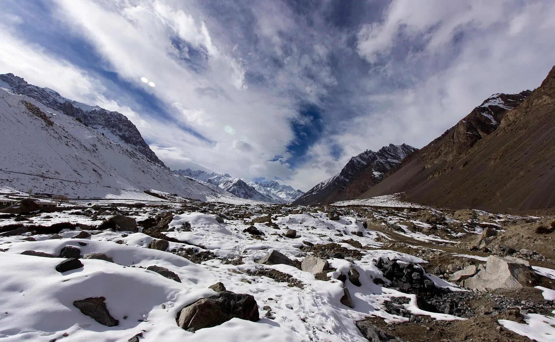
Photo: Zeeo Zia, with thanks · CC BY-SA 4.0 · via Wikimedia Commons · temporary stand-in photo

Lupgar Pir Pass
- Duration
- 6 days
- Distance
- 37.7 km
- Grade
- Strenuous
- Max altitude
- 5,190 m
- Season
- Jul – Sep
A six-day crossing of a non-glaciated 5,190 m pass from Yishkuk in Chapursan to Raminj in the Lupgar valley. Ochre hills, a glacier crossing on each side, red-walled canyons and old juniper forest. Very demanding, with tricky route-finding.
Overview
Lupgar Pir Pass (5,190 m) is a high, rocky pass that links the upper Chapursan valley with the Lupgar valley, south of Chapursan in Upper Hunza (Gojal). The pass has no glacier on it, but the route has two non-technical glacier crossings on the approaches. People do not traditionally use the pass. Herders graze their animals in the valleys on both sides. The British explorer Schomberg crossed it in 1934, and the authors of the 2002 Lonely Planet guide crossed it in 1994, which Nazir Sabir of Raminj believed to be the first crossing since. It has become more popular since.
The east side of the route has some of the best scenery of the trek. The upper Lupgar valley is lined with steep canyons, red, yellow and brown rock, spires and ancient junipers. Kuk Sar (6,943 m) and its large unclimbed face are visible from Banafshayeen on the west side.
Who it suits
This is a very demanding trek for strong, experienced mountain walkers. There is no marked trail above Banafshayeen. The pass sits above 5,000 m, so you must acclimatise first. There are loose scree slopes on both sides, a glacier crossing with crevasses on the east side and some exposed ledges in the canyon below Lupgar. It does not need ropes or technical skills in normal conditions, but you must be sure-footed.
Hire someone who knows the route. Route-finding beyond Kit-ke-zherav, across the Wyeen Glacier and up to the pass, is tricky. Many herders from Zood Khun know only as far as Banafshayeen, and herders from Raminj and Khaibar know the east side up to Wyeen. Ask for someone who has crossed.
When to go
Mid-June to September is the usual season. The pass is normally snow-free by mid-July. Before then, the upper slopes may be snowy. The route is described from west to east. This direction gives more gradual acclimatisation because Yishkuk is 300 m higher than Raminj, and the west side of the pass is shorter and has less scree. Rockfall in the canyon below Lupgar is deadly in wind or rain.
The route
Yishkuk (3,450 m) is a green meadow in upper Chapursan, with springs and berberis bushes. Day 1 is short. Walk south over moraine rubble to Raud (3,600 m), a camp beside a very cold stream. Use the extra time to acclimatise.
Day 2 crosses a glacial torrent on a wooden footbridge and climbs among junipers to the huts of Kit-ke-zherav (3,690 m). Follow the narrow ablation valley, then cross the black talus of Charva Shui and the stable Wyeen Glacier (about two hours) to Wyeen (4,100 m). Only a few tents fit by the huts.
Day 3 goes up the glacier's side moraine and then along the Banafshayeen stream to the grassy valley at 4,410 m, with its views of Kuk Sar. Above this point there is no trail or cairn. Skirt an unnamed glacier on its north side on black moraine and climb to Haji Beg Camp (4,680 m), a flat area with the remains of a square enclosure.
Day 4 is the crossing. Follow the stream to its head at about 5,100 m, then climb scree to the pass (5,190 m). Pamir Sar (7,016 m) is visible behind Kuk Sar. Descend steep, loose scree to a glacier, zigzag across it avoiding crevasses, and follow a medial moraine to its end. Traverse high on scree to the yak pasture of Wyeen (4,530 m) on the east side. There is a second place called Wyeen on the west side, so check which one your guide means.
Day 5 goes down the valley past Ilga (4,380 m), Ghorhil and Lupgar (4,140 m, the main summer settlement), then through the narrow canyon with its exposed trail and rockfall section called "God help us slides". Finish at Hoopkerch (3,700 m), among junipers.
Day 6 goes through the juniper forest to Harkeesh (3,489 m), then along the high canal path to Raminj (3,095 m). The canal was completed in 1978 and has tunnels through the cliffs.
Terrain and altitude profile
The trek changes surface almost every day: moraine rubble and a wooden footbridge on days 1 and 2, black talus and a stable glacier on day 2, side moraine and open grassy valley on day 3, steep loose scree and a crevassed glacier on day 4, a river ford and a narrow exposed canyon on day 5, then juniper forest and a canal path on day 6. The camps climb in steps, which is the main acclimatisation aid:
- Zood Khun (night before, lower than Yishkuk)
- Yishkuk 3,450 m, then Raud 3,600 m
- Wyeen (west) 4,100 m
- Haji Beg Camp 4,680 m
- Pass 5,190 m, then Wyeen (east) 4,530 m
- Hoopkerch 3,700 m and Raminj 3,095 m
The jump from Haji Beg Camp to the pass is about 510 m and the descent on the east side is steep, so a headache or poor sleep at 4,680 m is a reason to stop and not to push on.
Culture and people
Raminj sits above the junction of the Lupgar and Chapursan rivers. It is a well-kept village and the home of the mountaineer Nazir Sabir. Herders from Raminj and Khaibar share grazing rights in the Lupgar valley. The place names on both sides are mostly Wakhi, except for Harkeesh, which is Burushaski. Chapursan is a Wakhi valley. Ask before you photograph people and leave pastures and huts as you find them.
Practical information
Wikipedia lists the pass as about 9 km west of Lupghar village, in the Chipurson area of Gojal, and gives its height as 5,190 m.
Chapursan is beyond the Afiyatabad check post, so carry your passport. In the guidebook, vehicles leave Afiyatabad for Zood Khun every afternoon and the trip takes about three hours. Spend a night in Zood Khun to acclimatise, then drive or walk the 5.9 km to Yishkuk. At the finish, walk 15 minutes through Raminj to the road. Vehicles from Raminj to Afiyatabad are infrequent, about 1.25 hours, so a pre-booked transfer is better.
Porters ask a flat rate per stage and an equipment allowance. Pay only for stages where they carry a load. Agree on this before you set out. The old trek.pk page lists the area as open, with no permit, but foreign-trekker rules and fees in Gilgit-Baltistan changed in 2024. Check before you go.
Highlights
- A 5,190 m pass with no glacier on the summit
- Views of Kuk Sar's huge unclimbed face from Banafshayeen
- Red, yellow and brown canyons and spires in the upper Lupgar valley
- Ancient juniper forest at Hoopkerch and Harkeesh
- The marvel of the Raminj canal, cut through cliffs
Day by day
| Day | Camp | Altitude |
|---|---|---|
| 1 | Raud | 3,600 m |
| 2 | Wyeen (west of the pass) | 4,100 m |
| 3 | Haji Beg Camp | 4,680 m |
| 4 | Wyeen (east of the pass) | 4,530 m |
| 5 | Hoopkerch | 3,700 m |
| 6 | Raminj (village) | 3,095 m |
| Day | Route | Hours | Distance | Ascent / descent | Camp and altitude |
|---|---|---|---|---|---|
| Day 1 | Yishkuk to Raud | 0.5–1 h | 1.4 km | +150 m | Raud, 3,600 m |
Day 1 notesA very short walk south over moraine rubble to a camp beside a cold, clear stream. Use the day to acclimatise. Fill up with water here. | |||||
| Day 2 | Raud to Wyeen (west side) | 4.5–5.5 h | 7.2 km | +500 m | Wyeen (west of the pass), 4,100 m |
Day 2 notesCross the glacial torrent on a footbridge and climb through junipers to Kit-ke-zherav. Follow the ablation valley to Shot Dur, the last water before the glacier. Cross the black talus and the Wyeen Glacier (about two hours, easy but loose). Camp at the huts or by the glacial stream. | |||||
| Day 3 | Wyeen to Haji Beg Camp | 4–5 h | 5.4 km | +630 m | Haji Beg Camp, 4,680 m |
Day 3 notesClimb the side moraine and follow the Banafshayeen stream to the grassy valley (4,410 m), with views of Kuk Sar. There is no trail above this point. Skirt the unnamed glacier on its north side and climb to Haji Beg Camp, a flat area with a stone enclosure and a clear stream. | |||||
| Day 4 | Haji Beg Camp over Lupgar Pir Pass to Wyeen (east side) | 4–5 h | 4.1 km | +510 m / −660 m | Wyeen (east of the pass), 4,530 m |
Day 4 notesFollow the stream to its head, then climb scree to the pass (5,190 m). Descend steep, loose scree to a glacier, zigzag across it avoiding crevasses, follow the medial moraine and traverse high on scree to the yak pasture. Do not drop to the glacier's snout. | |||||
| Day 5 | Wyeen to Hoopkerch | 5–6 h | 12.3 km | −830 m | Hoopkerch, 3,700 m |
Day 5 notesFord the outwash stream and walk down the valley past Ilga, Ghorhil and Lupgar (4,140 m). Then follow the narrow canyon trail, with a deadly rockfall section in wind or rain, and cross natural and wooden footbridges. Descend through birch and juniper to Hoopkerch, a camp with a small spring. | |||||
| Day 6 | Hoopkerch to Raminj | 3.5–4 h | 7.3 km | +30 m / −605 m | Raminj (village), 3,095 m |
Day 6 notesWalk through the ancient juniper forest to Harkeesh (3,489 m), then along the exposed high trail above the gorge. Join the willow-lined canal and follow it, through tunnels and past springs, into Raminj. Walk 15 minutes down to the road. | |||||
Getting there
Chapursan lies beyond the Afiyatabad check post on the Karakoram Highway, so carry your passport. Vehicles run from Afiyatabad to Zood Khun, about three hours (guidebook), usually in the afternoon after the Gilgit coach arrives. Hire a special vehicle for the last part, or walk 5.9 km west-south-west along the road from Zood Khun to Yishkuk (about two hours). From Raminj at the finish, vehicles to Afiyatabad take about 1.25 hours but are sporadic. Since 2015 the KKH has bypassed Attabad Lake through tunnels, so the road from Gilgit is open, apart from landslides and winter snow.
Permits and rules
- Permit needed
- Usually not, Open zone
- Fee
- Current fees will be added soon
- Last checked
- 16 November 2026
The old trek.pk page lists the area as open, with no permit. Chapursan is beyond the Afiyatabad check post, where officials may ask to see your passport. Rules and fees for foreign trekkers in Gilgit-Baltistan changed in 2024 and were later contested, and no current official list was found. Check with the Gilgit-Baltistan Tourism Department or a licensed operator.
How trekking permits, NOCs and registration work: Visa and permits.
Season
Best: Jul – Sep
Water and camps
Raud has a very cold, clear spring. Shot Dur (3,780 m) is the last water until the glacier on day 2. Wyeen west has water just above the livestock pen, and few tent sites. Haji Beg Camp has a clear stream. On the east, Wyeen has a stream. Ilga's water is silty in the afternoon. A big spring about two-thirds of the way down the canyon is the last reliable clear water until Raminj. Hoopkerch has a small spring below the pen. Harkeesh has a good hut and open grass. Treat all water.
Gear and safety
This is a high, remote crossing. Acclimatise at Zood Khun and Raud. The glacier crossings are not technical, but you need to avoid crevasses, so carry a rope and know how to use it. The scree on both sides is steep and loose, so wear boots and keep spacing. The canyon trail below Lupgar is narrow and exposed, with deadly rockfall in wind and rain. Carry a satellite communicator. Rescue is from Raminj or Zood Khun, and a helicopter has to be requested through the army and an operator.
Variations
The route can be done in either direction, but west to east is easier on acclimatisation. From Harkeesh, a route leads to the Werthum Pass. Other Chapursan treks are reached from the same road. For a shorter Gojal trek with a pass side trip, see boibar and kilik-and-mintaka-passes.
Tips
- Go from west to east, as in this route. It is more gradual and the west side has less scree.
- Spend a night in Zood Khun and another at Raud before the climb.
- Hire a guide who has crossed the pass. Above Banafshayeen there are no cairns.
- Wait for mid-July so the upper slopes are snow-free.
- Do not use the canyon below Lupgar in rain or wind. Rockfall is deadly.
Photos we still need: Lupgar Pir Pass itself and the Wyeen glacier crossings; Lupgar valley canyon and the juniper forest near Harkeesh. Send us yours
Health and emergency
Mobile signal is patchy on most treks, so tell someone your plan before you go. Emergency numbers
Sources and last checked
Last checked Confidence low10 sources5 still to check
- Last checked
- Method
- Desk research from published sources
- Confidence
- low
- Checked by
- trek.pk research team
Researched from published sources; not yet checked on the ground by our team. Spot something out of date? Report a mistake.
Sources
- Trekking in the Karakoram and Hindukush (Lupgar Pir Pass trek) · Lonely Planet, c. 2002 (facts only) · checked
- Lupghar Pir Pass · Wikipedia · checked
- Lupgar Pir Pass Trek · Apricot Tours (operator) · checked
- Chapursan · Wikipedia · checked
- PM inaugurates Pak-China Friendship Tunnels over Attabad Lake · Dawn · checked
- GB winter adventure tourism hit by soaring permit fee, visa delays · Dawn · checked
- Land of Culture: District Hunza (tourist map) · Ministry of Tourism, Pakistan · checked
- To the end of the world: Chapursan Valley travel guide (updated 5 Jan 2021) · Lost With Purpose · checked
- List of Restricted/Prohibited/Border Areas in Pakistan (14 Jan 2026; operator page, supporting only) · Apricot Tours · checked
- Chapursan and Raminj photographs (Wikimedia Commons) · Wikimedia Commons · checked

Still to be checked on the ground (5)
- Current state of the route across the unnamed glacier on the west and the glacier on the east, which change each year
- No first-hand trip report from recent years was found; times and distances come from a c. 2002 guidebook
- Condition of the exposed trail and footbridges in the Lupgar canyon (Khuda Khair Charjeshan)
- Current transport and travel times: a travel guide updated Jan 2021 gives public jeeps from Sost to Chapursan twice a day (about 10:00 and 14:30), 2 to 3 hours, with a checkpoint where foreigners register; nothing recent for Afiyatabad, Zood Khun or Raminj
- Whether any permit or fee applies for foreigners in Chapursan and the Lupgar valley (the 2021 guide says a May 2019 check with the Commissioner's office found no NOC needed for Chapursan itself; an operator list dated 14 Jan 2026 treats Chapursan and the Lupgar crossing as restricted treks needing a permit; no official current source)
Nearby and related

Boibar

Kilik and Mintaka Passes

Asumbar Haghost
Lupgar Pir Pass
A non-glaciated pass of 5,190 m linking Yishkuk in Chapursan with Raminj in the Lupgar valley. Six very demanding days.
Werthum Pass
A rarely crossed pass of 5,147 m linking the Batura Glacier near Passu with the Lupgar valley. Basic ice skills needed for a cornice.