

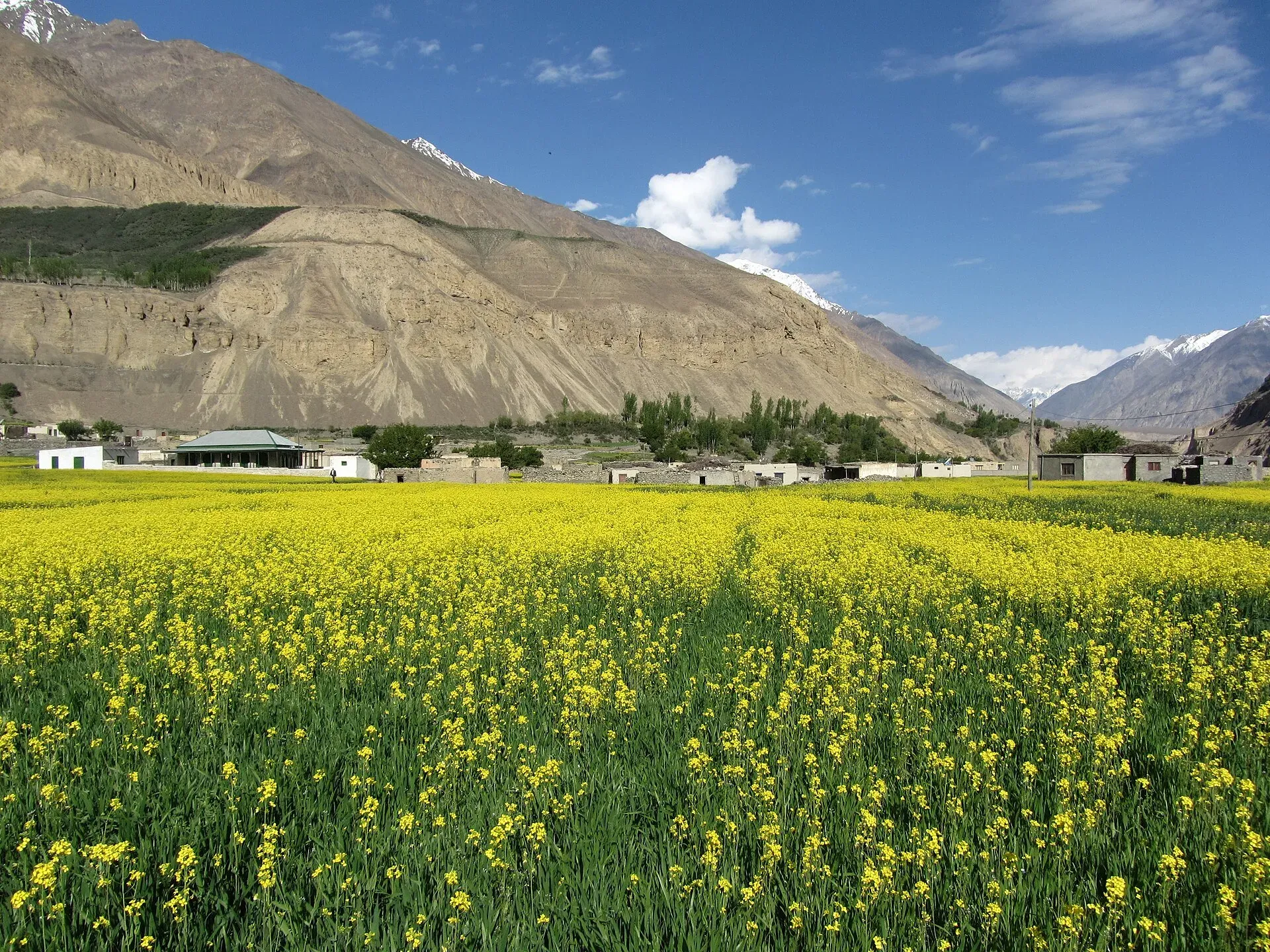
Photo: Shujaat Aly, with thanks · CC BY-SA 3.0 · via Wikimedia Commons · temporary stand-in photo

Mai Dur Pass
- Duration
- 8 days
- Distance
- 80.4 km
- Grade
- Technical
- Max altitude
- 5,700 m
- Season
- Jun – Sep
An eight-day high-altitude loop from Shimshal over the glaciated Mai Dur Pass (about 5,700 m), with a rope-and-rappel descent. For experienced mountain travellers with a local guide who has crossed it before.
Overview
Mai Dur Pass is a glaciated notch at about 5,700 m in the South Ghuzherav mountains, north of Shimshal. It was first crossed in 1925 by the Dutch geographer Philips Visser and his wife Jenny Visser-Hooft, who were exploring the sources of the Hunza River. The route then fell out of use. A Shimshal man, Farhad Khan, crossed it again in 1998, and the authors of the 2002 Lonely Planet guide crossed it in June 2000. A few operators now offer it.
The trek is a loop from Shimshal village. You go north through the Pamir-e-Tang gorge to the Mai Dur pastures, cross the pass, descend through the Ghuzherav valley and return over the Boisum Pass. The scenery is wild and quiet. The Karakoram's big peaks to the south, the Hispar Muztagh, are in view from the high camps. Blue sheep are common in the unvisited meadows.
Who it suits
This is a technical trek. It suits experienced mountain travellers who are fit and well acclimatised, and who are comfortable on snow and glacier ice. You need to be able to travel in roped teams and rappel (abseil) about 75 m on the east side of the pass. Crampons are advisable for everyone, including porters. The pass is steep, corniced and exposed to avalanche in early season.
You must go with at least one person who has crossed the pass before. The 2002 book names four Shimshal men with that experience. More local guides will have learned it since, but confirm this when you book.
When to go
The usual window is mid-June to September. Early in the season there is more snow and more avalanche risk, but the climb is easier on firm snow. Late in the season the east side can be mostly snow-free, which makes the rappel more awkward and the descent loose. Start from base camp by 4 am so you are on top of the pass by about 7 am, finish the rappel by about 8 am and leave the glacier basin by 9 am. After that the sun-softened slopes make the going slow.
The route
The first three days follow the Qachqar-e-Dur trek north from Shimshal village (3,000 m). Day 1 is long, 15 km and 7 to 9 hours. It goes along the Shimshal River, over Michael Bridge, up the Pamir-e-Tang gorge and along exposed galleries to Wuch Furzeen (3,365 m). Day 2 climbs to Pamir Mai Dur (4,348 m). Day 3 goes to Bipardah Pert (4,726 m) and on to Farhad Base Camp (4,992 m), named after Farhad Khan. It is rocky and cold.
Day 4 is the crux. From camp, follow the moraine and then the snow-covered glacier in roped teams, turning east towards the notch after about 1.5 hours. The snow slope steepens to 30 degrees for the last 100 m. The top is reached 3 to 3.5 hours from camp. The east side has a cornice with a 10 m vertical headwall and then a 45-degree slope. You need to lower loads and make a 75 m rappel. Cross the crevassed basin below, then go down the true left side of the Mai Dur Glacier to Yazmis (4,740 m), directly under the glacier's snout. The camp is windy but has plenty of clear water.
Day 5 follows the Ghuzherav Mai Dur River north-north-west past Meem-e-Goz, named after Jenny Visser-Hooft, a flower-filled meadow with blue sheep. It continues to Mai Dur-e-Gush (4,192 m), where the Ghuzherav Mai Dur and Ghidims rivers meet.
Day 6 fords the river, follows the Ghuzherav, and crosses a log footbridge into the Boisum valley at Mandikshlakh (4,129 m). Walk up the valley to Perchodwashk (4,580 m).
Days 7 and 8 return to Shimshal over Boisum Pass (4,875 m), through Shpodeen and Zardgarben (4,075 m), then down to the village. This part is the reverse of the Boisum and Chafchingol Passes trek.
Terrain underfoot
The loop covers four kinds of ground. The first two days follow the Shimshal River and then side streams over rubble slopes (talus) and high galleries cut into cliff faces. Days 2 and 3 climb over scree and black moraine, then loose stones around Farhad Base Camp. The pass day is the only true glacier day: a snow-covered glacier in roped teams, a cornice and short headwall on the east side, a 75 m rappel and a crevassed basin below it. After that the route drops to the Ghuzherav valley, where grassy flats, river fords and one log footbridge replace ice. The way back over Boisum Pass is a steep, rocky walk with no snow work.
Preparation and gear
One operator, Apricot Tours, lists a 14-day programme with the walking days running from Shimshal to Vonokin (where it ends the walk and picks up a jeep). It leaves mountaineering equipment to the client: crampons, mountaineering boots, ice axe, harness, two carabiners and a helmet. It also states that porters carry 14 kg of personal luggage and 8 kg of mountaineering gear each, and that a licensed guide is a government requirement. These are one operator's terms and should not be treated as official rules.
Camp names differ between sources. The operator calls its camps Furzin, Maidoor and Madiqshligh (about 4,100 m), which match Wuch Furzeen, Pamir Mai Dur and Mandikshlakh (4,129 m) in the 2002 guide used here. Ask your guide which spelling and which sites they use.
Spend at least a night or two in Shimshal before you start. Wikipedia and a 2016 Dawn feature put the village at about 3,000 m to 3,113 m, and the first night is already at 3,365 m.
Culture and people
Shimshal is a Wakhi village at the head of its valley and has a long tradition of mountaineering. Many of Pakistan's best high-altitude guides and porters come from here. Shimshal families keep livestock in summer pastures along this route. Dawn describes most residents as farmers who breed sheep, goats and yaks, and notes blue sheep and Marco Polo sheep in the valley. Wikipedia names Shimshal Pamir, Gujerav, Yazghail and Loopghar as the valley's extensive pastures. Ask before you photograph people, and follow your guide's advice about huts and pens. Do not leave rubbish on the glacier or at camps.
Practical information
There is no public transport to Shimshal. The village is reached by jeep on the Shimshal road, which leaves the KKH near Passu. Allow time for rockfall delays. Take a full mountaineering kit, including ropes, ice screws or snow anchors, harnesses, rappel gear and crampons. Bring a satellite communicator or phone. The route is days from help. The Khurdopin Glacier, in the Shimshal valley, surged in 2016 and 2017 and formed a large lake (Wikipedia), so check river conditions in the village before you set out.
The old trek.pk page says no permit. Fees and rules for foreign trekkers and climbers in Gilgit-Baltistan changed in 2024 and were later contested. A tour operator is the most reliable way to confirm the current requirements. Shimshal is close to the Khunjerab National Park, so check whether park fees apply.
Highlights
- A glaciated pass of about 5,700 m with a 75 m rappel on the east side
- Rarely visited meadows with blue sheep at Meem-e-Goz
- Views of the Hispar Muztagh and Destaghil Sar from the high camps
- A loop that starts and ends in Shimshal village
- Crossing the Boisum Pass on the way home
Day by day
| Day | Camp | Altitude |
|---|---|---|
| 1 | Wuch Furzeen | 3,365 m |
| 2 | Pamir Mai Dur | 4,348 m |
| 3 | Farhad Base Camp | 4,992 m |
| 4 | Yazmis | 4,740 m |
| 5 | Mai Dur-e-Gush | 4,192 m |
| 6 | Perchodwashk | 4,580 m |
| 7 | Zardgarben | 4,075 m |
| 8 | Shimshal village | 3,000 m |
| Day | Route | Hours | Distance | Ascent / descent | Camp and altitude |
|---|---|---|---|---|---|
| Day 1 | Shimshal village to Wuch Furzeen | 7–9 h | 15.1 km | +685 m / −320 m | Wuch Furzeen, 3,365 m |
Day 1 notesWalk up the Shimshal River to Michael Bridge, then to the junction with the Pamir-e-Tang River. Cross it and climb the spur to Gar-e-Sar (3,502 m). The galleries beyond are exposed and the trail is rough. Water is scarce between the bridge and Past Furzeen, so fill bottles at the spring before the bridge. | |||||
| Day 2 | Wuch Furzeen to Pamir Mai Dur | 6 h | 11.5 km | +983 m | Pamir Mai Dur, 4,348 m |
Day 2 notesClimb to Purien-e-Sar (3,916 m), then turn north-west and stay high above the Pamir Mai Dur River over talus. Pass Chashkin and reach the huts at Pamir Mai Dur at the river junction. Ford the Qachqar-e-Dur River and camp on the terrace north of the huts. | |||||
| Day 3 | Pamir Mai Dur to Farhad Base Camp | 4–5 h | 4.6 km | +644 m | Farhad Base Camp, 4,992 m |
Day 3 notesClimb over scree above the river, cross to the true left bank and walk on to the grassy hill of Bipardah Pert (4,726 m). Continue over the glacier's black moraine to the stone shelters at Farhad Base Camp. The amphitheatre of unclimbed 5,000 m peaks is the highlight. Rest and prepare gear for the early start. | |||||
| Day 4 | Farhad Base Camp over Mai Dur Pass to Yazmis | 6.5–8 h | 8.1 km | +708 m / −960 m | Yazmis, 4,740 m |
Day 4 notesLeave by 4 am and climb the snow-covered glacier in roped teams to the pass (about 5,700 m), 3 to 3.5 hours from camp. Lower loads and rappel 75 m down the east side. Cross the glacier basin and descend the true left side of the Mai Dur Glacier to Yazmis, beneath the snout. | |||||
| Day 5 | Yazmis to Mai Dur-e-Gush | 3.5 h | 8.1 km | −548 m | Mai Dur-e-Gush, 4,192 m |
Day 5 notesFollow the Ghuzherav Mai Dur River, passing the flower meadows of Meem-e-Goz. Climb over moraine, cross a glacier tongue and reach the plateau where grazing begins. Ford the river and camp on the open plain at the confluence with the Ghidims River. Clear water is scarce here, but you can find some at the river edge. | |||||
| Day 6 | Mai Dur-e-Gush to Perchodwashk | 3.5 h | 10 km | +388 m | Perchodwashk, 4,580 m |
Day 6 notesFord the Ghuzherav Mai Dur River and follow the Ghuzherav's true left bank to the Boisum River. Cross the log footbridge to Mandikshlakh (4,129 m), then walk south up the Boisum valley for about 2.5 hours to Perchodwashk. | |||||
| Day 7 | Perchodwashk over Boisum Pass to Zardgarben | 5 h | not given | +295 m / −800 m | Zardgarben, 4,075 m |
Day 7 notesClimb to Boisum Pass (4,875 m) in about 2 hours, descend to Shpodeen in 1.5 hours and continue to Zardgarben (4,075 m) in another 1.5 hours. Total distance for days 7 and 8 is 23 km. | |||||
| Day 8 | Zardgarben to Shimshal village | 2.5–3 h | not given | −1,075 m | Shimshal village, 3,000 m |
Day 8 notesDescend to Shimshal. The guidebook gives a combined 1,875 m of descent and 295 m of ascent for days 7 and 8; this split is approximate. | |||||
Getting there
Shimshal village (3,000 m) is at the end of the Shimshal road, which leaves the Karakoram Highway near Passu in Gojal. Hire a jeep in Passu or arrange a transfer through your operator. There is no public transport. Check the road for rockfall and bridge damage before you travel. Passu is a long half-day from Gilgit. Since 2015 the KKH has bypassed Attabad Lake through tunnels.
Permits and rules
- Permit needed
- Usually not, Open zone
- Fee
- Current fees will be added soon
- Last checked
- 16 November 2026
The old trek.pk page says open, no permit. Foreign-trekker and climber fees in Gilgit-Baltistan were raised in 2024, contested, and reduced again in May 2025 (The News, 25 May 2025); no official 2026 list was found. A high glaciated pass with a rappel is likely to need an operator who knows the current rules. Check with the Gilgit-Baltistan Tourism Department or a licensed operator before you go.
How trekking permits, NOCs and registration work: Visa and permits.
Season
Best: Jun – Sep
Water and camps
Water comes from glacier streams and side streams, and some is silty. Wuch Furzeen has a small spring near the hut, with a river fallback. Farhad Base Camp has moraine pools. Yazmis has plenty of clear water but is windy. At Mai Dur-e-Gush clear water is scarce. Camps on this route are bare and cold, so carry a four-season tent and treat all water.
Gear and safety
The pass needs mountaineering skills and kit. Carry ropes for roped travel and a 75 m rappel, harnesses, ice screws or anchors, helmets and crampons for everyone. Avalanche risk can be present on the east side early in the season. Crevasses are hidden under snow in the glacier basins. Altitude is a real concern above 4,700 m. The Shimshal gorge section has exposed galleries and rockfall. Rescue would have to come by helicopter, which must be requested through the army and your operator, and may take days.
Variations
The Mai Dur Pass is a harder start to the Boisum and Chafchingol Passes trek and a different finish to the Shimshal Pamir trek. The Farhad Base Camp side trip can be done alone from Bipardah Pert without crossing the pass. See also lupgar-sar-base-camp for a shorter trek in the same valley.
Tips
- Go with a guide who has crossed the pass. The route has no markings.
- Start from base camp by 4 am so you are across before the sun softens the snow.
- Acclimatise on the way up. Farhad Base Camp is at about 4,992 m.
- Check conditions in the weeks before you go. Snow depth changes the difficulty.
- Carry rescue and communication gear. Help is days away.
Photos we still need: Farhad Base Camp, the Mai Dur Pass rappel and the Pamir-e-Tang gorge galleries. Send us yours
Health and emergency
Mobile signal is patchy on most treks, so tell someone your plan before you go. Emergency numbers
Sources and last checked
Last checked Confidence low8 sources9 still to check
- Last checked
- Method
- Desk research from published sources
- Confidence
- low
- Checked by
- trek.pk research team
Researched from published sources; not yet checked on the ground by our team. Spot something out of date? Report a mistake.
Sources
- Trekking in the Karakoram and Hindukush (Mai Dur Pass trek, and Qachqar-e-Dur and Shpodeen Pass trek) · Lonely Planet, c. 2002 (facts only) · checked
- Mai Dur Pass Trek · Apricot Tours (operator) · checked
- Khunjerab National Park · Wikipedia · checked
- GB winter adventure tourism hit by soaring permit fee, visa delays · Dawn · checked
- Shimshal · Wikipedia · checked
- List of Restricted/Prohibited/Border Areas in Pakistan (14 Jan 2026; operator page, supporting only) · Apricot Tours · checked
- How the residents of Shimshal are setting a shining example for Pakistan (28 January 2016) · Dawn · checked
- GB slashes mountaineering, trekking fees to promote tourism (25 May 2025) · The News · checked
Still to be checked on the ground (9)
- Pass height: the book gives about 5,700 m; Apricot's page gives no pass height (only Madiqshligh camp about 4,100 m), Wikipedia lists the pass without a height, and a Ministry of Tourism map names 'Mai Dur-e-Gush' without one
- Whether the 75 m rappel is still needed and how the cornice and headwall change year to year
- Which Shimshal guides have crossed the pass recently (the book's list is from 2002)
- Current permit, fee and registration rules: Apricot says a licensed guide is a government requirement and 'government paperwork' is included; an operator list dated 14 Jan 2026 treats Shimshal routes as restricted. No official source for fees
- Day 3 figures (4.6 km, 644 m ascent) are worked out from the guidebook totals, not given directly
- Distance split between days 7 and 8 (guidebook gives only 23 km in total)
- Operators list a 14-day itinerary (Apricot, 2026-27 dates), but that counts travel days: the walking days run from Furzin to Vonokin over about 7 days, close to the guidebook's 8. Real time needed still unconfirmed
- Operator camp names (Furzin, Maidoor, Madiqshligh, Dih) are matched to the 2002 guide's camps by position only; the match is not confirmed
- Shimshal altitude: 3,000 m in the old guide, 3,113 m in Wikipedia's text and 3,100 m in its summary box
Nearby and related

Lupgar Sar Base Camp

Boibar

Asumbar Haghost
Mai Dur Pass
A glaciated pass of about 5,700 m north of Shimshal, first crossed in 1925. Roped travel and a 75 m rappel on the east side.
Boisum Pass
A rocky, non-glaciated pass of about 4,900 m (reported 4,900 to 5,090 m) in the Ghuzherav mountains near Shimshal. Crossed on two Shimshal treks; the height is disputed.
Chafchingol Pass
A glaciated pass of about 5,100 m between the Ghuzherav and Koksil on the Karakoram Highway. Deep river fords, crevasses and a rope-work descent.